
|
Boulders and scree slope Carn Dearg Beag
by Trevor Littlewood
geograph for square NN1773
The long ridge of Carn Mòr Dearg has two distinct but minor tops north of the... (more)
|
|
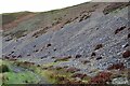
Scree slope, White Hill
by Jim Barton
geograph for square NT0533
Scree on a southeast-facing slope above the track that encircles the hill.
|

|
Scree slope and lochan, Beinn Odhar
by Alan O'Dowd
geograph for square NN3333
This lochan is un-named on the map. It lies on just about the only part of... (more)
|

|
Scree slope
by Oliver Dixon
geograph for square SH3544
Above the road to Nant Gwrtheyrn.
|
|
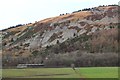
Scree on Plora Craig
by Jim Barton
for square NT3437
The steep slope of scree, heather and gorse above the A72 between Innerleithen... (more)
|

|
Scree slopes on north side of Birkie Knott
by Trevor Littlewood
geograph for square NY4318
Birkie Knott is the termination of a ridge running north from Steel Knotts.... (more)
|
|
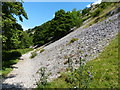
Limestone scree slope in Wolfscote Dale
by Mat Fascione
geograph for square SK1357
Next to the path heading north along the River Dove.
|
|
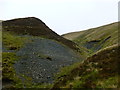
Hund Craig
by Alan O'Dowd
geograph for square NS8909
More of a small scree slope than a crag, but still fairly unusual in the smooth,... (more)
|
|
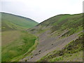
Scree slope on White Hill
by Alan O'Dowd
geograph for square NT0533
Typically the hills in this area don't have much exposed rock.
|
|
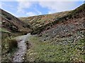
Path and scree slope in the Townbrook Valley
by Mat Fascione
geograph for square SO4494
|
|
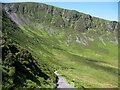
Dead Crags
by Adrian Taylor
geograph for square NY2731
Dead Crags form the north western slopes of the Wainwright summit of Bakestall.... (more)
|
|
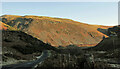
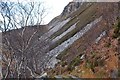
Scree, Brough Law
by Derek Harper
geograph for square NT9916
|
|
Scree slopes below Creag Ruadh
by Jim Barton
geograph for square NC2733
Scree below the quartzite cliffs.
|

|
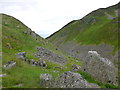
Scree slope on Thorpe Cloud
by Mat Fascione
geograph for square SK1451
Thorpe Cloud is a 287 m (942 ft) limestone hill, at Dovedale on the... (more)
|
|
Crags and scree at Tinnis Castle
by Alan O'Dowd
geograph for square NT1434
The view from the lower slopes of the mound where the fort and castle remains are located.
|

|
Scree slope at The Craigs, Drumelzier
by Alan O'Dowd
geograph for square NT1333
Looking over towards Logan Head.
|
|
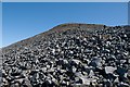
Making our way to the summit of Beinn a' Chaolais, Jura
by Becky Williamson
geograph for square NR4873
These scree covered slopes are very difficult to traverse.
|
|
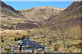
Firth Hope from Carrifran Burn
by Jim Barton
geograph for square NT1513
Firth Hope is the northern arm of the Carrifran valley surrounded by steep... (more)
|
|
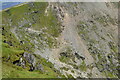
Almost up
by Bill Harrison
geograph for square SH6054
The gruelling final stage of the Pyg track zigzags up the side of the... (more)
|
|
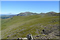
Scree slope to the west of Llyn Du'r Arddu...
by Bill Harrison
geograph for square SH5955
...as seen from the Snowdon Ranger path. The Halfway House cafe and a train on... (more)
|

|
The Cuillin Ridge from Sgurr Thearlaich
by Jim Barton
for square NG4421
In the foreground is Sgurr Mhic Choinnich leading to An Stac and the screes to... (more)
|

|
Scree slope
by Bill Harrison
geograph for square SD8373
These are, I think, millstone grit, including some quite hefty boulders. In the... (more)
|

|
Screes alongside Loch Ness
by Alan Murray-Rust
for square NH5836
The slopes of Creag Bhuidhe and Creag Dhearg at the narrow northern end of the... (more)
|
|
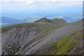
Carl Side and Ullock Pike
by Jim Barton
for square NY2528
The distinctive ridge of Ullock Pike culminates in the rounded summit of Carl... (more)
|
|
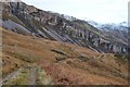
Creag Ruadh
by Jim Barton
geograph for square NC2633
Creag Ruadh is the sloping line of Cambrian quartzite cliffs, above which the... (more)
|
|
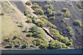
Gully on The Screes, Wast Water
by Rob Noble
geograph for square NY1505
A deep gully carved by runoff on the steep slopes below Illgill Head.
|
|
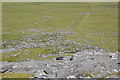
Scree slope, north of Little Rough Tor
by Bill Harrison
geograph for square SX1481
|

|
Scree on Geal-charn, Cairngorm National Park
by Andrew Tryon
geograph for square NH8802
Geal-charn is a 920 m (3018 ft) high hill on the western fringe of the Cairngorm... (more)
|
|
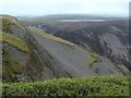
Valley head of the Afon Dulas
by Andrew Hill
for square SN8294
Dramatic slopes of grass, rock and scree eat into the moorland between Foel... (more)
|

|
Horses grazing above the Walker Burn
by Jim Barton
for square NT3637
On the steep slope of Caberston Craigs.
|
|
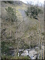
Scree slope, west bank of the River Twiss
by Christine Johnstone
geograph for square SD6974
Not far from a quarry shown on the large-scale OS map surveyed in 1846, but... (more)
|

|
Steep and rough slope, Sgurr nan Gobhar
by Jim Barton
geograph for square NG4222
Hard work on the ascent of Sgurr nan Gobhar (peak of the goats), a spur on the... (more)
|
|
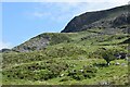
Lower slopes of Moel Lefn
by Bill Harrison
geograph for square SH5448
|
|
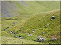
Scales Beck
by Trevor Littlewood
geograph for square NY3328
Scales Beck drains water from Scales Tarn on the east side of Blencathra into... (more)
|

|
Crags of east side of Combe Gill
by Trevor Littlewood
geograph for square NY2511
In the foreground is the narrow slot containing Combe Gill which descends from... (more)
|

|
Overhanging ledge above Prince Charlie's Cave
by Dougie Beck
for square NM7984
The slope around the cave is treacherous - ankle-snapping moss-covered slabs and... (more)
|

|
Beware of falling rocks in Gordale
by Christine Johnstone
geograph for square SD9163
There are several scree slopes on both sides of this steep-sided valley.
|

|
Navigating the scree slope...
by Bill Harrison
geograph for square SH6913
...on the ascent to Cadair Idris.
|
|
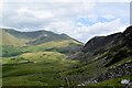
Long-distance look towards Cwm Dwyfor
by Bill Harrison
for square SH5450
The Nantlle Ridge crosses the rear of the Cwm. To the right, the far more... (more)
|

|
Scree slopes above Cwm Clogwyn...
by Bill Harrison
geograph for square SH6054
...with Llyn Coch and Llyn Ffynnon-y-gwas.
|
|
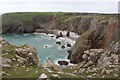
Flimston Bay & Flimston Bay Camp
by M J Roscoe
geograph for square SR9394
A picturesque bay just off the Coast Path; the grassy headland, left, the Camp,... (more)
|
|
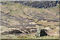
Cairn below Raven Craig, Carrifran
by Jim Barton
geograph for square NT1513
The cairn on the west bank of the burn.
|
|
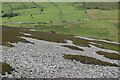
Scree slope to the south of Tre'r Ceiri...
by Bill Harrison
geograph for square SH3744
...with the B4417 road in the background. Numerous sheep can be seen in the... (more)
|
|
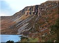
Sun on Creag Ruadh
by Jim Barton
geograph for square NC2733
The sun picking out pinkish red colour of these quartzite cliffs above Loch Gleann Dubh.
|

|
Sheep below Goat Scar, Longsleddale
by Karl and Ali
geograph for square NY4806
Goat Scar is the dominating feature of the western side of the upper dale.... (more)
|
|
Scree fans on Glenrath Hill
by Jim Barton
geograph for square NT2232
Steep heather gives way to scree on the north side of Glenrath Hope. The tree... (more)
|

|
Tracks around White Hill
by Jim Barton
geograph for square NT0533
There is a variety of colours on the heather, grass and scree hillsides here.... (more)
|

|
The south side of White Hill
by Jim Barton
geograph for square NT0533
Patchy heather and scree descending from the 399m summit.
|

|
Grass and scree below Tinnis Castle
by Jim Barton
geograph for square NT1434
This short defile almost resembles a miniature Lairig Ghru set down in the... (more)
|
|
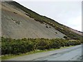
Gorse flowering around the scree, north of Uzzicar Farm
by Christine Johnstone
geograph for square NY2322
Early March on the north-east flank of Barrow.
|
