Public Tags
Tag: Sealoch
Showing images tagged with Sealoch tag.
|
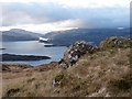
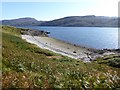
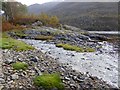
Across Loch Sunart from Beinn Buidhe
by Alan Reid geograph for square NM5762 Category: Scenery |
|
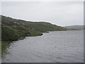
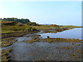
Looking across Loch Ryan from Finnarts Bay
by Oliver Dixon geograph for square NX0572 The cliffs of Clachan Heughs NX0370 can be seen on the far side of the loch.
|
|
Tangi Loch and Holm of Copister
by Oliver Dixon geograph for square HU4678 Headland connected to the Isle of Yell by a strip of beach. Tangi Loch is the... (more)
|
|
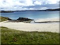
Northern end of the Tràigh na Belrigh
by Oliver Dixon geograph for square NB0936 And the waters of Caolas Phabaigh.
|
|
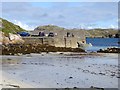
Birdwatchers on the pier at Bhaltos
by Oliver Dixon geograph for square NB0936 |
|
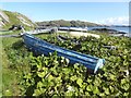
Derelict boat at Bhaltos
by Oliver Dixon geograph for square NB0936 Unlikely to put to sea ever again.
|
|
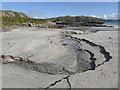
Stream crossing the beach at Tràigh Bhaltos
by Oliver Dixon geograph for square NB0936 |
|
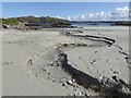
Stream crossing the beach at Tràigh Bhaltos
by Oliver Dixon geograph for square NB0936 |
|
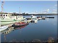
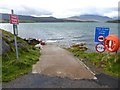
Jetty at Loch Miabhaig
by Oliver Dixon geograph for square NB0934 The smaller of the two boats on the left side of the jetty is MV Cuma which is... (more)
|
|
Loch Miabhaig
by Oliver Dixon geograph for square NB0934 Looking across the loch to the jetty at Uigean. Beyond is the hill of Niosa Mhòr... (more)
|
|
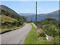
The road to Loggie
by Oliver Dixon geograph for square NH1686 Narrow road along the west side of Loch Broom.
|
|
A prospect of Ullapool
by Oliver Dixon geograph for square NH1195 Ullapool stands on a peninsula of level land near the mouth of Loch Broom. Seen... (more)
|
|
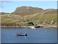
Bay and beach at the mouth of Loch Broom
by Oliver Dixon geograph for square NH0997 On the south side of the Rhue peninsula.
|
|
View north from Rubha Cadail
by Oliver Dixon geograph for square NH0997 Looking across Loch Kanaird to Isle Martin NH0999 and the impressive south... (more)
|
|
Rubha Cadail
by Oliver Dixon geograph for square NH0997 Tip of the peninsula on the north side of the mouth to Loch Broom.
|
|
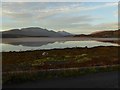
North shore of Loch Leven
by Oliver Dixon geograph for square NN1261 The B863 clings to the north shore of the loch. Looking towards the Narrows... (more)
|
|
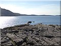
Mouth of burn at Rubha Cladaich
by Oliver Dixon geograph for square NN1260 A small rocky headland on the north shore of Loch Leven.
|
|
Field and farm road at North Ardnaclach
by Oliver Dixon geograph for square NM9443 The mouth of Loch Creran can be seen beyond.
|
|
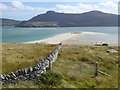
Sand spit below Midtown
by Oliver Dixon geograph for square NC5861 A large sand spit extends most of the way across the mouth of the Kyle of Tongue... (more)
|
|
Eastern end of the Tongue Causeway
by Oliver Dixon for square NC5858 Completed in 1971, the causeway across the Kyle of Tongue now carries the A838,... (more)
|
|
Slipway at Keoldale
by Oliver Dixon geograph for square NC3766 The weak bridge sign is a bit superfluous as it is a passenger-only ferry which... (more)
|
|
Cairn on Cnoc nan Sgliat
by Oliver Dixon geograph for square NC3971 Not quite the highest point of the Faraid Head peninsula but the highest point... (more)
|
|
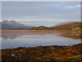
Dawn on the Kyle of Durness
by Oliver Dixon geograph for square NC3866 To the left, Foinaven; to the right, Farmheall.
|
|
Dawn on the Kyle of Durness
by Oliver Dixon geograph for square NC3866 Reflected in the calm waters of the Kyle: to the left, Beinn Spionnaidh and... (more)
|
|
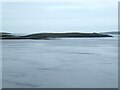
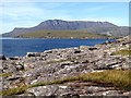
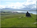
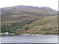
Loch Ob
by M J Richardson geograph for square NF7002 The north shore, near Bogach.
|
|
Rubha nam Feannag
by Oliver Dixon geograph for square NM4199 Headland on the north shore of Loch Scresort. The hill on the skyline is Meall... (more)
|
|
Inlet near the head of Loch Scresort
by Oliver Dixon geograph for square NM4099 |
|
The path to Puilladobhrain Anchorage
by Oliver Dixon geograph for square NM7819 A delightful path runs over the ridge from Tigh-an-Truish to Puilladobhrain Anchorage.
|
|
Head of Puilladobhrain Anchorage
by Oliver Dixon geograph for square NM7819 |
|
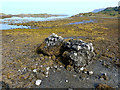
Conglomerate Boulder
by Oliver Dixon geograph for square NM7819 On the shore at the head of Puilladobhrain Anchorage.
|
|
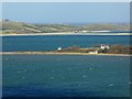
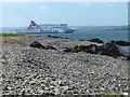
Stena Superfast VIII seen from Finnarts Bay
by Oliver Dixon geograph for square NX0572 The Stena high-speed ferry to Belfast now starts from the new port on the north... (more)
Tags:
top:CoastalX
top:Docks, HarboursX
FerryX
High Speed FerryX
Ro-Ro FerryX
Sealoch
Shingle BeachX
|
|
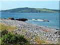
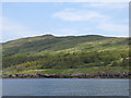
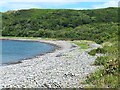
Finnarts Bay
by Oliver Dixon geograph for square NX0572 At the mouth of Glen App on the east shore of Loch Ryan.
|
|
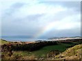
Rainbow over Auchalick Bay
by Joan Sykes geograph for square NR9174 Looking over Loch Fyne towards Knapdale.
|
|
Alltnaharrie
by Oliver Dixon geograph for square NH1193 Until 2002, this building was a remote and quirky hotel with a fine reputation,... (more)
|
|
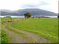
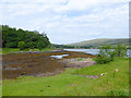
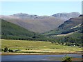
View across the head of Loch Broom
by Oliver Dixon for square NH1885 Looking across the tidal flats at the head of Loch Broom to the low-lying land... (more)
|
|
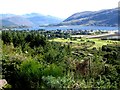
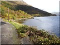
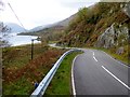
The winding road along Loch Leven
by Oliver Dixon geograph for square NN1361 The B863 was formerly designated as an A road before the Ballachulish bridge was... (more)
|