Public Tags
Tag: Seashore
Showing latest 50 of 108 images tagged with Seashore tag.
|
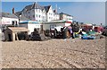
Lobster Pots on Seashore - near Pier
by Betty Longbottom geograph for square SZ9398 |

|
Seashore at Prestonpans
by Alan Murray-Rust geograph for square NT3874 The feel of a small fishing community is still given, although this is no longer... (more)
|

|
The Ouse from Lindisfarne Castle
by David P Howard geograph for square NU1341 Category: Seashore View West across the Ouse towards the ruins of the Benedictine Priory (in NU1241)
|

|
The seashore by the Strand
by Steve Daniels geograph for square TQ7869 |

|
The seashore by the Strand
by Steve Daniels geograph for square TQ7869 |

|
The seashore at Pilling
by Ian Greig geograph for square SD3850 Tags:
subject:Beach
top:Coastal
top:Estuary, Marine
top:Flat Landscapes
type:Geograph
Lancashire
Seashore
|
|
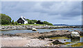
Boulders at shore of Gruinard Bay
by Trevor Littlewood geograph for square NG9092 Two lone boulders are prominent in the view at the seashore at Laide near to the... (more)
Tags:
subject:Boulder
Boulders
top:Coastal
top:Derelict, Disused
top:Docks, Harbours
top:Estuary, Marine
type:Geograph
top:Lowlands
Remains of Jetty
top:Rocks, Scree, Cliffs
Seashore
|

|
Seashore, Iona
by M J Richardson geograph for square NM2823 Looking southeast to Mull, across the Sound of Iona.
Tags:
Argyll and Bute
subject:Coast
top:Coastal
top:Estuary, Marine
type:Geograph
top:Grassland
place:Iona
top:Islands
top:Rocks, Scree, Cliffs
Seashore
Sound of Iona
|

|
Arran coast south-west of Merkland Point
by Trevor Littlewood geograph for square NS0238 Brodick Bay and the town of Brodick itself lie in the distance.
|

|
East Beach, Lossiemouth
by Alan Murray-Rust for square NJ2470 Contre-jour view from the end of the east pier of the harbour.
|

|
The Ouse
by Chris Heaton geograph for square NU1341 Small bay on the southern coast of Lindisfarne - with views over to the village... (more)
|

|
Shoreline near Sandbraes
by Doug Lee geograph for square NS0527 |

|
Becks running into the North Sea
by Pauline E geograph for square NZ8712 Dunsley Beck and Newholm Beck converge a few metres before they empty into the... (more)
|

|
Cliffs and sea defences
by Pauline E geograph for square TA1575 View across a line of WWII defences.
|

|
WWII defences
by Pauline E geograph for square TA1376 How many tides have these remnants from the past experienced? View across the... (more)
|

|
Preesall Sands
by Tom Richardson geograph for square SD3549 Finding a feature on the desolate mudflats was a real bonus
|

|
Tracks in the sand
by Tom Richardson geograph for square SD3449 Pretty much all there is in this square other than these vehicle tracks are lug... (more)
|

|
Asknish Bay
by Chris Heaton geograph for square NM7910 The bay as seen from the Arduaine Gardens
|

|
Looking out from Machrihanish Seabird Observatory
by Caroline Martin geograph for square NR6220 |

|
Porth Simdde
by Eirian Evans geograph for square SH1626 Eroded posts at Porth Simdde are all that remain of a jetty which was built to... (more)
Tags:
subject:Beach
top:Coastal
top:Estuary, Marine
type:Geograph
top:Islands
top:Quarrying, Mining
Seashore
|

|
The western shore of Coquet Island
by Christine Johnstone geograph for square NU2904 About two hours before high tide. Coquet Island is home to 40,000 breeding... (more)
|

|
Chalk Cliffs at South Landing
by Chris Heaton for square TA2269 Near Flamborough Head, a chalk headland that juts about four miles out into the... (more)
|

|
Cattersty Sands from the Jetty at Skinningrove
by Chris Heaton geograph for square NZ7120 |

|
Burn mouth near Caird's Cave
by Alan Murray-Rust geograph for square NH7459 The burn is unnamed on the map, although the steading on the hillside is named... (more)
|

|
Surf's Up! Upgang Beach
by Eirian Evans geograph for square NZ8712 |

|
Walking through the shingle
by Eirian Evans geograph for square NZ8712 As the tide recedes, a shingle shore appears below the sandy Upgang Beach
Tags:
subject:Beach
top:Coastal
top:Estuary, Marine
type:Geograph
top:Paths
Seashore
top:Sport, Leisure
|

|
Upgang Beach
by Eirian Evans geograph for square NZ8712 Upgang is a small beach on the north side of Whitby. It is sandwiched in between... (more)
|

|
Traeth Mawr
by Eirian Evans geograph for square SS9070 One of Wick's two beaches, the other being Traeth Bach, separated by... (more)
|

|
Limestone shelves near Traeth Mawr
by Eirian Evans geograph for square SS9069 Tags:
subject:Beach
top:Coastal
type:Geograph
top:Geological Interest
top:Rocks, Scree, Cliffs
Seashore
Wave-Cut Platform
|

|
Salen Bay
by Eirian Evans geograph for square NM5643 |

|
Geological Formations on Helwell Bay
by Chris Heaton geograph for square ST0743 Stratification of sedimentary mudstone cliffs, and fossil bearing rocky beaches... (more)
Tags:
Cliff
Coastal Scene
type:Geograph
top:Geological Interest
Rock Strata
Seashore
Sedimentary Rock
|

|
Offshore reef at Salen Bay
by Eirian Evans geograph for square NM5643 |

|
National Cycle Network 1 signpost at the Strand
by Steve Daniels geograph for square TQ7869 Tags:
top:Coastal
type:Geograph
place:Gillingham
National Cycle Network Route 1
National Cycle Network Signpost
top:Paths
Seashore
|

|
The seafront at the Strand
by Steve Daniels geograph for square TQ7869 |

|
On the rocks in Helwell Bay
by David Martin geograph for square ST0843 Tags:
top:Coastal
top:Estuary, Marine
type:Geograph
top:Geological Interest
top:Rocks, Scree, Cliffs
Seashore
|

|
Carsethorn beach, 90 minutes before low tide
by Christine Johnstone geograph for square NX9959 Where the Nith estuary meets the Solway Firth.
|

|
Shingle bank, Scarf Craig
by Alan Murray-Rust geograph for square NJ2271 The eastern extremity of the west beach at Lossiemouth, known as The Hythe.
|

|
Anti-tank blocks, West Beach, Lossiemouth
by Alan Murray-Rust geograph for square NJ2270 In a stunning blue sea.
|

|
Shingle shoreline between Kingston and Lossiemouth
by Alan Murray-Rust geograph for square NJ2868 The regular ridging of the shingle, forming small bays, results from the... (more)
|

|
Sunlight on the sea
by Alan Murray-Rust geograph for square NJ2370 From the east wall at Lossiemouth Harbour.
|

|
Airds Bay, Sandgreen
by M J Richardson geograph for square NX5752 An inlet of Fleet Bay.
Tags:
subject:Coast
top:Coastal
Dumfries and Galloway
Fleet Bay
type:Geograph
place:Sandgreen
Seashore
top:Village, Rural Settlement
|

|
Seafront - viewed from Esplanade Avenue
by Betty Longbottom geograph for square SS8176 |

|
Wick and Thurso train approaching Helmsdale
by Alan Murray-Rust geograph for square ND0114 The last stretch of shoreline before the line turns inland here for the climb... (more)
|

|
Wick and Thurso train approaching Helmsdale
by Alan Murray-Rust geograph for square ND0013 Winding along the coastline below Portgower.
|

|
Shore of Loch na Keal alongside B8035
by Trevor Littlewood geograph for square NM4535 The B8035 below steep ground. Inch Kenneth is just offshore, out of view.
Tags:
B Road (Classified B)
top:Coastal
type:Geograph
subject:Loch
top:Roads, Road Transport
Sea Loch
Seashore
|

|
Smeaton Pier St Ives
by Martin Dawes geograph for square SW5240 From the small pier north of the harbour.
Tags:
top:Coastal
top:Docks, Harbours
type:Geograph
Harbour Pier
top:Rocks, Scree, Cliffs
Seashore
top:Suburb, Urban Fringe
|

|
Newton Haven, north side
by Alan Murray-Rust geograph for square NU2424 The rocky foreshore is essentially submerged at high spring tides.
|

|
Stone maze, near Lindisfarne Castle
by Alan Murray-Rust geograph for square NU1341 Created on the area of raised beach at the eastern corner of the island using... (more)
|

|
Traeth yr As
by Stephen McKay geograph for square SS9070 Rocky beach at the foot of Cwm Nash.
|

|
Low tide at Broad Ledge, Lyme Regis
by Becky Williamson geograph for square SY3492 A great place for rockpooling.
|
