Geograph - photograph every grid square
About tags on Geograph
Tags
Geographical Context
Subjects
Types
Other Prefixes
Public Tags
Related Tags
|
Coverage Map
Tag:
Sedgemoor
Showing images tagged with
Sedgemoor
tag.
View all tagged images
-
In Browser
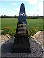
Information Board at Sedgemoor Crematorium
by
David Hillas
for square
ST3043
This board is at the entrance to the crematorium in Red Lane and has been... (
more
)
Tags:
top:
Burial Ground, Crematorium
type:
Close Look
Crematorium
Crematorium Entrance
top:
Flat Landscapes
Information Board
Sedgemoor
Entrance to Sedgemoor Crematorium
by
David Hillas
geograph for square
ST3043
This photo shows the entrance to Sedgemoor Crematorium in Red Lane TA6 4SR. The... (
more
)
Tags:
top:
Burial Ground, Crematorium
Crematorium
Crematorium Entrance
top:
Flat Landscapes
type:
Geograph
Information Board
Sedgemoor
Memorial Post Box at Sedgemoor Crematorium
by
David Hillas
for square
ST3043
This white EIIR post box is located by the Garden of Remembrance and was... (
more
)
Tags:
top:
Burial Ground, Crematorium
type:
Close Look
Crematorium
Elizabeth II Post Box
top:
Flat Landscapes
Memorial Post Box
Post Box
Post-Box
Sedgemoor
Covid-19 Memorial at the Sedgemoor Crematorium
by
David Hillas
geograph for square
ST3043
This memorial is on the right as one enters the crematorium in Red L. It was... (
more
)
Tags:
top:
Burial Ground, Crematorium
Covid 19
Covid 19 Memorial
COVID-19
Crematorium
top:
Flat Landscapes
type:
Geograph
Red Lane
off:
Red Lane
Sedgemoor
Parchey Bridge from NCN3
by
Kevin Pearson
geograph for square
ST3537
A photograph of Parchey Bridge near Chedzoy, taken from the NCN3 path alongside... (
more
)
Tags:
near:
Bawdrip
subject:
Bridge
near:
Chedzoy
top:
Flat Landscapes
type:
Geograph
river:
Kings Sedgemoor Drain
NCN3
Parchey Bridge
top:
Paths
top:
Rivers, Streams, Drainage
Sedgemoor
Somerset
county:
Somerset
Somerset Levels
top:
Sport, Leisure
top:
Village, Rural Settlement
Sedgemoor Crematorium from Red Lane
by
David Hillas
geograph for square
ST3043
This photo shows the crematorium from Red Lane with the cremation building in... (
more
)
Tags:
top:
Burial Ground, Crematorium
Crematorium
top:
Flat Landscapes
type:
Geograph
Red Lane
Sedgemoor
Sedgemoor Crematorium Board
by
David Hillas
for square
ST3043
This board is in Red Lane with the crematorium entrance in the distance. The... (
more
)
Tags:
top:
Burial Ground, Crematorium
type:
Close Look
Crematorium
Crematorium Board
top:
Flat Landscapes
Sedgemoor
Garden of Remembrance at the Sedgemoor Crematorium
by
David Hillas
geograph for square
ST3043
This photo shows the Garden of Remembrance at the west end of the crematorium.... (
more
)
Tags:
top:
Burial Ground, Crematorium
Crematorium
top:
Flat Landscapes
Garden of Remembrance
type:
Geograph
Sedgemoor
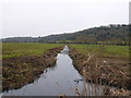
Wick Moor Rhyne
by
Nigel Mykura
geograph for square
ST3827
This rhyne drains the northeastern most corner of West Sedgemoor. On the right... (
more
)
Tags:
top:
Flat Landscapes
top:
Lakes, Wetland, Bog
Levels
Rhyne
top:
Rivers, Streams, Drainage
Sedgemoor
Somerset Levels
Sedgemoor Crematorium building
by
David Hillas
geograph for square
ST3044
This building provides cremation services to the people of Bridgwater,... (
more
)
Tags:
top:
Burial Ground, Crematorium
building type:
Crematorium
Crematorium
Crematorium Buildings
top:
Flat Landscapes
type:
Geograph
Sedgemoor
West Sedgemoor Main Drain at Stathe
by
David Smith
geograph for square
ST3728
Tags:
top:
Flat Landscapes
type:
Geograph
top:
Lowlands
top:
Rivers, Streams, Drainage
Sedgemoor
Somerset Levels
subject:
Water Infrastructure
top:
Water Resources
West Sedge Moor
by
Nigel Mykura
geograph for square
ST3826
This is the north eastern corner of the moor in between Red Hill which is the... (
more
)
Tags:
top:
Flat Landscapes
top:
Lakes, Wetland, Bog
Levels
Rhyne
top:
Rivers, Streams, Drainage
Sedgemoor
Somerset Levels
St Mark's Church
by
S
for square
ST3847
St Mark's Church was built in April 1268 as The Church of the Holy Cross.... (
more
)
Tags:
period:
1260s
date:
1268
period:
1400s
date:
1407
period:
1520s
date:
1524
period:
15th Century
period:
1790s
date:
1794
period:
1850s
date:
1853
period:
1930s
date:
1939
Andr?
April
April 1268
Belgium
Bruges
Cathedral
Choir
Church
type:
Close Look
Mark
former:
Market Cross
top:
Religious Sites
Sculptor
Sculpture
Sedgemoor
county:
Somerset
St Marks Church
St Salvators Cathedral
The Church of the Holy Cross
top:
Village, Rural Settlement
Wooden Sculpture
View more in the Image Search
or
in Browser
View images matching 'Sedgemoor' anywhere
in
the tags
Don't click these:
PotMel 1
PotMel 2
☰
Home
View
Search
Marked Images
Maps
Browser
Explore
Showcase
New Images
Collections
Interact
Games
Discussions
Blog
Contributors
Submit
Statistics
Leaderboards
General
FAQ
Help Pages
Sitemap
Contact Us
Support Us
sponsored by
🔍︎
What to search:
Photos
Enter keywords or a location/postcode to search nearby images
Enter a Grid Reference
Placenames
Collections
Website Pages
Everything
Others:
Advanced Search
|
Image Browser
Or:
Coverage Map
|
Searchable Map
You are not logged in
|
login
|
register