Public Tags
Tag: Side·Road
Showing latest 50 of 301 images tagged with Side Road tag.
|
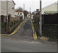
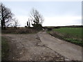
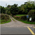
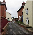
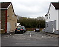
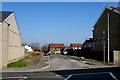
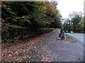
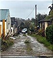
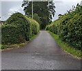
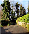
No parking in this side street, Ystrad Mynach
by Jaggery geograph for square ST1494 Double yellow lines on both sides of the dead-end side road ascending
from the... (more)
|
|
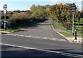
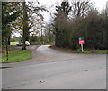
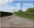
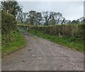
Unnamed side road viewed across the A4104, Upton-upon-Severn
by Jaggery geograph for square SO8540 The side road uses a route on the north side of the A4104 and rejoins it 300... (more)
Tags:
top:Roads, Road TransportX
Side Road
|
|
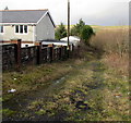
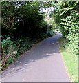
Grassy side road in Seven Sisters
by Jaggery geograph for square SN8209 Descending from the northwest side of the A4109, the main road through Seven Sisters.
Tags:
type:GeographX
Grassy Side RoadX
top:Roads, Road TransportX
Side Road
top:Village, Rural SettlementX
|
|
Side arm of Mackworth Road, Porthcawl
by Jaggery geograph for square SS8276 Dead-end side arm on the east side of the main north-south course of Mackworth Road.
|
|
Fork in a side road, Tythegston
by Jaggery geograph for square SS8579 Set back from the east side of the A4106 Bridgend Road.
Tags:
type:GeographX
top:Roads, Road TransportX
Side Road
Side Road ForkX
top:Village, Rural SettlementX
|
|
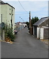
Side road on the NNW side of Caersalem Terrace, Llanelli
by Jaggery geograph for square SS5099 The side road leads to Marsh Street.
|
|
Steep side road in Senghenydd
by Jaggery geograph for square ST1190 Ascending from the north side of Caerphilly Road near the Commercial Street junction.
Tags:
type:GeographX
top:Roads, Road TransportX
Side Road
Steep Side RoadX
top:Village, Rural SettlementX
|
|
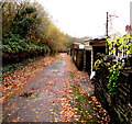
Fallen leaves on a side road in Ystrad Mynach
by Jaggery geograph for square ST1494 On the south side of Pantycelyn Road past the backs of houses
on the east side... (more)
|

|
Road on the west side of Goldcroft Common, Caerleon
by Jaggery geograph for square ST3390 This is a side road for access to houses. The main road is the B4236 on the east... (more)
Tags:
CommonX
Common LandX
type:GeographX
top:Housing, DwellingsX
top:Roads, Road TransportX
Side Road
|
|
Unnamed side road, Llanvetherine, Monmouthshire
by Jaggery geograph for square SO3617 From the north side of the B4521 Old Ross Road, the dead-end
side road leads... (more)
Tags:
Dead End RoadX
type:GeographX
top:Roads, Road TransportX
Side Road
top:Village, Rural SettlementX
|
|
Western end of a side road, Ashchurch
by Jaggery geograph for square SO9233 Parallel with the south side of the A46, this dead-end side road gives access to... (more)
Tags:
Dead End RoadX
type:GeographX
top:Roads, Road TransportX
Side Road
top:Village, Rural SettlementX
|
|
Side road to Bassaleg Road houses, Newport
by Jaggery geograph for square ST2987 The side road leads to houses set back from the south side of Bassaleg Road.... (more)
Tags:
type:GeographX
top:Housing, DwellingsX
top:Roads, Road TransportX
Side Road
top:Suburb, Urban FringeX
|
|
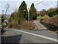
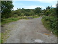
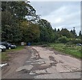
Side road towards a disused quarry west of Machynlleth
by Jaggery geograph for square SH7300 The side road ascends from the south side of the A487 Aberystwyth Road.
|
|
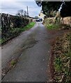
Uneven surface on a side road, Ludlow
by Jaggery geograph for square SO5174 Between Springfield Lodge on the left and Smithfield House on the right,
the... (more)
|
|
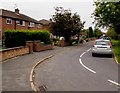
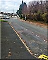
Side road on the west side of Stratford Road, Warwick
by Jaggery geograph for square SP2763 For 150 metres ahead, houses on the west side of Stratford Road are set back 30... (more)
|
|
Side road on the south side of the A4810, Llanwern
by Jaggery geograph for square ST3886 Formerly part of Llanwern Steelworks, all of which is now on the north side of the A4810.
Tags:
top:Roads, Road TransportX
Side Road
|
|
Public footpath on a side road, Abertysswg
by Jaggery geograph for square SO1205 The footpath signpost is on the right.
Carn-y-tyla Terrace is on the left side... (more)
Tags:
type:GeographX
Public FootpathX
top:Roads, Road TransportX
Side Road
top:Village, Rural SettlementX
|
|
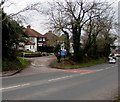
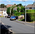
Side street on the east side of Commercial Street, Tynant
by Jaggery geograph for square ST0685 This side street is at the northern end of shops and other businesses in... (more)
|
|
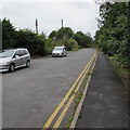
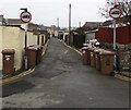
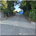
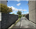
Wheelie bins and weight limit signs, Ystrad Mynach
by Jaggery geograph for square ST1494 At the southern end of the side road between Central Street and Commercial... (more)
|
|
Side road towards Church Road, New Quay
by Jaggery geograph for square SN3859 Viewed from Towyn Road. The part of the side road in view is parallel with Park Street.
|
|
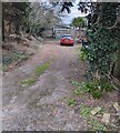
Short side road, Graig Wood Close, Newport
by Jaggery geograph for square ST3090 This 45 metre long side road is on the west side of the main part of Graig Wood Close.
Tags:
type:GeographX
top:Housing, DwellingsX
top:Roads, Road TransportX
Side Road
top:Suburb, Urban FringeX
|

|
Side road to Jireh Evangelical Church, Loughor
by Jaggery geograph for square SS5698 Parallel with The Croft on the right, this side road north of Castle Street... (more)
Tags:
top:Roads, Road TransportX
Side Road
|
|
Unnamed side road, Pemberton, Llanelli
by Jaggery geograph for square SN5200 On the north side of the B4297 Llandafen Road in the Pemberton area of Llanelli.
Tags:
top:Roads, Road TransportX
Side Road
|
|
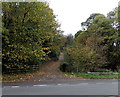
Side road and public footpath west of Shifnal
by Jaggery geograph for square SJ7407 On the left, a wooden signpost showing public footpath points along a side road... (more)
Tags:
top:PathsX
Public FootpathX
top:Roads, Road TransportX
Side Road
top:Village, Rural SettlementX
|
|
Unnamed side road in Abersychan
by Jaggery geograph for square SO2603 Viewed from the Incline Road end. The side road leads to the backs of a few... (more)
|
|
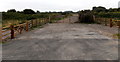
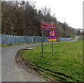
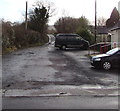
Road ahead closed - authorised access only, Aberfan
by Jaggery geograph for square ST0799 The unnamed side road extends from Aberfan Fawr on this side to Woodland Drive... (more)
|
|
Side road to a gas station west of Ashe Ingen Court Farm
by Jaggery geograph for square SO5725 The 500 metre long side road leads to a site shown on maps as Gas Station.... (more)
Tags:
top:Roads, Road TransportX
Side Road
|
|
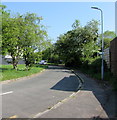
Side road from Penrhys Road, Ystrad
by Jaggery geograph for square SS9994 A flattish side road diverges from the steep B4512 Penrhys Road.
|
|
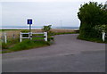
Side road towards Aust Cliff, Old Passage
by Jaggery geograph for square ST5688 The sign on the corner of Passage Road shows that the side road is not a through... (more)
Tags:
top:Roads, Road TransportX
Side Road
|
|
Side road from Portal Road, Monmouth
by Jaggery geograph for square SO5011 On the west side of Portal Road.
Tags:
top:Roads, Road TransportX
Side Road
|
|
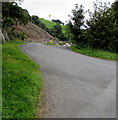
Side road ascends from Maesteg Road, Tondu
by Jaggery geograph for square SS8984 Drivers descending the side road have this mirror... (more)
Tags:
top:Roads, Road TransportX
Side Road
|
|
Side road heads away from Watford Road, Caerphilly
by Jaggery geograph for square ST1585 The side road connects Cuckoo House and Twyn-y-gwcw Cottages (about 200 metres... (more)
Tags:
top:Roads, Road TransportX
Side Road
|
|
Up a dead-end side road, Tidenham, Gloucestershire
by Jaggery geograph for square ST5595 Ascending from Tidenham Lane. A perimeter wall of St Mary and St Peter's... (more)
|
|
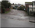
Dead-end side road at the southern edge of Malpas, Newport
by Jaggery geograph for square ST3089 The houses are alongside the A4051 Malpas Road.
Ableworld... (more)
Tags:
Dead End Side RoadX
type:GeographX
top:Roads, Road TransportX
Side Road
top:Suburb, Urban FringeX
|
|
Dead-end side road in Sedbury, Gloucestershire
by Jaggery geograph for square ST5493 Looking to the ESE from Grahamstown Road.
Tags:
Dead End Side RoadX
type:GeographX
top:Roads, Road TransportX
Side Road
top:Village, Rural SettlementX
|
|
Side road, Viney Hill, Gloucestershire
by Jaggery geograph for square SO6506 From the north side of Main Road in the Forest of Dean District of... (more)
|
|
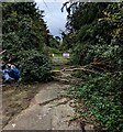
Blocked side road in Westend, Gloucestershire
by Jaggery geograph for square SO7806 Viewed from Grove Lane in October 2023.
Tags:
Blocked Side RoadX
type:GeographX
top:Roads, Road TransportX
Side Road
top:Village, Rural SettlementX
|
|
Dead-end side road, Stonehouse, Gloucestershire
by Jaggery geograph for square SO8005 Looking west from Verney Road.
|
|
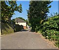
Side road, Mamhilad, Monmouthshire
by Jaggery geograph for square SO3003 On the west side of Old Abergavenny Road.
|
|
Dead-end side road, Malpas, Newport
by Jaggery geograph for square ST3091 On the east side of the A4051 Malpas Road.
Tags:
Dead End RoadX
type:GeographX
Minor Dead End RoadX
top:Roads, Road TransportX
Side Road
top:Suburb, Urban FringeX
|
|
Up a side road, Bruton
by Jaggery geograph for square ST6834 Dead-end side road ascending from the B3081.
|
|
Dead-end side road, Stanton, Monmouthshire
by Jaggery geograph for square SO3121 On the east side of the unclassified road from Llanthony to Llanvihangel... (more)
Tags:
Dead End RoadX
type:GeographX
top:Roads, Road TransportX
Side Road
top:Village, Rural SettlementX
|
|
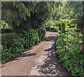
Hedge-lined side road in Llansoy, Monmouthshire
by Jaggery geograph for square SO4402 On the south side of the main road through Llansoy.
Tags:
type:GeographX
Hedge-Lined RoadX
top:Roads, Road TransportX
Side Road
top:Village, Rural SettlementX
|
|
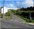
Dead-end side road in Ystradgynlais
by Jaggery geograph for square SN7910 On the west side of the B4599 Brecon Road near Penrhos.
|
|
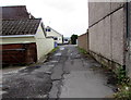
Potholed side road in Malpas, Newport
by Jaggery geograph for square ST3090 On the west side of the A4051 Malpas Road.
|
|
Side road in Malpas, Newport
by Jaggery geograph for square ST3089 From the A4051 Malpas Road, the side road leads to a path to Graig Wood Close.
|
|
Side road in Abergavenny
by Jaggery geograph for square SO2814 On the northwest side of the A40 Brecon Road.
|
|
Up a side road in Seven Sisters
by Jaggery geograph for square SN8209 Ascending from the southeast side of the A4109, the main road through Seven Sisters.
|
|
Water-filled potholes in Seven Sisters
by Jaggery geograph for square SN8108 On a side road on the NW side of Church Road on January 15th 2020.
Tags:
type:GeographX
PotholesX
Potholes (Road)X
top:Roads, Road TransportX
Side Road
top:Village, Rural SettlementX
|
|
Unnamed side road in Lydney
by Jaggery geograph for square SO6202 Dead-end side road viewed across Templeway West.
|