Public Tags
Tag: Site·of·Former·Workhouse
Showing images tagged with Site of Former Workhouse tag.

|
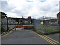
Former Workhouse buildings
by Gerald England geograph for square SJ8989 Derelict buildings formerly part of St Thomas's Hospital. The site belongs... (more)
|
|
Construction site behind Stockport College
by Gerald England geograph for square SJ8989
The derelict buildings in the background were formerly part of St... (more)
|
|
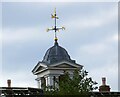
Workhouse weather vane
by Gerald England for square SJ8989
Seen over the top of derelict buildings formerly part of St Thomas's... (more)
|

|
Stockport College Carpark
by Gerald England geograph for square SJ8989 In the background is the former St Thomas' Hospital which was acquired by... (more)
Tags:
Car Park
College
top:Derelict, Disused
top:Educational Sites
former:Hospital
Site of Former Workhouse
Stockport College
former:Workhouse
|

|
Royal George Street
by Gerald England geograph for square SJ8989
This end of Royal George Street was at one time just a footpath SJ8989 : Royal George Street.... (more)
|

|
Site of Ashton Union Workshouse
by Gerald England geograph for square SJ9599 Inside a seating area near the Hartshead South entrance to Tameside General... (more)
Tags:
date:1851
date:1930
date:2011
Christmas Tree
Green Plaque
top:Health and Social Services
Hospital
person:Jackie Lane
Site of Former Workhouse
Tameside Metropolitan Borough Council
former:Workhouse
|

|
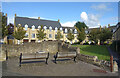
Scott House
by Richard Croft geograph for square TF3343 Grade II listed former entrance to the Union Workhouse, by Sir George Gilbert... (more)
|
|
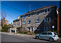
Site of the former Witney Workhouse
by Des Blenkinsopp geograph for square SP3409 Housing is now on the site once occupied by a municipal workhouse, In the... (more)
|
|
Wimborne - Allen Court, site of Parish Workhouse
by Mike Searle geograph for square SU0100 Allen Court, sheltered housing for the elderly, built on the site of the former... (more)
Tags:
top:City, Town Centre
top:Historic Sites and Artefacts
top:Housing, Dwellings
top:People, Events
Site of Former Workhouse
|

|
Maunder Close
by Neil Owen geograph for square ST7028 A modern, twentieth century housing development belies its past. This was the... (more)
Tags:
type:Geograph
top:Historic Sites and Artefacts
subject:Houses
top:Housing, Dwellings
Site of Former Workhouse
top:Suburb, Urban Fringe
|

|
Site of the old workhouse
by Neil Owen geograph for square ST3261 Weston did not have a proper facility of its own. It was part of the Axbridge... (more)
Tags:
type:Geograph
top:Historic Sites and Artefacts
subject:Houses
top:Housing, Dwellings
Site of Former Workhouse
top:Suburb, Urban Fringe
|

|
Gate piers of the old workhouse
by Stephen Craven geograph for square SE2931 Looking at the 1908 25-inch map, this was the entrance to the Holbeck Union... (more)
|
|
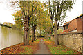
Workhouse walk
by Richard Croft geograph for square SK9772 Footpath from Burton Road that formerly led to the workhouse
|

|
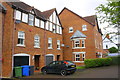
The Oasis at St Luke's School
by Stephen Craven geograph for square SE2931 St Luke's Primary School occupies the site of the former Holbeck Union... (more)
|
|
New housing on the west side of Wiggington Road
by Roger Templeman geograph for square SK2005 Ordnance Survey documents indicate that in 1956 a benchmark was levelled at... (more)
|

|
Slade House
by Neil Owen geograph for square SU0061 The large, modern block is the focal point of the extensive housing development... (more)
Tags:
type:Geograph
top:Health and Social Services
top:Historic Sites and Artefacts
subject:Houses
Site of Former Workhouse
top:Suburb, Urban Fringe
|

|
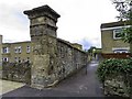
Disused gate piers, Cambrian Terrace
by Stephen Craven geograph for square SE2931 This was once the entrance to the large Holbeck Union Workhouse, built 1864 on... (more)
|
|
A stone pillar and wall on London Road
by Steve Daniels geograph for square SP5507 The pillar and wall were part of the former Headington Union Workhouse.
Tags:
top:Boundary, Barrier
type:Geograph
place:Headington
Site of Former Workhouse
Stone Pillar
Stone Wall
|

|
A last survivor of the old union
by Neil Owen geograph for square ST8032 This lodge on Castle Street is the last part of the original Mere Union... (more)
Tags:
type:Geograph
top:Historic Sites and Artefacts
top:Housing, Dwellings
subject:Lodge
Site of Former Workhouse
top:Suburb, Urban Fringe
|

|
Across Maunder Close
by Neil Owen geograph for square ST7028 Now a quiet housing area, the site was where the old Union Workhouse was built.... (more)
Tags:
type:Geograph
top:Historic Sites and Artefacts
subject:Houses
top:Housing, Dwellings
Site of Former Workhouse
top:Suburb, Urban Fringe
|

|
An alleyway off Baker Street
by Neil Owen geograph for square ST3261 Victorian houses front onto Alfred Street with modern housing around Baker... (more)
Tags:
subject:Alleyway
type:Geograph
top:Historic Sites and Artefacts
top:Housing, Dwellings
Site of Former Workhouse
top:Suburb, Urban Fringe
|
