Public Tags
Tag: Sluice
Other tags: subject:Sluice
Showing latest 50 of 1,154 images tagged with Sluice tag.

|
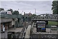
The Grand Sluice
by Bob Harvey for square TF3244 The huge granite cutwaters of the Grand Sluice of 1766 viewed from the... (more)
Tags:
place:Boston
Bridges Over the Witham
type:Close Look
top:Flat Landscapes
Grade II Listed
river:River Witham
top:Rivers, Streams, Drainage
subject:Sluice
|
|
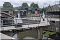
The Grand Sluice
by Bob Harvey geograph for square TF3244 The sluice consists of 4 arches. The nearest one is used by the Lock, to allow... (more)
Tags:
place:Boston
subject:Bridge
Bridges Over the Witham
top:Flat Landscapes
type:Geograph
Grade II Listed
river:River Witham
top:Rivers, Streams, Drainage
subject:Sluice
|
|
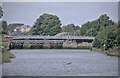
Lock and Sluice
by Bob Harvey geograph for square TF3244 It's a cluttered place, the upstream side of the Grand Sluice, and a tricky... (more)
Tags:
date:1766
place:Boston
Bridges Over the Witham
top:Flat Landscapes
type:Geograph
Lock
river:River Witham
top:Rivers, Streams, Drainage
subject:Sluice
top:Suburb, Urban Fringe
|
|
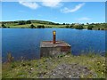
The Grand Sluice
by Bob Harvey geograph for square TF3244 Tags:
date:1766
near:Boston
Bridge
Bridges Over the Witham
top:Flat Landscapes
type:Geograph
Grade II Listed
river:River Witham
top:Rivers, Streams, Drainage
subject:Sluice
top:Suburb, Urban Fringe
Tidal Limit
Tidal River
|
|
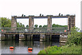
Whinhill Reservoir: sluice
by Lairich Rig geograph for square NS2774 The sluice is first marked on the 1912 revision of the map, and first labelled... (more)
|
|
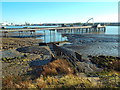
The A G Wright Sluice
by Chris Allen geograph for square TF5801 Part of the complex at Denver Sluice. This is the inlet sluice to the flood... (more)
Tags:
Denver Sluice
top:Flat Landscapes
Flood Defence
Flood Relief
top:Rivers, Streams, Drainage
subject:Sluice
Sluice
|
|
Sluice near Dagenham
by Malc McDonald geograph for square TQ4882 A sluice flowing into the River Thames near Dagenham.
This image was taken at... (more)
Tags:
near:Barking
near:Barking Riverside
near:Creekmouth
near:Dagenham
place:East London
type:Geograph
Mudflats
river:River Thames
River Thames
top:Rivers, Streams, Drainage
Sluice
subject:Sluice
Sluice Outfall
Tidal Mudflats
|

|
Abbey Mill Sluice, Tewkesbury
by Jaggery geograph for square SO8832 A nearby Environment Agency information board states that this single fish-belly... (more)
Tags:
top:Rivers, Streams, Drainage
Sluice
|

|
Sluice gate
by Richard Sutcliffe for square NS2945 A sluice gate with footbridge behind. The sluice controls the water entering the... (more)
|

|
Sluice gate, Kelly Cut
by Richard Sutcliffe geograph for square NS2471 The Kelly Cut is an aqueduct, constructed in 1845, linking Kelly Reservoir to... (more)
Tags:
subject:Aqueduct
type:Geograph
top:Historic Sites and Artefacts
top:Rivers, Streams, Drainage
subject:Sluice
Sluice Gate
|

|
Sluices, Bremilham Mill
by Vieve Forward geograph for square ST9086 |

|
Sluice maintenance on the Cardiff Bay Barrage
by Chris Allen geograph for square ST1972 The Cardiff Bay Barrage closes the entrance to Cardiff Bay creating a 500 acre... (more)
Tags:
Cardiff Bay
Cardiff Bay Barrage
top:Docks, Harbours
type:Geograph
place:Penarth
subject:Sluice
Sluices
|
|
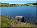
Whinhill Reservoir: old sluice
by Lairich Rig geograph for square NS2774 A later sluice (NS2774 : Whinhill Reservoir: sluice) that is about 45 metres further north along the... (more)
|

|
Abbey Mill Sluice, Tewkesbury
by Russel Wills geograph for square SO8832 The single, fish belly, sluice with all the debris on it on the left, is in the... (more)
Tags:
type:Geograph
top:Historic Sites and Artefacts
top:Lowlands
top:Rivers, Streams, Drainage
subject:Sluice
|

|
Sluice gate, Croome Park
by Philip Halling geograph for square SO8843 A wooden sluice gate on the Sluice Pond at the southern end of Croome River in... (more)
|

|
The canal sluice, Nene Quay, Wisbech
by Richard Humphrey geograph for square TF4609 The canal sluice was installed in 1930 where the Wisbech to Outwell Canal joined... (more)
Tags:
Bridge
Canal
top:Historic Sites and Artefacts
River
top:Rivers, Streams, Drainage
subject:Sluice
Sluice
|

|
Sloop Amy Hewson, New River Ancholme, Ferriby Sluice
by Jo and Steve Turner geograph for square SE9721 The New River Ancholme is the result a local landowner cutting a straight... (more)
Tags:
top:Historic Sites and Artefacts
top:Rivers, Streams, Drainage
subject:Sluice
top:Village, Rural Settlement
|

|
Sluice and water abstraction point
by Rudi Winter geograph for square SN7787 The massive concrete structure is a former sluice in the Maesnant. It no longer... (more)
Tags:
top:Derelict, Disused
top:Rivers, Streams, Drainage
subject:Sluice
top:Uplands
top:Water Resources
|

|
The "George Hay" Sluice along the River Welland
by Mat Fascione geograph for square TF2930 This is the point where the Lord's Drain joins the River Welland.
This... (more)
|

|
The "George Hay" Sluice along the River Welland
by Mat Fascione geograph for square TF2930 This is the point where the Lord's Drain joins the River Welland.
This... (more)
|

|
The "George Hay" Sluice along the River Welland
by Mat Fascione geograph for square TF2930 This is the point where the Lord's Drain joins the River Welland.
This... (more)
|

|
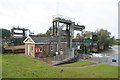
Lea Bridge sluice
by Richard Croft geograph for square TQ3586 Sluice house and sluice where the River Lee / Lea joins the Lee Navigation Canal
Tags:
top:Canals
place:Lea Bridge
River Lee Navigation
top:Rivers, Streams, Drainage
Sluice
Sluice House
|
|
Denver Sluice
by Chris Allen geograph for square TF5801 Built to bar tides from the low fen area and improve navigation. first... (more)
|
|
Denver Sluice
by Chris Allen for square TF5801 Built to bar tides from the low fen area and improve navigation. first... (more)
|

|
Sluice gate, Lisburn/Hilden (4)
by Albert Bridge for square J2864 See J2864 : Sluice gate, Lisburn/Hilden (3). The downstream side of the sluice gate, controlling the Lagan,... (more)
|

|
Sluice on Round Dam
by Rob Farrow geograph for square SD9952 A close-up of the sluice seen in SD9952 : Round Dam. This sluice controls the outflow... (more)
|

|
Dunwich River Sluice
by Geographer for square TM4974 Category: Sluices Tags:
Dunwich River
Dunwich River Sluice
top:Rivers, Streams, Drainage
subject:Sluice
Sluice
at:Walberswick
|

|
The sluice at Ross Low
by Oliver Dixon geograph for square NU1335 Access across the sluice now provides continuity for the King Charles III... (more)
Tags:
top:Estuary, Marine
type:Geograph
King Charles III England Coast Path National Trail
top:Lakes, Wetland, Bog
National Trail
Path
top:Paths
Salt Marsh
subject:Sluice
Sluice
|
|
Cowbit Sluice piers
by Bob Harvey geograph for square TF2421 Although called a sluice, there are no sluice gates. The grooves in these... (more)
Tags:
top:Flat Landscapes
type:Geograph
river:River Welland
top:Rivers, Streams, Drainage
subject:Sluice
place:Spalding
top:Suburb, Urban Fringe
|

|
The Sluice
by Bob Harvey geograph for square TF2729 The sluice gates can be raised to permit vessels through when the tidal height... (more)
Tags:
Fenland
top:Flat Landscapes
type:Geograph
river:Glen
Lowest Bridging Point
subject:River
top:Rivers, Streams, Drainage
subject:Sluice
Sluice Gate Mechanism
place:Surfleet Seas End
The Fens
top:Village, Rural Settlement
|

|
Sluice mechanism
by Bob Harvey geograph for square TF2729 On the landward side of sluice at Surfleet Seas Ends, the sluice gate can be... (more)
Tags:
subject:Bridge
Fenland
top:Flat Landscapes
type:Geograph
river:Glen
top:Rivers, Streams, Drainage
subject:Sluice
Sluice Gate Mechanism
place:Surfleet Seas End
The Fens
top:Village, Rural Settlement
|

|
Sluice for Chatsworth Mill
by Ian Calderwood geograph for square SK2568 This sluice controlled the supply of water from the Derwent, which powered the... (more)
Tags:
former:Corn Mill
top:Country Estates
top:Derelict, Disused
river:Derwent
river:Derwent (Derbyshire)
type:Geograph
Mill Leat Sluice Gate
top:Rivers, Streams, Drainage
subject:Sluice
Sluice Gate
top:Water Resources
|

|
Redundant sluice
by John Myers geograph for square TQ9693 A major sluice structure originally constructed to control water flow from the... (more)
Tags:
top:Coastal
top:Estuary, Marine
type:Geograph
top:Islands
top:Lakes, Wetland, Bog
subject:Sluice
Sluice (Disused)
Wallasea Island Wild Coast Project
|

|
The Weaver Sluices
by David Dixon geograph for square SJ4980 The Weaver sluices are situated opposite the confluence of the River Weaver and... (more)
Tags:
top:Canals
top:Estuary, Marine
type:Geograph
Manchester Ship Canal
Mersey Estuary
camera:Panasonic DMC-G7
River Mersey
River Weaver
top:Rivers, Streams, Drainage
Sluice Gates
Sluices
|

|
Manchester Ship Canal, Weaver Sluices
by David Dixon geograph for square SJ4980 The Weaver sluices are situated opposite the confluence of the River Weaver and... (more)
Tags:
top:Canals
top:Estuary, Marine
type:Geograph
Manchester Ship Canal
Mersey Estuary
camera:Panasonic DMC-G7
River Mersey
River Weaver
top:Rivers, Streams, Drainage
Sluice Gates
Sluices
|

|
Sluice at Snow Hill
by Rob Farrow geograph for square SZ7798 A view over the concrete abutments of the sluice at Snow Hill to the west of... (more)
Tags:
top:Coastal
top:Estuary, Marine
top:Rivers, Streams, Drainage
subject:Sluice
place:Snowhill Creek
place:West Wittering
|

|
Sluices opening
by Neil Owen geograph for square ST5772 A red beacon - now a thoroughly modern LED array - flashes to warn that the... (more)
Tags:
top:City, Town Centre
top:Docks, Harbours
Former Docks
top:Industry
subject:Sluice
Sluices
Warning Sign
top:Water Resources
|

|
Sluice, Mill Avon
by David Dixon geograph for square SO8832 The Mill Avon, which supplied water to drive the mill wheels of Abbey Mill... (more)
Tags:
12th Century
river:Avon
Canal
top:Industry
Leat
Millstream
top:Rivers, Streams, Drainage
Sluice Control Box
Sluices
Twelfth Century
|

|
Spout at sluice on Abhainn Srath Rainich north of Garve
by ian shiell geograph for square NH3775 There was insufficient flow for the sluice to be taking any water at all -... (more)
|

|
Murals to combat graffiti on the sluice gate building
by Ian Greig geograph for square SJ8092 The sluice gate building was the victim of regular graffiti which is unsightly... (more)
|

|
Flood Relief Cut-off Channel
by Hugh Venables geograph for square TF5901 Looking towards Impounding Sluice. See TF5801 : Denver Sluice information board for a map of all the channels... (more)
|
|
Sluice at East Lock
by Oast House Archive geograph for square TQ6447 Category: Sluice gate On River Medway
Tags:
top:Rivers, Streams, Drainage
subject:Sluice
|

|
Sluice gate approach
by Mr Ignavy geograph for square TL3671 Category: Sluice gate A far cry from timber and a mechanical winch. Webbs Hole sluice gate detail.
Tags:
top:Rivers, Streams, Drainage
subject:Sluice
|

|
Close up of Mill sluice gates
by Mr Ignavy for square TL4352 Category: Sluices From what I could see there is no longer a mill wheel, however, the flow of... (more)
Tags:
top:Rivers, Streams, Drainage
subject:Sluice
|

|
A sluice on Wall Common
by Neil Owen geograph for square ST2545 The easternmost of two sluices on Wall Common regulates the runoff from the... (more)
|

|
Sluice on the Louth Navigation
by Oliver Dixon geograph for square TF3488 On the site of the former Top Lock.
|

|
The sluice at Ross Low
by Oliver Dixon geograph for square NU1335 The King Charles III England Coast Path crosses the stream at this point.
Tags:
type:Geograph
King Charles III England Coast Path National Trail
National Trail
Path
top:Paths
top:Rivers, Streams, Drainage
subject:Sluice
Sluice
|

|
Sluice on the Blane Water
by Richard Sutcliffe geograph for square NS5579 The remains of the cobbled surface of a weir can be seen under the water, just... (more)
Tags:
river:Blane Water
type:Geograph
top:Historic Sites and Artefacts
top:Rivers, Streams, Drainage
subject:Sluice
Weir
|

|
Sluice control mechanisms, Loch Katrine Dam
by Richard Sutcliffe geograph for square NN4806 There are 13 sluices altogether. The mechanisms were made by Glenfield Co Ltd, Kilmarnock.
Tags:
Dam
type:Geograph
top:Lakes, Wetland, Bog
Loch Katrine
subject:Sluice
Sluices
top:Water Resources
|

|
Sluices, Bo'ness Dock
by Richard Sutcliffe geograph for square NS9981 The original lock gates (behind the sluices) NT0081 : Bo'ness Dock are now disused. The... (more)
|
