Public Tags
Tag: Speed·Restriction·Sign
Showing latest 50 of 52 images tagged with Speed Restriction Sign tag.
|
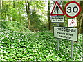
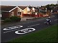
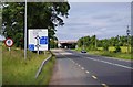
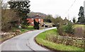
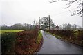
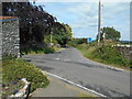
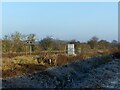
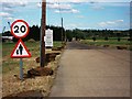
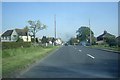
Wild Garlic and Road signs.
by Nigel Mykura geograph for square ST5204 At the southern entrance to the village, on the minor road down from the A356,... (more)
|
|
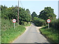
Speed Restriction Signs
by Keith Evans geograph for square TM3562 Speed restriction signs on The Grove near to Sweffling, Suffolk.
|
|
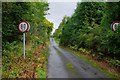
80 km/h speed restriction signs on Dromneavane near Kenmare, Co. Kerry
by P L Chadwick geograph for square V9172 At this point the speed restriction changes from 50 km/h to 80 km/h.
Tags:
type:GeographX
RoadX
top:Roads, Road TransportX
Speed Restriction SignsX
top:UplandsX
top:Village, Rural SettlementX
|
|
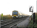
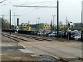
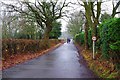
Speed restriction at Hoo
by Stephen Craven geograph for square TQ6973 Unit no. 465239 at the rear of the 16.44 Gillingham - Charing Cross as it heads... (more)
|
|
Twenty twenty vision
by Ian Paterson geograph for square SJ3046 Just what you need when there's motorcyclists about.
Think once.
Think... (more)
|
|
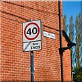
"Antique" speed restrictor signs, Uffmoor Estate, Hasbury
by Oliver Mills geograph for square SO9582 Located just on the outskirts of Halesowen, on the junction with Hagley Road.... (more)
Tags:
subject:EstateX
type:GeographX
place:HalesowenX
top:Housing, DwellingsX
Pre-WorboysX
signage:Road SignX
top:Roads, Road TransportX
subject:SignX
Speed Limit 30mphX
Speed Limit 40mphX
Speed Restriction Sign
top:Suburb, Urban FringeX
|
|
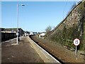
Platform 2, Whitehaven Station
by Adrian Taylor geograph for square NX9718 Platform 2 at Whitehaven Station, formerly known as Whitehaven Bransty Station... (more)
|
|
Road signs at east end of Green Head Lane
by Luke Shaw geograph for square SD8263 The hardware includes speed restriction signs, Pennine Way finger sign post and... (more)
|
|
R448 road approaching junction with M9, near Prumplestown, Co. Kildare
by P L Chadwick geograph for square S7682 The R448 road from Carlow approaching its junction with the M9 Dublin to... (more)
|
|
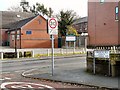
Signs at the end of Osborne Road
by Gerald England geograph for square SJ9594 At the junction with Stockport Road. Zion Congregational Church is opposite.
|
|
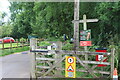
Entrance to Usk sports facilities, Mill Street
by M J Roscoe geograph for square SO3700 The wooden Usk Valley Walk appears to indicate that the Walk goes across the... (more)
Tags:
top:Boundary, BarrierX
subject:GateX
type:GeographX
No Dog Fouling SignX
top:Roads, Road TransportX
Speed Restriction Sign
top:Suburb, Urban FringeX
Usk Valley WalkX
Wooden SignpostX
|
|
Heartfelt plea
by Neil Owen geograph for square ST4259 A speed restriction sign with a difference.
Tags:
type:GeographX
top:Roads, Road TransportX
subject:SignX
Speed Restriction Sign
top:Village, Rural SettlementX
|
|
Sign at the end of Hulme Road
by Gerald England for square SJ9095 The sign denotes that the speed limit on Manchester Road ahead is 40mph and this... (more)
|
|
Approaching Kelly Bray
by Derek Harper geograph for square SX3571 The speed restriction signs and village name, here about 100 metres before the... (more)
|
|
Short speed restriction
by Alan Murray-Rust geograph for square SK5437 The basic limit along this particular section of the tramway is 50 kph, but... (more)
Tags:
top:Construction, DevelopmentX
name:NET Phase TwoX
top:RailwaysX
top:Roads, Road TransportX
Speed Restriction Sign
top:Suburb, Urban FringeX
TramwayX
subject:TramwayX
Tramway ConstructionX
|
|
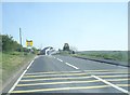
A4139 road approaching Lydstep, Pembs
by P L Chadwick geograph for square SS0898 The 30 miles per hour speed restriction signs mark the approach to the small... (more)
|
|
Entrance to the village of Lulsley, Worcs
by P L Chadwick geograph for square SO7453 Entering the village from the direction of Alfrick. Just past the speed... (more)
|
|
A polite speed sign
by Neil Owen geograph for square ST3558 This street name sign includes a rather unusual speed notice.
Tags:
type:GeographX
subject:RoadX
top:Roads, Road TransportX
Speed Restriction Sign
Street Name SignX
top:Village, Rural SettlementX
|
|
The A361 road approaching Lechlade-on-Thames, Glos
by P L Chadwick geograph for square SP2100 The A361 road is about to enter the small riverside town of Lechlade-on-Thames.... (more)
Tags:
type:GeographX
RoadX
top:Roads, Road TransportX
Speed Restriction SignsX
top:Village, Rural SettlementX
|
|
Coming into Stathern (1)
by Kate Jewell geograph for square SK7730 Toft's Lane, an unmade "green" road, becomes Toft's Hill as... (more)
Tags:
type:GeographX
subject:RoadX
top:Roads, Road TransportX
Speed Restriction SignsX
Tofts LaneX
Vale of BelvoirX
top:Village, Rural SettlementX
|
|
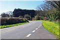
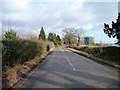
Wilmore Lane, near Wythall, Worcs
by P L Chadwick geograph for square SP0775 Wilmore Lane on a wet and dull January day. The signs indicate a 30 mph speed... (more)
Tags:
type:GeographX
RoadX
top:Roads, Road TransportX
Speed Restriction SignsX
top:Village, Rural SettlementX
|
|
Wilmore Lane & the North Worcestershire Path, near Wythall, Worcs
by P L Chadwick geograph for square SP0775 Wilmore Lane is seen here heading for the bridge which takes it across the A435... (more)
Tags:
type:GeographX
Long Distance FootpathX
top:PathsX
RoadX
top:Roads, Road TransportX
Speed Restriction Sign
top:Village, Rural SettlementX
|
|
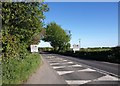
The southern approach to Runcton Holme, Norfolk
by Richard Humphrey geograph for square TF6108 |
|
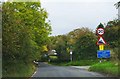
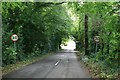
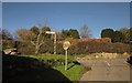
Approaching Kincardine O'Neil
by Stanley Howe geograph for square NO5999 On the minor road from Torphins; past St Erchards Well on the left by the speed... (more)
Tags:
postcode area:AB34X
place:Kincardine O NeilX
Minor RoadX
top:Roads, Road TransportX
Speed Restriction Sign
VillageX
|
|
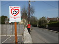
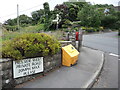
Please drive carefully
by Anthony Vosper geograph for square ST4571 Speed restrictions in Church Lane, Tickenham.
|
|
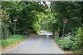
Getting near to Outgate
by Bill Boaden geograph for square NY3500 The beginning of the speed restriction for Outgate village, though you... (more)
|
|
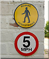
Entrance to Kellockbank car park
by Stanley Howe geograph for square NJ6529 10mph speed restriction after crossing The Kellock stream.
|
|
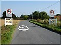
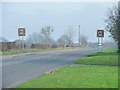
B4196 road leaving Shrawley, Worcs
by P L Chadwick geograph for square SO7966 Ahead are speed signs raising the 30 mph limit in the village to 40 mph. It used... (more)
Tags:
type:GeographX
RoadX
Road BridgeX
top:Roads, Road TransportX
Speed Restriction Sign
top:Village, Rural SettlementX
|
|
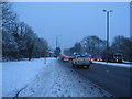
Afternoon traffic, A45
by E Gammie geograph for square SP3176 The carriageways of Fletchamstead Highway are clear but the spray from passing... (more)
Tags:
top:Air, Sky, WeatherX
top:Roads, Road TransportX
SnowX
Speed Camera Warning SignX
Speed Restriction Sign
top:Suburb, Urban FringeX
season:WinterX
|
|
Chesterton Lane
by Nigel Mykura geograph for square SP0101 This road runs from the A419 Tetbury Rd which is behind the photographer, east... (more)
|
|
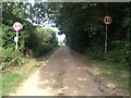
Long Lane, Alkmonton
by Christine Johnstone geograph for square SK1838 Not the Roman road, which ran in a straight line south of the village's position.
|
|
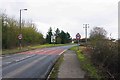
Speed limit on the A1039
by Christine Johnstone geograph for square TA0379 Entering Flixton from the west.
|
|
X40 near Burton Joyce
by Alan Murray-Rust geograph for square SK6342 Indicating a 40 mph speed limit through the level crossing at Burton Joyce Station.
|
|
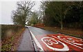
Chapel Lane, Wythall, Worcs
by P L Chadwick geograph for square SP0775 The speed restrictons are marked on the road.
Tags:
type:GeographX
RoadX
top:Roads, Road TransportX
Speed Restriction SignsX
top:Village, Rural SettlementX
|
|
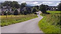
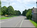
Priors Hill, Wroughton
by P L Chadwick geograph for square SU1479 Priors Hill is narrow and steep, and descends to the centre of the village of... (more)
|
|
Warnings at BWB Red Bull near Hardings Wood, Staffordshire
by Roger D Kidd for square SJ8255 At the end of this old BWB maintenance yard building are these two signs. It... (more)
Tags:
top:CanalsX
Speed Restriction Sign
|
|
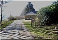
Entrance to The Ridgeway Business Park
by John Brightley geograph for square TL1549 Category: Industrial site |
|
Studfield Road
by Alan Murray-Rust geograph for square SK3190 The sign suggests that this is the edge of the Wisewood housing estate.
Tags:
20 ZoneX
Housing DevelopmentX
top:Housing, DwellingsX
period:Inter-WarX
top:Roads, Road TransportX
Speed Restriction Sign
top:Suburb, Urban FringeX
Suburban RoadX
place:WisewoodX
|
|
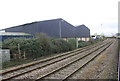
Railway line at Gowdall
by Alan Murray-Rust geograph for square SE6122 Originally the Lancashire and Yorkshire Railway's main line to its port at... (more)
|
|
The A451 road near Iverley heading for Stourbridge
by P L Chadwick geograph for square SO8780 Just behind the camera position is the county boundary between Staffordshire and... (more)
|
|
A68 approaching Fir Tree village
by Stanley Howe geograph for square NZ1334 |
|
Cresting the steep hill from Allensford
by Stanley Howe geograph for square NZ0749 The A68 enters Castleside near 'The Fleece' pub.
|
|
St Marnan Road, Torphins
by Stanley Howe geograph for square NJ6202 B993 entry from the north.
|
|
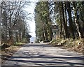
Approach to West Lodge from Learney House
by Stanley Howe geograph for square NJ6303 |
|
Great Ancoats Street
by Gerald England geograph for square SJ8498 From the top deck of a bus on Lever Street. Across Great Ancoats Street is... (more)
|
|
Bridge across River Brit at Pymore
by Becky Williamson geograph for square SY4794 On the northern side of Bridport.
Tags:
subject:BridgeX
BridgeX
county:DorsetX
type:GeographX
river:River BritX
top:Rivers, Streams, DrainageX
RoadX
top:Roads, Road TransportX
Speed Restriction Sign
|
|
Road into West Stafford
by Becky Williamson geograph for square SY7289 |
|
Railway lines in Avonmouth Docks
by Roger Templeman geograph for square ST5280 |
|
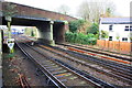
Approaching Staines Station from the east
by Roger Templeman geograph for square TQ0471 Tags:
Railway TracksX
top:RailwaysX
bridge:Road Over RailwayX
top:Roads, Road TransportX
Speed Restriction Sign
top:Suburb, Urban FringeX
|
|
Junction, Moretonhampstead
by Derek Harper geograph for square SX7585 Brinning Lane climbs to meet Pound Street, which leads into the centre of... (more)
Tags:
national park:DartmoorX
Hedge on WallX
top:LowlandsX
Road JunctionX
top:Roads, Road TransportX
Speed Restriction Sign
top:Suburb, Urban FringeX
|