Public Tags
Tag: Spring·Cereal
Showing images tagged with Spring Cereal tag.

|
Spring cereals
by Philip Halling geograph for square SO8042 A green shoots in a field of spring cereals at Hanley Swan. The Malvern Hills... (more)
Tags:
Arable Field
top:Farm, Fishery, Market Gardening
subject:Field
Field
type:Geograph
Malvern Hills
Spring Cereals
|

|
Farmland near Carnduncan
by M J Richardson geograph for square NR2564 The rolled field is either grass or spring cereal - possibly the latter, Some... (more)
Tags:
Argyll and Bute
near:Carnduncan
top:Farm, Fishery, Market Gardening
Farmland
type:Geograph
top:Grassland
top:Islands
island:Islay
subject:Landscape
Loch Gorm
top:Moorland
Rinns of Islay
Spring Cereals
|

|
Spring Cereal in Aimes Green
by Glyn Baker geograph for square TL4002 The winter wheat & barley around here is far more advanced than this crop.
|

|
Arable field north east of Bridekirk
by Graham Robson geograph for square NY1234 An arable field in which a spring cereal crop (most likely barley) is growing.... (more)
|

|
Arable land near Heather Law
by Graham Robson geograph for square NU1038 Looking across a spring sown cereal crop near Heather Law towards what I think... (more)
|

|
Fields above Culross
by M J Richardson geograph for square NS9886 With spring cereal emerging, electricity transmission lines and pylons. The... (more)
Tags:
subject:Crop
near:Culross
Electricity Transmission Lines
top:Energy Infrastructure
top:Farm, Fishery, Market Gardening
place:Fife
Firth of Forth
type:Geograph
top:Lowlands
Pylons
Spring Cereals
Trees
|

|
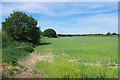
Spring Cereal & Bridleway to Sugar Lane
by Glyn Baker geograph for square TL7334 Part of TL7334 : Bridleway 115_40
|
|
Spring Cereal Near Hamford Water
by Glyn Baker geograph for square TM2127 I am assuming by the height of the earthwork to the left this is reclaimed land
Tags:
Arable Land
top:Estuary, Marine
top:Farm, Fishery, Market Gardening
type:Geograph
Reclaimed Land
Spring Cereal
|

|
Little Roothing Panorama
by Glyn Baker geograph for square TL5407 Acres of spring cereal
|

|
Arable land east of Berryhill
by Graham Robson geograph for square NZ1490 A large arable field to the east of Berryhill. A spring cereal crop, probably... (more)
|

|
Arable field south of Berryhill
by Graham Robson for square NZ1389 An arable field to the south of Berryhill. A spring sown cereal crop is... (more)
|

|
The Abhainn na Braid passing under the road to Kilchiaran
by M J Richardson geograph for square NR2060 With pasture in the foreground and spring cereals beyond the farmhouse.
Tags:
Argyll and Bute
subject:Farm
top:Farm, Fishery, Market Gardening
Farmhouse
Fields
type:Geograph
top:Housing, Dwellings
top:Islands
Isle of Islay
near:Kilchiaran
Pasture
top:Rivers, Streams, Drainage
Spring Cereals
|

|
Spring Cereal
by Glyn Baker geograph for square TQ9692 Happily this bland monoculture is soon to be replaced with wetland as part of... (more)
|

|
Track To The Sea Wall
by Glyn Baker geograph for square TQ9692 This farmland is due to be transformed into wetland as part of the Wallasea... (more)
Tags:
Farm Track
top:Farm, Fishery, Market Gardening
top:Flat Landscapes
type:Geograph
top:Islands
top:Paths
Spring Cereal
Wallasea Island
Wallasea Island Wild Coast Project
|

|
Seed-time at Bonhard
by M J Richardson geograph for square NT0179 Sowing spring cereals into what seems to be relatively recently ploughed land -... (more)
|

|
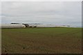
Green shoots of a cereal crop
by Philip Halling for square SO8042 Green shoots of a cereal crop in a field at Hanley Swan.
Tags:
Arable Field
type:Close Look
top:Farm, Fishery, Market Gardening
Field
subject:Field
Spring Cereals
|
|
Coastal farmland above Seaton Cliffs
by Graham Robson geograph for square NO6641 A cereal crop has been sown on the ground in the foreground. Behind is the edge... (more)
|

|
Footpath 192_29
by Glyn Baker geograph for square TL5309 The path passes through the hedge out onto Watery Lane. The right of way cuts... (more)
Tags:
top:Farm, Fishery, Market Gardening
type:Geograph
top:Paths
Public Footpath
Spring Cereal
Waymark Post
|

|
Sages End farm
by Glyn Baker geograph for square TL6441 On the outskirts of Helions Bumpstead. It looks like the field in the foreground... (more)
|

|
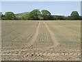
Coastal arable field at West Seaton
by Graham Robson geograph for square NO6641 An arable field on the coast south east of West Seaton. A young arable crop,... (more)
|
|
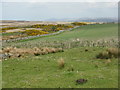
Arable field in Cramlington
by Graham Robson geograph for square NZ2577 An arable field which is more or less surrounded by development. The crop in the... (more)
|
|
Arable field near Sunderland Farm
by M J Richardson geograph for square NR2464 Most likely Spring Barley. Looking northeast.
Tags:
Argyll and Bute
near:Carnduncan
subject:Crop
top:Farm, Fishery, Market Gardening
type:Geograph
plant:Gorse
top:Grassland
top:Islands
island:Islay
Rinns of Islay
Rushes
Spring Cereals
|

|
Perimeter Fence & Field Boundary
by Glyn Baker geograph for square TL7333 With no decernible waymarks I mistook the field margin for the bridleway. I had... (more)
|

|
Freshly cultivated field at East Fenton
by Graham Robson geograph for square NT9734 This arable field beside the road at East Fenton has been recently cultivated.... (more)
|

|
Fields above Culross
by M J Richardson geograph for square NS9886 Looking southwest to the Firth of Forth and the oil terminal at Grangemouth.
Tags:
top:Coastal
near:Culross
top:Farm, Fishery, Market Gardening
place:Fife
Firth of Forth
type:Geograph
subject:Landscape
top:Lowlands
Manure Heap
Spring Cereals
Trees
top:Woodland, Forest
|
|
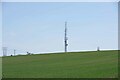
Telecoms Mast
by Glyn Baker geograph for square TL7844 The communications mast at The Sheerings.
|

|
Bridleway 62_7 Panorama
by Glyn Baker geograph for square TL7844 You can see the TL7844 : Telecoms Mast at "The Sheerings" on the horizon.
Tags:
top:Boundary, Barrier
top:Farm, Fishery, Market Gardening
type:Geograph
Hedge
Panorama
top:Paths
Spring Cereal
|

|
Cherry Blossom by the Bridleway
by Glyn Baker geograph for square TL7844 Looking along the 893m bridleway 62_7.
Tags:
top:Boundary, Barrier
Bridleway
Cherry Blossom
top:Farm, Fishery, Market Gardening
type:Geograph
Hedge
top:Paths
Spring Cereal
|

|
Footpath to Helions Bumpstead
by Glyn Baker geograph for square TL6441 PROW 91_21 is 904m long and takes you to the centre of Helions Bumpstead.
Tags:
Arable Fields
top:Farm, Fishery, Market Gardening
Fingerpost
type:Geograph
top:Paths
Public Footpath
Spring Cereal
|

|
Footpath to Chalky Road
by Glyn Baker geograph for square TL5745 Looking back towards the TL5745 : Two Plank Footbridge in the distance.
Tags:
Arable Field
top:Farm, Fishery, Market Gardening
type:Geograph
top:Paths
Public Footpath
Spring Cereal
|

|
Bridleway to Sugar Lane Panorama
by Glyn Baker geograph for square TL7334 Looking towards TL7434 : Sugar Lane
Tags:
Bridleway
top:Farm, Fishery, Market Gardening
Field Margin
type:Geograph
Hedge
Panorama
top:Paths
Spring Cereal
|

|
Bridleway 115_40
by Glyn Baker geograph for square TL7334 This path runs 389m from the perimeter fence of the former airfield until it... (more)
Tags:
Bridleway
top:Burial Ground, Crematorium
top:Farm, Fishery, Market Gardening
Field Margin
type:Geograph
Hedge
top:Paths
Spring Cereal
|

|
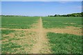
Stort Valley Way Footpath 197_34
by Glyn Baker geograph for square TL5007 Here the Stort Valley Way... (more)
Tags:
Arable Field
top:Farm, Fishery, Market Gardening
type:Geograph
top:Paths
Spring Cereal
footpath:Stort Valley Way
|
|
Bridleway near Park Woods
by Glyn Baker geograph for square TL5410 Once across the former airfield track PROW 186_2 became clear on the ground... (more)
Tags:
Arable Field
Bridleway
top:Farm, Fishery, Market Gardening
type:Geograph
top:Paths
Spring Cereal
|

|
Footpath to Elm Cottage
by Glyn Baker geograph for square TL5908 This Footpath is PROW 212_37 it is 852m long and joins with Byway 186_31
Tags:
Arable Field
top:Farm, Fishery, Market Gardening
type:Geograph
top:Paths
Public Footpath
Spring Cereal
|

|
Junction With PROW 212_37
by Glyn Baker geograph for square TL5908 The TL5908 : Footpath to Elm Cottage links this path 212_12 and the byway Public Right Of Way 186_31... (more)
|

|
PROW 212_12 and Red Campion
by Glyn Baker geograph for square TL5908 Beside the crop is Public Right Of Way 212_12.
Tags:
Arable Field
top:Farm, Fishery, Market Gardening
type:Geograph
top:Paths
Public Footpath
Red Campion
Spring Cereal
|

|
Footpath to Shellow Rd
by Glyn Baker geograph for square TL5908 This is Public Right Of Way 212_12
Tags:
Arable Field
top:Farm, Fishery, Market Gardening
type:Geograph
top:Paths
Public Footpath
Spring Cereal
|

|
Ruin at Toranore
by M J Richardson geograph for square NR2166 A year on and the eastern half of the roof has gone NR2166 : Toranore.
Tags:
Argyll and Bute
top:Derelict, Disused
top:Farm, Fishery, Market Gardening
Field
type:Geograph
House (Derelict)
top:Housing, Dwellings
top:Islands
island:Islay
subject:Ruin
Spring Cereals
Then and Now
|

|
Abhainn na Braid at Kilchiaran
by M J Richardson geograph for square NR2060 Looking north to communications masts inNR2061.
Tags:
Argyll and Bute
Communication Masts
top:Communications
top:Farm, Fishery, Market Gardening
subject:Field
Fields
type:Geograph
top:Islands
Isle of Islay
near:Kilchiaran
top:Rivers, Streams, Drainage
Spring Cereals
|
