Public Tags
Tag: Staggered·Crossroads
Showing latest 50 of 107 images tagged with Staggered Crossroads tag.

|
"Staggered crossroads" sign, Ballymena
by Albert Bridge geograph for square D0804 A sign, on the Cullybackey Road D0903 : The Cullybackey Road, Ballymena (April 2014), approaching the staggered... (more)
Tags:
place:Ballymena
Crossroads
subject:Road
Road
Road Sign
top:Roads, Road Transport
Staggered Crossroads
|
|
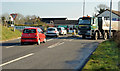
The Temple Crossroads (2013-6)
by Albert Bridge geograph for square J3560 The view towards the main road from the Lisburn side. I spent about 15 minutes... (more)
|

|
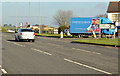
The Temple Crossroads (2013-3)
by Albert Bridge geograph for square J3560 The eastern side of the main road looking towards Carryduff. The road to... (more)
|
|
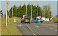
The Temple Crossroads (2013-7)
by Albert Bridge geograph for square J3560 The right-turn bay for northbound traffic heading towards Saintfield. The blue... (more)
|
|
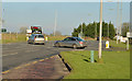
The Temple Crossroads (2013-5)
by Albert Bridge geograph for square J3560 The western side of the main road, looking towards Carryduff, as a car, from the... (more)
|
|
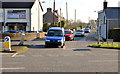
The Temple Crossroads (2013-4)
by Albert Bridge geograph for square J3560 The eastern side of the main road, looking towards Carryduff, as two cars cross... (more)
|
|
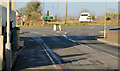
The Temple Crossroads (2013-2)
by Albert Bridge geograph for square J3560 The view, towards Saintfield, from the main road. All the vehicles turned right... (more)
|
|
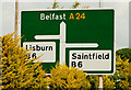
The Temple Crossroads (2013-1)
by Albert Bridge geograph for square J3560 The view, from the Saintfield side, towards the main road. The road to Lisburn... (more)
|
|
The Temple crossroads sign near Carryduff
by Albert Bridge for square J3560 Category: Road signs The trees have grown since this one J3560 : Signboard at The Temple taken in October 2005.... (more)
|

|
On foot from Portsmouth Harbour to London Waterloo (2390)
by Basher Eyre geograph for square SU9745 Modest staggered crossroads in Furze Lane
|

|
On foot from Portsmouth Harbour to London Waterloo (2373)
by Basher Eyre geograph for square SU9745 Staggered crossroads of Warren Road, Bourne Road and Furze Lane
|

|
Staggered Crossroad near Milton of Logie
by Stanley Howe geograph for square NJ4402 Sign on A97, advising of the staggered W-E crossing by B9119.
Tags:
A97
postcode area:AB34
B9119
Clouds
subject:Crossroad
type:Geograph
place:Logie Coldstone
top:Roads, Road Transport
Staggered Crossroads
Trees
|

|
Staggered crossroads and height restriction signs, Templepatrick (August 2014)
by Albert Bridge geograph for square J2485 Two road signs on the Belfast road. The top refers to the staggered crossroads... (more)
|

|
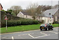
Road junction in the New Forest, near Hythe
by Malc McDonald geograph for square SU3807 A staggered road junction in the New Forest National Park. Traditional... (more)
Tags:
near:Beaulieu
type:Geograph
county:Hampshire
near:Hythe
Junction of Rural Roads
Minor Road
road:Minor Road
Minor Road Junction
Minor Rural Road
Minor Rural Road Junction
National Cycle Network
National Cycle Network Route 2
National Cycle Route 2
NCN
NCN 2
place:New Forest
national park:New Forest
New Forest
New Forest National Park
subject:Road Junction
Road Junction
top:Roads, Road Transport
national cycle network:Route 2
Rural Road
Rural Road Junction
Staggered Crossroads
Staggered Junction
Staggered Rural Crossroads
|
|
Warning sign - staggered crossroads ahead, Pontnewynydd
by Jaggery geograph for square SO2701 Facing the A4043 Osborne Road, the red-edged triangular sign is on the approach... (more)
|

|
Staggered crossroads
by David Smith geograph for square SZ2899 Originally the junction with the B3055 was not staggered. At some stage the... (more)
Tags:
top:Roads, Road Transport
Staggered Crossroads
|
|
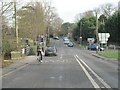
Crossroad at Clifton Hampden
by Bill Nicholls geograph for square SU5495 More of a staggered crossroad which has always been a bit of a bottleneck due to... (more)
|
|
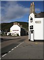
Staggered crossroads
by Richard Sutcliffe geograph for square ND0215 The A9 (Stafford Street) is crossed by the A897 (Dunrobin Street). It was... (more)
|

|
Staggered crossroads on the A75
by Ann Cook geograph for square NX6154 The right turning is for Gatehouse and the second [left] leads to Kirkcudbright.
|

|
Staggered crossroads
by David Pashley geograph for square TG2319 Tags:
subject:Crossroad
type:Geograph
top:Lowlands
top:Roads, Road Transport
Staggered Crossroads
top:Village, Rural Settlement
|

|
Staggered crossroads in Portskewett
by Jaggery geograph for square ST4988 Viewed from Manor Way. Caldicot Road is on the left, Crick Road is ahead, Main... (more)
Tags:
Crossroads
type:Geograph
top:Roads, Road Transport
Staggered Crossroads
top:Village, Rural Settlement
|

|
Staggered crossroads in Farnworth
by Bill Boaden geograph for square SJ5187 Farnworth here is a suburb of Widnes, not to be confused with the larger suburb... (more)
Tags:
top:Business, Retail, Services
type:Geograph
top:Lowlands
top:Roads, Road Transport
Shops
Staggered Crossroads
top:Suburb, Urban Fringe
|

|
Advance direction sign, Ballinderry (May 2017)
by Albert Bridge geograph for square J1666 Advance direction sign, on the Moira Road J1665 : The Moira Road, Ballylacky, Moira/Ballinderry (May 2017), approaching the staggered... (more)
|

|
Crossroads on the B4465
by Derek Harper geograph for square ST7279 The B road passes two very tiny lanes which for a staggered crossroads. But the... (more)
|

|
Staggered crossroads
by Stanley Howe geograph for square NO3546 Near Hatton of Eassie; on minor road to Glamis. Left turn for Eassie (1 mile).
Tags:
subject:Crossroad
postcode area:DD8
Fingerpost Sign
place:Glamis
top:Roads, Road Transport
Staggered Crossroads
Tree
|

|
Staggered crossroads
by Stanley Howe geograph for square NO4038 West of Tealing. Right for Balcalk, left for Kirkton of Tealing.
Tags:
subject:Crossroad
area postcode:DD4
Minor Road
Road Direction Signs
top:Roads, Road Transport
Staggered Crossroads
place:Tealing
|
|
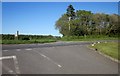
Crossroads on the A388
by Derek Harper geograph for square SX3572 A staggered crossroads beside SX3572 : Camelot Kennels, with the lane ahead to South... (more)
|
|
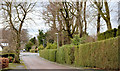
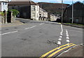
The Cairnburn Road, Belfast (February 2014)
by Albert Bridge geograph for square J3875 The Cairnburn Road descending towards the Old Holywood Road J3875 : The Old Holywood Road, Belfast. The... (more)
Tags:
place:Belfast
Crossroads
Road
top:Roads, Road Transport
Staggered Crossroads
top:Suburb, Urban Fringe
|
|
Staggered crossroads in Tonypandy
by Jaggery geograph for square SS9892 The main road is Court Street on the descent towards the centre of Tonypandy.... (more)
|

|
Staggered crossroads in the centre of Nailsworth
by Jaggery geograph for square ST8599 View from Market Street looking across the A46 (Bath Road and Fountain Street)... (more)
|

|
Staggered crossroad near Steeple Claydon
by Steve Daniels geograph for square SP6726 Tags:
top:Roads, Road Transport
Staggered Crossroads
|

|
Staggered crossroads at Pattard Cross
by David Smith geograph for square SS2525 |

|
Western fork of Baxworthy Cross
by David Smith geograph for square SS2822 Baxworthy Cross is a staggered crossroads, with this fork as the western part
Tags:
top:Roads, Road Transport
Staggered Crossroads
|

|
Baxworthy Cross
by David Smith geograph for square SS2822 This is a staggered crossroads, as the road to the left forks almost at once
Tags:
top:Roads, Road Transport
Staggered Crossroads
|

|
Southern end of staggered crossroads
by Barbara Carr geograph for square NU0039 The B6353 continues westward from here, while the B6525 heads south to Wooler.... (more)
|

|
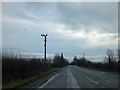
Woolfardisworthy Cross
by David Smith geograph for square SS8208 A staggered crossroads to the north of the village; the temporary sign warns... (more)
|
|
Staggered crossroads on old route of A419
by David Smith geograph for square SU0896 When the A419 was made a dual carriageway, this stretch was by-passed. As is... (more)
|

|
Staggered crossroads near East Ashey Farm
by David Smith geograph for square SZ5888 Tags:
top:Roads, Road Transport
Staggered Crossroads
|

|
Instaple Cross
by David Smith geograph for square SS3111 The crossroads is staggered, with two single track roads meeting this (slightly... (more)
Tags:
top:Roads, Road Transport
Staggered Crossroads
|

|
A staggered crossroads on the A75
by Ann Cook geograph for square NX6154 The turning to the right is the A755. The turning left [where the black car is... (more)
|

|
Coldharbour Cross
by David Smith geograph for square SX7152 A staggered crossroads, with the road to the left (west) a few metres to the... (more)
|

|
Beeson Pool Cross
by David Smith geograph for square SX8041 This is a staggered crossroads, with the road to Beeson on the right. A road to... (more)
|

|
Marridge Cross
by David Smith geograph for square SX6954 This is a staggered crossroads; the minor road from the left is clear, that from... (more)
|

|
The turning to Glenluce
by Ann Cook geograph for square NX1956 This is a staggered crossroads. Beyond, on the left, is the turning to Stairhaven.
|

|
A staggered crossroads with the A747
by Ann Cook geograph for square NX2157 |

|
Approaching a staggered crossroads with the A747
by Ann Cook geograph for square NX2157 |

|
Staggered crossroads near Y Ferwig
by Richard Law geograph for square SN1949 The lane on the right comes in from Penyparc on the A487; the lane to the left... (more)
|
|
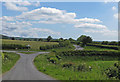
Staggered crossroads, Kirkdale
by Pauline E geograph for square SE6885 The lane running left/right, or north/south is Starfits Lane (different sources... (more)
Tags:
top:Roads, Road Transport
Staggered Crossroads
|

|
Road junction near Heathfield
by Stephen Craven geograph for square TQ5532 This is the other part of the staggered crossroads: see also TQ5532 : Signpost at a crossroads. The... (more)
|

|
Cridling Stubbs Crossing
by Chris Heaton geograph for square SE5121 Staggered crossroads with Northfield Lane as the main route running straight... (more)
|
