
|
The Manor Water at Glenrath
by Jim Barton
geograph for square NT2034
The Manor Water from the bridge for the farm road.
|

|
Wycoller Beck from Covey Bridge
by Luke Shaw
geograph for square SD9240
|

|
Moorland stream flows along track towards Sargill Gate
by Roger Templeman
geograph for square SD8991
|

|
Afon Dwyfach, looking upstream...
by Bill Harrison
geograph for square SH4745
...from the Lon Eifion cycle path.
|

|
Beldon Beck flowing southeast west of Bolton Castle
by Roger Templeman
geograph for square SE0091
|

|
Beldon Beck flowing southeast on Bolton West Park
by Roger Templeman
geograph for square SE0092
|

|
Looking NW along Beldon Beck in Bolton West Park
by Roger Templeman
geograph for square SE0092
|

|
Long Preston Beck seen over north parapet of Holme Bridge
by Luke Shaw
geograph for square SD8458
|

|
Hazel catkins on north bank of River Gelt
by Roger Templeman
geograph for square NY5059
|

|
River Gelt in woodland with holly and hazel trees
by Roger Templeman
geograph for square NY5059
|

|
Afon Lwyd in culvert under road
by M J Roscoe
geograph for square SO2309
|

|
Church Beck, Coniston
by M J Roscoe
geograph for square SD3097
A tributary of Lake Coniston, looking upstream with Forge Bridge Cottages in the... (more)
|
|
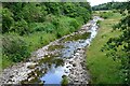
The Kinnel Water from Park Bridge
by Jim Barton
geograph for square NY0797
Low flow after a dry spell for this tributary of the River Annan.
|
|
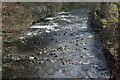
River Rhymney, Bargoed Woodland Park
by M J Roscoe
for square ST1598
|

|
Widdale Beck at location of washed-away footbridge
by Roger Templeman
geograph for square SD8389
|

|
River Usk below Cyffredin
by M J Roscoe
geograph for square SO1619
Looking downstream from the mouth of Nant Cleisfer.
|

|
River Ebbw below Brynhywfryd Terrace
by M J Roscoe
geograph for square SO1706
|

|
Pipe bridge, Afon Soden, Nanternis
by M J Roscoe
geograph for square SN3756
The uppermost of several similar bridges on the river below Pont Nanternis. The... (more)
|

|
Cascade, Afon Soden
by M J Roscoe
geograph for square SN3756
Roadside river just below one of several pipe bridges.
|

|
Afon Soden (2), Nanternis
by M J Roscoe
for square SN3756
|

|
Afon Soden, Nanternis
by M J Roscoe
geograph for square SN3756
|

|
Abhainn Shira from Victoria Bridge
by Jim Barton
geograph for square NN2742
Looking downstream towards Loch Tulla with Beinn Achaladair (L) and part of... (more)
|

|
Abhainn Shira from Victoria Bridge
by Jim Barton
for square NN2642
Looking westwards along the chain of hills to Ben Starav in the distance.
|

|
Malpas Brook Aqueduct
by M J Roscoe
for square ST3089
|

|
Calder Bridge, Newtonmore
by Jim Barton
geograph for square NN7098
The A86 crossing the Calder west of the village.
|

|
River Calder near Newtonmore
by Jim Barton
geograph for square NN7098
The Calder drains a large area of the Monadh Liath into Glen Banchor, from which... (more)
|

|
River Orrin
by Jim Barton
geograph for square NH4552
Looking downstream from the bridge at Strathan.
|

|
Eroded river cliff and fallen trees, near Briery
by Christine Johnstone
geograph for square NY2824
The aftermath of Storm Desmond on the River Greta.
|

|
River Greta, looking upstream [locally east]
by Christine Johnstone
geograph for square NY2824
Storm water has eroded the cliffs on the outside of the bend and dumped stones... (more)
|

|
Storm-felled trees, River Greta
by Christine Johnstone
geograph for square NY2823
The uprooted trees have been swept or placed onto the rocky islet, and then cut... (more)
|

|
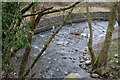
Pant-du Road crosses the Nant Cae-dudwg
by M J Roscoe
geograph for square ST0892
Looking downstream from gate on a public footpath.
|
|
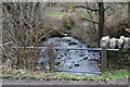
Bend in Nant Cae-dudwg, Pant-du Road
by M J Roscoe
geograph for square ST0892
|
|
Nant Cae-dudwg below former mill
by M J Roscoe
geograph for square ST1093
The road bridge carries the Rhymney Valley Ridgeway Walk.
|

|
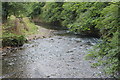
Afon Gwydderig above Pont Wen
by M J Roscoe
geograph for square SN8332
|
|
River Ebbw downstream from footbridge
by M J Roscoe
geograph for square ST2688
River flowing alongside former industrial site, viewed from opposite side of... (more)
|

|
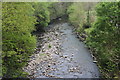
Pont Ebbw, Cardiff Road, Newport
by M J Roscoe
geograph for square ST2985
Looking upstream, the bridge carries the B4237 over the River Ebbw; the bridge... (more)
|
|
Rhymney River below footbridge, Bargoed Woodland Park
by M J Roscoe
geograph for square ST1598
Looking downstream from a wooden footbridge; the numerous dry stones in the... (more)
|

|
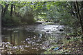
Ynysddu Bridge, River Sirhowy, Ynysddu
by M J Roscoe
geograph for square ST1792
|
|
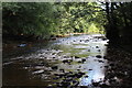
River Sirhowy, Pontllanfraith
by M J Roscoe
geograph for square ST1795
Looking downstream.
|
|
River Sirhowy below Tram Road, Pontllanfraith
by M J Roscoe
geograph for square ST1895
Looking upstream from the mouth of Nant Brynar.
|

|
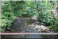
Pont Abernantyfelin, River Sirhowy
by M J Roscoe
geograph for square SO1701
Narrow concrete road bridge leading down from Markham to a rough track.
|
|
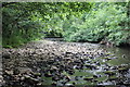
River Sirhowy below Pont Abernantyfelin
by M J Roscoe
geograph for square SO1701
Looking downstream from narrow road bridge east of Markham
|
|
River Sirhowy below Pont Syr Dafydd
by M J Roscoe
geograph for square ST1898
Looking upstream towards the stone arched bridge after a dry period.
|

|
Moorland track crossing Beldon Beck at footbridge and ford
by Roger Templeman
geograph for square SE0091
|
