|
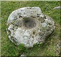
Chysauster - Hollowed stone in House 6
by Rob Farrow
for square SW4735
This hollowed stone was perhaps used as an ancient mortar for grinding food with... (more)
|

|
Chysauster - House 2
by Rob Farrow
geograph for square SW4735
House 2 in the ancient village of Chysauster is the least intact of all the nine... (more)
|

|
Chysauster - House 1 - Entrance
by Rob Farrow
geograph for square SW4735
The entranceway into House 1 at Chysauster. This is the northernmost of the nine... (more)
|

|
Chysauster - House 3b - Entrance
by Rob Farrow
geograph for square SW4735
The entrance into the right-hand dwelling of the pair of semi-detached dwellings... (more)
|

|
Chysauster - House 9 - Interior
by Rob Farrow
geograph for square SW4734
Looking through the centre of House 9 at Chysauster. This courtyard area is less... (more)
|

|
Chysauster - House 6 - Back entrance
by Rob Farrow
geograph for square SW4735
House 6 has a back entrance, seen here, which leads into the large circular room... (more)
|

|
Chysauster - House 6 - Interior
by Rob Farrow
geograph for square SW4735
House 6 is the best preserved of all the houses at Chysauster. The interior... (more)
|

|
Chysauster - House 5 - Circular end room
by Rob Farrow
geograph for square SW4735
Entered via these two large stones flanking its entrance from the courtyard,... (more)
|

|
Chysauster - House 5 - Interior
by Rob Farrow
geograph for square SW4735
|

|
Chysauster - House 4 - Box-like structure
by Rob Farrow
for square SW4735
This little stone-lined 'box' is thought to have been either a hearth... (more)
|

|
Chysauster - House 4 - Interior
by Rob Farrow
geograph for square SW4735
An interior view of the courtyard and entrances to side rooms in House 4 at... (more)
|

|
Chysauster - House 3b - Probable hearth or forge
by Rob Farrow
geograph for square SW4735
It is thought that this stone structure in the centre of the large circular room... (more)
|
|
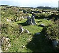
Chysauster - House 3b - Looking back towards entrance
by Rob Farrow
geograph for square SW4735
This view is from the northern end of House 3b looking back.
The large... (more)
|

|
Chysauster - House 3b - Interior courtyard area
by Rob Farrow
geograph for square SW4735
|

|
Chysauster - House 3a - Interior
by Rob Farrow
geograph for square SW4735
Inside the left-hand of the two semi-detached dwellings that comprise House 3a... (more)
|

|
Chysauster - House 8
by Rob Farrow
geograph for square SW4734
House 8 is after House 2 the second least well preserved of the houses at... (more)
|

|
Chysauster - House 6 - Entrance
by Rob Farrow
geograph for square SW4735
House 6 is the 'showhouse' of Chysauster, being the best preserved and... (more)
|

|
Chysauster - House 5 - Entrance
by Rob Farrow
geograph for square SW4735
House 5 is one of the smaller houses at Chysauster, but has substantial remains... (more)
|

|
Chysauster - House 4 - Entrance
by Rob Farrow
geograph for square SW4735
The entrance into House 4 at Chysauster. This is a well-preserved house in the... (more)
|

|
Chysauster - House 3b - Interior from 3a
by Rob Farrow
geograph for square SW4735
House 3 at Chysauster is a pair of 'semi-detached' dwellings known as... (more)
|

|
Chysauster - House 3a - Entrance
by Rob Farrow
geograph for square SW4735
House 3 at Chysauster is unique in being effectively a pair of semi-detached... (more)
|

|
Chysauster - Fogou
by Rob Farrow
geograph for square SW4734
A Fogou is an underground passage which takes its name from the Cornish for... (more)
|

|
Finlaggan - Ancient jetty (remains)
by Rob Farrow
geograph for square NR3868
This jumble of stones poking into Loch Finlaggan are the remains of a stone... (more)
|

|
Finlaggan - Modern causeway to Eilean Mòr
by Rob Farrow
geograph for square NR3868
On the right of the image can be seen the attractively constructed wooden... (more)
|

|
Finlaggan - Council Isle (Eilean na Comhairle)
by Rob Farrow
geograph for square NR3868
A view of the little circular "Council Isle" - Eilean na Comhairle in... (more)
|
|
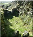
Chysauster - pathway and ancient stile
by Rob Farrow
geograph for square SW4735
This pathway is at the northern perimeter of the ancient village and is... (more)
|

|
Giants Grave, nr Luckington, Wiltshire 2019
by Ray Bird
geograph for square ST8282
Ancient burial site dating back to the Neolithic period.
|

|
Shoreham-by-Sea: The Marlipins
by Nigel Cox
geograph for square TQ2105
The Marlipins, now a local and maritime museum, is thought to have originally... (more)
|

|
Calanais II - Cnoc Ceann a' Ghàrraidh
by Doug Lee
geograph for square NB2232
The weather conditions in Lewis combined with the dramatic shapes of the stones... (more)
|

|
Finlaggan - View to the Chapel from the Great Hall
by Rob Farrow
geograph for square NR3868
Looking roughly northeastwards out of the ruins of the Great Hall at Finlaggan... (more)
|

|
Finlaggan - Great Hall (ruin) and Council Isle
by Rob Farrow
geograph for square NR3868
Straight ahead here are the remains of the C14th Great Hall, the main public... (more)
|

|
Finlaggan - Eilean Mòr and Eilean na Comhairle
by Rob Farrow
geograph for square NR3868
A view of the southern end of Eilean Mòr in Loch Finlaggan with the diminutive... (more)
|

|
Finlaggan - Grave slabs inside the chapel
by Rob Farrow
geograph for square NR3868
There are several grave slabs inside the ruined C14th chapel at Finlaggan. They... (more)
|

|
Finlaggan - The Chapel (ruins)
by Rob Farrow
geograph for square NR3868
The ruins of the C14th chapel built by John I, Lord of the Isles. The chapel was... (more)
|

|
Finlaggan in Loch Finlaggan
by Rob Farrow
for square NR3868
An overall view of the historic Finlaggan site on Islay. The remains of the... (more)
|
|
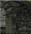
St Piran's Oratory - Arch detail
by Rob Farrow
for square SW7656
|

|
St Piran's Oratory - Looking down into the interior
by Rob Farrow
geograph for square SW7656
Looking across the waterlogged nave of the ancient monument of St Piran's... (more)
|

|
St Piran's Oratory - Looking down from the path
by Rob Farrow
geograph for square SW7656
There are numerous paths criss-crossing the dunes to the east of Perran Beach... (more)
|

|
Silbury Hill
by Rob Farrow
geograph for square SU0968
Silbury Hill is a dramatic and evocative man-made mound dating from the late... (more)
|
|
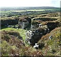
Chysauster - Looking over House 6
by Rob Farrow
geograph for square SW4735
Taken from the wooden viewing stand to the east of House 6 looking across its interior.
|

|
Giant's Grave, near Luckington, Wiltshire 2019
by Ray Bird
geograph for square ST8282
Ancient burial site dating to Neolithic period. During excavation one of the... (more)
|

|
Ancient settlement
by Michael Dibb
geograph for square SX6765
Seen from the path, the jumble of stones alongside the Avon Dam Reservoir is an... (more)
|

|
St Piran's Oratory - Interior
by Rob Farrow
for square SW7656
Looking at the altar from the south entrance.
|

|
Giant's Grave, near Luckington, Wiltshire 2019
by Ray Bird
geograph for square ST8282
Ancient burial ground dating to Neolithic period. Named Giant's Cave/Grave... (more)
|

|
Site of ancient Priory Cross
by Paul Charlesworth
for square SD4309
The base of a medieval cross near the ruins of Burscough Priory.
|

|
Near sunset at the Calanais Standing stones
by Doug Lee
geograph for square NB2133
|

|
Stockbridge Down ancient field system
by Oscar Taylor
geograph for square SU3834
The down is an area of common land and owned by the National Trust. The down is... (more)
|

|
Ancient remains
by Chris Thomas-Atkin
geograph for square SX6584
Some of the ancient remains at the Fernworthy Stone Circle which dates from the... (more)
|

|
Iron Age/Romana- British field system by West Brow
by Andrew Diack
geograph for square TV5795
This photo, particularly to the right of centre, shows part of an ancient field... (more)
|

|
Ancient Earthworks, Amberley
by Alex Passmore
geograph for square TQ0512
Ancient Earthworks, on Rackham Hill near Amberley. The photo shows a broad view... (more)
|