Public Tags
Other tags: Canal
bridge:Canal
category:Canal
derelict:Canal
disused:Canal
disused signal:Canal
former:Canal
Showing latest 50 of 18,446 images tagged with subject:Canal tag.
|
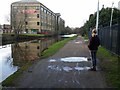
Leeds and Liverpool Canal by Salts Mill Road, Shipley
by Rich Tea geograph for square SE1437 Looking out from under the road bridge, to the north west
Tags:
subject:Bridge
Bridge
subject:Canal
subject:Canal Towpath
top:Canals
canal:Leeds and Liverpool
top:Suburb, Urban Fringe
|
|
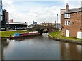
Bridge #3a
by Gerald England geograph for square SJ8598 The bridge crosses the short Islington branch of the Ashton Canal.
|
|
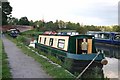
Narrowboats near Braunston
by David P Howard geograph for square SP5365 Category: Canal Narrowboats on the Grand Union Canal just SW of bridge 95, with the junction of... (more)
|

|
Grand Union Canal, Harefield
by Stephen McKay geograph for square TQ0491 This view shows the stretch of canal between bridge 177 and Copper Mill Lock.... (more)
|

|
Grand Union Canal, Harefield
by Stephen McKay geograph for square TQ0491 Looking towards Copper Mill Lock and Waterways Cottage.
|

|
Grand Union Canal, Harefield
by Stephen McKay geograph for square TQ0491 'Doinmein' (geddit?) is moored on the non-towpath side of the canal... (more)
|

|
White Cottage, Grand Union Canal
by Stephen McKay geograph for square TQ0491 White Cottage dates from the late 18th century and stands on the towpath side of... (more)
|

|
Grand Union Canal, Maple Cross
by Stephen McKay geograph for square TQ0492 Taken from the towpath bridge across a channel connecting to the River Colne,... (more)
|

|
Grand Union Canal, Maple Cross
by Stephen McKay geograph for square TQ0492 It is notable that in this vicinity, where the canal passes Maple Cross sewage... (more)
|

|
Grand Union Canal, near Maple Cross
by Stephen McKay geograph for square TQ0492 A varied collection of vessels is moored on the non-towpath side just south of... (more)
|

|
Grand Union Canal, near Maple Cross
by Stephen McKay geograph for square TQ0492 A collection of vessels is moored here close to a pipe bridge south of Springwell Lock.
|

|
Grand Union Canal, south of Springwell Lock
by Stephen McKay geograph for square TQ0492 A colourful blue and red narrowboat is moored close to a bend as the canal heads... (more)
|

|
Grand Union Canal, above Springwell Lock
by Stephen McKay geograph for square TQ0493 A narrowboat heads towards Springwell Lock passing a line of moored boats.
|

|
Grand Union Canal, west of Batchworth
by Stephen McKay geograph for square TQ0593 Most stretches of the Grand Union Canal - especially as it approaches London -... (more)
|

|
Grand Union Canal, Batchworth
by Stephen McKay geograph for square TQ0694 A line of narrowboats is moored just west of Batchworth Bridge. The one on the... (more)
|

|
Grand Union Canal, Batchworth
by Stephen McKay geograph for square TQ0694 'Pride of Batchworth' is moored between the bottom of the lock and the... (more)
|

|
Bridgewater Canal in Patricroft
by DS Pugh geograph for square SJ7698 Looking down from Bridgewater Canal Bridge onto the Bridgewater Canal.
|

|
Canal from Throstle Nest footbridge
by DS Pugh geograph for square SJ8196 The Bridgewater Canal near Pomona.
|

|
Throstle Nest footbridge
by DS Pugh geograph for square SJ8196 The Bridgewater Canal with Throstle Nest footbridge ahead.
|

|
Bridgewater Canal and Manchester Waters
by DS Pugh geograph for square SJ8196 Buildings on Pomona Island viewed across the Bridgewater Canal.
|

|
Link to Manchester Ship Canal
by DS Pugh geograph for square SJ8296 The Bridgewater Canal underneath a Metrolink Bridge to Pomona Island. Ahead a... (more)
|

|
Bridgewater Canal opposite Pomona Island
by DS Pugh geograph for square SJ8296 Part of the Bridgewater Canal in Manchester.
|

|
Bend on the Bridgewater Canal
by DS Pugh geograph for square SJ8296 Part of the Bridgewater Canal in Manchester opposite Pomona Island.
|

|
Graffiti on the tram wall beside the canal
by DS Pugh geograph for square SJ8296 Part of the Bridgewater Canal in Manchester with Manchester Metrolink above on the left.
|

|
Canal near Cornbook Road
by DS Pugh geograph for square SJ8296 Part of the Bridgewater Canal in Manchester.
|

|
Canal near Trentham Street
by DS Pugh geograph for square SJ8297 Part of the Bridgewater Canal in Manchester.
|

|
Canal near Hulme Hall Road
by DS Pugh geograph for square SJ8297 Part of the Bridgewater Canal in Manchester.
|

|
Sinking pontoons near Egerton Street Bridge
by DS Pugh geograph for square SJ8297 Part of the Bridgewater Canal in Manchester.
|

|
Canal beside Bridgewater House
by DS Pugh geograph for square SJ8297 The Bridgewater Canal and the Castlefield Viaducts.
|

|
Grand Union Canal, approaching bridge 166
by Stephen McKay geograph for square TQ0898 A hired narrowboat is moored in a shady spot in this sylvan setting on a hot day.
|

|
Grand Union Canal, near Grove Mill
by Stephen McKay geograph for square TQ0898 The canal bends to the right here before passing under bridge 165 on this... (more)
|

|
Grand Union Canal, Grove Mill
by Stephen McKay geograph for square TQ0898 The canal bends round and straight ahead is the Grove Mill. To the right is Old... (more)
|

|
The Grove Bridge, Grand Union Canal
by Stephen McKay geograph for square TQ0898 Bridge 164 is rather more ornate than most others on this canal. It carries the... (more)
|

|
Grand Union Canal from bridge 163
by Stephen McKay geograph for square TQ0899 The canal swings to the left here as it approaches Lady Capel's Wharf.
|

|
Grand Union Canal, south of Hunton Bridge
by Stephen McKay geograph for square TQ0899 A narrowboat is moored on the stretch of canal between Hunton Bridge Lock and... (more)
|

|
'Dick's Folly' at Hunton Bridge
by Stephen McKay for square TL0800 'Dick's Folly' is a 70 foot narrowboat belonging to the South... (more)
|

|
Hunton Bridge Bottom Lock, Grand Union Canal
by Stephen McKay geograph for square TL0800 Looking towards the lower (and southernmost) of the two locks at Hunton Bridge.
|

|
Grand Union Canal, Hunton Bridge
by Stephen McKay geograph for square TL0800 This view is looking towards Hunton Bridge Top Lock from bridge 162.
|

|
Grand Union Canal approaching Hunton Bridge
by Stephen McKay geograph for square TL0800 The canal bends round towards Hunton Bridge and, beyond that, the two Hunton... (more)
|

|
Grand Union Canal, above Hunton Bridge
by Stephen McKay geograph for square TL0801 Two boats are moored by the towpath as the canal approaches North Grove Lock.
|

|
Grand Union Canal, below North Grove Lock
by Stephen McKay for square TL0801 The canal sweeps round towards Hunton Bridge, close to Abbots Langley.
|

|
Bridge 159 and Home Park Lock, Grand Union Canal
by Stephen McKay geograph for square TL0702 Close inspection shows that there are two bridges in the foreground here: the... (more)
|

|
Grand Union Canal, Apsley
by Stephen McKay geograph for square TL0605 A narrowboat heading north-west arrives at the landing for lock 67.
|

|
Grand Union Canal, Apsley
by Stephen McKay geograph for square TL0604 A narrowboat heads past the entrance to Apsley Marina where a boat with the... (more)
|

|
Narrowboat at Apsley
by Stephen McKay geograph for square TL0605 The towpath here on the Apsley flight of locks is covered in leaves as is the... (more)
|

|
Grand Union Canal, Apsley
by Stephen McKay geograph for square TL0605 Apsley Top Lock is just through the distinctive whitewashed bridge 153. Beside... (more)
|

|
Grand Union Canal, Apsley
by Stephen McKay geograph for square TL0605 A line of boats is moored by the towpath below Apsley Top Lock.
|

|
Grand Union Canal by Durrants Hill Road Bridge
by Stephen McKay geograph for square TL0505 The flats across the canal are on Ebberns Road.
|

|
Bridge 140C, Grand Union Canal
by Stephen McKay geograph for square SP9908 This attractively painted bridge carries Lower King's Road over the canal.... (more)
|

|
Broadwater Lock, Grand Union Canal
by Stephen McKay geograph for square SP9908 Lock 53 is the uppermost of the flight of three Berkhamsted Locks. Immediately... (more)
|
