Public Tags
Other tags: Landing Stage
ruin:Landing Stage
Showing latest 50 of 206 images tagged with subject:Landing Stage tag.

|
Bangor Pier from an extraordinarily long way away
by Oliver Mills for square SH5873 This relatively uninteresting view of the Pier, taken from the landing stage... (more)
Tags:
place:Bangor
Bangor Pier
type:Cross Grid
top:Estuary, Marine
top:Historic Sites and Artefacts
subject:Landing Stage
place:Menai Bridge
place:Menai Strait
Menai Suspension Bridge
subject:Pier
|

|
The end of Clarence Pier, Southsea
by Oliver Mills for square SZ6398 The edge of the wharf-like profile of Clarence Pier is set up in landing... (more)
Tags:
Clarence Pier
type:Close Look
top:Docks, Harbours
top:Historic Sites and Artefacts
subject:Landing Stage
Landing Stage
Navigation Beacon
Navigation Light
subject:Pier
place:Portsmouth
top:Public Buildings and Spaces
place:Southsea
|

|
Houses with gardens by Fray's River, Uxbridge
by David Hawgood geograph for square TQ0585 These houses have back gardens with landing stages on Fray's River.
Tags:
Back Garden
type:Geograph
top:Housing, Dwellings
subject:Landing Stage
Landing Stage
Landing Stages
subject:River
top:Rivers, Streams, Drainage
top:Suburb, Urban Fringe
|

|
Clevedon Pier landing stage
by Oliver Mills geograph for square ST3972 A view of the northern end of the landing stage on the pier.
Tags:
place:Clevedon
Clevedon Pier
top:Coastal
top:Docks, Harbours
top:Estuary, Marine
top:Historic Sites and Artefacts
Landing Stage
subject:Landing Stage
subject:Pier
top:Public Buildings and Spaces
Severn Estuary
top:Suburb, Urban Fringe
|

|
Landing stage at Loch na Cuilce
by Oliver Dixon geograph for square NG4819 A landing stage, usable at all stages of the tide, giving ready access to Loch... (more)
|

|
Landing stage on the River Dodder
by John S Turner for square O1734 A derelict landing stage on the River Dodder provides a useful platform for two... (more)
Tags:
type:Close Look
Cormorants
type:Cross Grid
Heron
Landing Stage
subject:Landing Stage
River
top:Rivers, Streams, Drainage
top:Wild Animals, Plants and Mushrooms
|

|
Landing stage
by Richard Sutcliffe geograph for square NS8093 The landing stage on the River Forth beside Shore Road. It is loosely attached... (more)
|

|
Stoney Port - Hunterston
by Raibeart MacAoidh geograph for square NS1751 Looking towards Hunterston Landing Stage and Hunterston 'B' Power... (more)
|

|
Submerged landing stage at Hawse End
by Trevor Littlewood geograph for square NY2521 Following seemingly endless rainfall and a sequence of storms during the winter... (more)
Tags:
top:Docks, Harbours
type:Geograph
Lake
top:Lakes, Wetland, Bog
Landing Stage
subject:Landing Stage
|

|
Bangor Pier landing stage
by Oliver Mills geograph for square SH5873 A view of the landing stage on Bangor Pier. Although it is rarely used, it is a... (more)
Tags:
place:Bangor
Bangor Pier
top:Canals
top:Coastal
top:Estuary, Marine
county:Gwynedd
top:Historic Sites and Artefacts
subject:Landing Stage
Landing Stage
Pier
top:Suburb, Urban Fringe
country:Wales
|

|
Landing stage at Waterhead, Lake Windermere
by Malc McDonald geograph for square NY3702 A private landing stage at Waterhead, at the northern end of Lake Windermere.
Tags:
near:Ambleside
county:Cumbria
Jetty
Lake District
national park:Lake District
top:Lakes, Wetland, Bog
subject:Landing Stage
Landing Stage
place:The English Lake District
place:The Lake District
place:The Lake District National Park
place:Waterhead
place:Windermere
lake:Windermere
|

|
Landing at Loch na Cuilce
by Oliver Dixon geograph for square NG4819 A landing stage, usable at all stages of the tide, giving ready access to Loch... (more)
Tags:
Boat
top:Coastal
top:Docks, Harbours
subject:Landing Stage
Landing Stage
top:Rocks, Scree, Cliffs
Sea Loch
|

|
Landing stage at the end of Llandudno Pier
by Jonathan Hutchins geograph for square SH7883 Tags:
top:Docks, Harbours
top:Estuary, Marine
subject:Fishing Off Llandudno Pier
type:Geograph
subject:Landing Stage
Landing Stage
Llandudno Pier
top:Sport, Leisure
|

|
Gosport Ferry landing stage
by Oliver Dixon geograph for square SZ6299 Spinnaker Tower dominates the cityscape of Portsmouth on the far side of the... (more)
Tags:
top:Docks, Harbours
top:Estuary, Marine
Ferry Landing
type:Geograph
subject:Landing Stage
Landing Stage
|

|
Luing - Cullipool - Landing stage
by Rob Farrow geograph for square NM7312 A rectangular concrete area can be accessed from the road to the south of... (more)
Tags:
top:Coastal
place:Cullipool
top:Docks, Harbours
type:Geograph
top:Islands
subject:Landing Stage
island:Luing
top:Village, Rural Settlement
|

|
South Parade landing stage, Southsea
by Oliver Mills geograph for square SZ6597 The newly restored landing stage, popular with both anglers and recreational... (more)
Tags:
top:Docks, Harbours
type:Geograph
top:Historic Sites and Artefacts
subject:Landing Stage
subject:Pier
top:Public Buildings and Spaces
South Parade Pier
place:Southsea
|

|
New landing stage
by Richard Sutcliffe geograph for square NS5575 A recently built new landing stage suitable for a rowing boat at the side of... (more)
Tags:
Coronavirus Pandemic
type:Geograph
top:Housing, Dwellings
top:Lakes, Wetland, Bog
subject:Landing Stage
subject:Loch
|

|
Landing stage, Clonmacnoise
by Alan Murray-Rust geograph for square N0030 Category: Landing stage The exceptional river levels in June 1981 are clearly seen here - the causeway... (more)
Tags:
subject:Landing Stage
|

|
Landing-stage at Aberystwyth
by John Lucas geograph for square SN5881 Category: Landing stage Tags:
subject:Landing Stage
|

|
Kirby-le-Soken: Horsey Island boat landing stage
by Nigel Cox geograph for square TM2322 This landing stage is at the mainland end of Island Road, the tidal causeway to... (more)
|

|
Barrow Bay landing stage, Derwent Water
by Kate Jewell geograph for square NY2620 This is one of eight landing stages around the lake.
|

|
Boats and landing stage, Grasmere
by Richard Sutcliffe geograph for square NY3406 Rowing boats tied up at a small landing stage on the shore of Grasmere. Silver... (more)
|

|
Landing stage at the end of the pier
by Neil Owen geograph for square ST3972 Clevedon Pier was built with the passenger vessel services in mind. Many... (more)
|

|
Landing stage, Devenish Island, Lower Lough Erne
by Rod Grealish geograph for square H2247 The view is across to the east shore of the lough. Devenish Island (Irish... (more)
Tags:
county:County Fermanagh
irish:Daimhinis
place:Devenish Island
type:Geograph
top:Historic Sites and Artefacts
top:Islands
subject:Landing Stage
lough:Lower Lough Erne
country:Northern Ireland
top:Religious Sites
province:Ulster
part of:United Kingdom
|

|
Landing stages on a flooded River Severn
by Mat Fascione geograph for square SO8071 The flooding was caused by Storm Christoph in January 2021.
Tags:
Flooding
type:Geograph
subject:Landing Stage
Landing Stages
river:River Severn
top:Rivers, Streams, Drainage
|

|
Landing stage
by Richard Sutcliffe geograph for square NT3975 The landing stage was used for the Cockenzie Power Station, which stood on the... (more)
Tags:
top:Coastal
top:Docks, Harbours
top:Energy Infrastructure
top:Estuary, Marine
type:Geograph
subject:Landing Stage
top:Rocks, Scree, Cliffs
Site of Former Power Station
|

|
Landing stage at low tide, Hazelbeach
by M J Roscoe geograph for square SM9404 Public landing stage SM9404 : Landing stage, Hazelbeach at low tide at low water on spring tide.
Tags:
top:Coastal
top:Docks, Harbours
type:Geograph
subject:Landing Stage
Tidal River
top:Village, Rural Settlement
|

|
Landing stage, Hazelbeach
by M J Roscoe geograph for square SM9404 Public landing stage SM9404 : Landing stage, Hazelbeach at low tide on an outgoing tide. Pembroke docks are on the... (more)
Tags:
top:Coastal
top:Docks, Harbours
Footbridge Access Ramp
type:Geograph
subject:Landing Stage
top:Paths
Shingle Beach
Slipway
Stone Retaining Wall
Tidal River
|

|
Remains of the Landing Stage at Bangor Pier
by Alan Walker for square SH5873
The photographs shows the remains of the Landing Stage at Bangor Pier. For a... (more)
|

|
Landing stages
by Oscar Taylor geograph for square SD3996 Empty landing stages off Bowness Bay Marina.
Tags:
top:Docks, Harbours
type:Geograph
top:Lakes, Wetland, Bog
subject:Landing Stage
top:Uplands
top:Woodland, Forest
|

|
Landing stage for hire boats
by Oscar Taylor geograph for square SD4096 The long landing stage into Windermere used for hire boats.
Tags:
top:Docks, Harbours
type:Geograph
top:Lakes, Wetland, Bog
subject:Landing Stage
top:Woodland, Forest
|

|
Broomielaw Pontoon
by Oliver Dixon geograph for square NS5864 Landing stage on the north bank of the River Clyde. A rather unattractive... (more)
Tags:
Footbridge
type:Geograph
subject:Landing Stage
Landing Stage
top:Paths
Pontoon
River
top:Rivers, Streams, Drainage
|

|
Landing stage, Dartmouth
by Chris Allen geograph for square SX8751 This is the main landing stage used by the river steamers and the ferry from... (more)
Tags:
place:Dartmouth
top:Docks, Harbours
type:Geograph
subject:Landing Stage
river:River Dart
top:Rivers, Streams, Drainage
|

|
Fishing paraphernalia on the landing stage at Brancaster Staithe in Norfolk
by Richard Humphrey geograph for square TF7944 Tags:
top:Coastal
Crab Pots
Creeks
type:Geograph
Harbour
subject:Landing Stage
Landing Stage
Lobster Pots
Norfolk
Saltmarsh
|

|
Low tide near the landing stage in Brancaster Staithe
by Richard Humphrey geograph for square TF7944 Tags:
top:Coastal
Creeks
Fishing Boats
type:Geograph
Harbour
subject:Landing Stage
Landing Stage
Saltmarsh
|

|
Landing stage on the Alde estuary
by Oliver Dixon geograph for square TM4056 Tags:
top:Docks, Harbours
Estuary
top:Estuary, Marine
type:Geograph
Landing Stage
subject:Landing Stage
Mudflats
Reed Beds
|

|
Landing stage
by Richard Sutcliffe geograph for square NS9082 One of two landing stages on the River Carron beside the sea lock leading into... (more)
Tags:
top:Canals
top:Estuary, Marine
type:Geograph
subject:Landing Stage
top:Rivers, Streams, Drainage
|

|
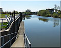
The landing stage at Bala
by Bob Walters geograph for square SH9235 Bala Lake landing stage on a chilly November morning, no tourists around today!
|
|
Landing stage along the River Severn at Diglis
by Mat Fascione geograph for square SO8453 Tags:
type:Geograph
Landing Stage
subject:Landing Stage
top:Lowlands
river:River Severn
top:Rivers, Streams, Drainage
|

|
Landing stages at Derwent Water
by DS Pugh geograph for square NY2622 Landing stages for the Derwent Water ferry.
|

|
Old landing stage on the River Dee
by Mat Fascione geograph for square SJ3169 The Wales Coast Path is heading towards Chester.
Tags:
river:Dee
top:Derelict, Disused
top:Flat Landscapes
type:Geograph
ruin:Landing Stage
subject:Landing Stage
top:Paths
top:Rivers, Streams, Drainage
long distance path:Wales Coast Path
|

|
Landing Stage
by DS Pugh geograph for square NY3919 Looking along the landing stage for Aira Force on Ullswater.
|

|
Landing stages on Ullswater
by Oliver Dixon geograph for square NY4419 Belonging to the nearby Outward Bound Centre.
Tags:
top:Docks, Harbours
type:Geograph
Lake
top:Lakes, Wetland, Bog
subject:Landing Stage
Landing Stages
|

|
Landing Stage at The Mere
by Alan Walker geograph for square TA0386
This landing stage used to be the departure point for the... (more)
Tags:
type:Geograph
top:Lakes, Wetland, Bog
subject:Landing Stage
top:Park and Public Gardens
top:Sport, Leisure
|

|
Derwent Water landing stages, Keswick
by Ian Taylor geograph for square NY2622 There are no customers for a cruise on the Lakeland Mist. There is a cold breeze... (more)
Tags:
Derwent Water
type:Geograph
Jetties
top:Lakes, Wetland, Bog
subject:Landing Stage
top:Sport, Leisure
|

|
Derwent Water landing stage
by Kate Jewell geograph for square NY2620 Public landing stage on the south east shore of the lake. Across the water is... (more)
|

|
Part of the derelict landing stage at Dunston Staiths
by Mike Quinn for square NZ2362 For information about the coal staiths, see NZ2362 : Dunston Staiths.
The location of the... (more)
Tags:
top:City, Town Centre
type:Close Look
top:Derelict, Disused
top:Docks, Harbours
subject:Landing Stage
top:Quarrying, Mining
|

|
Landing stage at low tide
by Chris Allen geograph for square SX9685 One sailing was suspended today as the tide was too low, requiring the ferry to... (more)
|

|
The northernmost landing stage, Fleetwood ferry terminal
by Christine Johnstone geograph for square SD3448 There are four smaller linked landing stages, as well as the main structure. The... (more)
Tags:
top:Docks, Harbours
former:Ferry Terminal
place:Fleetwood
type:Geograph
subject:Landing Stage
former:Ship Ferry Terminal
Stena Ferry Terminal
Wyre Estuary
|

|
Landing stage
by Michael Dibb geograph for square SX8851 The ferry from Dartmouth approaches the landing stage at Kingswear.
Tags:
top:City, Town Centre
top:Coastal
top:Docks, Harbours
top:Estuary, Marine
type:Geograph
subject:Landing Stage
|
