Public Tags
Showing latest 50 of 198 images tagged with subject:Spillway tag.

|
Eastern bellmouth spillway, Ladybower Reservoir
by Karl Peet geograph for square SK2085 The circular stone structure is the eastern of Ladybower Reservoir’s two... (more)
|

|
Tunstall Reservoir - weir at spillway
by Trevor Littlewood geograph for square NZ0640 A spillway at this or any other reservoir allows excess water to drain past a... (more)
Tags:
Deciduous Woodland
type:Geograph
Reservoir
subject:Spillway
Spillway
top:Water Resources
top:Woodland, Forest
|

|
Clare Spillway Ford
by John Walton geograph for square TL7745 This ford is found on the spillway at Clare.
|

|
Spillway, Picketlaw Reservoir
by Richard Sutcliffe geograph for square NS5651 The spillway is at the northeast corner of the reservoir, which was built... (more)
|

|
Spillway on the Llangollen Canal
by Oliver Dixon geograph for square SJ4333 If the canal gets overfull, surplus water can discharge down the spillway into Cole Mere.
|

|
Spillway on Thruscross Reservoir Dam
by Oliver Dixon geograph for square SE1557 Completed in 1966. The face of the dam is particularly steep and unusually the... (more)
|

|
Head of the spillway on the Embsay Reservoir
by Oliver Dixon geograph for square SE0054 Rather unusually for these times, water is actually flowing down the spillway.
|

|
Spillway on the Embsay Reservoir
by Oliver Dixon geograph for square SE0054 Rather unusually for these times, water is actually flowing down the spillway.
|

|
Spillway on Hallington East Reservoir
by Oliver Dixon geograph for square NY9776 Judging by the amount of vegetation, it is a while since the reservoir was so... (more)
|

|
Spillway on Hallington West Reservoir
by Oliver Dixon geograph for square NY9675 Judging by the amount of vegetation, it is a very long time since the reservoir... (more)
|

|
Butterley reservoir spillway, dropping 34 metres
by Christine Johnstone geograph for square SE0410 This spillway was built in 2016, 110 years after the reservoir opened.
|

|
Bellmouth spillway at Redmires Reservoirs
by Graham Hogg geograph for square SK2685 The upper reservoir has been drained at the time of this photograph and a coping... (more)
|

|
Bellmouth spillway at Digley Reservoir
by Graham Hogg geograph for square SE1107 An unusual design with a walkway above the spillway. It could be some time until... (more)
|
|
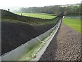
Dry spillway, Ardsley reservoir
by Christine Johnstone geograph for square SE2924 The water level in the reservoir is very low.
Tags:
place:Ardsley Reservoir
type:Geograph
Overflow Spillway
Reservoir Spillway
subject:Spillway
top:Water Resources
|
|
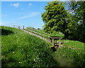
Spillway at the Wormleighton Reservoir
by Mat Fascione geograph for square SP4451 The spillway leads to the Oxford Canal.
|

|
The spillway from Swithland Reservoir
by David P Howard geograph for square SK5514 Category: Spillway View NW down the spillway from the Kinchley Lane bridge.
Tags:
subject:Spillway
top:Water Resources
|

|
Spillway, Dumbrock Loch
by Richard Sutcliffe geograph for square NS5578 The spillway is no more than a dip in the dam wall. The water level in the loch... (more)
Tags:
top:Construction, Development
Dam
type:Geograph
top:Grassland
top:Lakes, Wetland, Bog
Loch
subject:Spillway
top:Uplands
|

|
The top of the spillway, Wessenden Head reservoir
by Christine Johnstone geograph for square SE0707 The spillway lip has been raised with timber, but it makes no difference when... (more)
Tags:
type:Geograph
Low Water Level
national park:Peak District
Reservoir Spillway
subject:Spillway
top:Water Resources
Wessenden Head Reservoir
|

|
Bellmouth spillway in Ladybower Reservoir
by Graham Hogg geograph for square SK2085 The western spillway in full flow after a period of heavy rain. See [[[5303696]]... (more)
Tags:
place:Bamford
type:Geograph
Heavy Rain
River Derwent
top:Rivers, Streams, Drainage
subject:Spillway
Spillway
top:Water Resources
|

|
Bellmouth spillway in Ladybower Reservoir
by Graham Hogg geograph for square SK1985 The eastern spillway in full flow after a period of heavy rain. See [[[5303696]]... (more)
Tags:
place:Bamford
type:Geograph
Ladybower Reservoir
River Derwent
subject:Spillway
Spillway
top:Water Resources
|

|
Llyn Brianne Dam and Spillway
by Ben Meyrick geograph for square SN7948 Tags:
subject:Dam
type:Geograph
Reservoir Spillway
top:Rivers, Streams, Drainage
subject:Spillway
top:Water Resources
|

|
Landing stage and spillway
by Richard Sutcliffe geograph for square NS2472 The spillway allows water overflowing from the Compensation Reservoir to run... (more)
Tags:
Compensation Reservoir
type:Geograph
top:Lakes, Wetland, Bog
subject:Landing Stage
top:Rivers, Streams, Drainage
subject:Spillway
|

|
Dam and spillway, Greenside Reservoir
by Richard Sutcliffe geograph for square NS4775 Water overflowing from the reservoir flows down the spillway and into the Loch... (more)
Tags:
Burn
subject:Dam
type:Geograph
top:Grassland
top:Lakes, Wetland, Bog
plant:Meadowsweet
top:Rivers, Streams, Drainage
subject:Spillway
top:Uplands
top:Water Resources
|

|
Garnlydan Reservoir Spillway
by Colin Cheesman geograph for square SO1713 The reservoir constructed in the early 18th century and later expanded to 20... (more)
Tags:
Blaenau Gwent
type:Geograph
top:Moorland
place:Near Brynmawr
Reservoir
subject:River
top:Rivers, Streams, Drainage
subject:Spillway
top:Village, Rural Settlement
top:Water Resources
|

|
Spillway on the Curin Dam
by Oliver Dixon geograph for square NH3755 The Curin Dam holds back the 3 km long Loch Meig. The head of water supplies... (more)
Tags:
subject:Dam
top:Energy Infrastructure
top:Rivers, Streams, Drainage
subject:Spillway
Spillway
Trees
|

|
Spillway from the lower lake at The Vyne
by Mr Ignavy geograph for square SU6357 Category: Spillway Tags:
subject:Spillway
top:Water Resources
|

|
Spillway from the upper lake at The Vyne
by Mr Ignavy geograph for square SU6357 Category: Spillway Tags:
subject:Spillway
top:Water Resources
|

|
East along the bypass spillway near Bottoms Reservoir
by DS Pugh geograph for square SK0297 A bypass spillway for Bottoms Reservoir.
|

|
Reservoir bypass spillway
by DS Pugh geograph for square SK0297 A bypass spillway for Bottoms Reservoir.
|

|
Valehouse reservoir spillway
by DS Pugh geograph for square SK0397 The spillway carries water from Valehouse Reservoir into Bottoms Reservoir.
|

|
Spillway into Bottoms Reservoir
by DS Pugh geograph for square SK0397 The spillway connecting Valehouse Reservoir and Bottoms Reservoir.
|

|
Spillway for Hollingworth Lake
by DS Pugh geograph for square SD9415 The spillway is entirely empty given the recent prolonged hot and dry weather.
|

|
River Calder and spillway
by DS Pugh for square SE2420 A spillway cutting off a meander of the River Calder in Dewsbury.
|

|
Spillway from Thornhill Road
by DS Pugh geograph for square SE2320 A spillway cutting off a meander of the River Calder in Dewsbury.
|

|
Spillway for the River Calder
by DS Pugh geograph for square SE2320 A spillway cutting a meander of the River Calder in Dewsbury.
|

|
Spillway by the lake
by Neil Owen geograph for square SU1660 The waters contained in the Scotchel are regulated by a spillway.
Tags:
type:Geograph
top:Park and Public Gardens
top:Rivers, Streams, Drainage
subject:Spillway
top:Suburb, Urban Fringe
|

|
Spillway into Leeming Water
by DS Pugh geograph for square SE0334 The spillway from Leeming Reservoir.
|

|
Bridge over the spillway
by DS Pugh geograph for square SE0231 Catchwater Drain is a leat running across a stretch of Midgley Moor, collecting... (more)
|

|
Spillway from Catchwater Drain
by DS Pugh geograph for square SE0231 Catchwater Drain is a leat running across a stretch of Midgley Moor, collecting... (more)
|

|
Spillway on Scar House Reservoir
by Russel Wills geograph for square SE0676 Bradford Corporation spared no expense when completing this impressive dam.... (more)
|

|
The spillway, Ardsley Reservoir
by habiloid geograph for square SE2924 |

|
Top of the spillway
by Richard Sutcliffe geograph for square NS6677 Water from Woodburn Reservoir flows into the spillway.
Tags:
type:Geograph
top:Lakes, Wetland, Bog
Reservoir
top:Rivers, Streams, Drainage
subject:Spillway
top:Water Resources
|

|
Spillway, Woodburn Reservoir
by Richard Sutcliffe geograph for square NS6677 Looking towards the top of the spillway.
|

|
Flood protection spillway from Thornhill Road
by DS Pugh geograph for square SE2320 The flood protection spillway which connects to the River Calder in Dewsbury.
|

|
Flood spillway beside the Calder
by DS Pugh geograph for square SE2320 A flood spillway in Dewsbury viewed from the Calder Valley Greenway.
|

|
Spillway associated with the former Crowley Iron Works at Winlaton
by David Robinson geograph for square NZ1860 The Crowley Iron Works at Winlaton Mill was established in 1691 by Ambrose... (more)
Tags:
top:Derelict, Disused
type:Geograph
top:Historic Sites and Artefacts
top:Industry
subject:Spillway
top:Water Resources
|

|
Ardsley Reservoir spillway
by Kevin Waterhouse geograph for square SE2924 Bottoms Wood is at the end of the spillway
Tags:
type:Geograph
top:Grassland
top:Lakes, Wetland, Bog
top:Lowlands
subject:Spillway
top:Water Resources
|

|
Spillway from Langcliffe Mill Reservoir
by DS Pugh geograph for square SD8165 A path runs along the reservoir from Holmehead to Langcliffe High Mill. The... (more)
Tags:
top:Farm, Fishery, Market Gardening
type:Geograph
top:Rivers, Streams, Drainage
subject:Spillway
|
|
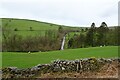
Reservoir spillway
by DS Pugh geograph for square SD2578 Looking towards the spillway from Pennington Reservoir.
|

|
Bell mouth spillway on Ladybower Reservoir
by Graham Hogg geograph for square SK2085 One of a pair on the reservoir and known locally as the 'plugholes',... (more)
Tags:
place:Bamford
type:Geograph
Ladybower Reservoir
top:Lakes, Wetland, Bog
subject:Spillway
top:Water Resources
|
