|
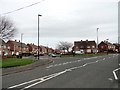
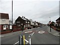
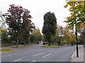
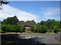
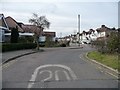
Suburban road junction
by Robert Graham
geograph for square NZ3655
This is the junction of Sunningdale Road with Grindon Lane, in Springwell. This... (more)
|
|
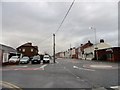
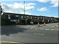
Suburban road junction
by Robert Graham
geograph for square NZ3656
This at the south end of Front Road at the junction with Hylton Road, in the... (more)
|
|
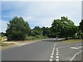
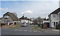
Iford Lane, Iford, near Bournemouth
by Malc McDonald
geograph for square SZ1493
Iford Lane is a suburban road through Iford, on the north-eastern fringe of Bournemouth.
|
|
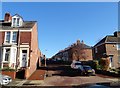
Side street off Saltwell Road
by Robert Graham
geograph for square NZ2461
This is the junction of Faraday Road with Saltwell Road. The side streets here... (more)
|
|
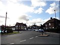
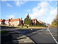
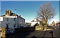
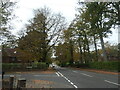
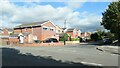
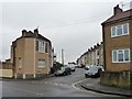
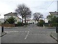
Somerset Road, Springwell
by Robert Graham
geograph for square NZ3655
At the junction with Grindon Lane. Springwell is one of a whole series of large... (more)
|
|
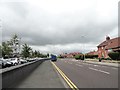
Heath Road
by Christine Johnstone
geograph for square ST6371
Looking westwards from the junction with Memorial Road.
|
|
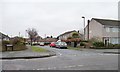
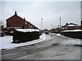
Junction of Newlands Crescent and Newlands Drive
by Christine Johnstone
geograph for square SE2827
The snow shows the differing qualities of roof insulation.
|
|
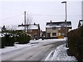
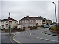
Road junction on Blackhill bank
by Robert Graham
geograph for square NZ0951
This is the junction of Benfieldside Road with Durham Road. The pub just along... (more)
|
|
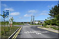
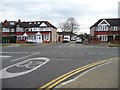
Road junction near Selsdon
by Malc McDonald
geograph for square TQ3463
The junction of Farley Road and Croham Valley Road near Selsdon, in south... (more)
|
|
Junction of Pinewood Gardens and the Coach Road
by Robert Graham
geograph for square NZ2360
Part of a large suburban estate at Lobley Hill, on the west side of Gateshead.
|
|
The north end of Durley Avenue
by Christine Johnstone
geograph for square TQ1288
Looking eastwards from the junction with Cannon Lane.
|
|
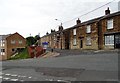
Junction Road and Front Street, Pity Me
by Robert Graham
geograph for square NZ2645
View south down Front Street on a rather wet autumn morning.
|
|
Junction of Enfield Road with Durham Road
by Robert Graham
geograph for square NZ2561
In the Saltwell area of Gateshead. Durham Road is the main north south road... (more)
|
|
Junction on St Luke's Road
by Robert Graham
geograph for square NZ3657
A rather complicated roundabout in the western suburbs of Sunderland. Viewed... (more)
|
|
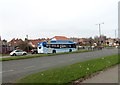
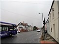
Bus at a road junction
by Robert Graham
geograph for square NZ3754
This is the junction of the south end of Grindon Lane with Durham Road, on the... (more)
|
|
Stanmore: Lansdowne Road, from The Ridgeway
by Christopher Hilton
geograph for square TQ1791
|
|
Gordon Avenue, east end
by Christopher Hilton
geograph for square TQ1691
|
|
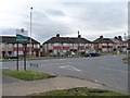
Junction of Armthorpe Road and Sandringham Road
by Christine Johnstone
geograph for square SE5904
A slightly offset roundabout probably slows down Doncaster's suburban traffic.
|
|
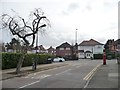
Summerfield Road, Gateshead
by Robert Graham
geograph for square NZ2561
This is the junction of Summerfield Road at its western end with Durham Road.... (more)
|
|
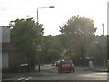
Looking east along Hylton Road
by Robert Graham
geograph for square NZ3556
This is one of the main roads through the western suburbs of Sunderland,... (more)
|
|
Hadrian Way from Roman Drive, Chilworth
by Christopher Hilton
geograph for square SU4117
|
|
Staplehurst Road dropping westwards into the valley
by Christopher Hilton
geograph for square TQ2763
The B278 (Beeches Avenue / Woodmansterne Road) follows a valley southwards out... (more)
|
|
Junction of Rydal and Newlands Crescent, Morley
by Christine Johnstone
geograph for square SE2727
As the streets loop back on themselves, they have little through traffic and are... (more)
|
|
Suburban junction
by Bill Harrison
geograph for square NO9197
Despite the ominous road markings, the road in the foreground, which leads to a... (more)
|
|
Hiltingbury Road, Chandler's Ford
by Christine Johnstone
geograph for square SU4322
Looking westwards from the junction with Oakwood Road.
|
|
Courtleet Road, Cheylesmore, Coventry
by Christine Johnstone
geograph for square SP3477
From the junction with The Mount.
|
|
Semis at the junction of William Bristow and Montalt Roads
by Christine Johnstone
geograph for square SP3477
Shown as built on the 6 inch OS map surveyed in 1937. Each house is in a different road.
|
|
Semis climbing William Bristow Road, Coventry
by Christine Johnstone
geograph for square SP3476
Just north of the junction with Seneschal Road, in the southern Coventry suburb... (more)
|
|
The Park Paling, Coventry
by Christine Johnstone
geograph for square SP3476
A suburban road off William Bristow Road.
|
|
Ulverscroft Road, Coventry
by Christine Johnstone
geograph for square SP3376
Looking north from the junction with a road called The Chesils.
|
|
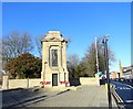
Gateshead Cenotaph
by Robert Graham
geograph for square NZ2561
This war memorial stands at the junction of Durham Road and Prince Consort Road,... (more)
|
|
Looking south along Queen Elizabeth Avenue
by Robert Graham
geograph for square NZ2660
This street is in the Sheriff Hill suburb of southern Gateshead. It takes its... (more)
|
|
The Travellers Rest
by Robert Graham
geograph for square NZ2943
Pub on Sunderland Road in Gilesgate Moor, at the junction with Dragon Lane. The... (more)
|
|
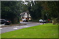
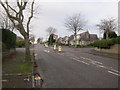
Roundabout on Chester Road, Sunderland
by Robert Graham
geograph for square NZ3655
This is for the junction with Pennywell Road. Pennywell is the westernmost of a... (more)
|
|
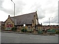
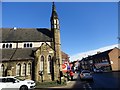
Blackhill Baptist Church
by Robert Graham
geograph for square NZ0951
Located at the western end of Durham Road, beside the junction with Pemberton Road.
|
|
Junction of Fenton Avenue and Barbour Avenue
by Christine Johnstone
geograph for square NZ3865
Looking eastwards.
|
|
West Community Centre, Chester Road
by Robert Graham
geograph for square NZ3856
In Sunderland, at the junction of Chester Road and Sorley Street. Looks like it... (more)
|
|
Junction of Malvern Avenue and Thistledean Avenue
by Christine Johnstone
geograph for square TQ1286
Looking south-east from Torbay Road.
|
|
Entrance to Chestnut Drive from Cannon Lane
by Christine Johnstone
geograph for square TQ1288
This side road has an unusual semicircular off-set roundabout at its junction... (more)
|
|
Junction of Malpas Drive and Eastcote Road
by Christine Johnstone
geograph for square TQ1188
Looking southwards.
|
|
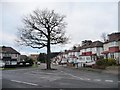
Tree at the junction of Harold Road and Grove Roads
by Christine Johnstone
geograph for square TQ3893
A suburban landmark, even in winter.
|
|
Stinkpipe, junction of Fountain Drive and Stanley Park Road, Carshalton
by Christopher Hilton
geograph for square TQ2763
This ornate stinkpipe design is common along the southern edges of what is now... (more)
|
|
Lichfield Road
by Christine Johnstone
geograph for square SX8992
At the junction with Ely Close. All the roads in this suburb are named after cathedrals.
|
|
Furber Road drops down the hillside
by Christine Johnstone
geograph for square ST6372
Taken from the junction with Furber Close.
|
|
St Anne's Road
by Christine Johnstone
geograph for square ST6372
Seen from its junction with Furber Road.
|
|
Block of four houses on Raeburn Road
by Christine Johnstone
geograph for square ST6372
At the junction with Furber Road.
|
|
Suburban junction...
by Bill Harrison
geograph for square NJ9106
...of Edgehill Road and Woodhill Road (crossing). Much of the gridsquare is... (more)
|
|
Aberdeen suburban junction
by Bill Harrison
geograph for square NJ9305
Crown Street meets Wellington Place. The granite terraces are typical of the... (more)
|
|
Trees in Gloucester Place
by Christine Johnstone
geograph for square NZ3864
A cul-de-sac on the west side of Borough Road.
|
|
Welcome to Hillingdon
by Christine Johnstone
geograph for square TQ1286
Boundary sign on Malvern Avenue, at the junction with Field End Road.
|