|
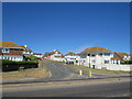
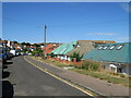
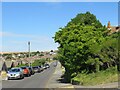
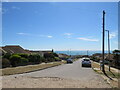
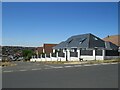
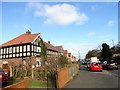
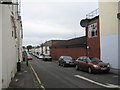
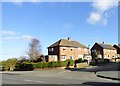
Bannings Vale, Saltdean
by Malc McDonald
geograph for square TQ3801
Bannings Vale is a residential road in Saltdean, on the Sussex coast near Brighton.
|
|
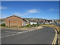
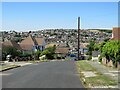
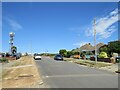
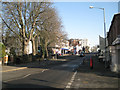
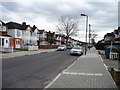
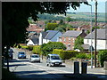
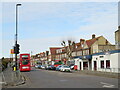
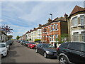
Longridge Avenue, Saltdean
by Malc McDonald
geograph for square TQ3801
Longridge Avenue runs along the boundary between Brighton & Hove unitary... (more)
|
|
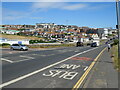
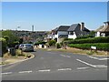
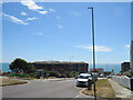
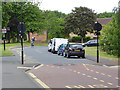
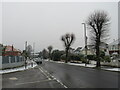
Marine Drive, Saltdean
by Malc McDonald
geograph for square TQ3701
Marine Drive forms part of the route of the coastal A259 road as it passes... (more)
|
|
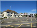
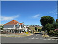
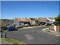
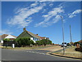
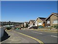
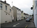
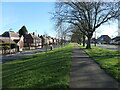
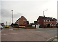
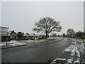
Saltdean Drive, Saltdean
by Malc McDonald
geograph for square TQ3702
Saltdean Drive is a residential road in Saltdean, on the Sussex coast near Brighton.
|
|
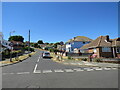
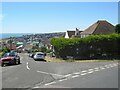
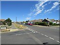
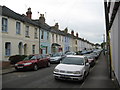
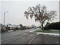
Chichester Drive West, Saltdean
by Malc McDonald
geograph for square TQ3702
Chichester Drive West is a residential road in Saltdean, on the Sussex coast... (more)
|
|
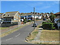
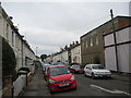
Founthill Avenue, Saltdean
by Malc McDonald
geograph for square TQ3702
Founthill Avenue is a residential road in Saltdean, on the Sussex coast near Brighton.
|
|
Founthill Avenue, Saltdean
by Malc McDonald
geograph for square TQ3702
Founthill Avenue is a residential road in Saltdean, on the Sussex coast near Brighton.
|
|
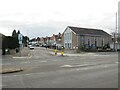
Chichester Drive East, Saltdean
by Malc McDonald
geograph for square TQ3802
Chichester Drive East is a residential road on a hillside in Saltdean, on the... (more)
|
|
Greenbank Avenue, Saltdean
by Malc McDonald
geograph for square TQ3802
Greenbank Avenue is a residential road in Saltdean, on the Sussex coast near Brighton.
|
|
Rodmell Avenue, Saltdean
by Malc McDonald
geograph for square TQ3802
Rodmell Avenue is a residential road in Saltdean, on the Sussex coast near... (more)
|
|
Rodmell Avenue, Saltdean
by Malc McDonald
geograph for square TQ3802
Rodmell Avenue is a residential road in Saltdean, on the Sussex coast near Brighton.
|
|
Linchmere Avenue, Saltdean
by Malc McDonald
geograph for square TQ3802
Linchmere Avenue is a residential road in Saltdean, on the Sussex coast near Brighton.
|
|
Longridge Avenue, Saltdean
by Malc McDonald
geograph for square TQ3802
Longridge Avenue is a residential road in Saltdean, on the Sussex coast near... (more)
|
|
Longridge Avenue, Saltdean
by Malc McDonald
geograph for square TQ3802
Longridge Avenue is a residential road in Saltdean, on the Sussex coast near... (more)
|
|
Rodmell Avenue, Saltdean
by Malc McDonald
geograph for square TQ3802
Rodmell Avenue is a residential road in Saltdean, on the Sussex coast near Brighton.
|
|
Rodmell Avenue, Saltdean
by Malc McDonald
geograph for square TQ3802
Rodmell Avenue is a residential road in Saltdean, on the Sussex coast near Brighton.
|
|
Bevendean Avenue, Saltdean
by Malc McDonald
geograph for square TQ3802
Bevendean Avenue is a residential road in Saltdean, on the Sussex coast near Brighton.
|
|
Longridge Avenue, Saltdean
by Malc McDonald
geograph for square TQ3802
Longridge Avenue is a residential road in Saltdean, on the Sussex coast near... (more)
|
|
Wicklands Avenue, Saltdean
by Malc McDonald
geograph for square TQ3802
Wicklands Avenue is a residential road in Saltdean, on the Sussex coast near Brighton.
|
|
Longridge Avenue, Saltdean
by Malc McDonald
geograph for square TQ3802
Longridge Avenue is a residential road in Saltdean, on the Sussex coast near... (more)
|
|
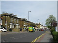
Large houses on Hylton Road
by Robert Graham
geograph for square NZ3756
Looking east along Hylton Road, in the Ford Estate suburb of Sunderland. One of... (more)
|
|
Roman Road IV - Cheltenham, Gloucestershire
by Martin Richard Phelan
geograph for square SO9322
In 1850 the Cheltenham and Gloucester Freehold Land Society bought 15 acres in... (more)
|
|
Roman Road III - Cheltenham, Gloucestershire
by Martin Richard Phelan
geograph for square SO9322
In 1850 the Cheltenham and Gloucester Freehold Land Society bought 15 acres in... (more)
|
|
Roman Road II - Cheltenham, Gloucestershire
by Martin Richard Phelan
geograph for square SO9322
In 1850 the Cheltenham and Gloucester Freehold Land Society bought 15 acres in... (more)
|
|
Roman Road I - Cheltenham, Gloucestershire
by Martin Richard Phelan
geograph for square SO9322
In 1850 the Cheltenham and Gloucester Freehold Land Society bought 15 acres in... (more)
|
|
West end of Warwick Street by the Dell
by Robin Stott
geograph for square SP3166
The spacious approach to Leamington town centre from the west exhibits the... (more)
|
|
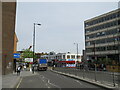
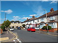
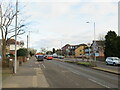
Brigstock Road, Thornton Heath
by Malc McDonald
geograph for square TQ3268
Brigstock Road in Thornton Heath, in the suburbs of south London.
|
|
Thorne Road, Doncaster
by Christine Johnstone
geograph for square SE5904
On the right, the edge of Wheatley Hills, a 1920s and 1930s suburb. On the left,... (more)
|
|
Suburban estate at South Hylton
by Robert Graham
geograph for square NZ3656
One of the western suburbs of Sunderland. This is the junction of Prestwick Road... (more)
|
|
Champion Road, Upminster
by Malc McDonald
geograph for square TQ5586
Champion Road is a residential street in Upminster, in the outer suburbs of east London.
|
|
Silloth Road, Sunderland
by Robert Graham
geograph for square NZ3654
In Thorney Close, one of the western suburbs of the city.
|
|
Open area beside Greenwood Road
by Robert Graham
geograph for square NZ3555
At Grindon, one of the western suburbs of Sunderland. The big trees here are a... (more)
|
|
Houses in blocks of three, Torbay Road
by Christine Johnstone
geograph for square TQ1286
Unusual in most suburbs, but quite common on this estate.
|
|
Traffic calming on Vigo Lane
by Oliver Dixon
geograph for square NZ2853
A pinch point and speed cushions on the approach to Rickleton Primary School in... (more)
|
|
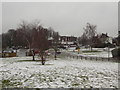
Epsom: a wintry view over Tattenham Corner
by Chris Downer
geograph for square TQ2258
Looking across this rural-ish suburb of Epsom, with the station sign just ahead... (more)
|
|
Llanfairpwllgwyngyll: view over the suburbs
by Chris Downer
geograph for square SH5371
I'm not sure if the town is big enough for this to be described as the... (more)
|
|
Matlock Road and western suburbs of Chesterfield
by Andrew Hill
geograph for square SK3669
View west across the A632, close to the Blue Stoops pub. Suburbs and rising... (more)
|
|
Fortis Green, Muswell Hill
by Malc McDonald
geograph for square TQ2789
Fortis Green is on the route of the A504 as it passes through the north London... (more)
|
|
Moor Lane, Chessington
by Malc McDonald
geograph for square TQ1864
Moor Lane is a dual-carriageway in Chessington, in the outer suburbs of south... (more)
|
|
Church Lane and Methodist Church, Chessington
by Malc McDonald
geograph for square TQ1864
Church Lane is a residential road in Chessington, in the outer suburbs of south... (more)
|
|
Green Lane, Norbury
by Malc McDonald
geograph for square TQ3169
Green Lane forms part of the short B273 road through Norbury, in the suburbs of... (more)
|
|
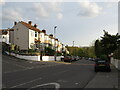
Castle Lane West, Charminster, Bournemouth
by Malc McDonald
geograph for square SZ0995
A wintry scene on Castle Lane West in Charminster, in the northern suburbs of... (more)
|
|
Winter weather on Castle Lane West, Charminster, Bournemouth
by Malc McDonald
geograph for square SZ0995
A wintry scene on Castle Lane West in Charminster, in the northern suburbs of... (more)
|
|
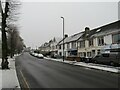
Winter weather in Charminster, Bournemouth
by Malc McDonald
geograph for square SZ0994
A wintry scene on Charminster Road, in the northern suburbs of Bournemouth.... (more)
|
|
Winter weather in Charminster, Bournemouth
by Malc McDonald
geograph for square SZ0994
A wintry scene on Charminster Road, in the northern suburbs of Bournemouth.... (more)
|
|
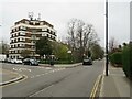
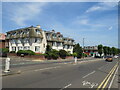
Marlborough Mansions, Pokesdown, Bournemouth
by Malc McDonald
geograph for square SZ1292
Marlborough Mansions is a black of flats on Christchurch Road in Pokesdown, a... (more)
|
|
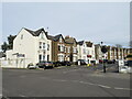
Grange Road, Upper Norwood
by Malc McDonald
geograph for square TQ3369
Grange Road is a residential road on a hillside in Upper Norwood, in the suburbs... (more)
|
|
Lodge Road, Thornton Heath
by Malc McDonald
geograph for square TQ3167
Lodge Road is a residential road in Thornton Heath, in the suburbs of south London.
|
|
Gonville Road, Thornton Heath
by Malc McDonald
geograph for square TQ3067
Gonville Road is a residential road in Thornton Heath, in the suburbs of south London.
|
|
Brigstock Road, Thornton Heath
by Malc McDonald
geograph for square TQ3167
Brigstock Road is a 'B' road in Thornton Heath, in the suburbs of south London.
|