|
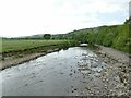
Depth gauge on the Swale by Bridge End House
by Stephen Craven
geograph for square NY8801
There was little flow in the river in a fairly dry Spring, but the Swale is... (more)
|
|
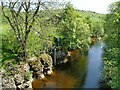
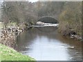
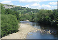
The Swale downstream from Easby
by Stephen Craven
geograph for square SE1899
Viewed from the old railway bridge.
|
|
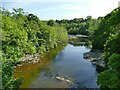
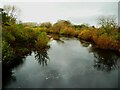
River Swale downstream from Mercury Bridge
by Stephen Craven
for square NZ1701
The river does a sharp, nearly 90 degree turn as it encounters harder rock.
|
|
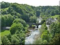
Views from Richmond castle (6)
by Stephen Craven
for square NZ1600
Looking west from the south-east tower of the castle to the road bridge over the... (more)
|
|
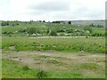
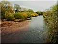
Old and new courses of the Swale near Grinton
by Stephen Craven
geograph for square SE0398
My 1984 edition 1:25,000 map still shows this nearer channel as the course of... (more)
|
|
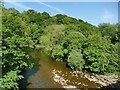
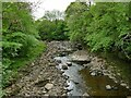
The Swale upstream of East Gill
by Stephen Craven
geograph for square NY8901
The river had very little flow in it, the result of weeks with little rain.
|
|
Looking upstream from Reeth 'Swing Bridge'
by Stephen Craven
geograph for square SE0398
|
|
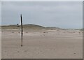
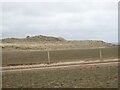
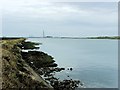
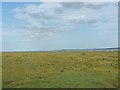
Wide Open
by Oliver Dixon
geograph for square NU1339
A long line of dunes stretches northwards to landward of Ross Back Sands. At... (more)
|
|
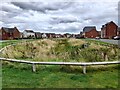
A swale in Branston Leas
by Ian Calderwood
geograph for square SK2120
Branston Leas is a new housing development on the edge of Burton-upon-Trent. A... (more)
|
|
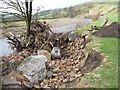
Rebuilt river wall in Grinton
by Stephen Craven
geograph for square SE0498
|
|
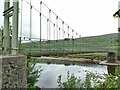
North end of Reeth 'Swing Bridge'
by Stephen Craven
geograph for square SE0398
The name of this footbridge is odd, as it is not a swing bridge in the... (more)
|
|
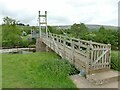
South end of Reeth 'Swing Bridge'
by Stephen Craven
geograph for square SE0398
The name of this footbridge is odd, as it is not a swing bridge in the... (more)
|
|
Ross Point and Wide Open
by Oliver Dixon
geograph for square NU1339
A long line of dunes stretches northwards to landward of Ross Back Sands. At... (more)
|
|
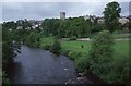
The River Swale at Richmond
by Philip Halling
geograph for square NZ1700
The River Swale at Richmond with the keep of Richmond Castle prominent on the horizon.
|
|
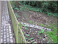
Rainwater conservation path and gutter, Holland Park
by David Hawgood
for square TQ2479
"The two main sloping paths and linking paths will be resurfaced with... (more)
|
|
Goosander on the Swale
by Christine Johnstone
geograph for square SD9497
By Gunnerside Great [or New] Bridge.
|
|
Erosion on the bank of the Swale
by Christine Johnstone
geograph for square SD9497
Floods and rabbits eat at the banks, giant boulders are dropped in to protect it.
|
|
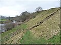
Footpath down to the Swale at Marble Scar
by Christine Johnstone
geograph for square SD9498
The mapped public footpath has been moved. You no longer drop down from the... (more)
|
|
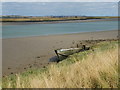
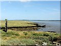
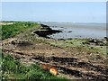
Abandoned Boat by the Swale
by Chris Whippet
geograph for square TQ9169
|
|
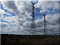
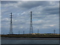
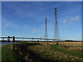
Pylons carrying power over the Swale
by Chris Whippet
geograph for square TQ9168
|
|
Pylons carrying power over the Swale
by Chris Whippet
geograph for square TQ9168
|
|
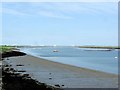
The Swale
by Chris Whippet
geograph for square TQ9267
|
|
The Swale
by Chris Whippet
geograph for square TQ9267
|
|
Clay Reach, The Swale
by Chris Whippet
geograph for square TQ9267
|
|
River Swale from Grinton Bridge
by Pauline E
geograph for square SE0498
The river is running roughly east/west at this point.
|
|
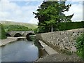
The River Swale upstream of the bridge near Great Langton
by Humphrey Bolton
geograph for square SE2996
|
|
The River Swale looking downstream from the bridge
by Humphrey Bolton
geograph for square SE2996
|
|
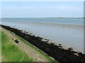
Long Reach, the Swale
by Chris Whippet
geograph for square TQ8970
|
|
Kissing gate, Saxon Shore Way, by the Swale
by Chris Whippet
geograph for square TQ8970
|
|
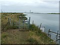
Electrical cable warning signs by the Swale
by Chris Whippet
geograph for square TQ9069
|
|
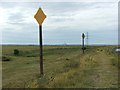
Electrical cable warning signs by the Swale
by Chris Whippet
geograph for square TQ9069
|
|
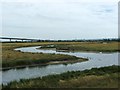
Drainage channel near the Swale
by Chris Whippet
geograph for square TQ9069
|
|
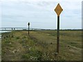
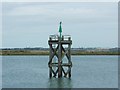
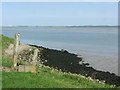
Navigation Beacon, the Swale
by Chris Whippet
geograph for square TQ9069
|

|
Saxon Shore Way, by the Swale
by Chris Whippet
geograph for square TQ9169
|
|
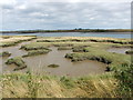
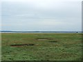
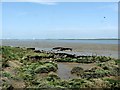
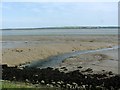
Salt marsh by the Swale
by Chris Whippet
geograph for square TR0467
|
|
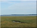
Salt marsh by the Swale
by Chris Whippet
geograph for square TR0467
|
|
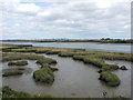
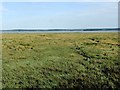
Salt marsh by the Swale
by Chris Whippet
geograph for square TR0367
|
|
Salt marsh by the Swale
by Chris Whippet
geograph for square TR0367
|
|
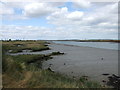
The Swale
by Chris Whippet
geograph for square TR0165
|
|
The Swale
by Chris Whippet
geograph for square TQ9965
|
|
The Swale
by Chris Whippet
geograph for square TQ9965
|
|
The Swale
by Chris Whippet
geograph for square TQ9965
|
|
The Swale
by Chris Whippet
geograph for square TQ9865
|
|
The Swale
by Chris Whippet
geograph for square TQ9865
|
|
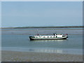
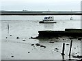
Boat on the Swale
by Chris Whippet
geograph for square TQ9765
|
|
The Swale
by Chris Whippet
geograph for square TQ9765
|
|
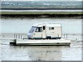
Caravan Yacht Hybrid, the Swale
by Chris Whippet
for square TQ9665
|
|
Yachts and Caravan, the Swale
by Chris Whippet
geograph for square TQ9665
|
|
Pylons carrying power over the Swale
by Chris Whippet
geograph for square TQ9169
|
|
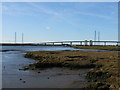
The Swale
by Chris Whippet
geograph for square TQ9268
Sheppey crossing and the Kings Ferry bridge in the distance.
|