
|
The Cumbria Way and the Caldew Cycleway
by Adrian Taylor
geograph for square NY3851
Parallel to the Cumbrian Coast Line behind the metal palisade fencing, The... (more)
|

|
The Cumbria Way near Brownelson Wood
by Adrian Taylor
geograph for square NY3851
Both The Cumbria Way and the Caldew Cycleway follow the same tarmacked path... (more)
|

|
The Cumbria Way beside the River Caldew
by Adrian Taylor
geograph for square NY3852
Between the metal palisade fencing bordering the Cumbrian Coast railway line and... (more)
|

|
Cattle grid on the Caldew Cycleway
by Adrian Taylor
geograph for square NY3851
Small cattle grids were provided on the Caldew Cycleway to retain grazing sheep... (more)
|

|
The Cumbria Way, Gill Banks
by Adrian Taylor
geograph for square SD2878
The Cumbria Way follows a wooded path beside Gill Banks Beck soon after leaving... (more)
|

|
Beddgelert: llwybr glan yr afon / riverside path
by Christine Johnstone
geograph for square SH5947
Ar lan orllewinol Afon Glaslyn. Wedi'i darmacio oherwydd ei fod yn arwain... (more)
|

|
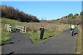
Bridge on the Caldew Cycleway
by Adrian Taylor
geograph for square NY3851
Near Thurnam Wood this bridge on the Caldew Cycleway crosses a small beck which... (more)
|
|
Cycle path, Central Valley LNR, Ebbw Vale
by M J Roscoe
geograph for square SO1708
Cycle and pedestrian path, tarmacked during the summer, on the site of the... (more)
|

|
Path and steps in Jesmond Dene
by Trevor Littlewood
geograph for square NZ2666
Jesmond Dene is a linear park in Newcastle upon Tyne along the valley of the... (more)
|

|
Narrow, tarmacked footpath at North End
by Trevor Littlewood
geograph for square NZ2643
The path passes west to east through a residential area of Durham city, well... (more)
|

|
Boats moored at Cùlag
by Trevor Littlewood
geograph for square NS3595
Cùlag is a property with self-catering units on the west side of Loch Lomond... (more)
|
|
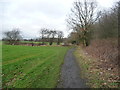
Public bridleway heading north from Skellow Cross
by Christine Johnstone
geograph for square SE5310
The tarmacked path to Burghwallis.
|

|
Beddgelert: Bedd Gelert / Gelert's grave
by Christine Johnstone
geograph for square SH5947
Nawr mor boblogaidd, mae'r llwybr wedi'i darmacio. Ffuglen broffidiol... (more)
|

|
The Wales Coast Path towards footbridge over the Ewenny River
by eswales
geograph for square SS8877
On the short stretch of the Coast Path which runs to the footbridge over the... (more)
|

|
Harbour side footpath, Lower Town
by M J Roscoe
geograph for square SM9637
Coast Path on permissive path from The Slade to a dinghy/car park, camera.
|

|
Path beside Dalston Church
by Adrian Taylor
geograph for square NY3650
This path, beside St Michael and All Angels Church in Dalston is a pleasant... (more)
|

|
Paths in Dalston Cemetery
by Adrian Taylor
geograph for square NY3650
The path leading round to the left is a pleasant unofficial alternative to The... (more)
|

|
Path from railway station to Station Road
by M J Roscoe
geograph for square SM9901
The path lies between the railway line, left, and the station car park. The far... (more)
|

|
Path down to nature reserve, Parc Cwm Darran
by M J Roscoe
geograph for square SO1103
|
|
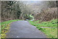
Path to Nant Cwm-parc, Abertridwr
by M J Roscoe
geograph for square ST1289
Path from the Aber Cycleway down to the stream (left); the path later climbs to... (more)
|
|
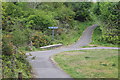
Path crossroads, Bargoed Woodland Park
by M J Roscoe
geograph for square ST1598
The meeting of four paths close to the entrance going away from the camera from... (more)
|

|
Squeeze stile at top of new path, Oakdale
by M J Roscoe
geograph for square ST1898
Metal squeeze stile at end of new path from Pen-rhiw bengi Lane, Oakdale down to... (more)
|

|
Path at the end of The Slade
by M J Roscoe
for square SM9637
The Coast Path goes down to the harbour past a vehicle barrier on to a waterside... (more)
|

|
Path up from side of Nant Cwm-parc
by M J Roscoe
geograph for square ST1189
The path comes up over a tributary (green bridge railings) of the Nant Cwm-parc... (more)
|

|
Path next to retail park to Cwmbran Drive
by M J Roscoe
geograph for square ST2995
Path from patch of woodland behind B&Q store to derelict canal and road.
|

|
Path from junction of Morley Road & Hawkwood Lane
by M J Roscoe
geograph for square TQ4469
Path north across open grassland.
|

|
Path towards cockpit, Chislehurst
by M J Roscoe
geograph for square TQ4469
Path from Watt's Lane, B264, on a fine autumn day.
|

|
Path to Medart Street, Risca
by M J Roscoe
for square ST2291
Cycle route and path, part of the Raven Walk, from Green Meadow canal bridge.... (more)
|

|
Path down to Mwldan, Cardigan
by M J Roscoe
geograph for square SN1746
Path leading down from the cemetery to a footbridge over a stream next to... (more)
|

|
Path towards Pen-y-fan Pond Country Park
by M J Roscoe
geograph for square SO2000
Path up to Parkway from Charles Street, Trinant.
|

|
End of footpath to Chapel Lane
by M J Roscoe
geograph for square ST2997
The path is at the northern end of a Community Link route from Cwmbran boating lake.
|

|
Footpath, Bridge Meadow Park
by M J Roscoe
geograph for square SM9516
The path runs alongside the tree-lined river before turning towards the camera.
|

|
Path, alongside A4139, to lane
by M J Roscoe
geograph for square SN0100
Quiet path east of Cleggars Park allowing people to avoid walking by the side of... (more)
|

|
Path onto new housing estate
by Jonathan Hutchins
geograph for square SJ8146
The site of Silverdale Colliery (closed 1998) is now mostly occupied by a... (more)
|

|
Path heading for underpass beneath A1231
by Trevor Littlewood
geograph for square NZ2856
The location is among the factory units of the Crowther Industrial Estate in... (more)
|

|
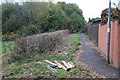
Path under Jack Williams Gateway Bridge
by M J Roscoe
geograph for square SO1912
The bridge, named to commemorate a local WW I soldier VC, carries Main Road Link... (more)
|
|
Path alongside Coed Meyrick-moel Nature Reserve, Cwmbran
by M J Roscoe
geograph for square ST2794
Public footpath, from The Incline, between Gwent Wildlife Trust's reserve... (more)
|

|
Footpath descending to centre of Callander
by Trevor Littlewood
geograph for square NN6308
The path descends from woods north of Callander to cross the residential... (more)
|

|
Afon Lwyd below Chapel Lane
by M J Roscoe
geograph for square ST2997
Looking upstream towards footbridge.
|

|
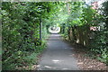
Grid and gates on cycle route NCR 492
by M J Roscoe
geograph for square SO2111
Double set of bridle gates and field gates across path on former railway trackbed.
|
|
The Incline, by Coed Meyrick-moel, Cwmbran
by M J Roscoe
geograph for square ST2794
Looking up a cycle and footpath alongside Coed Meyric-moel local nature reserve... (more)
|
|
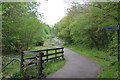
NCR 468 in Bargoed Woodland Park
by M J Roscoe
geograph for square ST1598
National Cycle Route 468 above the Rhymney River. The route goes to the left in... (more)
|

|
A469 Bridge over the Rhymney River
by M J Roscoe
geograph for square ST1598
|

|
National Cycle Route 466, near Tallistown
by M J Roscoe
geograph for square SO1804
|
|
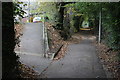
The Incline, Tramway Close, Cwmbran
by M J Roscoe
geograph for square ST2794
The incline, now a cycle lane and footpath, follows the route of the dismantled... (more)
|
|
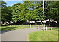
Boothen, Stoke-on-Trent: grassed area with paths
by Jonathan Hutchins
geograph for square SJ8744
This area lies between London Road and the Michelin works.
|

|
Pathway between Ancaster Road and Glenartney Road
by Trevor Littlewood
geograph for square NN6208
Ancaster Road and Glenartney Road are on the north side of the A84 passing... (more)
|
|
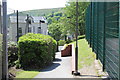
Pedestrian entrance to Georgetown School, Tredegar
by M J Roscoe
geograph for square SO1408
Entrance from Poplar Road to rear of Georgetown Primary School, Tredegar. The... (more)
|

|
Brooks House, Durham
by Trevor Littlewood
geograph for square NZ2842
Brooks House is student accommodation for the St. Cuthbert's Society in the... (more)
|

|
Western Cleddau downstream from footbridge
by M J Roscoe
geograph for square SM9516
|
