Public Tags
Tag: Tide
Other tags: subject:Tide
Showing latest 50 of 160 images tagged with Tide tag.
|
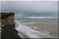
High tide at the time of a “micromoon”, Birling Gap, East Sussex
by Andrew Diack geograph for square TV5595 This photo shows the observed state of the tide, on Birling Gap beach, at the... (more)
Tags:
top:Coastal
top:Estuary, Marine
type:Geograph
top:Housing, Dwellings
Micromoon and High Tide
top:Rocks, Scree, Cliffs
subject:Tide
|

|
Causeway to Island Eddy exposed by spring tide
by Jessica Hynes geograph for square M3516 Island Eddy is joined to Killeenaran peninsula by a causeway which is only... (more)
Tags:
subject:Causeway
Causeway
top:Coastal
top:Estuary, Marine
Galway Bay
place:Island Eddy
top:Islands
place:Killeenaran
Low Tide
Spring Tide
Tide
|

|
Incoming tide on uncharted sandbank, east of Humber buoy 23
by Christine Johnstone geograph for square TA0525 The tide goes out slowly, but comes in much more quickly. The navigation buoys... (more)
Tags:
top:Estuary, Marine
river:Humber
Navigable River
Rising Tide
Sandbank
Tidal River
subject:Tide
|

|
High tide at Torre Abbey Sands, Torquay
by Malc McDonald geograph for square SX9163 Waves break against the promenade at Torre Abbey Sands. The beach has... (more)
Tags:
Beach at High Tide
Breaking Waves
top:Coastal
county:Devon
Evening Sunshine
High Tide
subject:Tide
place:Torbay
place:Torquay
Waves
|

|
Sea foam on Llandanwg beach, Gwynedd
by I Love Colour geograph for square SH5628 Llandanwg beach, Gwynedd; just south down the coast from Harlech.
The last day... (more)
Tags:
top:Air, Sky, Weather
subject:Beach
Beach
Beach at High Tide
Breaking Waves
top:Coastal
top:Estuary, Marine
county:Gwynedd
place:Harlech
High Tide
place:Llandanwg
place:North Wales
Receding Tide
Sea Foam
top:Sport, Leisure
Tide
subject:Tide
Waves
weather:Wind
Wind
Wind Blown Sea Foam
|
|
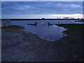
Flood tide at Fosdyke Bridge
by Ian Paterson geograph for square TF3132 An even higher high tide compared to this high tide TF3132 : Not quite a record.
Tags:
top:Estuary, Marine
Flood
type:Geograph
High Tide
top:Rivers, Streams, Drainage
Slipway
subject:Tide
|
|
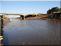
Spring low
by Ian Paterson geograph for square TF3132 Low spring tide two days after the full moon. Note the submerged rocks and... (more)
Tags:
top:Coastal
top:Docks, Harbours
type:Geograph
Low Water
top:Rivers, Streams, Drainage
Spring Tide
subject:Tide
|

|
The Lagan Weir, Belfast (18)
by Albert Bridge geograph for square J3474 Another in the series showing the weir at different states of the tide. Today... (more)
|

|
Low tide at Rest Bay
by Alan Hughes for square SS7978 The gentle ripple of the waves at this spring low tide is in marked contrast to... (more)
|

|
Low tide
by Alan Hughes geograph for square SS6389 Three minutes after low tide and there are signs that the tide is on the turn at... (more)
|
|
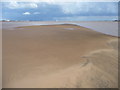
Uncharted sandbank 105 minutes after emerging, east of Humber buoy 23
by Christine Johnstone geograph for square TA0525 At its full extent. The navigation buoys and light floats are moved as and when... (more)
|

|
Leaving the Dorus Mor
by Gordon Brown for square NR7698 One of the well-known 'tidal gates' on the west coast of Scotland. The... (more)
|

|
Entering the Dorus Mor
by Gordon Brown geograph for square NR7598 One of the well-known 'tidal gates' on the west coast of Scotland.... (more)
|
|
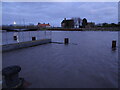
Almost on the level
by Ian Paterson geograph for square TF3132 A 7.4m high spring tide on the River Welland at Fosdyke Bridge. Compare these... (more)
Tags:
Fosdyke
type:Geograph
High Tide
top:Rivers, Streams, Drainage
Spring Tide
subject:Tide
Welland
|

|
Coastal East Lothian : Green Grass & High Tides
by Richard West geograph for square NT5585 It was a stonkinly sunny late September afternoon in North Berwick. The... (more)
|

|
Incoming tide
by Alan Hughes geograph for square SS4087 The incoming tide will soon have turned Worm’s Head into an island. On this... (more)
|

|
Uncharted sandbank 35 minutes after emerging, east of Humber buoy 23
by Christine Johnstone geograph for square TA0525 The navigation buoys and light floats are moved as and when the sandbanks and... (more)
Tags:
top:Estuary, Marine
river:Humber
Navigable River
Receding Tide
Sandbank
Tidal River
subject:Tide
|

|
Uncharted sandbank, 30 minutes after emerging, east of Humber buoy 23
by Christine Johnstone geograph for square TA0525 The navigation buoys and light floats are moved as and when the sandbanks and... (more)
Tags:
top:Estuary, Marine
river:Humber
Navigable River
Receding Tide
Sandbank
Tidal River
subject:Tide
|

|
Uncharted sandbank emerging, east of Humber buoy 23
by Christine Johnstone geograph for square TA0525 The navigation buoys and light floats are moved as and when the sandbanks and... (more)
Tags:
top:Estuary, Marine
river:Humber
Navigable River
Receding Tide
Sandbank
Tidal River
subject:Tide
|

|
High Tide marker at Melfort
by M J Richardson geograph for square NM8312 On the shore of Loch na Cille, this stone marks the high water level of an... (more)
Tags:
1881
Argyll and Bute
top:Coastal
top:Estuary, Marine
Flood Depth Marker
High Tide
Melfort
top:People, Events
subject:Tide
top:Village, Rural Settlement
|

|
The ebbing tide at Kinmel Bay
by Jeff Buck geograph for square SH9980 The ebbing tide at Kinmel Bay has left pools in the soft sand.
Tags:
subject:Beach
Beach
top:Coastal
county:Conway
Ebbing Tide
top:Estuary, Marine
place:Kinmel Bay
Sand
Tide
country:Wales
|
|
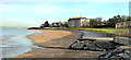
High water, Seapark, Holywood
by Albert Bridge geograph for square J4079 The loughshore, at Seapark, about 30 minutes before high water, four hours... (more)
Tags:
place:Belfast Lough
top:Coastal
Full Moon
High Tide
place:Holywood
Loughshore
Shore
Spring Tide
Tidal Variation
Tide
|

|
Footsteps in the sand - Avon Mawddach estuary
by I Love Colour for square SH6214 Avon Mawddach estuary from Barmouth bridge, looking towards Fairbourne.
Low... (more)
Tags:
top:Air, Sky, Weather
Avon Mawddach
place:Barmouth
Barmouth Bridge
Bridge
top:Coastal
Coastal
Coastal Area
Coastal Scenery
Coastal View
type:Cross Grid
top:Docks, Harbours
subject:Estuary
Estuary
top:Estuary, Marine
Exploring
place:Fairbourne
top:Flat Landscapes
place:Gwynedd
North Wales
Outdoors
Sand
beach:Sand
Sand Dunes
Sea
Sky
Sky Blue
top:Sport, Leisure
Tide
Walking
|

|
Afon Conwy estuary from West shore, Llandudno
by I Love Colour geograph for square SH7782 Low tide at West shore, Llandudno by the Great Orme headland.
Looking out into... (more)
Tags:
place:Afon Conwy
river:Afon Conwy
top:Air, Sky, Weather
Beach
weather:Clouds
top:Coastal
Estuary
subject:Estuary
top:Estuary, Marine
type:Geograph
place:Great Orme
Mountains
place:North Wales
Pebbles
Sand
Sea View
Sky
Sky Blue
place:Snowdonia
top:Sport, Leisure
Stones
Tidal Estuary
Tidal Sands
subject:Tide
Tide
Tide Line
place:Wales
|

|
Lochanscadden
by Andy Farrington geograph for square NX3737 View west from the shore near Lochanscadden, a small tidal pond on the coast... (more)
|

|
High tide at Thorness Bay IOW
by Colin Park geograph for square SZ4593 Although passable on this occasion, the coastal path follows the shore at this... (more)
|

|
Tide turning on an Eriskay beach
by AlastairG geograph for square NF7811 The tide is just lapping at the outer rocks on the beach.
|
|
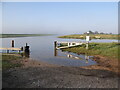
Not quite a record
by Ian Paterson geograph for square TF3132 This is what the high spring tide looked like at 09:15. Clearly not the highest... (more)
|
|
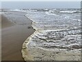
Spring tide at Kenfig Sands
by Alan Hughes for square SS7781 This photograph was taken at the time when the October spring tide was at its... (more)
|

|
Bosham near Chichester at high tide
by Colin Park geograph for square SU8003 Underneath this water is a road which floods every high tide.
|

|
Incoming tide at Rest Bay
by Alan Hughes geograph for square SS7977 View across Rest Bay towards Sker Point. The sand in the corner of Grid Square... (more)
|

|
Waiting for low tide
by Alan Hughes for square SS9168 Grid square SS9068 can only be photographed at a low spring tide. I am already... (more)
|

|
Incoming tide
by Alan Hughes for square SS8574 Incoming tide at Ogmore beach.
|

|
High tide storm
by Alan Hughes for square SS8176 A 10 m high spring tide batters the sea wall at Porthcawl promenade.
|

|
Incoming tide
by Alan Hughes for square SS4087 The incoming tide takes just over 2 hours to cover the causeway between Rhossili... (more)
|

|
Incoming tide
by Alan Hughes geograph for square SS4086 The southernmost rocks of Tears Point are being submerged beneath the incoming tide.
|

|
Ebbing tide
by Alan Hughes geograph for square SS4298 Still 30 minutes until low tide, but it seems unlikely that it will retreat the... (more)
|

|
Low tide at Pembrey Burrows
by Alan Hughes geograph for square SS4299 The tide is about to turn.
|

|
Incoming tide
by Alan Hughes geograph for square SS4188 Incoming tide at Rhossili Bay. Worm’s Head in the distance.
|

|
Incoming tide
by Alan Hughes geograph for square SS8476 The incoming tide whipped up by a strong breeze leaves a deposit of murky foam... (more)
|

|
Incoming tide at Beaumaris
by Alan Hughes geograph for square SH6176 The incoming tide washes over the pebbles depositing an ugly froth on the shore.... (more)
|

|
Tide line
by Alan Hughes geograph for square SN3900 Incoming tide line at Cefn Sidan. The headland of Rhossili and Worm’s Head in... (more)
|

|
Incoming tide
by Alan Hughes geograph for square SN3800 Incoming tide at Cefn Sidan near Pembrey.
|
|
Low Tide
by kevin higgins geograph for square S6713 Low tide in the River Suir estuary looking towards the confluence of the River Barrow.
|

|
From Land to Beach
by Andy Beecroft geograph for square TA4213 Since its breach in December 2013, there is almost no indication that there was... (more)
|
|
Tide in Flow at Kenfig Sands
by Alan Hughes geograph for square SS7782 Flow tide at Kenfig Sands with Swansea bay in the distance.
|

|
The causeway floods
by Chris Allen geograph for square SW5130 The tide is coming in and starting to submerge the causeway linking St... (more)
|

|
Incoming tide at Milnthorpe Sands
by philandju geograph for square SD4780 The tide travels quickly up the funnel created by Morecambe Bay.
|

|
Ravenglass
by Peter Trimming geograph for square SD0896 In-coming tide, at least 40 minutes before high tide.
|

|
High tide at Durgan slipway
by David Hawgood geograph for square SW7727 See SW7727 : The village of Durgan on the Helford River and SW7727 : Durgan beach for photos with beach visible at lower tide.
|
