
|
Douglas Park Topograph - Trig Point TP7637
by Raibeart MacAoidh
geograph for square NS2158
Looking over Largs to Bute and Cowal from Douglas Park topograph at... (more)
|

|
Topograph and boulder at Great Orme summit
by David Hillas
for square SH7683
This photo shows the topograph on a boulder at Great Orme summit. The... (more)
|

|
Topograph on Pepperbox Hill
by David Martin
for square SU2124
Looking down on the topograph, which is set on a pillar. The symbol near the... (more)
|

|
Leckhampton Hill - topograph
by Stephen McKay
geograph for square SO9418
A topograph is provided for identifying various landscape features visible from... (more)
|

|
Topograph on the summit of Great Orme
by David Hillas
for square SH7683
This photo shows the topograph on the stone column at the summit of the Great... (more)
|

|
Topograph at Kinver Hill Fort
by David Martin
geograph for square SO8383
A rather fine topograph, incorporating a map within a compass rose.
|

|
Topograph at a Viewpoint in Wendover Woods
by David Hillas
for square SP8809
This topograph is located at a viewpoint in Wendover Woods where one can see the... (more)
|

|
Topograph on Snowdon Summit
by Adrian Taylor
for square SH6054
The Ordnance Survey trigonometrical column on the summit of Snowdon was... (more)
|

|
Flush Bracket Benchmark, Snowdon Summit
by Adrian Taylor
for square SH6054
Detail of the Ordnance Survey flush bracket benchmark on the topograph on the... (more)
|

|
Topograph on Baslow Edge
by David Lally
geograph for square SK2574
Looking over the Derwent valley
|

|
Topograph on Walton Hill
by David Martin
for square ST4634
|
|
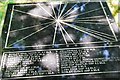
Topograph on Tompkin Road (off Knowsley Road)
by Stu JP
for square SJ9451
This device indicates the direction and distance of landscape features in the... (more)
|

|
The Vaughan Williams topograph (4)
by David Purchase
for square SN8395
There are several photos of this memorial on site. But I thought it would be... (more)
|

|
The Vaughan Williams topograph (3)
by David Purchase
for square SN8395
There are several photos of this memorial on site. But I thought it would be... (more)
|

|
The Vaughan Williams topograph (1)
by David Purchase
for square SN8395
There are several photos of this memorial on site. But I thought it would be... (more)
|

|
The topograph on Alport Height
by Humphrey Bolton
for square SK3051
|

|
Topograph on Tarmore Hill
by David Martin
geograph for square NS0558
Just to the north of the spot identified as a viewpoint on OS mapping.
|

|
Topograph, East Lomond hill
by Bill Harrison
geograph for square NO2406
Fine views as far as Dundee and Edinburgh may be had from the 434-metre summit.
|

|
Topograph stone at Badbury Rings
by David Martin
geograph for square ST9602
The woodland appears to have grown up and obscured views of local landmarks... (more)
|

|
The summit of the Wrekin
by Stephen McKay
geograph for square SJ6208
As well as a standard issue Ordnance Survey triangulation pillar, this topograph... (more)
|

|
Inscription on a Topograph in Wendover Woods
by David Hillas
for square SP8809
This inscription shows the places one can see from this viewpoint in Wendover... (more)
|

|
Furnishings upon the Summit of Win Green
by Chris Heaton
geograph for square ST9220
These include a topograph and a trig point, which marks the summit at 910'... (more)
|

|
Grass track on the Hill of Alyth
by Peter Wood
geograph for square NO2450
Looking westward towards the Triangulation Pillar and Topograph.
|

|
Shaftesbury: topograph on Park Walk
by Jonathan Hutchins
for square ST8622
|

|
The Topograph on Stinchcombe Hill
by Ian S
geograph for square ST7398
The Cotswold Way, day four 9:20am
|

|
The Topograph on Stinchcombe Hill
by Ian S
geograph for square ST7398
The Cotswold Way, day four 9:20am
|

|
Worcestershire Beacon
by Rude Health
for square SO7645
Worcestershire historic county top and Worcestershire current county/UA top.... (more)
|

|
The inner ward at Beeston Castle
by Jeff Buck
geograph for square SJ5359
The inner ward at Beeston Castle now has the added feature of a toposcope (or... (more)
|

|
Beeston Castle Toposcope
by Jeff Buck
for square SJ5359
The toposcope (or topograph) in the inner ward of Beeston Castle has only been... (more)
|

|
Beeston Castle Toposcope
by Jeff Buck
geograph for square SJ5359
The toposcope (or topograph) in the inner ward of Beeston Castle has only been... (more)
|

|
Beeston Castle Toposcope
by Jeff Buck
geograph for square SJ5359
The toposcope (or topograph) in the inner ward of Beeston Castle has only been... (more)
|

|
Hampsfell Hospice
by Adrian Taylor
geograph for square SD3979
Hampsfell Hospice was built in the nineteentl century as a shelter for walkers... (more)
|

|
Stone Toposcope
by Michael Westley
for square SO7639
Which direction next, just south of British Camp Reservoir
|

|
View from the top
by Bill Harrison
geograph for square SH6054
Looking approximately northeast from Snowdon summit. There was only about a... (more)
|

|
Compass Rose feature at Beachy Head
by David Hillas
for square TV5995
Situated off Beachy Road, BN20 7YA, this stone compass has the following... (more)
|

|
Triangulation Pillar, High Pike
by Adrian Taylor
geograph for square NY3135
The Ordnance Survey triangulation pillar on the summit of High Pike.
The flush... (more)
|

|
Triangulation Pillar, High Pike
by Adrian Taylor
geograph for square NY3135
The Ordnance Survey triangulation pillar on the summit of High Pike, with the... (more)
|
