|
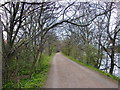
The Thames Path in early spring
by Stefan Czapski
geograph for square TQ1976
Category: Riverside path
March 21st, and hawthorn leaves have just started to open along this stretch of... (more)
|

|
Cycle path and tow path, Brecon
by M J Roscoe
geograph for square SO0527
The Taff Trail and the tow path, Usk Vale Walk, part company briefly.
|

|
Tow Path beside the Leeds and Liverpool Canal
by Graham Robson
geograph for square SD9850
Looking along the tow path of the Leeds and Liverpool Canal as a pair of... (more)
|

|
Towpath resurfacing on the Trent and Mersey
by Ian Calderwood
geograph for square SK3728
In the fourth quarter of 2022, the towpath between Swarkestone Lock and bridge... (more)
|

|
Tow path joins road on approach to bridge 165
by M J Roscoe
geograph for square SO0527
The Usk Valley Walk, on the tow path, rejoins the Taff Trail on the road.
|

|
Pencelli Bridge, No 154
by M J Roscoe
geograph for square SO0925
The Taff Trail leaves the tow path here and goes left over this road bridge to... (more)
|

|
The tow path
by Malcolm Neal
geograph for square SK0048
The tow path along the Caldon Canal is generally in a very good condition.
|

|
Regent's Canal, Kentish Town Lock
by David Dixon
geograph for square TQ2884
|

|
Regent's Canal, Bridge#25 (Kentish Town)
by David Dixon
geograph for square TQ2884
|

|
View Along The Tow Path
by Rude Health
geograph for square SD5039
A view SW along the tow path of the Lancaster Canal on a cool sunny Monday.
|

|
A View Along The Towing Path
by Rude Health
geograph for square SD6324
A view along the Leeds and Liverpool Canal towing path from near the milestone... (more)
|
|
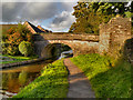
Macclesfield Canal, Bridge#39 (Holland's Bridge)
by David Dixon
geograph for square SJ9273
Holland's Bridge, number 39 on the Macclesfield Canal, is a footbridge... (more)
|
|
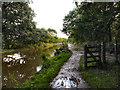
Macclesfield Canal. Middlewood
by David Dixon
geograph for square SJ9584
|

|
Tow path of Grantham Canal
by Trevor Littlewood
geograph for square SK8036
The grassed strip is the towing path of the disused Grantham Canal, still in... (more)
|

|
Leeds and Liverpool Canal, Moss Bridge
by David Dixon
geograph for square SD5803
Moss Bridge at the south-east corner of Scotsman's Flash is a... (more)
|
|
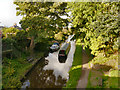
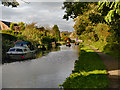
Macclesfield Canal
by David Dixon
geograph for square SJ9272
Looking down onto the Macclesfield Canal from Leadbeater's Bridge at Windmill Street.
|
|
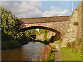
Macclesfield Canal
by David Dixon
geograph for square SJ9272
The Macclesfield Canal, just north of Leadbeater's Bridge.
|
|
Macclesfield Canal, Verdon's/Barnshaw Bridge
by David Dixon
geograph for square SJ9272
Bridge#41 on the Macclesfield Canal.
|

|
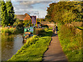
Macclesfield Canal, Bridge#40 (Leadbeater's Bridge)
by David Dixon
geograph for square SJ9272
Leadbeater's Bridge, number 40 on the Macclesfield Canal, carries Windmill... (more)
|
|
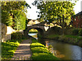
Macclesfield Canal
by David Dixon
geograph for square SJ9272
A narrowboat moored alongside the canal towpath between Leadbeater's Bridge... (more)
|
|
Macclesfield Canal, Bridge#38 (Black Road)
by David Dixon
geograph for square SJ9273
Black Road Bridge, number 38 on the Macclesfield Canal.
|

|
Macclesfield Canal, Higher Poynton
by David Dixon
geograph for square SJ9584
|

|
Macclesfield Canal, Higher Poynton
by David Dixon
geograph for square SJ9484
|
|
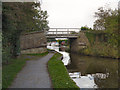
Macclesfield Canal, Bridge#14
by David Dixon
geograph for square SJ9483
Farm access bridge (Barlow House Farm) at Higher Poynton.
|
|
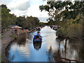
Macclesfield Canal at Higher Poynton
by David Dixon
geograph for square SJ9483
|
|
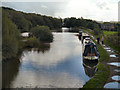
Macclesfield Canal, Higher Poynton
by David Dixon
geograph for square SJ9483
|

|
On the Beat, Thames Tow Path, Kew, London
by Christine Matthews
geograph for square TQ1776
A Policeman and Policewoman on the beat along the Tow Path at Kew Gardens.
|

|
Moss Bridge, Leeds and Liverpool Canal
by David Dixon
geograph for square SD5803
Moss Bridge on the Leigh branch of the Leeds and Liverpool canal, is at the... (more)
|

|
Tow path at Broad Oak
by Mr Ignavy
geograph for square SU7552
Also part of The Three Castles Path.
|

|
Canal bridge at end of Groes Road
by M J Roscoe
geograph for square ST2788
Southern aspect of semi-elliptical stone arch bridge over the Crumlin Arm canal.... (more)
|

|
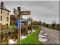
Canal with path drainage feature
by Trevor Littlewood
geograph for square SJ7825
This stretch of the Shropshire Union Canal was originally the Birmingham and... (more)
|
|
Monmouthshire and Brecon Canal Towpath, Taff Trail (NCN 8)
by David Dixon
geograph for square SO0527
The Taff Trail (Taith Taf) is a popular walking and cycle path that runs for 55... (more)
|

|
Path onto the Peak Forest Canal
by David Dixon
geograph for square SJ9397
Near bridge#2 at Ashton Street.
|

|
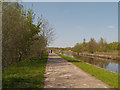
Canal Towpath, Wigan Flashes
by David Dixon
geograph for square SD5803
The Leigh branch of the Leeds and Liverpool Canal runs on an embankment across... (more)
|
|
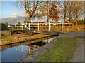
Leeds and Liverpool Canal at Wigan Flashes Nature Reserve
by David Dixon
geograph for square SD5803
|
|
Clockhouse Swing Bridge, Fairfield
by David Dixon
geograph for square SJ8997
Bridge #15 on the Ashton Canal is this swing bridge at Fairfield. It takes the... (more)
|

|
Leeds & Liverpool Canal on the outskirts of Barnoldswick
by Trevor Littlewood
geograph for square SD8846
The canal heading into open country looking south-east from Long Ing Bridge, No.... (more)
|

|
Canal, Crumlin Arm, west of Oaktree Cottage
by M J Roscoe
geograph for square ST2689
Disused canal, the tow path is part of NCR 47, Celtic Trail.
|

|
Shropshire Union Canal from Turnover Bridge
by Trevor Littlewood
geograph for square SJ8317
Turnover is the name and is also descriptive of the bridge. The towing path... (more)
|

|
Almshouses Bridge, No 145
by M J Roscoe
geograph for square SO1123
Modern bridge carrying B4558 over canal and Taff Trail on tow path.
|

|
White Hart Bridge, No 143, Talybont
by M J Roscoe
geograph for square SO1122
The White Hart Inn is to the left. The signposted Taff Trail comes over the... (more)
|

|
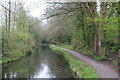
Bridge 50, Monmouthshire & Brecon Canal
by M J Roscoe
geograph for square ST2999
Looking south along tow path, NCR 49, to road bridge, Griffithstown.
|
|
Monmouthshire & Brecon Canal, Griffithstown
by M J Roscoe
geograph for square ST2999
Looking north, the canal runs alongside the County Hospital. The tow path is... (more)
|

|
Narrow boats below Lock 65, Cwm Crawnon
by M J Roscoe
geograph for square SO1419
Moored commercial narrow boats on a curve in the Monmouthshire & Brecon... (more)
|
|
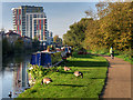
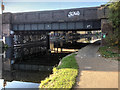
River Lee Navigation at Hackney Wick
by David Dixon
geograph for square TQ3685
The Lee Navigation is a canalised river incorporating the River Lea (also called... (more)
|
|
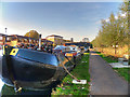
Lee Navigation, Eastway Bridge
by David Dixon
geograph for square TQ3685
The Lee Navigation is a canalised river incorporating the River Lea (also called... (more)
|
|
Lea Valley Walk, Hackney Wick
by David Dixon
geograph for square TQ3784
The Lee Navigation is a canalised river incorporating the River Lea (also called... (more)
|

|
River Lee Navigation, White Post Lane
by David Dixon
geograph for square TQ3784
The Lee Navigation is a canalised river incorporating the River Lea (also called... (more)
|

|
Stratford, River Lee Navigation
by David Dixon
geograph for square TQ3784
The Lee Navigation is a canalised river incorporating the River Lea (also called... (more)
|

|
River Lee Navigation at Stratford
by David Dixon
geograph for square TQ3784
The Lee Navigation is a canalised river incorporating the River Lea (also called... (more)
|
