Geograph - photograph every grid square
About tags on Geograph
Tags
Geographical Context
Subjects
Types
Other Prefixes
Public Tags
Related Tags
|
Coverage Map
Tag:
Track·/·Path·Junction
Showing images tagged with
Track / Path Junction
tag.
View all tagged images
-
In Browser
Track in Brockishill Inclosure, New Forest, near Lyndhurst
by
Malc McDonald
geograph for square
SU3011
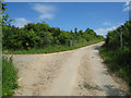
A junction of a path and a track in Brockishill Inclosure in the New Forest... (
more
)
Tags:
Cycle Route
Cycle Route Marker
Cycling and Walking Trail
Forest Track
Forestry Track
type:
Geograph
county:
Hampshire
near:
Lyndhurst
place:
New Forest
New Forest
national park:
New Forest
New Forest National Park
subject:
Path Junction
top:
Paths
Track / Path Junction
Track and Path
Track and Path Junction
Woodland Access Track
Woodland Track
top:
Woodland, Forest
Parley Common, near Ferndown
by
Malc McDonald
geograph for square
SZ0999
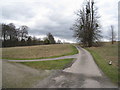
A path and a track on Parley Common in Dorset.
Tags:
near:
Bournemouth
ceremonial county:
Dorset
county:
Dorset
near:
Ferndown
type:
Geograph
top:
Heath, Scrub
Heathland Path
Junction of Paths
place:
Parley Common
Path
Path Junction
subject:
Path Junction
top:
Paths
Track / Path Junction
Track and Path
Track and Path Junction
near:
West Parley
Poole Harbour Trail near Wareham
by
Malc McDonald
geograph for square
SY9292
Trails met in a forest in Dorset. Both of the trails ahead are on the route of... (
more
)
Tags:
Cycling and Walking Trail
ceremonial county:
Dorset
county:
Dorset
weather:
Dull
Dull Day
Dull Weather
Forest Path
Forest Path Junction
Forest Track
Forest Trail
Forestry Track
type:
Geograph
Junction of Paths
Path Junction
subject:
Path Junction
Path Junction in Wood
top:
Paths
long distance path:
Poole Harbour Trail
Track / Path Junction
near:
Wareham
top:
Woodland, Forest
Track and path junction in Bateswood Country Park
by
Jonathan Hutchins
geograph for square
SJ7948
Tags:
Bateswood Country Park
type:
Geograph
subject:
Path Junction
Path Junction in Wood
top:
Paths
top:
Roads, Road Transport
Track / Path Junction
Track and Path Junction
top:
Woodland, Forest
Junction of paths on the Sandstone Trail
by
Christopher Hilton
geograph for square
SJ4952
Tags:
Footpath Sign
Footpath Signpost
type:
Geograph
Horse
Junction of Paths
Path
subject:
Path Junction
Path Junction
top:
Paths
long distance path:
Sandstone Trail
Sandstone Trail
The Sandstone Trail
Track / Path Junction
Track and Path Junction
top:
Woodland, Forest
Woods
Track to The Lodge
by
Mr Ignavy
geograph for square
SU6550
Category: Track / path junction
Just beyond the trees to the right of the track is a cricket ground.
Tags:
Track / Path Junction
subject:
Track Junction
Parting of ways
by
Mr Ignavy
geograph for square
SY7995
Category: Track / path junction
Footpath to the left, farm track straight ahead.
Tags:
Track / Path Junction
subject:
Track Junction
Muddy path near Godstone
by
Malc McDonald
geograph for square
TQ3452
A muddy path and track near Godstone. This image was taken in October 2019,... (
more
)
Tags:
near:
Caterham
type:
Geograph
near:
Godstone
Muddy Path
place:
North Downs
top:
Paths
Public Footpath Signpost
county:
Surrey
Track / Path Junction
Track and Path Junction
Turning for Home Farm
by
Mr Ignavy
geograph for square
SU6550
Category: Track / path junction
Tags:
Track / Path Junction
subject:
Track Junction
Path and track junction below Chesters Wood
by
Jim Barton
geograph for square
NT3663
On the track between Blinkbonny and Southside with Traprain Law on the skyline ahead.
Tags:
Farm Road
top:
Farm, Fishery, Market Gardening
Farmland
Footpath Signpost
type:
Geograph
top:
Paths
top:
Roads, Road Transport
Track / Path Junction
Footpath by garden fence, Waungron
by
M J Roscoe
geograph for square
SN1915
The wooden fence is on the south side of Waungron Barn; the track goes down to... (
more
)
Tags:
top:
Boundary, Barrier
type:
Geograph
Grass Down the Middle
subject:
Path
top:
Paths
top:
Roads, Road Transport
Track / Path Junction
Track to Dwelling
Waymarker Post
Footpath signs below Chesters Wood
by
Jim Barton
geograph for square
NT3663
Signs for footpaths and the Tyne Esk Trail horseriding route at the junction... (
more
)
Tags:
top:
Farm, Fishery, Market Gardening
Farmland
Footpath Signpost
type:
Geograph
top:
Paths
Track / Path Junction
Path at Puddle Bridge, Ormiston
by
Jim Barton
geograph for square
NT4169
A useful short link path from the pavement on the B6371 to the Pencaitland... (
more
)
Tags:
top:
Derelict, Disused
Footpath Bridge Over Burn
Footpath Signposts
type:
Geograph
top:
Paths
top:
Railways
Track / Path Junction
View more in the Image Search
or
in Browser
View images matching 'Track / Path Junction' anywhere
in
the tags
Don't click these:
PotMel 1
PotMel 2
☰
Home
View
Search
Marked Images
Maps
Browser
Explore
Showcase
New Images
Collections
Interact
Games
Discussions
Blog
Contributors
Submit
Statistics
Leaderboards
General
FAQ
Help Pages
Sitemap
Contact Us
Support Us
sponsored by
🔍︎
What to search:
Photos
Enter keywords or a location/postcode to search nearby images
Enter a Grid Reference
Placenames
Collections
Website Pages
Everything
Others:
Advanced Search
|
Image Browser
Or:
Coverage Map
|
Searchable Map
You are not logged in
|
login
|
register