Public Tags
Tag: Track·Junction
Other tags: category:Track Junction
subject:Track Junction
Showing latest 50 of 1,359 images tagged with Track Junction tag.

|
Track branching from former railway
by Andy Waddington geograph for square NY9644 Category: Public footpath Just west of the junction which connects the permissive traffic-free cycle route... (more)
Tags:
category:Estate Track
type:Geograph
top:Moorland
top:Paths
category:Public Footpath
category:Railway (Former)
category:Track Junction
category:Traffic Free Cycle Route
top:Uplands
|

|
Scarred landscape north of Great Pinseat
by Andy Waddington geograph for square NY9703 Category: Track junction Now used mainly to access the grouse moors to the west, these tracks were both... (more)
Tags:
top:Barren Plateaux
type:Geograph
category:Mine Workings (Disused)
top:Paths
category:Public Bridleway
top:Quarrying, Mining
category:Track Junction
top:Uplands
|

|
Track junction by the Achmore Burn
by Andy Waddington geograph for square NN5830 Category: Track junction Tags:
top:Farm, Fishery, Market Gardening
category:Forest Track
type:Geograph
top:Paths
category:Track Junction
top:Uplands
top:Woodland, Forest
|

|
Forest track branches off byway, Slaley Forest
by Andy Waddington geograph for square NY9755 Category: Public byway The route to the right is supposedly a byway, though the line of that right of... (more)
Tags:
category:Forest Track
type:Geograph
top:Paths
category:Public Byway
category:Track Junction
top:Uplands
top:Woodland, Forest
|

|
Forest track branches off byway, Slaley Forest
by Andy Waddington geograph for square NY9455 Category: Public byway The forest track to the left is guarded by a closed barrier to deter those who... (more)
Tags:
category:Forest Track
type:Geograph
top:Paths
category:Public Byway
category:Track Junction
top:Uplands
top:Woodland, Forest
|

|
Misleading signage on Castle Bolton estate
by Andy Waddington geograph for square SE0090 Category: Public bridleway Clear signage is usually welcome in popular walking areas frequented by tourists... (more)
Tags:
top:Country Estates
type:Geograph
top:Moorland
top:Paths
category:Public Bridleway
category:Signage
category:Track Junction
top:Uplands
|

|
Tracks on Witton Moor
by Andy Waddington geograph for square SE1383 Category: Track junction From the gate on the right emerges Sowden Beck Road, a byway, and a good track... (more)
|

|
Track Junction
by Mark Anderson geograph for square SH3965 Category: Track junction Tags:
category:Track Junction
|

|
Forest junction
by Andy Waddington geograph for square NZ0629 Category: Track junction Hamsterley forest seems to have outgrown its purpose as merely a place for... (more)
Tags:
top:Roads, Road Transport
top:Sport, Leisure
category:Track Junction
top:Uplands
top:Woodland, Forest
|

|
Sheep at top of track to Cam Houses
by Andy Waddington geograph for square SD8282 Category: Sheep The Pennine Way here follows Cam High Road, along the line of a Roman Road which... (more)
Tags:
type:Geograph
top:Moorland
top:Roads, Road Transport
category:Sheep
category:Track Junction
top:Uplands
|

|
Tracks in the New Forest near Lyndhurst
by Malc McDonald geograph for square SU2406 A junction of tracks in the Anderwood Inclosure in the New Forest National Park.... (more)
Tags:
Cycle Route
Cycle Route Marker
Forest Path
Forest Track
Forest Track Junction
Forestry Track
Forestry Track Junction
type:Geograph
county:Hampshire
Junction of Tracks
near:Lyndhurst
national park:New Forest
place:New Forest
New Forest
New Forest National Park
top:Paths
Track Junction
subject:Track Junction
Woodland Path
top:Woodland, Forest
|

|
Track in the New Forest, near Ringwood
by Malc McDonald geograph for square SU1808 A junction of tracks in the Great Linford Inclosure in the New Forest National... (more)
Tags:
Cycling and Walking Trail
Forest Track
Forest Track Junction
Forestry Track
Forestry Track Junction
type:Geograph
county:Hampshire
place:New Forest
New Forest
national park:New Forest
New Forest National Park
top:Paths
near:Ringwood
Track
subject:Track Junction
Track Junction
Woodland Track
top:Woodland, Forest
|
|
Track junction at Afan Forest Park
by eswales geograph for square SS8193 Category: Track junction A track junction with waymark on Mynydd Penhydd.
|
|
Track junction at the south west corner of Coed Cwm Kenfig
by eswales geograph for square SS8385 Category: Track junction A junction of tracks, both also footpaths, in a pleasant deciduous area on the... (more)
|
|
Track junction in the north of Coed Cwm Kenfig
by eswales geograph for square SS8387 Category: Track junction Although the track to the left (which continues behind the photographer's... (more)
Tags:
Cwm Cynffig
Cwm Kenfig
top:Paths
Track
subject:Track Junction
Track Junction
top:Woodland, Forest
|

|
Tracks in the New Forest near Fordingbridge
by Malc McDonald geograph for square SU2014 Tracks in the New Forest National Park. The track going straight ahead can be... (more)
Tags:
Cycle Route
Cycling and Walking Trail
Drought
weather:Drought
Drought 2026
near:Fordingbridge
type:Geograph
county:Hampshire
top:Heath, Scrub
place:New Forest
New Forest
national park:New Forest
New Forest National Park
top:Roads, Road Transport
Rural Track
Track
Track and Path Junction
Track Junction
subject:Track Junction
|

|
Tracks through Milkham Inclosure, near Ringwood
by Malc McDonald geograph for square SU2110 A fork in the tracks in Milkham Inclosure in the New Forest National Park.
Tags:
Forest Track
Forestry Track Junction
type:Geograph
county:Hampshire
national park:New Forest
place:New Forest
New Forest
New Forest National Park
top:Paths
near:Ringwood
Rural Track
Track
subject:Track Junction
Track Junction
Woodland Track
top:Woodland, Forest
|

|
Track through Milkham Inclosure, near Ringwood
by Malc McDonald geograph for square SU2109 A wide gravel track through Milkham Inclosure in the New Forest National Park.
Tags:
Forest Track
Forestry Track Junction
type:Geograph
county:Hampshire
place:New Forest
New Forest
national park:New Forest
New Forest National Park
top:Paths
near:Ringwood
Rural Track
Track
Track Junction
subject:Track Junction
Woodland Track
|

|
Tracks in the New Forest, near Ringwood
by Malc McDonald geograph for square SU2009 A fork in tracks through a wooded enclosure in the New Forest National Park.
Tags:
Forest Track
Forestry Track Junction
type:Geograph
county:Hampshire
near:Linwood
national park:New Forest
place:New Forest
New Forest
New Forest National Park
top:Paths
near:Ringwood
Rural Track
Track
subject:Track Junction
Track Junction
Woodland Track
top:Woodland, Forest
|

|
A fork in the tracks, near Ringwood
by Malc McDonald geograph for square SU1910 A junction of tracks in the New Forest National Park. Cycling is permitted on a... (more)
Tags:
type:Geograph
county:Hampshire
near:Linwood
national park:New Forest
place:New Forest
New Forest
New Forest National Park
near:Ringwood
top:Roads, Road Transport
subject:Track Junction
Track Junction
Tracks
|

|
Berwickshire Landscape : View uphill to track junction on Bell Hill
by Richard West geograph for square NT8365 The newer hard track bends round to the left towards the out of sight wind... (more)
Tags:
hill:Bell Hill Berwickshire
top:Farm, Fishery, Market Gardening
type:Geograph
near:Grantshouse
top:Lowlands
top:Paths
top:Roads, Road Transport
Track
Track Junction
subject:Track Junction
Vehicle Track
Windfarm Access Road
|
|
Junction of two tracks
by Robert Graham geograph for square NZ0751 This is the junction of a track running north from Derwent Manor Hotel with the... (more)
Tags:
Dry Stone Wall
Field Path
type:Geograph
top:Lowlands
top:Paths
top:Roads, Road Transport
Track Junction
subject:Track Junction
|
|
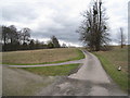
Track to The Lodge
by Mr Ignavy geograph for square SU6550 Category: Track / path junction Just beyond the trees to the right of the track is a cricket ground.
Tags:
Track / Path Junction
subject:Track Junction
|

|
Track to Kemphill, south-west of Coupar Angus
by Karl Peet geograph for square NO2039 An unsealed farm track leading towards Kemphill through agricultural land... (more)
|

|
Junction of farm tracks between cultivated fields
by Karl Peet geograph for square NO0936 A broad unsurfaced farm track reaches a junction between cultivated fields, with... (more)
Tags:
top:Farm, Fishery, Market Gardening
type:Geograph
top:Roads, Road Transport
subject:Track Junction
|

|
Berwickshire Landscape : Track junction between Renton House and Renton Barns cottages
by Richard West geograph for square NT8265 The track to the left heads towards the track up Bell Hill.
The track to the... (more)
Tags:
Farm Access Road
top:Farm, Fishery, Market Gardening
type:Geograph
near:Grantshouse
top:Lowlands
top:Paths
near:Renton Barns
top:Roads, Road Transport
subject:Track Junction
Track Junction
|

|
Track junction below Meall Dubh, Glen Bruar
by AlastairG geograph for square NN8372 A rough track, shown on the 1:50 000 OS map, would appear to offer a shortcut... (more)
|
|
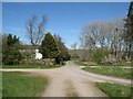
Tracks at Nether Row
by Adrian Taylor geograph for square NY3237 Nether Row comprises little more than a scattering of houses and a junction of... (more)
Tags:
Cumbria
Cumbria Way
Cumbria Way Alternative Route
type:Geograph
Junction of Tracks
Nether Row
top:Roads, Road Transport
ldp:The Cumbria Way
The Cumbria Way
long distance path:The Cumbria Way
The Cumbria Way Alternative Route
subject:Track Junction
Tracks
top:Village, Rural Settlement
|
|
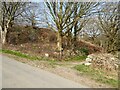
Lane entrance near Brookside
by Adrian Taylor geograph for square SD2389 Leading from the road near Brookside the lane leads to Buttstead Wood and... (more)
|
|
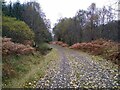
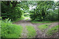
Track junction
by Aleks Scholz geograph for square NN5831 Fall leaves on the tracks. This is the junction between two paths through the... (more)
Tags:
type:Geograph
top:Paths
top:Rivers, Streams, Drainage
subject:Track Junction
top:Woodland, Forest
|
|
Track junction off Troed-y-rhiw Road
by M J Roscoe geograph for square ST1995 Two tracks leave the road almost opposite its junction with a byway and cross... (more)
|

|
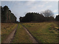
Track junction, Inshriach Forest
by Graham Robson geograph for square NH8605 A junction of tracks in Inshriach Forest. The track to the left heads towards... (more)
Tags:
long distance path:East Highland Way
Forest Track
type:Geograph
place:Inshriach Forest
top:Paths
Track Junction
top:Woodland, Forest
|
|
Track junction
by David Pashley geograph for square TL7998 Track junction with Cold Harbour cottage in background.
Tags:
Breckland Norfolk
top:Flat Landscapes
type:Geograph
top:Paths
Thetford Forest
subject:Track Junction
Track Junction
top:Woodland, Forest
|

|
Track junction, Ardverikie Estate
by Graham Robson geograph for square NN5086 A junction of tracks in the vast forest on the south east shore of loch Laggan.... (more)
Tags:
long distance path:East Highland Way
Forest Track
type:Geograph
top:Paths
Track Junction
top:Woodland, Forest
|

|
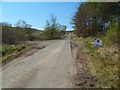
Track junction in the Crychan Forest
by Andrew Hill geograph for square SN8238 The upper one is a dead end according to the map. The look of the track... (more)
Tags:
place:Crychan Forest
Forest Track
type:Geograph
Hillside
Track Junction
Trees
top:Woodland, Forest
|
|
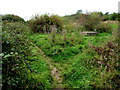
Track junction
by Lairich Rig geograph for square NS5079 The junction of tracks is depicted on the 1:25000 and 1:50000 maps. The track... (more)
Tags:
type:Geograph
long distance path:John Muir Way
top:Roads, Road Transport
subject:Track Junction
|
|
Track junction south of Quarry Road, Ryde
by Jaggery geograph for square SZ5991 A minor track on the right diverges from the well-trodden track on the left,... (more)
|
|
Northbourne Road: junction with Lonely Lane along west side of Updown House park
by Hugh Craddock geograph for square TR3153 Turning off the Northbourne Road down a track along the west side of Updown... (more)
|
|
Parting of ways
by Mr Ignavy geograph for square SY7995 Category: Track / path junction Footpath to the left, farm track straight ahead.
Tags:
Track / Path Junction
subject:Track Junction
|

|
Track junction on the western slope of Cold Law
by Stephen Craven geograph for square NT9424 Category: Track junction The track comes up from the Harthope valley (right) and branches off to... (more)
|

|
Track junction in Haye Park Wood
by Fabian Musto geograph for square SO4871 We approached this junction from the track seen to the right, and turned left... (more)
Tags:
top:Air, Sky, Weather
type:Geograph
top:Paths
top:Roads, Road Transport
subject:Track Junction
top:Wild Animals, Plants and Mushrooms
top:Woodland, Forest
|

|
Track junction near Gillbirks
by Adrian Taylor geograph for square SD4487 This junction of woodland tracks is within the Whitbarrow National Nature... (more)
|

|
Tracks in the New Forest, near Lyndhurst
by Malc McDonald geograph for square SU2611 A junction of tracks in the New Forest National Park.
Tags:
type:Geograph
county:Hampshire
near:Lyndhurst
national park:New Forest
place:New Forest
New Forest
New Forest National Park
top:Roads, Road Transport
Track
Track Junction
subject:Track Junction
|

|
Berwickshire Landscape : View downhill from a track junction on Bell Hill, near Grantshouse
by Richard West geograph for square NT8365 Tags:
hill:Bell Hill Berwickshire
top:Farm, Fishery, Market Gardening
type:Geograph
near:Grantshouse
top:Lowlands
top:Paths
top:Roads, Road Transport
Track
subject:Track Junction
Track Junction
Vehicle Track
Windfarm Access Road
|

|
Track junction at Clunbury
by Fabian Musto geograph for square SO3780 This track junction is by an old tractor, and we took the track to the left,... (more)
Tags:
top:Air, Sky, Weather
type:Geograph
top:Paths
top:Roads, Road Transport
subject:Track Junction
|

|
Track junction, by Tornagrain
by Craig Wallace geograph for square NH7849 A junction on the forest track - straight ahead for Tornagrain new town, left... (more)
Tags:
Forest Track
type:Geograph
top:Roads, Road Transport
Timber Stack
Track Junction
top:Woodland, Forest
|

|
Track junction, Glen Estate
by Jim Barton geograph for square NT2932 Junction of the lower track coming up from The Glen and the track to Glenshiel Banks.
Tags:
top:Country Estates
Farmland
Footpath Signpost
type:Geograph
top:Paths
top:Roads, Road Transport
Track Junction
|
|
Forest track junction
by jeff collins geograph for square SX5260 Left hand track heads towards Ramage Wood. Right hand track comes from Cann... (more)
|
|
Track junction
by David Pashley geograph for square TL9392 Junction of forest paths with forest road 83
Tags:
Breckland Norfolk
top:Flat Landscapes
type:Geograph
top:Paths
top:Roads, Road Transport
Thetford Forest
Track Junction
subject:Track Junction
top:Woodland, Forest
|

|
Forest track junction
by Graham Robson for square NN3378 A junction of tracks in the extensive forest on the slopes of Meall Laire south... (more)
Tags:
type:Cross Grid
long distance path:East Highland Way
Forest
Forest Track
Track Junction
top:Woodland, Forest
|
