
|
Trees and bluebells in Sherwood Forest
by Andy Stephenson
for square SK5969
Bluebells carpet the forest floor at the side of Hanger Hill Drive.
|

|
Bluebells near Hanger Hill
by Andy Stephenson
for square SK5968
An early flowering alongside Hanger Hill Drive.
|

|
Bluebells near Hanger Hill Drive
by Andy Stephenson
geograph for square SK5969
An early flowering this year after several weeks of fine, warm, sunny weather.
|

|
Start of narrow track, Twyn Wenallt
by M J Roscoe
geograph for square SO2413
A public footpath on a partly overgrown hillside track lined by trees and bushes... (more)
|

|
Springtime scene
by Bill Harrison
geograph for square NO3524
After a cold and wet March and earlier part of April in 2023, the trees are at... (more)
|
|
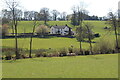
Spring Cottage, Brynygwenin
by M J Roscoe
geograph for square SO3316
The Mynachdy Brook, indicated by line of bushes, runs across the picture.
|

|
Ornamental lake, Llanerchaeron
by M J Roscoe
geograph for square SN4860
The lake on the National Trust's Llanerchaeron estate is encircled by a... (more)
|

|
Ancient beech tree, Twyn Wenallt
by M J Roscoe
geograph for square SO2413
|

|
Site of disused colliery air shaft
by M J Roscoe
geograph for square SO1900
The security fencing protects the top of the shaft. The trees and bushes on the... (more)
|

|
Gate to Coast Path from field
by M J Roscoe
geograph for square SM9240
Footpath of Pilgrim Way goes through gate then left into Cwm Felin
|

|
Uphill to the monument on Carregwastad
by M J Roscoe
geograph for square SM9240
Part of the Coast Path can be seen in the centre of the picture; the monument... (more)
|

|
Gorse in flower on hillside next to A4048, Tredegar
by M J Roscoe
geograph for square SO1407
Hillside next to bypass opposite lay-by on A4048.
|

|
Alongside the A4048, Tredegar
by M J Roscoe
geograph for square SO1407
Gorse in bloom on the side of the bypass looking south.
|

|
Flights of steps on coastal valley side
by M J Roscoe
geograph for square SN1807
|

|
View east over roofs from New Road, New Quay
by M J Roscoe
geograph for square SN3959
Looking out an upstairs window of house on New Road; the hillin the background... (more)
|
|
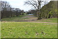
Strip of bare ground towards solar panels
by M J Roscoe
geograph for square SO1900
The strip of ground, stripped of grass and bushes, is where the connection to... (more)
|
|
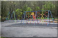
Playground, Aberbeeg
by M J Roscoe
geograph for square SO2001
Children's playground near Aberbeeg Community Centre and new cycle lane.... (more)
|

|
Spring sunshine...
by Bill Harrison
geograph for square NJ9146
...on the Formartine and Buchan Way to the southwest of Maud.
|
|
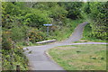
Path crossroads, Bargoed Woodland Park
by M J Roscoe
geograph for square ST1598
The meeting of four paths close to the entrance going away from the camera from... (more)
|

|
Squeeze stile at top of new path, Oakdale
by M J Roscoe
geograph for square ST1898
Metal squeeze stile at end of new path from Pen-rhiw bengi Lane, Oakdale down to... (more)
|

|
A40 near Pentrebach
by M J Roscoe
geograph for square SN8133
The grass verge marks the northern boundary of the Brecon Beacons National Park.... (more)
|

|
Summer house, The Old Rectory
by M J Roscoe
geograph for square SN1514
|

|
Footpath, Bridge Meadow Park
by M J Roscoe
geograph for square SM9516
The path runs alongside the tree-lined river before turning towards the camera.
|

|
Tow path west from Ruskin Avenue
by M J Roscoe
geograph for square ST2788
The path carries the Sirhowy Valley Walk and NCR 47 by the disused Crumlin Arm... (more)
|

|
Cycle path and tow path, Brecon
by M J Roscoe
geograph for square SO0527
The Taff Trail and the tow path, Usk Vale Walk, part company briefly.
|

|
Path down to forestry road
by M J Roscoe
geograph for square ST2086
The path, part of the Cambrian Way, veers to the right and down a flight of... (more)
|
|
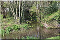
Tributary, Monmouthshire & Brecon Canal
by M J Roscoe
geograph for square ST2896
Overflow from pond into canal below Five Locks.
|

|
NCR 47, Celtic Trail, Cwmfelinfach
by M J Roscoe
geograph for square ST1991
National Cycle Route 47 on a former railway line just east of a bridge over a... (more)
|

|
Track/Byway near Pant-y-cyfrwy
by M J Roscoe
geograph for square ST2090
Narrow track from minor road; the track is part of the Rhymney Valley Ridgeway,... (more)
|

|
Nant Carn emerging from under bridge, Cwm Carn
by M J Roscoe
geograph for square ST2393
Looking downstream; the track alongside the stream is part of the Raven Walk in... (more)
|

|
Start of hillside path up to Twmbarlwm
by M J Roscoe
geograph for square ST2393
|
|
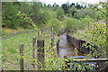
Drainage channel, Cwm Nant-gam
by M J Roscoe
geograph for square SO2012
Man-made watercourse draining old coal workings. The water goes under the road... (more)
|

|
Right bank of River Sirhowy
by M J Roscoe
for square SO1505
Curve in river below Newport Road, A4048, near top of picture. The square... (more)
|

|
A pleasant stretch...
by Bill Harrison
geograph for square NJ9147
...of the Formartine and Buchan Way.
|

|
Burn in springtime
by Bill Harrison
geograph for square NJ9146
One of numerous burns or ditches that drain farmland to the west of Maud, which... (more)
|

|
Long, straight stretch...
by Bill Harrison
geograph for square NJ9247
...of the Formartine and Buchan Way to the southwest of Maud.
|

|
The Formartine and Buchan Way...
by Bill Harrison
geograph for square NJ9247
...just to the southwest of Maud.
|

|
Light and shade on the Formartine and Buchan Way
by Bill Harrison
geograph for square NJ8915
|
|
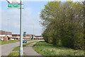
Sirhowy Valley Walk, Duffryn Way
by M J Roscoe
geograph for square ST2984
The Sirhowy Valley Walk follows the pavement having joined the Way from Tredegar... (more)
|

|
Path up from side of Nant Cwm-parc
by M J Roscoe
geograph for square ST1189
The path comes up over a tributary (green bridge railings) of the Nant Cwm-parc... (more)
|

|
Ruined wall of Ty'n-y-gelli, Silent Valley
by M J Roscoe
geograph for square SO1807
The overgrown remains of a wall of Ty'n-y-gelli can just be discerned in... (more)
|
|
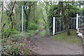
Sirhowy Valley Walk from former Cwrt-y-bella Crossing
by M J Roscoe
geograph for square ST1899
The path here runs north, parallel with the former railway. The footpath sign... (more)
|

|
Nant Grwhay near Cwm-corrwg
by M J Roscoe
geograph for square SO1800
Man-made course of the Nant Grwhay in a concrete channel on the edge of... (more)
|

|
Sheep pasture near Cwm-corrwg
by M J Roscoe
geograph for square SO1800
Ewes and lambs in field next to Nant Grwhay.
|

|
Stony footpath, Cwmcarn Forest
by M J Roscoe
geograph for square ST2393
This broad public footpath at the base of the hillside is part of the Raven Walk.
|
|
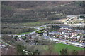
Cwmcarn from above (2)
by M J Roscoe
for square ST2193
Viewed from a high point on Cwmcarn Forest Drive, the long row of terraced... (more)
|
|
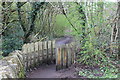
Footpath above Cwmcarn Forest Drive
by M J Roscoe
geograph for square ST2293
Start of a public footpath from car park near the visitor centre. The path forms... (more)
|

|
Confluence of Ebbw Rivers, Aberbeeg
by M J Roscoe
geograph for square SO2001
|

|
End of Jetty Road at Dale Road, Hubberston
by M J Roscoe
geograph for square SM8806
Northern end of private road to Gelliswick Bay.
|

|
Entrance to Milford Haven Golf Club, Clay Lane
by M J Roscoe
geograph for square SM8806
Vehicle entrance from Dale Road.
|
