Public Tags
Tag: Tudor·Style
Showing images tagged with Tudor Style tag.

|
Entrance to Fairholme Farm
by Vieve Forward geograph for square SU0271 Tudor-styled lodge at start of drive to Fairholme Farm.
Tags:
top:Farm, Fishery, Market Gardening
type:Geograph
top:Housing, Dwellings
Lodge
house:Mock-Tudor Style
Tudor Style
|

|
4 Park Street, Chester
by Jeff Buck geograph for square SJ4066 4 Park Street in Chester was built as a town house in 1881 by W. H. Kelly in the... (more)
Tags:
county:Cheshire
place:Chester
top:City, Town Centre
Dental Practice
country:England
top:Health and Social Services
top:Historic Sites and Artefacts
style:Tudor
Tudor Style
|

|
Kerrycroy Village
by Steven Haslington geograph for square NS1061 Kerrycroy is a village on the east coast of the Isle of Bute, Scotland.
Tags:
top:Coastal
top:Housing, Dwellings
Isle of Bute
style:Mock Tudor
style:Tudor Revival
Tudor Style
top:Village, Rural Settlement
|
|
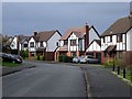
Delves Walk, Great Boughton
by Jeff Buck geograph for square SJ4265 Modern mock Tudor style housing at Great Boughton.
Tags:
county:Cheshire
place:Chester
country:England
place:Great Boughton
top:Housing, Dwellings
style:Mock Tudor
Road
Suburb
top:Suburb, Urban Fringe
Tudor Style
|

|
Hampton Court Palace: west front in sunset light
by Christopher Hilton geograph for square TQ1568 Tags:
place:Hampton Court
Hampton Court
Hampton Court Palace
place:Hampton Court Palace
top:Historic Sites and Artefacts
Palace
subject:Palace
style:Tudor
Tudor
Tudor Style
|

|
Montacute House: gardens and fountain
by Helena Hilton geograph for square ST4917 |

|
Hampton Court Palace, across the Thames
by Christopher Hilton geograph for square TQ1568 Tags:
place:Hampton Court
Hampton Court
Hampton Court Palace
place:Hampton Court Palace
top:Historic Sites and Artefacts
Landing Stage
Landing Stages
subject:Palace
Palace
River
subject:River
river:River Thames
top:Rivers, Streams, Drainage
river:Thames
style:Tudor
Tudor
Tudor Style
|

|
HSBC and book cafe, Thirsk Market Place
by Stephen Craven for square SE4382 Built c.1900, according to Historic England (listed grade II, list entry... (more)
Tags:
date:1900
architects:Bedford and Kitson
Bookshop
top:Business, Retail, Services
top:City, Town Centre
type:Cross Grid
Grade II Listed
HSBC Bank Branch
Tudor Style
|

|
Seacroft Grange
by Stephen Craven geograph for square SE3536 A grade II listed house of 1837 in an older Tudor style (according to Historic... (more)
Tags:
type:Geograph
Grade II Listed
top:Housing, Dwellings
Retirement Village
top:Suburb, Urban Fringe
Tudor Style
|

|
Tudor style in Girton
by Stanley Howe geograph for square TL4260 On the Huntingdon Road (A1307) into Cambridge.
|

|
Burghley House
by Christopher Hilton geograph for square TF0406 |

|
Nat West Bank
by Ian Paterson geograph for square SN9584 At the corner of Great Oak Street.
|

|
Wythenshawe Hall
by David Dixon geograph for square SJ8189 The first Wythenshawe Hall, thought to have been built in 1316, burned down in... (more)
|

|
Church of St Mary the Virgin, Haughton Green
by David Dixon geograph for square SJ9393 This Tudor-style timber framed Grade II-listed building, in Measdow Lane, dates... (more)
|

|
St Mary's Church and Lychgate
by David Dixon geograph for square SJ9393 This Tudor-style timber framed building dates from the 1870s; the foundation... (more)
|

|
Haughton Green, The Church of St Mary the Virgin
by David Dixon geograph for square SJ9393 This Tudor-style timber framed Grade II-listed building, in Measdow Lane, dates... (more)
|

|
Whalley Abbey: tudor courtyard
by Stephen Craven geograph for square SD7336 The buildings here are part of Assheton's post-reformation restoration of... (more)
Tags:
top:Historic Sites and Artefacts
Tudor Style
|

|
King's Road, Newcastle University
by Robert Graham geograph for square NZ2465 North side of this road which runs through the university site. Buildings here... (more)
Tags:
Archway
Boiler House
Chimney
top:City, Town Centre
top:Educational Sites
type:Geograph
Tower
Tudor Style
subject:University
University Building
|

|
The Arches, Newcastle University
by Robert Graham geograph for square NZ2465 This building straddles Kings Walk, in the centre of the University complex. The... (more)
Tags:
subject:Arch
top:City, Town Centre
Double-Entrance Archway
top:Educational Sites
type:Geograph
Statue
Tudor Style
University Building
|

|
'Roubartelle Abbas', High Street
by Roger Templeman geograph for square SU5495 Ordnance Survey records indicate a benchmark on the chimney at the right hand... (more)
Tags:
Benchmark
housing:Detached House
top:Housing, Dwellings
Ordnance Survey
Tudor Style
top:Village, Rural Settlement
|

|
The south side of the High Street
by Roger Templeman geograph for square SU6089 The top of the tower of St Peter's Church just visible to left of the lamp... (more)
|
|
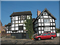
The Lower Chequer, Sandbach
by Stephen Craven geograph for square SJ7560 Category: Public house The pub gets its name by contrast with the Swan and Chequer, higher up the hill... (more)
|
|
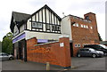
Co-op Funeral Care, Welford Road
by Roger Templeman geograph for square SK5901 There is an Ordnance Survey benchmark SK5901 : Benchmark on Co-op Funeral Care building, Welford Road on the brick wall of the part... (more)
|
|
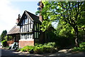
Hastings House Lodge, Stoughton Drive South
by Roger Templeman geograph for square SK6101 University of Leicester building
Tags:
housing:Detached House
top:Educational Sites
type:Geograph
top:Housing, Dwellings
Lodge
Ordnance Survey
Roadside Trees
top:Suburb, Urban Fringe
Tudor Style
|

|
Ombersley, The King's Arms
by David Dixon geograph for square SO8463 This black and white timbered inn is reputed to date from the early 1400s. King... (more)
|
