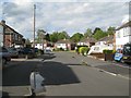
|
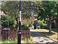
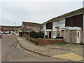
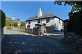
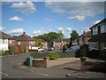
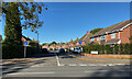
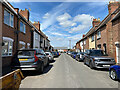
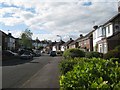
Path between front gardens, Crystal Palace
by Robin Stott
geograph for square TQ3370
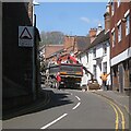
Three heavily-trafficked, noisy streets intersect to form the Crystal Palace... (more)
|
|
Allendale Close, Camberwell, south London
by Robin Stott
geograph for square TQ3276
This low-rise residential development from the 1980s is an oasis of relative... (more)
|
|
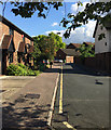
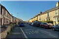
North on Bernard Street, St Albans
by Robin Stott
geograph for square TL1407
Bernard Street is one of the many residential streets west of the town centre.... (more)
|
|
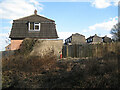
Works to a vacant plot, Vine Lane, Warwick
by Robin Stott
geograph for square SP2865
|
|
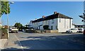
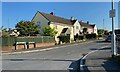
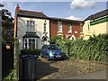
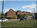
Rankin Close, off Sheaveshill Avenue, Colindale, Barnet
by David Hawgood
geograph for square TQ2189
A street of 2-storey housing.
|
|
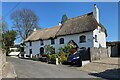
Two thatched cottages, Golvers Hill Road, Kingsteignton
by Robin Stott
geograph for square SX8773
|
|
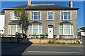
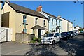
Corner cottage, Regent Grove, Royal Leamington Spa
by Robin Stott
geograph for square SP3265
As Regent Grove approaches its junction with Clarendon Street there is this odd,... (more)
|
|
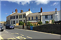
Terrace of five houses, Chudleigh Road, Kingsteignton
by Robin Stott
geograph for square SX8673
The terrace does look like former local authority housing. Comparison of gappy... (more)
|
|
House with a central chimney, Golvers Hill Road, Kingsteignton
by Robin Stott
geograph for square SX8773
The house looks old: the massive tall central chimney is a clue. It's... (more)
|
|
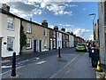
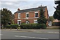
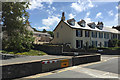
South on Quarry Street, Royal Leamington Spa
by Robin Stott
geograph for square SP3065
At first glance these are terraced houses but closer inspection shows that they... (more)
|
|
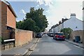
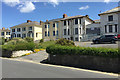
Housing along The Drive, Bishopsteignton
by Robin Stott
geograph for square SX9073
The Drive led from the Newton Road to a large Victorian villa built in 1840,... (more)
|
|
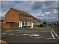
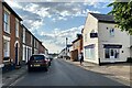
Houses in Bexleyheath
by Malc McDonald
geograph for square TQ5075
Houses on Mayplace Road East in Bexleyheath, in the outer suburbs of south east London.
|
|
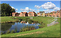
Surface water pond in open space for new housing, Wood End, north Coventry
by Robin Stott
geograph for square SP3682
This recent development replaces terraces of council houses built in the late... (more)
|
|
New houses and open space, Wood End, north Coventry
by Robin Stott
geograph for square SP3682
This replaces council housing built on farmland in the late 1950s, judging by... (more)
|
|
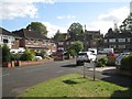
Southeast on Cliffe Way at the junction with Guys Close, Warwick
by Robin Stott
geograph for square SP2965
Twice on Cliffe Way the houses are set back to create a little greenspace. Now... (more)
|
|
Guys Close off Cliffe Way, Warwick
by Robin Stott
geograph for square SP2965
The Cliffe Way estate of semi-detached houses was built around 1960. In the... (more)
|
|
North on Cliffe Way, Warwick
by Robin Stott
geograph for square SP2965
The road name, with its final 'e'. must derive somehow from nearby... (more)
|
|
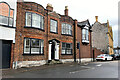
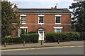
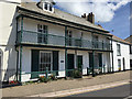
Minerva House, Highweek Street, Newton Abbot
by Robin Stott
geograph for square SX8571
No 2 Highweek Street is Grade II listed... (more)
|
|
Grey stone house, Gestridge Road, Kingsteignton
by Robin Stott
geograph for square SX8673
The stone is probably the grey Devonian limestone of the area; the local cream... (more)
|
|
Houses in Moors End, off Chudleigh Road, Kingsteignton
by Robin Stott
geograph for square SX8673
The terrace has the look of former local authority housing. Comparison of... (more)
|
|
Older properties on Sheffield Street, Boldmere, north Birmingham
by Robin Stott
geograph for square SP1193
The house on the left, No 35, has a stone inscribed 'Franks Villa'. To... (more)
|
|
Bridge House, 146 Coventry Road, Warwick
by Robin Stott
geograph for square SP2865
Built around 1780, listed Grade II... (more)
|
|
Bridge House, 146 Coventry Road, Warwick
by Robin Stott
geograph for square SP2865
Late eighteenth century, listed Grade II... (more)
|
|
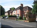
Semi-detached houses, All Saints Road, Emscote, Warwick
by Robin Stott
geograph for square SP2965
|
|
The view from Highland Close to Cliffe Way and Wharf Street, Warwick
by Robin Stott
geograph for square SP2965
The porched and dormered terrace, centre, is part of the Emscote Lawn... (more)
|
|
North on the northwest leg of Campriano Drive, Warwick
by Robin Stott
geograph for square SP2965
While the central part of the Emscote Lawn site is faux-Regency, 'in... (more)
|
|
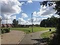
Mixed housing, Northgate Street, Oakham
by Robin Stott
geograph for square SK8508
|
|
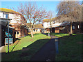
Within Alberta Court, Teignmouth
by Robin Stott
geograph for square SX9473
It's an informal, secluded, landscaped arrangement of local authority... (more)
|
|
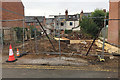
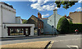
House clearance, Warwick
by Robin Stott
geograph for square SP2865
A small house in Chapel Street looks to be at the start of a refurb. It may be... (more)
|
|
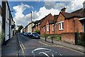
Northeast on Church Street, St Albans
by Robin Stott
geograph for square TL1407
Church Street is one of the older residential streets west of St Peter's... (more)
|
|
Church Street, St Albans
by Robin Stott
geograph for square TL1407
The view is southwest from the junction with Grange Street; early evening, June.... (more)
|
|
Grange Street, St Albans
by Robin Stott
geograph for square TL1407
Grange Street runs northwest from St Peter's Street. It is mainly... (more)
|
|
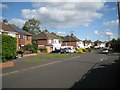
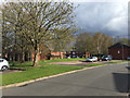
Rectory Park Avenue, Sutton Coldfield
by Robin Stott
geograph for square SP1395
|
|
Bus stop, B3195 Gestridge Road, Kingsteignton
by Robin Stott
geograph for square SX8673
The Stagecoach service 2, Newton Abbot-Exeter, calls here on its long detour... (more)
|
|
Older houses, north side of Chudleigh Road, Kingsteignton
by Robin Stott
geograph for square SX8673
Their date is not known but the location away from the village centre fits the... (more)
|
|
Houses of cream brick, Chudleigh Road, Kingsteignton
by Robin Stott
geograph for square SX8673
The cream bricks were made locally from local clay.
|
|
North on Quarry Street, Royal Leamington Spa
by Robin Stott
for square SP3066
|
|
Gable ends of houses in Pine Tree Close, Batchley, Redditch
by Robin Stott
geograph for square SP0167
|
|
Mansard roofs of houses in Pine Tree Close, Batchley, Redditch
by Robin Stott
geograph for square SP0167
|
|
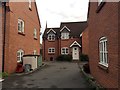
Houses, Brooke Mews, Warwick
by Robin Stott
geograph for square SP2865
Built on backland of a Smith Street property but accessed from St Nicholas... (more)
|
|
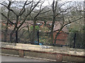
Housing on the site of Crystal Palace (High Level) station, Upper Norwood, London
by Robin Stott
geograph for square TQ3371
The view is from a bus on Crystal Palace Parade. The site of the Crystal Palace... (more)
|
|
Kilnsey Grove, Woodloes Park, Warwick
by Robin Stott
geograph for square SP2866
Through the gap, right of centre, is a footpath through open space adjacent to... (more)
|
|
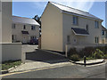
New houses by Kiln Close Lane, Instow
by Robin Stott
geograph for square SS4730
The name Kiln Close speaks of something older lime kiln; pottery?
|
|
A pair of houses with balconies, Marine Parade, Instow
by Robin Stott
geograph for square SS4730
|
|
Across Marine Parade to houses by Quay Lane, Instow
by Robin Stott
geograph for square SS4730
The object set in the wall, foreground, is one of a pair of floodgates.
|
|
Mixed fortunes in housing, Marine Parade, Instow
by Robin Stott
geograph for square SS4730
Some spruce semi-detached villas, some less spruce, some boarded up.
|
|
Group of houses on Marine Parade at Lane End, Instow
by Robin Stott
geograph for square SS4730
Spruce.
|
|
White House Close off Lane End Road, Instow
by Robin Stott
geograph for square SS4730
|
|
Northwest on Cliffe Way, Warwick
by Robin Stott
geograph for square SP2965
Cliffe Way was developed around 1960. At the top it turns to the right and... (more)
|
|
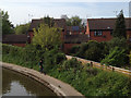
Houses in Whittington Close, off Austin Edwards Drive, east Warwick
by Robin Stott
geograph for square SP2965
This estate was built on allotments. The view is from the Emscote Road canal... (more)
|