|
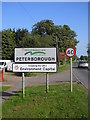
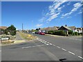
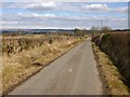
Welcome to Peterborough
by Paul Bryan
for square TF1409
This sign, which is located on Lincoln Road just south of Market Deeping, marks... (more)
|
|
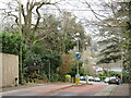
Springdale Road, Corfe Mullen
by Malc McDonald
geograph for square SY9995
Springdale Road leaving Corfe Mullen and entering the neighbouring district of... (more)
|
|
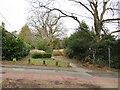
Roman Road, Broadstone
by Malc McDonald
geograph for square SY9995
This path follows the route of an old Roman Road along the boundary of... (more)
|
|
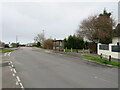
Lancaster Drive, Broadstone
by Malc McDonald
geograph for square SY9996
Lancaster Drive is a minor road in Broadstone, on the outskirts of Poole.... (more)
|
|
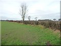
City of York boundary, Strensall Forest
by Christine Johnstone
geograph for square SE6262
South of High Roans Farm. The field hedge is also the boundary between the City... (more)
|
|
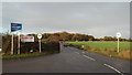
Hempstead Road, near Chatham
by Malc McDonald
geograph for square TQ7863
Hempstead Road, near Chatham in Kent. The sign to the left of the image... (more)
|
|
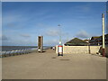
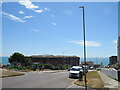
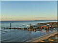
Gateway to Cleveleys
by Malc McDonald
geograph for square SD3142
The promenade which stretches along the entire length of Blackpool's... (more)
|
|
Headland Way crossing a banked field boundary
by Christine Johnstone
geograph for square TA1674
This is also an administrative boundary - Bempton civil parish and the East... (more)
|
|
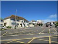
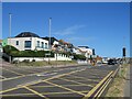
Longridge Avenue, Saltdean
by Malc McDonald
geograph for square TQ3801
Longridge Avenue runs along the boundary between Brighton & Hove unitary... (more)
|
|
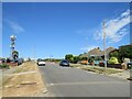
Longridge Avenue, Saltdean
by Malc McDonald
geograph for square TQ3802
Longridge Avenue is a residential road in Saltdean, on the Sussex coast near... (more)
|
|
Longridge Avenue, Saltdean
by Malc McDonald
geograph for square TQ3802
Longridge Avenue is a residential road in Saltdean, on the Sussex coast near... (more)
|
|
Longridge Avenue, Saltdean
by Malc McDonald
geograph for square TQ3802
Longridge Avenue is a residential road in Saltdean, on the Sussex coast near... (more)
|
|
Longridge Avenue, Saltdean
by Malc McDonald
geograph for square TQ3802
Longridge Avenue is a residential road in Saltdean, on the Sussex coast near... (more)
|
|
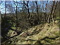
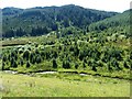
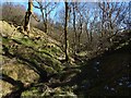
Burn flowing through woodland
by Lairich Rig
geograph for square NS3678
|
|
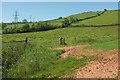
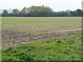
Fields on slopes of Windmill Hill
by Derek Harper
geograph for square SX8558
|
|
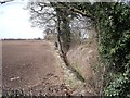
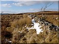
Boundary ditch and hedge
by Ian Calderwood
geograph for square SK3931
This ditch and hedge marks what is now a unitary authority boundary
|
|
Old School Road
by Lairich Rig
geograph for square NS4485
As the map indicates, a unitary authority boundary (that of West Dunbartonshire... (more)
|
|
Beach works in Cleveleys (2)
by Stephen Craven
geograph for square SD3142
Several items of construction plant working on what may be a sewer outfall. The... (more)
|
|
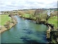
The River Avon, looking upstream
by Christine Johnstone
geograph for square ST6868
Seen from an Avon Valley Railway train on the bridge. The river is a unitary... (more)
|
|
Looking across the Afon Tarrenig
by Robin Drayton
geograph for square SN8083
Taken from a layby on the A44.
The Afon Tarrenig is a tributary of the River... (more)
|
|
Moorland fence
by Lairich Rig
geograph for square NS3580
The line of the fence coincides with the unitary authoritary boundary that is... (more)
|
|
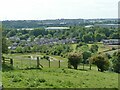
Discover the spirit
by Christine Johnstone
geograph for square SE5113
Doncaster Metropolitan District boundary sign, about 100 metres inside the... (more)
|
|
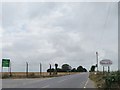
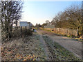
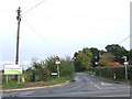
Country road near Upper Shelton
by Malc McDonald
geograph for square SP9943
The sign indicates that the road crosses a local authority boundary here.
|
|
Long Lane
by Christine Johnstone
geograph for square SE5114
It ceases to be a public bridleway beyond this bend. Coincidentally [or not]... (more)
|
|
Trans Pennine Trail
by David Dixon
geograph for square SJ7088
The Trans Pennine Trail approaching the bridge over the River Bollin. The Bollin... (more)
|
|
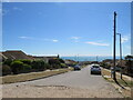
South Coast Road, Saltdean
by Malc McDonald
geograph for square TQ3801
South Coast Road is on the route of the A259 as it leaves Saltdean, crossing the... (more)
|
|
Trees on the county boundary, north of Hexton
by Christine Johnstone
geograph for square TL1031
This side Hertfordshire, far side Bedfordshire.
|
|
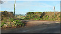
Junction, Barton Cross
by Derek Harper
geograph for square SX9067
Daccombe Hill meets Kingskerswell Road (foreground). The latter carries the... (more)
|
|
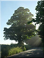
Tree, Kingskerswell Road
by Derek Harper
geograph for square SX9067
The road is followed by the boundary between Coffinswell parish (left) and Torbay UA.
|
|
Kingskerswell Road
by Derek Harper
for square SX8967
|
|
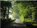
Kingskerswell Road
by Derek Harper
geograph for square SX8967
The road is followed by the boundary between Coffinswell parish (right) and... (more)
|
|
Kingskerswell Road
by Derek Harper
for square SX9067
|
|
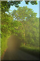
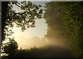
Kingskerswell Road
by Derek Harper
for square SX8967
Early morning mist by the eastern corner of Orestone Plantation (left). The road... (more)
|
|
Burn flowing through woodland
by Lairich Rig
geograph for square NS3678
|
|
Dry-stone wall
by Lairich Rig
geograph for square NS3679
As is indicated on the OS map, this part of the wall is on the boundary between... (more)
|
|
Pond below Cliff Hollins Lane
by Stephen Craven
for square SE1728
The pond is probably naturally formed at the bottom of the field. Beyond it is a... (more)
|
|
Footbridge on Worcestershire Way
by Derek Harper
geograph for square SO7648
Malvern footpath 513(D) crosses Whippets Brook and the boundary between... (more)
|
|
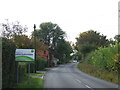
Crabtree Lane, near Woburn Sands
by Malc McDonald
geograph for square SP9337
This image was taken on the border of Buckinghamshire and Bedfordshire.... (more)
|