Geograph - photograph every grid square
About tags on Geograph
Tags
Geographical Context
Subjects
Types
Other Prefixes
Public Tags
Related Tags
|
Coverage Map
Prefix:
unitary authority
Tag:
Dorset
Other tags:
Dorset
ceremonial county:
Dorset
county:
Dorset
place:
Dorset
shire county:
Dorset
Showing images tagged with
unitary authority:
Dorset
tag.
View all tagged images
-
In Browser
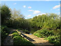
Autumn shadows on the Stour Valley Way, near Bournemouth
by
Malc McDonald
geograph for square
SZ0996
A view of the Stour Valley Way as it passes through the Stour Valley Nature... (
more
)
Tags:
Bench
Bench Seat
top:
Boundary, Barrier
near:
Bournemouth
unitary authority:
Bournemouth Christchurch and Poole
unitary authority:
Dorset
county:
Dorset
type:
Geograph
Long Shadows
Nature Reserve
Path Along River Bank
Path in Nature Reserve
top:
Paths
subject:
River Bank
top:
Rivers, Streams, Drainage
Riverside Path
Shadows
river:
Stour
footpath:
Stour Valley Path
long distance path:
Stour Valley Way
Stour Valley Way
ldp:
Stour Valley Way
river:
Stour(Dorset)
Sunlight and Shadows
Unitary Authority Boundary
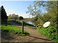
Stour Valley Way near Bournemouth
by
Malc McDonald
geograph for square
SZ0996
A view of the Stour Valley Way as it passes through the Stour Valley Nature... (
more
)
Tags:
Bench
Bench Seat
top:
Boundary, Barrier
near:
Bournemouth
unitary authority:
Bournemouth Christchurch and Poole
county:
Dorset
unitary authority:
Dorset
type:
Geograph
Long Shadows
Nature Reserve
Path Along River Bank
Path in Nature Reserve
top:
Paths
subject:
River Bank
top:
Rivers, Streams, Drainage
Riverside Path
Shadows
river:
Stour
footpath:
Stour Valley Path
long distance path:
Stour Valley Way
ldp:
Stour Valley Way
river:
Stour(Dorset)
Sunlight and Shadows
Unitary Authority Boundary
Matchams Lane, near Christchurch
by
Malc McDonald
geograph for square
SZ1299
A view of Matchams Lane in countryside between Christchurch and Ringwood.... (
more
)
Tags:
subject:
Boundary
Boundary
top:
Boundary, Barrier
unitary authority:
Bournemouth Christchurch and Poole
near:
Christchurch
ceremonial county:
Dorset
county:
Dorset
unitary authority:
Dorset
type:
Geograph
Minor Country Road
road:
Minor Road
Minor Road
Minor Rural Road
near:
Ringwood
top:
Roads, Road Transport
Rural Road
Unitary Authority Boundary
Handfast Point and Old Harry Rocks
by
Rod Grealish
for square
SZ0582
Old Harry Rocks can be seen at the end of Handfast Point. They are three chalk... (
more
)
Tags:
Ballard Down
postcode district:
BH19
Chalk Stacks
top:
Coastal
type:
Cross Grid
ceremonial county:
Dorset
unitary authority:
Dorset
top:
Geological Interest
Headfast Point
subject:
Headland
Jurassic Coast
Old Harry Rocks
top:
Rocks, Scree, Cliffs
top:
Sport, Leisure
near:
Studland
civil parish:
Studland
top:
Suburb, Urban Fringe
Unesco World Heritage Site
Ocean Views Apartments, Fortuneswell, Portland
by
Rod Grealish
geograph for square
SY6874
Ocean Views Apartments are available for rent. The apartments have balconies... (
more
)
Tags:
subject:
Apartment Block
Balconies
road:
Castle Street
top:
Coastal
unitary authority:
Dorset
shire county:
Dorset
postcode district:
DT5
place:
Fortuneswell
type:
Geograph
top:
Housing, Dwellings
Ocean Views Apartments
Rental Apartments
top:
Suburb, Urban Fringe
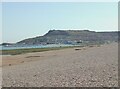
Chesil Beach and the blue sea
by
Rod Grealish
geograph for square
SY6675
Chesil Beach is a 30-kilometre (18-mile) long shingle barrier beach stretching... (
more
)
Tags:
subject:
Beach
Blue Sea
place:
Chesil Beach
top:
Coastal
shire county:
Dorset
unitary authority:
Dorset
postcode district:
DT4
top:
Estuary, Marine
type:
Geograph
top:
Geological Interest
part of:
Jurassic Coast
Pebble Beach
top:
Sport, Leisure
Unesco World Heritage Site
place:
Wyke Regis
Fortuneswell on the Isle of Portland from Chesil Beach
by
Rod Grealish
for square
SY6873
Fortuneswell is on the slopes of the Isle of Portland. The Isle of Portland is... (
more
)
Tags:
road:
A354
type:
Cross Grid
unitary authority:
Dorset
shire county:
Dorset
postcode district:
DT5
top:
Estuary, Marine
place:
Fortuneswell
subject:
Island
top:
Islands
place:
Isle of Portland
Jurassic Coast
rock:
Limestone
civil parish:
Portland
post town:
Portland
top:
Suburb, Urban Fringe
View to Wyke Regis from Chesil Bank
by
Rod Grealish
geograph for square
SY6676
Wyke Regis is a village south-west of Weymouth. It was merged with Weymouth in... (
more
)
Tags:
Chesil Bank
top:
Coastal
shire county:
Dorset
unitary authority:
Dorset
postcode district:
DT4 9
top:
Estuary, Marine
type:
Geograph
top:
Suburb, Urban Fringe
subject:
Village
post town:
Weymouth
civil parish:
Weymouth
Whitehead Torpedo Works
place:
Wyke Regis
View north-west along Chesil Beach
by
Rod Grealish
geograph for square
SY6675
Chesil Beach (or Chesil Bank) is one of three major shingle beaches in Britain.... (
more
)
Tags:
subject:
Beach
top:
Boundary, Barrier
location:
Chesil Beach
top:
Coastal
unitary authority:
Dorset
ceremonial county:
Dorset
postcode district:
DT4
top:
Estuary, Marine
type:
Geograph
Ramsar
Shingle Beach
SSSI
lagoon:
The Fleet
place:
Weymouth
civil parish:
Weymouth
View more in the Image Search
or
in Browser
View images matching 'Dorset' anywhere
in
the tags
Don't click these:
PotMel 1
PotMel 2
☰
Home
View
Search
Marked Images
Maps
Browser
Explore
Showcase
New Images
Collections
Interact
Games
Discussions
Blog
Contributors
Submit
Statistics
Leaderboards
General
FAQ
Help Pages
Sitemap
Contact Us
Support Us
sponsored by
🔍︎
What to search:
Photos
Enter keywords or a location/postcode to search nearby images
Enter a Grid Reference
Placenames
Collections
Website Pages
Everything
Others:
Advanced Search
|
Image Browser
Or:
Coverage Map
|
Searchable Map
You are not logged in
|
login
|
register