Public Tags
Tag: Village·Boundary
Showing latest 50 of 338 images tagged with Village Boundary tag.

|
Old-style boundary sign in a hedge, Colwall Village
by Jaggery geograph for square SO7542 The old-style boundary sign Link is... (more)
|

|
Northeast boundary sign, Mardy
by Jaggery geograph for square SO3116 Hereford Road passes the boundary sign at the NE edge of Mardy (Maerdy in... (more)
|

|
NE boundary of Aston Ingham
by Jaggery geograph for square SO6823 The B4222 from Kilcot reaches the boundary sign for Aston Ingham, a small... (more)
|
|
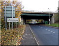
Upton St Leonards and Stroud District boundary sign
by Jaggery geograph for square SO8514 Viewed along the B4073 looking towards the bridge carrying the M5 motorway.
The... (more)
|

|
Western boundary of Skenfrith
by Jaggery geograph for square SO4520 The B4521 from Norton reaches Skenfrith, a small village in NE Monmouthshire... (more)
|

|
NW boundary of Boughrood
by Jaggery geograph for square SO1239 The boundary sign is alongside the junction of the road from Painscastle and the... (more)
|

|
Northern boundary of Ludford
by Jaggery geograph for square SO5174 The boundary sign is on the corner of Park Road and Overton Road (B4361).... (more)
Tags:
top:Boundary, Barrier
top:Roads, Road Transport
Village Boundary
top:Village, Rural Settlement
|
|
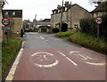
Northern boundary of Bisley
by Jaggery geograph for square SO9006 The 30mph speed limit on Cheltenham Road drops to 20mph near the village... (more)
|

|
Southern boundary of Llanvair Kilgeddin, Monmouthshire
by Jaggery geograph for square SO3406 The boundary sign is alongside the B4598 at the southern edge of Llanvair... (more)
Tags:
top:Boundary, Barrier
type:Geograph
top:Roads, Road Transport
Village Boundary
Village Boundary Sign
top:Village, Rural Settlement
|

|
Stone - please drive carefully
by Jaggery geograph for square ST6895 In Gloucestershire, the A38 from Woodford passes the Stone village boundary... (more)
|

|
Northeast boundary of Llangattock/Llangatwg near Crickhowell
by Jaggery geograph for square SO2117 The bilingual (Welsh/English) boundary sign faces Hillside Road 100 metres SW of... (more)
|

|
Western boundary of Caersws
by Jaggery geograph for square SO0291 The B4569 Trefeglwys Road reaches Caersws (Caersŵs in Welsh), a village in... (more)
|
|
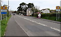
Southern boundary of Llandybie
by Jaggery geograph for square SN6214 The A483 north from Ammanford reaches the boundary sign for Llandybie, a large... (more)
|
|
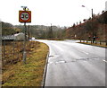
Northern boundary of Cymmer
by Jaggery geograph for square SS8796 The A4107 from Abergwynfi reaches the boundary sign for Cymmer, a village in... (more)
|
|
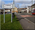
Southern boundary of Caerau
by Jaggery geograph for square SS8593 Alongside Coegnant Road. The northern boundary sign for Nantyffyllon... (more)
|
|
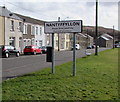
Northern boundary of Nantyffyllon
by Jaggery geograph for square SS8593 Alongside Coegnant Road. The southern boundary sign for Caerau is on the other... (more)
|

|
NE boundary of Cwmdare
by Jaggery geograph for square SN9803 About 200 metres west of the B4275 (Hirwaun Road and Cemetery Road),
Cwmdare... (more)
|

|
Southern boundary of Hoarwithy
by Jaggery geograph for square SO5428 On the west bank of the River Wye, a minor road reaches the boundary of... (more)
|

|
Inconspicuous boundary sign, Tisbury
by Jaggery geograph for square ST9428 The small Tisbury sign on the left marks the southern boundary of the Wiltshire village.
|
|
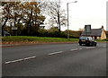
Northern boundary of Tondu
by Jaggery geograph for square SS8984 The A4063 Maesteg Road passes the boundary sign on the left.
Tondu (pronounced... (more)
|

|
Southern boundary of Sarn
by Jaggery geograph for square SS9083 Bryncoch Road passes the boundary signs for Sarn, a village in Bridgend County Borough.
|

|
Manmoel boundary sign
by Jaggery geograph for square SO1703 Located inside a grass triangle at a road junction on the north side of the main... (more)
|

|
Western boundary of Eastington
by Jaggery geograph for square SO7705 The minor road from Claypits and Puddleworth passes the boundary sign for... (more)
|
|
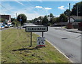
Western boundary sign, Llanharan
by Jaggery geograph for square SS9982 The A473 Bridgend Road passes the boundary sign for Llanharan,
a village in... (more)
|

|
Eastern boundary of Llanharan
by Jaggery geograph for square ST0083 The National Speed Limit on the A473 drops to 30mph at the boundary of... (more)
|

|
Southern boundary of Brynsadler
by Jaggery geograph for square ST0280 Alongside the A4222 Cowbridge Road. Brynsadler is a small village in the County... (more)
|
|
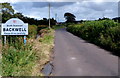
Western boundary of Backwell
by Jaggery geograph for square ST4870 East of Nailsea, Backwell Bow reaches the boundary sign for Backwell, North... (more)
|

|
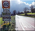
Western boundary of Llanvair Discoed
by Jaggery geograph for square ST4492 The National Speed Limit behind the camera reduces to 30mph at the boundary of... (more)
|
|
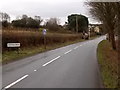
Northern boundary of Painswick
by Jaggery geograph for square SO8710 The 50mph speed limit along the A46 Cheltenham Road reduces to 40mph at the... (more)
Tags:
road:A46
top:Boundary, Barrier
top:Roads, Road Transport
Village Boundary
Village Boundary Sign
top:Village, Rural Settlement
|

|
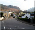
Southern boundary of Gellinudd
by Jaggery geograph for square SN7303 The A474 from Rhos passes the boundary sign for Gellinudd, a village near Pontardawe.
|
|
Northern boundary of Devauden
by Jaggery geograph for square ST4899 The B4293 passes the boundary sign for Devauden, a small village in upland... (more)
Tags:
top:Boundary, Barrier
top:Roads, Road Transport
top:Uplands
Village Boundary
Village Boundary Sign
top:Village, Rural Settlement
|
|
Northern boundary of Efail Fach
by Jaggery geograph for square SS7895 The B4287 from Neath passes the boundary sign on the right for Efail Fach,
a... (more)
|

|
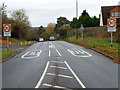
Western boundary of Magor
by Jaggery geograph for square ST4287 The B4245 Newport Road reaches Magor, a large village in Monmouthshire.
|
|
Western boundary of Charfield
by Jaggery geograph for square ST7191 The 40mph speed limit on the B4058 reduces to 30mph at the boundary sign for... (more)
|

|
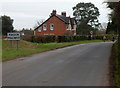
Eastern boundary sign, Knucklas
by Jaggery geograph for square SO2574 The B4355 from Knighton reaches the boundary sign for the small village in... (more)
|
|
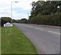
Northern boundary of Magor
by Jaggery geograph for square ST4287 A few metres south of passing under the M4 motorway,... (more)
|
|
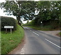
Southern boundary of Grovesend
by Jaggery geograph for square SS5999 The B4296 from Gorseinon reaches the boundary sign for Grovesend (Pengelli in... (more)
|
|
Western boundary of Clehonger
by Jaggery geograph for square SO4437 The B4349 from Kingstone reaches Clehonger, a large village in SW Herefordshire,... (more)
|

|
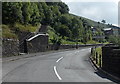
Southern boundary of Llanddewi Ystradenni, Powys
by Jaggery geograph for square SO1068 The Llanddewi boundary sign on the left is on the southern access road from the... (more)
|
|
Blaenllechau boundary sign
by Jaggery geograph for square ST0097 Viewed across Station Road. The Ferndale boundary sign is on the opposite side... (more)
|

|
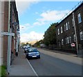
Northern boundary of Crossgates, Powys
by Jaggery geograph for square SO0865 The A483 passes the boundary sign for Crossgates, a small village NE of Llandrindod Wells.
|
|
Southern boundary of Tylorstown
by Jaggery geograph for square ST0094 Viewed from the northern edge of Pontygwaith. A small rectangular sign on a post... (more)
|

|
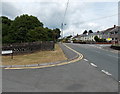
Southern boundary of Hollybush
by Jaggery geograph for square SO1602 The A4048 from Markham reaches Hollybush, a small village in Caerphilly County Borough.
|
|
Southern boundary of Nantyglo
by Jaggery geograph for square SO1909 The road north from Blaina reaches Nantyglo, a village in the county borough of... (more)
|

|
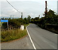
SE boundary of Erwood
by Jaggery geograph for square SO1042 The A470 reaches Erwood (Erwyd in Welsh), a small village in Powys about 10km SE... (more)
Tags:
road:A470
A470
top:Boundary, Barrier
top:Roads, Road Transport
Village Boundary
Village Boundary Sign
top:Village, Rural Settlement
|
|
Southern boundary of Whitson
by Jaggery geograph for square ST3783 The boundary sign is at the edge of the bridge carrying the road over... (more)
|

|
Northern boundary of Goldcliff
by Jaggery geograph for square ST3783 The road from Whitson reaches the white-on-blue boundary sign for Goldcliff.... (more)
|
|
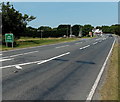
New Hedges boundary sign
by Jaggery geograph for square SN1202 The A478 Narberth Road from Tenby passes the boundary sign
for New Hedges, a... (more)
|

|
Inconspicuous boundary sign, Clydach
by Jaggery geograph for square SO2112 Looking more like a street name sign, the Clydach boundary sign is alongside... (more)
|

|
SE boundary of Llyswen
by Jaggery geograph for square SO1337 The A479 passes the boundary sign for Llyswen, a small village in Powys on the... (more)
|
