|
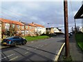
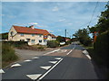
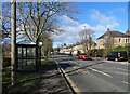
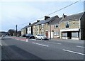
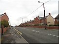
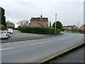
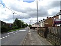
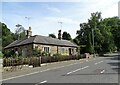
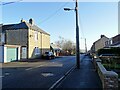
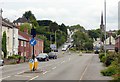
Village centre, West Rainton
by Robert Graham
geograph for square NZ3246
The village main street, with North Street on the left. These are mainly modern... (more)
|
|
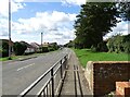
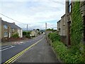
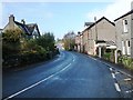
East end of Whittonstall
by Robert Graham
geograph for square NZ0757
View looking west down the main street, the B6309. This is an old village on a... (more)
|
|
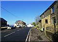
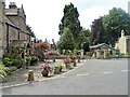
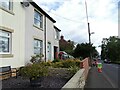
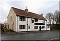
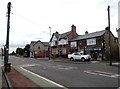
The main street in Nettlesworth
by Robert Graham
geograph for square NZ2547
This is looking west along Park View, part of the B6312 which runs through the... (more)
|
|
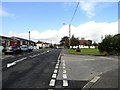
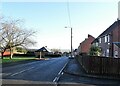
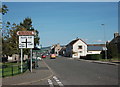
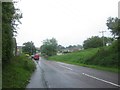
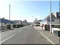
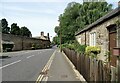
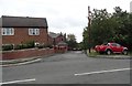
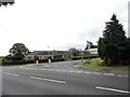
Main road through Streetgate
by Robert Graham
geograph for square NZ2159
Looking south up Gateshead Road, the main A692 from Gateshead.
|
|
Colchester Road, Wix
by Malc McDonald
geograph for square TM1528
Colchester Road, entering the village of Wix.
This would once have been a... (more)
|
|
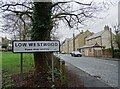
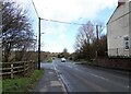
Village sign for Low Westwood
by Robert Graham
geograph for square NZ1156
On the A694, the main road between Swalwell and Shotley Bridge. This is the main... (more)
|
|
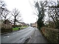
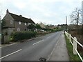
View along the A694 in Low Westwood
by Robert Graham
geograph for square NZ1156
View looking west along the main road through the village. This is a former... (more)
|
|
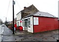
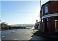
Post Office, Hamsterley
by Robert Graham
geograph for square NZ1156
On the A694, the main road through the village.
|
|
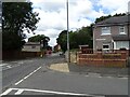
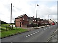
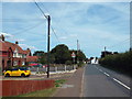
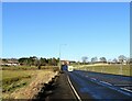
Bus stop on Durham Road
by Robert Graham
geograph for square NZ1647
The main road into Lanchester from the east. The tower of the village church can... (more)
|
|
Road into Langley Park village
by Robert Graham
geograph for square NZ2145
This is the main road into the village; Front Street. It runs along from the... (more)
|
|
Looking south from the west end of Witton Gilbert
by Robert Graham
geograph for square NZ2245
Looking over the Browney valley to the village of Esh on the far side. The... (more)
|
|
St Aidan's Road looking west
by Robert Graham
geograph for square NZ3452
This is the B1286, the main road through this former mining village. Fletcher... (more)
|
|
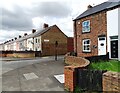
Camoron's Buildings, Dipton
by Robert Graham
geograph for square NZ1553
One of the old late 19th century streets in Dipton. This is on the A692, the... (more)
|
|
Bus stop on West Road
by Robert Graham
geograph for square NZ1754
On the main road through the little ex-mining village of Whit-le-Head.
|
|
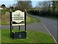
Cotgrave village entrance sign
by Alan Murray-Rust
geograph for square SK6435
On Plumtree Road, it shows the parish Church of All Saints. The new Cotgrave... (more)
|
|
Main Street, Sicklinghall
by Christine Johnstone
geograph for square SE3648
The eastern end, by the pond. There was a pump here in the 1880s.
|
|
View along Edward Street in Craghead
by Robert Graham
geograph for square NZ2150
Looking north along the main street through the village. Craghead was mainly... (more)
|
|
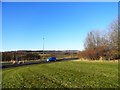
Looking along the footpath beside the A691
by Robert Graham
geograph for square NZ1647
This is the main road through Lanchester from the north. It now forms a bypass... (more)
|
|
Main street, Rhynie
by Bill Harrison
geograph for square NJ4927
Rhynie began as an improvement village ca. 1790 with a wide single main street... (more)
|
|
A358 in Musbury
by David Smith
geograph for square SY2794
Many of the village houses are clustered around the roads to the east of the... (more)
|
|
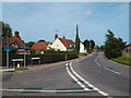
Main road through East Ord
by Graham Robson
geograph for square NT9751
Looking east along the main road into the village of East Ord.
|
|
Main road through Castleside
by Robert Graham
geograph for square NZ0748
The village is strung out along the A68 road. This view is looking north on the... (more)
|
|
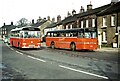
Pennine Motor Services, Gargrave 1971
by Alan Murray-Rust
geograph for square SD9354
With their distinctive orange and black livery, Pennine's main service ran... (more)
|
|
Coronation Terrace, Grange Villa
by Robert Graham
geograph for square NZ2352
This street must be named for the coronation of either Edward VII in 1902, or... (more)
|
|
The main road through Thulston
by Alan Murray-Rust
geograph for square SK4031
The blocked road to the left was the old main road, the current road being... (more)
|
|
Road into Satley village
by Robert Graham
geograph for square NZ1142
The main road through the village is the B6296, running north from the A68 at High Stoop.
|
![SK2310 : Main Road, Haunton [2] by Christine Johnstone](https://s3.geograph.org.uk/geophotos/04/76/19/4761943_cecc495d_120x120.jpg)
|
Main Road, Haunton [2]
by Christine Johnstone
geograph for square SK2310
Looking westwards from the church.
|
![SK2310 : Main Road, Haunton [1] by Christine Johnstone](https://s3.geograph.org.uk/geophotos/04/76/17/4761731_b1327d0a_120x120.jpg)
|
Main Road, Haunton [1]
by Christine Johnstone
geograph for square SK2310
Looking eastwards from the church.
|
|
Harwich Road, Little Oakley
by Malc McDonald
geograph for square TM2129
Harwich Road at the junction with Rectory Road in the village of Little Oakley.
|
|
Colchester Road, Wix
by Malc McDonald
geograph for square TM1528
Colchester Road in the village of Wix, in north Essex.
The road would once... (more)
|
|
Main Street, Ballantrae
by Ann Cook
geograph for square NX0882
The village shop is on the right.
|
|
Village postbox, Main Road, Anslow
by Christine Johnstone
geograph for square SK2125
At the entrance to a very narrow public footpath going eastwards towards Horninglow.
|
|
Contrasting houses on Main Road, Anslow
by Christine Johnstone
geograph for square SK2125
A new property set back from the road, and an older one at right angles to it.
|
|
Old terraced street in New Herrington
by Robert Graham
geograph for square NZ3352
This is a view looking west along the main B1286 in the village centre. The... (more)
|
|
Looking west along the main street in New Herrington
by Robert Graham
geograph for square NZ3352
View along the B1286 in the centre of the former mining village. The terraced... (more)
|
|
Looking along St Aidan's Terrace, New Herrington
by Robert Graham
geograph for square NZ3452
View west along the B1286, the main road through this former mining village.
|
|
West end of Main Street, Corbridge
by Robert Graham
geograph for square NY9964
The former Inn of Monksholme on the Left, and the ornate gates to Bythorne House... (more)
|
|
View towards Main Street in Corbridge
by Robert Graham
geograph for square NY9964
Looking west along Newcastle Road. This would have been the edge of the village... (more)
|
|
Roadside cottages
by Robert Graham
geograph for square NY9964
On Newcastle Road, Corbridge, on the eastern side of the village. This is the... (more)
|
|
Looking east along Lead Road in Greenside
by Robert Graham
geograph for square NZ1361
This is the main road leading into the village from the west.
|
|
Looking along the B6173 to Tantobie
by Robert Graham
geograph for square NZ1854
This is the main road from Stanley. View looking east along the section between... (more)
|
|
Road junction at the bottom of South View
by Robert Graham
geograph for square NZ1754
At the east end of Tantobie village, this is the junction of South View with the... (more)
|
|
West Road, White-le-Head
by Robert Graham
geograph for square NZ1754
View looking east down the main street of this little ex-mining village.
|
|
Looking down Rowley Bank at Castleside
by Robert Graham
geograph for square NZ0748
This is the main road which cuts through the western end of the village. It is a... (more)
|
|
The Horse and Groom, Castleside
by Robert Graham
geograph for square NZ0848
There has been a pub on this spot for a long time. In the early 18th century it... (more)
|
|
Entrance to George Street, Craghead
by Robert Graham
geograph for square NZ2150
This street runs behind Edward Street, the main street through the south side of... (more)
|
|
Station Road, Castle Donington
by Alan Murray-Rust
geograph for square SK4427
Looking towards the junction of Hillside and Bondgate. The latter forms the main... (more)
|
|
'On the main road heading northwest into Cark village'
by Christine Johnstone
geograph for square SD3676
From 'Walks from the Furness Line, Walk 5'.
|
|
Granby Terrace, Sunniside
by Robert Graham
geograph for square NZ2058
One of the original streets in the village, it faces on to the main road, the... (more)
|
|
Bottom of Pennyfine Road, Streetgate
by Robert Graham
geograph for square NZ2159
This is the junction of Pennyfine Road with the main A692 through the village.... (more)
|