Geograph - photograph every grid square
About tags on Geograph
Tags
Geographical Context
Subjects
Types
Other Prefixes
Public Tags
Related Tags
|
Coverage Map
Tag:
Village·Map
Showing latest 50 of 67 images tagged with
Village Map
tag.
View all tagged images
-
In Browser
Search within these images
:
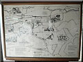
Map of Chenies inside bus shelter
by
David Hillas
for square
TQ0198
This illustrated map is located inside a bus shelter on Chenies Green WD3 6EG... (
more
)
Tags:
place:
Chenies
Chenies
type:
Inside
subject:
Map
Map
Village Map
top:
Village, Rural Settlement
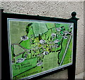
Village map and information, Llandenny, Monmouthshire
by
Jaggery
for square
SO4103
The map located here
Link
shows the... (
more
)
Tags:
type:
Close Look
Village Map
top:
Village, Rural Settlement
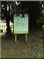
Hepworth map showing points of interest
by
Adrian S Pye
for square
TL9875
The map is mounted almost flat on the brick and flint plinth seen here... (
more
)
Tags:
type:
Close Look
Hepworth
Village Map
Village Sign
top:
Village, Rural Settlement
Carleton Rode Village Map
by
Geographer
for square
TM1192
Off Church Road (Close up)
Tags:
at:
Carleton Rode
Carleton Rode Village Map
off:
Church Road
type:
Close Look
Map
subject:
Sign
Village Map
top:
Village, Rural Settlement
Carleton Rode Village Map
by
Geographer
for square
TM1192
Off Church Road
Tags:
at:
Carleton Rode
Carleton Rode Village Map
off:
Church Road
type:
Close Look
Map
subject:
Sign
Village Map
top:
Village, Rural Settlement
Cotton Village Map
by
Geographer
for square
TM0667
At Cotton Village Hall off Wickham Lane (Close up)
Tags:
at:
Cotton
at:
Cotton Village Hall
Cotton Village Map
subject:
Sign
Village Hall
Village Map
top:
Village, Rural Settlement
off:
Wickham Lane
Cotton Village Map
by
Geographer
geograph for square
TM0667
At Cotton Village Hall off Wickham Lane
Tags:
at:
Cotton
at:
Cotton Village Hall
Cotton Village Map
subject:
Sign
Village Hall
Village Map
top:
Village, Rural Settlement
off:
Wickham Lane
Village Notice Board & Map
by
Geographer
geograph for square
TM2289
Off the Street at Harwick Village Hall
Tags:
bucket:
Closeup
at:
Hardwick
Hardwick
Hardwick Village Hall
Hardwick Village Map
at:
Harwick Village Hall
Harwick Village Notice Board
subject:
Notice
Notice Board
off:
The Street
The Street
Village Hall
Village Map
Village Notice Board
top:
Village, Rural Settlement
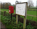
Hardwick Village Map & St.Neots Road Postbox
by
Geographer
for square
TL3659
On St.Neots Road Postbox No.CB3 350
Tags:
top:
Business, Retail, Services
postbox:
E II R
at:
Hardwick
Hardwick Village Map
Map
subject:
Postbox
on:
St.Neots Road
Village Map
top:
Village, Rural Settlement
Hardwick Village Map
by
Geographer
for square
TL3659
On St.Neots Road
Tags:
at:
Hardwick
Hardwick Village Map
Map
subject:
Sign
on:
St.Neots Road
Village Map
top:
Village, Rural Settlement
Hardwick Village Map & St.Neots Road Postbox
by
Geographer
geograph for square
TL3659
On St.Neots Road Postbox No.CB3 350
Tags:
top:
Business, Retail, Services
postbox:
E II R
at:
Hardwick
Hardwick Village Map
Map
subject:
Postbox
on:
St.Neots Road
Village Map
top:
Village, Rural Settlement
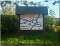
Burton Fleming map
by
Lauren
for square
TA0872
A map of the village of Burton Fleming
Tags:
type:
Close Look
Map
decorative feature:
Sign
subject:
Sign
Village Map
top:
Village, Rural Settlement
Hepworth Village Map & Notice Board
by
Geographer
geograph for square
TL9875
Off The Street
Tags:
type:
Geograph
at:
Hepworth
Hepworth Village Map
Hepworth Village Notice Board
Notice Board
Seats
subject:
Sign
off:
The Street
Village Map
Village Notice Board
top:
Village, Rural Settlement
Fersfield Village sign & Map
by
Geographer
geograph for square
TM0682
On The Street at the junction with Hall Lane & Lopham Road near St... (
more
)
Tags:
at:
Fersfield
Fersfield Road
Fersfield Village Map
Fersfield Village Sign
Hall Lane
Lopham Road
Road Junction
subject:
Sign
near:
St Andrews Church
on:
The Street
Village Map
Village Sign
top:
Village, Rural Settlement
Mottram in Longdendale Village Map
by
Gerald England
for square
SJ9995
A (not-to-scale) map of the village showing the whereabouts of important... (
more
)
Tags:
person:
Roy Oldham
Village Map
top:
Village, Rural Settlement
Stratton Strawless Village Map
by
Geographer
for square
TG2120
At Burrouges Hall near Parish Road Low Common Postbox Off Parish Road
Tags:
at:
Burrouges Hall
type:
Close Look
off:
Parish Road
near:
Parish Road Low Common Postbox
subject:
Sign
at:
Stratton Strawless
Stratton Strawless Village Map
Village Hall
Village Map
top:
Village, Rural Settlement
Stratton Strawless Village Map
by
Geographer
for square
TG2120
At Burrouges Hall near Parish Road Low Common Postbox Off Parish Road
Tags:
at:
Burrouges Hall
type:
Close Look
off:
Parish Road
near:
Parish Road Low Common Postbox
subject:
Sign
at:
Stratton Strawless
Stratton Strawless Village Map
Village Map
top:
Village, Rural Settlement
Gissing Village Map
by
Geographer
for square
TM1485
Off Lower Street (Close up)
Tags:
type:
Close Look
at:
Gissing
Gissing Village Map
off:
Lower Street
subject:
Sign
Village Map
top:
Village, Rural Settlement
Gissing Village Map
by
Geographer
for square
TM1485
Off Lower Street
Tags:
type:
Close Look
at:
Gissing
Gissing Village Map
off:
Lower Street
subject:
Sign
Village Map
top:
Village, Rural Settlement
Hepworth Village Map
by
Geographer
for square
TL9875
Off The Street (Close up)
Tags:
type:
Close Look
at:
Hepworth
Hepworth Village Map
subject:
Sign
off:
The Street
Village Map
top:
Village, Rural Settlement
Hepworth Village Map
by
Geographer
for square
TL9875
Off The Street
Tags:
type:
Close Look
at:
Hepworth
Hepworth Village Map
subject:
Sign
off:
The Street
Village Map
top:
Village, Rural Settlement
Hepworth Village Map
by
Geographer
for square
TL9875
Off The Street
Tags:
type:
Close Look
bucket:
Closeup
at:
Hepworth
Hepworth Village Map
subject:
Sign
off:
The Street
Village Map
top:
Village, Rural Settlement
Fersfield Village Map
by
Geographer
for square
TM0682
On The Street at the junction with Lopham Road & Hall Lane near St.Andrews... (
more
)
Tags:
at:
Fersfield
Fersfield Village Map
Hall Lane
Lopham Road
Road Junction
subject:
Sign
near:
St.Andrews Church
on:
The Street
Village Map
top:
Village, Rural Settlement
Fersfield Village Map
by
Geographer
for square
TM0682
On The Street at the junction with Lopham Road & Hall Lane near St.Andrews Church
Tags:
at:
Fersfield
Fersfield Village Map
Hall Lane
Lopham Road
Road Junction
subject:
Sign
near:
St.Andrews Church
on:
The Street
Village Map
top:
Village, Rural Settlement
Telephone Box & Village Map
by
Geographer
for square
TG1313
Off The Street
Tags:
top:
Communications
at:
Ringland
Ringland Village Map
subject:
Telephone Box
off:
The Street
Village Map
top:
Village, Rural Settlement
Burston Strike School Museum sign & Village Map
by
Geographer
for square
TM1383
On Church Green off Diss Road (Close up)
Link
Tags:
at:
Burston
Burston Strike School
Burston Strike School Museum
Burston Village Map
off:
Diss Road
top:
Educational Sites
Museum
Museum Sign
subject:
Sign
Village Map
top:
Village, Rural Settlement
Wortwell Village Map
by
Geographer
for square
TM2784
Off High Road at the junction with Low Road (Close up)
Tags:
off:
High Road
Low Road
top:
Paths
Road Junction
subject:
Sign
Village Map
top:
Village, Rural Settlement
at:
Wortwell
Wortwell Village Map
Wortwell Village Map
by
Geographer
for square
TM2784
Off High Street at the junction with Low Road
Tags:
off:
High Road
Low Road
top:
Paths
Road Junction
subject:
Sign
Village Map
top:
Village, Rural Settlement
at:
Wortwell
Wortwell Village Map
Cotton Village Map
by
Geographer
for square
TM0668
On the B1113 Station Road (Close up)
Tags:
B1113
at:
Cotton
Cotton Village Map
subject:
Sign
Station Road
on:
The B1113 Station Road
Village Map
top:
Village, Rural Settlement
Hardwick Village Map
by
Geographer
for square
TL3758
Off Main Street (Close up)
Tags:
at:
Hardwick
Hardwick Village Map
off:
Main Street
subject:
Sign
Village Map
top:
Village, Rural Settlement
Hardwick Village Map
by
Geographer
for square
TL3758
Off Main Street
Tags:
at:
Hardwick
Hardwick Village Map
off:
Main Street
subject:
Sign
Village Map
top:
Village, Rural Settlement
Burston & Shimpling Village Map
by
Geographer
for square
TM1582
On Burston Road at the junction with Hall Lane (Close up)
Tags:
Burston & Shimpling Village Map
on:
Burston Road
Hall Lane
Road Junction
at:
Shimpling
subject:
Sign
Village Map
top:
Village, Rural Settlement
Burston & Shimpling Village Map
by
Geographer
for square
TM1582
On Burston Road at the junction with Hall Lane
Tags:
Burston & Shimpling Village Map
on:
Burston Road
Hall Lane
Road Junction
at:
Shimpling
subject:
Sign
Village Map
top:
Village, Rural Settlement
Burston & Shimpling Village Map
by
Geographer
for square
TM1582
On Burston Road at the junction with Hall Lane
Tags:
Burston & Shimpling Village Map
Burston Road
on:
Burston Road
Dickleburgh Road
Hall Lane
Road Junction
at:
Shimpling
Shimpling
subject:
Sign
at:
The Junction with Hall Lane
Village Map
top:
Village, Rural Settlement
Brockdish Village Map
by
Geographer
for square
TM2179
On Scole Road at the junction with Grove Road
Tags:
at:
Brockdish
Brockdish Village Map
Road Junction
Scole Road
subject:
Sign
Village Map
top:
Village, Rural Settlement
Roadsign, Notice Board & Map
by
Geographer
geograph for square
TM1979
On Mill Road at the junction with The Street
Tags:
on:
Mill Road
Notice Board
Road Junction
top:
Roads, Road Transport
Roadsign
subject:
Sign
The Street
at:
Thorpe Abbotts
Thorpe Abbotts Village Map
Thorpe Abbotts Village Notice Board
Village Map
Village Notice Board
top:
Village, Rural Settlement
Thorpe Abbotts Village Map
by
Geographer
for square
TM1979
On Mill Road at the junction with The Street
Tags:
on:
Mill Road
Mill Road
Road Junction
subject:
Sign
The Street
at:
Thorpe Abbotts
Thorpe Abbotts Village Map
Village Map
top:
Village, Rural Settlement
Roadsign, Notice Board & Map
by
Geographer
geograph for square
TM1979
On Mill Road at the junction with The Street
Tags:
on:
Mill Road
Notice Board
top:
Roads, Road Transport
Roadsign
subject:
Sign
The Street
at:
Thorpe Abbotts
Thorpe Abbotts Village Map
Thorpe Abbotts Village Notice Board
Village Map
Village Notice Board
top:
Village, Rural Settlement
Swainsthorpe Village Map
by
Geographer
for square
TG2100
On Church Road at the junction with Church Close (Close up)
Tags:
Church Close
on:
Church Road
Road Junction
subject:
Sign
at:
Swainsthorpe
Swainsthorpe Village Map
Village Map
top:
Village, Rural Settlement
Bentley Parish Map, Main Road
by
Des Blenkinsopp
geograph for square
SU7843
A large colourful map of the village next to the Memorial Hall.
Tags:
type:
Geograph
top:
Housing, Dwellings
Village Map
top:
Village, Rural Settlement
Cotton Village Map at St. Andrew's Church
by
Geographer
for square
TM0766
Off Church Road at the junction with Stonham Road
Tags:
off:
Church Road
Church Road
bucket:
Closeup
at:
Cotton
Cotton
Cotton Village Map
Road Junction
subject:
Sign
at:
St Andrews Church
St Andrews Church
Stonham Road
at:
The Junction with Stonham Road
Village Map
top:
Village, Rural Settlement
The Street Postbox & Starston Village Map
by
Geographer
for square
TM2384
On The Street Postbox No.IP20 7056
Tags:
top:
Business, Retail, Services
postbox:
E II R
subject:
Postbox
at:
Starston
Starston Village Map
on:
The Street
Village Map
Roydon Village Map in St.Remigius Church
by
Geographer
for square
TM0980
In the Porch
Tags:
church:
Church of England
High Road
top:
Paths
Porch
top:
Religious Sites
at:
Roydon
Roydon Village Map
subject:
Sign
St.Remigius Church
off:
The A1066 High Road
Village Map
Village Map, Village Notice Board & Village Hall Victorian Postbox
by
Geographer
geograph for square
TG2902
On Church Road at Yelverton Village Hall Postbox No.NR14 1439
Tags:
top:
Business, Retail, Services
on:
Church Road
Notice Board
subject:
Postbox
postbox:
Victorian
Village Map
Village Notice Board
top:
Village, Rural Settlement
postbox:
VR
at:
Yelverton
at:
Yelverton Village Hall
Local map, Green Hammerton
by
Alan Murray-Rust
geograph for square
SE4556
Rather than being displayed in a noticeboard, the parish map is displayed on a... (
more
)
Tags:
type:
Geograph
Plinth
building material:
Stone and Brick
Village Map
top:
Village, Rural Settlement
Map of Farringdon
by
David Howard
for square
SU7035
Tags:
type:
Close Look
top:
Communications
Map
subject:
Notice
Village Map
top:
Village, Rural Settlement
High Road Postbox
by
Geographer
for square
TM2784
On High Street at the junction with Low Road Postbox No.IP20 7074
Tags:
top:
Business, Retail, Services
postbox:
E II R
on:
High Road
Low Road
Notice Board
subject:
Postbox
Road Junction
Village Map
Village Notice Board
top:
Village, Rural Settlement
at:
Wortwell
Wortwell Village Map
Wortwell Village Notice Board
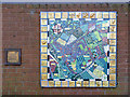
Jacksdale Parish Map
by
Alan Murray-Rust
for square
SK4451
A ceramic mosaic created with the help of local children, on the wall of the... (
more
)
Tags:
material:
Ceramic
subject:
Plaque
Village Map
top:
Village, Rural Settlement
Church Close/Station Road Postbox
by
Geographer
geograph for square
TG2100
On Church Road at the junction with Church Close Postbox No.NR14 1466
Tags:
top:
Business, Retail, Services
Church Close
on:
Church Road
postbox:
E II R
Notice Board
subject:
Postbox
Road Junction
at:
Swainsthorpe
Swainsthorpe Village Map
Swainsthorpe Village Notice Board
Village Map
Village Notice Board
top:
Village, Rural Settlement
Tonight is chip shop night!
by
Neil Owen
geograph for square
ST3522
So says one board. Another suggests the Crown is the place to be. All in all the... (
more
)
Tags:
Advertising Boards
top:
Communications
type:
Geograph
subject:
Village
Village Map
top:
Village, Rural Settlement
View more in the Image Search
or
in Browser
View images matching 'Village Map' anywhere
in
the tags
Don't click these:
PotMel 1
PotMel 2
☰
Home
View
Search
Marked Images
Maps
Browser
Explore
Showcase
New Images
Collections
Interact
Games
Discussions
Blog
Contributors
Submit
Statistics
Leaderboards
General
FAQ
Help Pages
Sitemap
Contact Us
Support Us
sponsored by
🔍︎
What to search:
Photos
Enter keywords or a location/postcode to search nearby images
Enter a Grid Reference
Placenames
Collections
Website Pages
Everything
Others:
Advanced Search
|
Image Browser
Or:
Coverage Map
|
Searchable Map
You are not logged in
|
login
|
register