Public Tags
Tag: Village·Primary·School
Showing latest 50 of 142 images tagged with Village Primary School tag.

|
Penshurst C of E Primary School
by Malc McDonald geograph for square TQ5243 A Church of England primary school in the village of Penshurst, Kent.
Tags:
near:Edenbridge
top:Educational Sites
type:Geograph
county:Kent
place:Penshurst
building type:Primary School
Primary School
Primary School (Church of England)
subject:School
near:Tunbridge Wells
Village Primary School
top:Village, Rural Settlement
|

|
Oaksey Church of England Primary School, The Street, Oaksey
by Vieve Forward geograph for square ST9893 Oaksey Church of England Primary School. Link
 |

|
Westbury-on-Severn C of E Primary School
by Jaggery geograph for square SO7114 The school website states that this is a Church of England Primary School for... (more)
|

|
Bredhurst, Kent
by Malc McDonald geograph for square TQ7962 The village of Bredhurst in Kent. In the foreground is the village sign.... (more)
|

|
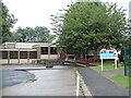
Otley primary school
by Christopher Hilton geograph for square TM2055 Tags:
top:Educational Sites
type:Geograph
building type:Primary School
Primary School
subject:School
Village Primary School
Village School
top:Village, Rural Settlement
|
|
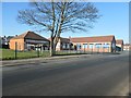
Locking Primary School
by Neil Owen geograph for square ST3659 Schooling in the area had begun in the mid nineteenth century: the Parochial... (more)
Tags:
top:Educational Sites
type:Geograph
subject:School
Village Primary School
top:Village, Rural Settlement
|
|
St Joseph & St Theresa's RC Primary School, Woodlands
by Christine Johnstone geograph for square SE5407 Just south of the church of the same name.
Tags:
Catholic Primary School
top:Educational Sites
type:Geograph
building type:Primary School
RC Primary School
Roman Catholic Primary School
subject:School
Village Primary School
|

|
East Lothian Townscape : East Linton Primary School
by Richard West geograph for square NT5877 Tags:
place:East Linton
East Linton Primary School
top:Educational Sites
type:Geograph
top:Roads, Road Transport
subject:School
Victorian Era Primary School
Village Primary School
top:Village, Rural Settlement
Winter Streetscene
|

|
East Lothian Architecture : East Linton primary school (south elevation)
by Richard West geograph for square NT5877 Tags:
place:East Linton
East Linton Primary School
top:Educational Sites
type:Geograph
subject:School
Victorian Era Primary School
Village Primary School
top:Village, Rural Settlement
Winter Streetscene
|

|
Beckwithshaw Community Primary School
by Stephen Craven geograph for square SE2653 The original school building on Otley Road bears the date AD 1865. See also SE2653 : Beckwithshaw Community School.
Tags:
date:1865
top:Educational Sites
type:Geograph
Village Primary School
top:Village, Rural Settlement
|

|
Colourful primary school building, Wick
by Jaggery geograph for square SS9272 Part of Wick and Marcross Church in Wales Primary School, in the background... (more)
Tags:
top:Educational Sites
type:Geograph
Primary School
School
Village Primary School
top:Village, Rural Settlement
|

|
Bus stop and shelter near the village primary school, Cwmdare
by Jaggery geograph for square SN9803 Alongside Gobaith Terrace near the south edge of Cwmdâr Primary School.
Though... (more)
|

|
Five trees at the edge of the village school, Creigiau
by Jaggery geograph for square ST0781 Near the Tynant Road/Tregarth Court corner of Creigiau Primary School.
|

|
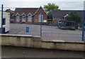
Roecliffe Church of England Primary School
by Stephen Craven geograph for square SE3765 Since the parish church SE3766 : St Mary's Church, Roecliffe was closed in 1983 the congregation has met... (more)
Tags:
date:1874
top:Educational Sites
type:Geograph
Grade II Listed
Primary School (Church of England)
top:Religious Sites
Village Primary School
top:Village, Rural Settlement
|
|
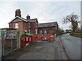
Ashchurch Primary School, Ashchurch
by Jaggery geograph for square SO9233 Viewed from the village hall car park.
|
|
The school in School Lane
by Christine Johnstone geograph for square SJ7764 Brereton C of E primary school must have been built in the late 1800s [as a... (more)
|

|
Addingham Primary School
by Stephen Craven geograph for square SE0750 Built in 1979 as a Middle School; when Bradford education authority changed from... (more)
Tags:
date:1979
top:Educational Sites
Former Middle School
type:Geograph
Village Primary School
top:Village, Rural Settlement
|

|
Fordyce Primary School
by Bill Harrison geograph for square NJ5563 The typical Aberdeenshire granite primary school was built in 1923: the school... (more)
Tags:
top:Educational Sites
type:Geograph
building material:Granite
Village Primary School
top:Village, Rural Settlement
|

|
Weaverthorpe C of E Primary School
by Martin Dawes geograph for square SE9670 |

|
Ashchurch Primary School, Ashchurch
by Jaggery geograph for square SO9233 Viewed across the school perimeter fence.
|

|
Village school entrance gates, Church Road, Aylburton
by Jaggery geograph for square SO6101 Entrance to Aylburton Church of England Primary School, located opposite the... (more)
|

|
Slaidburn village school
by Stephen Craven geograph for square SD7152 Adjacent to the churchyard, this is a church school owing its loyalty to the... (more)
|

|
Original buildings, Brookland Primary School
by Christine Johnstone geograph for square TQ9825 Next to St Augustine's church on High Street. The school has been massively... (more)
|
|
Bream C of E Primary School, Bream
by Jaggery geograph for square SO6006 Located on the west side of High Street, the Church of England primary school is... (more)
|

|
Embsay C of E Primary School, Pasture Road
by Stephen Craven geograph for square SE0053 A former National School, as labelled on the oldest OS map of 1850.
|

|
Stiperstones Primary School
by Bill Harrison for square SJ3600 The remote school survived a closure scare in around 2009 and in 2021 the school... (more)
Tags:
Church of England Primary School
type:Close Look
top:Educational Sites
building material:Sandstone
Village Primary School
top:Village, Rural Settlement
|

|
Village school, Llanbister
by Jaggery geograph for square SO1073 The south side of Llanbister Community Primary School viewed from the B4356.
Tags:
top:Educational Sites
type:Geograph
Primary School
Village Primary School
top:Village, Rural Settlement
|

|
Crosby Ravensworth Church of England primary school
by Stephen Craven geograph for square NY6214 This village school looks to have been recently rebuilt, so even though one... (more)
|

|
Machen Primary School
by Jaggery geograph for square ST2089 On the south side of the A468 Commercial Road. The school opened in January 1909.
Tags:
top:Educational Sites
type:Geograph
Primary School
School
Village Primary School
top:Village, Rural Settlement
|

|
Long Preston primary school
by Bill Harrison geograph for square SD8358 The school is 'voluntary aided', presumably by the Church of England;... (more)
|

|
Hutton Cranswick primary school
by Stephen Craven geograph for square TA0252 A school in the village centre.
Tags:
top:Educational Sites
type:Geograph
Primary School
Village Primary School
top:Village, Rural Settlement
|

|
Northwest corner of Lydbrook Primary School, Lydbrook
by Jaggery geograph for square SO6015 School buildings and picnic tables viewed from School Road.
The Parish Church... (more)
Tags:
top:Educational Sites
type:Geograph
Primary School
top:Religious Sites
Village Primary School
top:Village, Rural Settlement
|
|
Birdwell Primary School
by Christine Johnstone geograph for square SE3401 On the east side of Sheffield Road.
Tags:
top:Educational Sites
Primary School
building type:Primary School
subject:School
Village Primary School
|

|
Broad Hinton Primary School
by Des Blenkinsopp geograph for square SU1076 A Victorian village school building from 1864 with modern extensions. Listing... (more)
|

|
Otterhampton Primary School
by Neil Owen for square ST2542 Although based in the village of Combwich the parish school is named... (more)
Tags:
type:Close Look
top:Educational Sites
subject:School
Village Primary School
top:Village, Rural Settlement
|

|
Harewood Church of England Primary School
by Stephen Craven geograph for square SE3245 The school's buildings are behind the privacy of a tall hedge.
|

|
Countess Gytha primary school
by Neil Owen geograph for square ST5924 Queen Camel's school is now at the south end of the village. The original... (more)
Tags:
top:Educational Sites
type:Geograph
subject:School
Village Primary School
top:Village, Rural Settlement
|

|
St Combs Primary School, High Street, St Combs
by Bill Harrison geograph for square NK0563 School roll 64, taught in three composite classes as of 2021. The school is... (more)
Tags:
top:Educational Sites
type:Geograph
Planned Village
Village Primary School
top:Village, Rural Settlement
|

|
Goldsborough C of E primary school
by Stephen Craven geograph for square SE3856 Apart from an extension to the rear, the footprint of this school is unchanged... (more)
|

|
Carleton Church of England Primary School
by Stephen Craven geograph for square SD9749 A sign on the lower extension to the original school says it was added in 2000.
|

|
Stuartfield Primary School
by Bill Harrison geograph for square NJ9745 The older parts of the school are behind the modern extension, which shows the... (more)
|

|
Laurencekirk primary school
by Bill Harrison geograph for square NO7170 The new primary school serving the ever-expanding village with a roll of 309 in 2018-19.
|

|
Village school, Stainsacre
by Stephen Craven geograph for square NZ9208 In full, Hawsker cum Stainsacre Church of England Voluntary Controlled Primary... (more)
|

|
Ruswarp primary school
by Stephen Craven geograph for square NZ8809 A Church of England school opposite the church itself.
|

|
Ewyas Harold Primary School
by Jaggery geograph for square SO3828 Viewed across School Road in Ewyas Harold, Herefordshire.
Tags:
top:Educational Sites
type:Geograph
Primary School
Village Primary School
top:Village, Rural Settlement
|
|
Sorn Primary School
by Humphrey Bolton geograph for square NS5526 Tags:
top:Educational Sites
type:Geograph
top:Lowlands
Primary School
subject:School
Village Primary School
top:Village, Rural Settlement
|

|
Wittersham primary school
by Christine Johnstone geograph for square TQ8926 On The Street, close to the parish church.
|
|
Clutton Primary School
by Neil Owen geograph for square ST6259 The village school, a twentieth century building. Previously the school was a... (more)
Tags:
top:Educational Sites
type:Geograph
subject:School
Village Primary School
top:Village, Rural Settlement
|

|
Covid Cairn, Eddleston Primary School
by Jim Barton for square NT2447 A colourful cairn of painted stones with messages about the pandemic, in front... (more)
|

|
Premnay primary school
by Bill Harrison geograph for square NJ6224 The school (roll in 2018 = 47) is located in the village of Auchleven but named... (more)
Tags:
top:Educational Sites
type:Geograph
building material:Granite
School Playground
Village Primary School
top:Village, Rural Settlement
|
