Public Tags
Tag: Visible·Earthworks
Showing images tagged with Visible Earthworks tag.
|
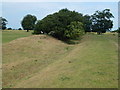
Stonea Camp - Bushes on the eastern earthworks
by Richard Humphrey geograph for square TL4493 A large grass-covered site with just earthworks remaining, but a good series of... (more)
|
|
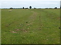
Stonea Camp - South western earthworks
by Richard Humphrey geograph for square TL4492 A large grass-covered site with just earthworks remaining, but a good series of... (more)
|
|
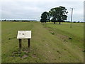
Stonea Camp - Eastern earthworks
by Richard Humphrey geograph for square TL4493 A large grass-covered site with just earthworks remaining, but a good series of... (more)
|
|
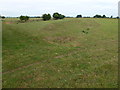
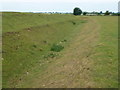
Stonea Camp - Central ditch and bank
by Richard Humphrey geograph for square TL4493 A large grass-covered site with just earthworks remaining, but a good series of... (more)
|
|
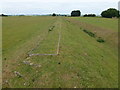
Stonea Camp - The lowest hill fort in the UK
by Richard Humphrey geograph for square TL4493 A large grass-covered site with just earthworks remaining, but a good series of... (more)
|
|
Stonea Camp - Northern embankment
by Richard Humphrey geograph for square TL4493 A large grass-covered site with just earthworks remaining, but a good series of... (more)
|

|
Earthworks at Church Norton
by PAUL FARMER geograph for square SZ8795 The site of a Norman Castle
Tags:
Ancient Earthworks
place:Church Norton
subject:Earthwork
Earthworks
type:Geograph
top:Historic Sites and Artefacts
county:Sussex
Visible Earthworks
West Sussex
county:West Sussex
|

|
The Mounds of South Woodham Ferrers
by terry joyce geograph for square TQ8297 There are a seies of mounds in this field near Hogwell Farm that are shown on... (more)
Tags:
county:Essex
top:Farm, Fishery, Market Gardening
top:Grassland
Hogwell Farm
top:Lowlands
place:South Woodham Ferrers
top:Village, Rural Settlement
Visible Earthworks
|

|
Three R's Transport
by Martin Dawes geograph for square SE7667 From the top of the earthworks, first the Railway, York to Scarborough. Then... (more)
Tags:
top:Lowlands
top:Paths
top:Railways
top:Rivers, Streams, Drainage
top:Roads, Road Transport
top:Village, Rural Settlement
Visible Earthworks
|

|
Blackhall Hill with earthworks on Rise Park
by Martin Dawes geograph for square TA1441 From Rise Road on the NW corner of the park
Tags:
top:Flat Landscapes
type:Geograph
top:Grassland
top:Historic Sites and Artefacts
Visible Earthworks
top:Woodland, Forest
|

|
Theddlethorpe All Saints
by Richard Croft geograph for square TF4687 Probably an obsolete drain in a field near The Woodlands Farm, though the field... (more)
|
|
Earthworks of Cranmore Castle
by David Smith geograph for square SS9611 There is a brief description of Cranmore Castle in Wikipedia... (more)
|
