|
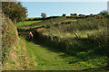
Diamond Jubilee Way
by Derek Harper
for square SX8750
|
|
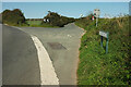
Junction on A379
by Derek Harper
geograph for square SX8650
Forking off to the right is Jawbones Hill, carrying the Diamond Jubilee Way. As... (more)
|
|
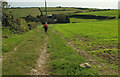
Diamond Jubilee Way at Higher Weeke
by Derek Harper
geograph for square SX8749
Tracks meet southeast of the farm buildings. The Way is following Dartmouth Footpath 5.
|
|
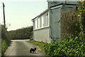
Cat by Tollgate Cottage
by Derek Harper
geograph for square SX8650
Obviously concerned that, by going round the back way, we have evaded the toll.... (more)
|
|
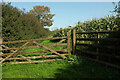
Gate on bridleway, Little Dartmouth
by Derek Harper
geograph for square SX8849
Dartmouth Bridleway 7 passes through this gateway on its way to the stretch... (more)
|
|
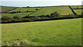
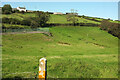
Valley, Weeke
by Derek Harper
geograph for square SX8749
|
|
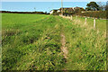
Diamond Jubilee Way south of Weeke
by Derek Harper
geograph for square SX8749
Climbing on Dartmouth Footpath 6.
|
|
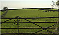
Entrance by the Diamond Jubilee Way
by Derek Harper
geograph for square SX8749
|
|
Farmland near Week
by Derek Harper
geograph for square SX8749
|
|
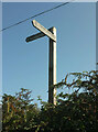
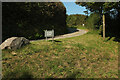
Signpost, Diamond Jubilee Way
by Derek Harper
for square SX8650
Rising above the hedgebank at Swannaton Gate.
|
|
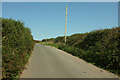
Jawbones Hill
by Derek Harper
geograph for square SX8750
A no through road that becomes a green lane / public access route from the... (more)
|
|
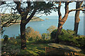
View from Castle Road
by Derek Harper
geograph for square SX8849
From the Diamond Jubilee Way, looking across the mouth of the Dart to Inner... (more)
|
|
Diamond Jubilee Way above Weeke
by Derek Harper
geograph for square SX8749
A double bend on Dartmouth Footpath 6. On the right is the field of maize shown... (more)
|
|
Diamond Jubilee Way approaching Weeke
by Derek Harper
geograph for square SX8749
|
|
Diamond Jubilee Way near Weeke Cottage
by Derek Harper
geograph for square SX8749
|
|
Diamond Jubilee Way above Weeke Cottage
by Derek Harper
geograph for square SX8749
|
|
Diamond Jubilee Way at Weeke Cottage
by Derek Harper
geograph for square SX8749
|
|
Diamond Jubilee Way at Weeke Cottage
by Derek Harper
geograph for square SX8749
|
|
Diamond Jubilee Way near Higher Weeke
by Derek Harper
geograph for square SX8749
Following Dartmouth footpath 5 up the entrance track to the farm hamlet, from... (more)
|
|
Diamond Jubilee Way near Higher Weeke
by Derek Harper
geograph for square SX8749
|
|
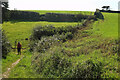
Combe below Higher Week
by Derek Harper
geograph for square SX8749
From the Diamond Jubilee Way. The falling ground immediately in front of the... (more)
|
|
Diamond Jubilee Way approaching Swannaton
by Derek Harper
geograph for square SX8749
|
|
Diamond Jubilee Way at Higher Weeke
by Derek Harper
geograph for square SX8749
A left turn on Dartmouth Footpath 5 to go round the cottages.
|
|
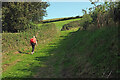
Approaching Higher Weeke
by Derek Harper
for square SX8749
(Higher Week on the 1:25000 map). The walker is following the Diamond Jubilee... (more)
|
|
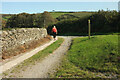
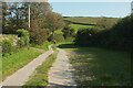
Footpath from Swannaton
by Derek Harper
geograph for square SX8750
The Diamond Jubilee Way follows Dartmouth Footpath 5 to Higher Week or Weeke,... (more)
|
|
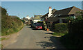
Higher Swannaton
by Derek Harper
geograph for square SX8750
Swannaton Road reaches the hamlet of about five properties including Higher... (more)
|
|
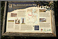
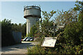
Water tower, Jawbones Hill
by Derek Harper
geograph for square SX8750
Together with a car park, and, next to a footpath signpost, an information board... (more)
|

|
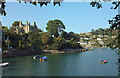
Warfleet Creek
by Derek Harper
geograph for square SX8850
|
|
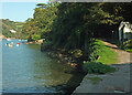
Warfleet Creek
by Derek Harper
geograph for square SX8850
From Dartmouth Footpath 13 (right), looking along the southern side of the creek.
|
|
Warfleet Creek
by Derek Harper
geograph for square SX8850
From Dartmouth Footpath 13. On the left is the former Ravensbury "built on... (more)
|
|
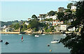
Kingswear from Castle Road
by Derek Harper
geograph for square SX8850
On the left is the sadly-altered listed Kittery Court, unrecognisable from the... (more)
|
|
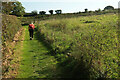
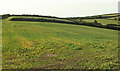
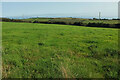
Farmland south of Weeke
by Derek Harper
geograph for square SX8749
|
|
Valley, Weeke
by Derek Harper
geograph for square SX8749
|
|
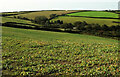
Maize above Weeke
by Derek Harper
geograph for square SX8749
|
|
Gap in the hedge, Weeke
by Derek Harper
geograph for square SX8749
|
|
Maize above Weeke
by Derek Harper
geograph for square SX8749
|
|
Valley, Weeke
by Derek Harper
geograph for square SX8749
|
|
Meadow by Weeke Hill
by Derek Harper
geograph for square SX8749
The B3205 runs behind the trees on the left. Not obvious except at larger sizes... (more)
|
|
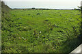
Catch meadow at Little Weeke
by Derek Harper
geograph for square SX8749
|
|
Farmland, Week
by Derek Harper
for square SX8749
|
|
Farmland, Swannaton
by Derek Harper
for square SX8749
|
|
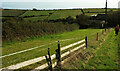
Cattle pasture by Swannaton Road
by Derek Harper
for square SX8749
|
|
Pasture by Swannaton Road
by Derek Harper
for square SX8649
The field also abuts the A379 on its western upper side. Dartmouth Footpath 4... (more)
|
|
Field by Swannaton Gate
by Derek Harper
for square SX8750
From the junction of the A379 and Jawbones Hill. The hedge across the field... (more)
|
|
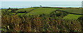
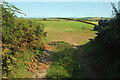
Field by Jawbones Hill
by Derek Harper
geograph for square SX8750
|
|
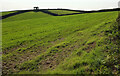
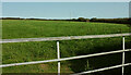
Field by Jawbones Hill
by Derek Harper
geograph for square SX8750
A grass field on the east side of the lane.
|
|
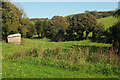
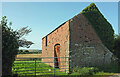
Barn, Jawbones Hill
by Derek Harper
geograph for square SX8750
|
|
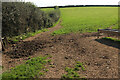
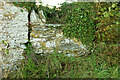
Wall by barn, Jawbones Hill
by Derek Harper
for square SX8750
I think I was wondering whether this was an old stone stile. There's no... (more)
|
|
Field by Jawbones Hill
by Derek Harper
geograph for square SX8750
|
|
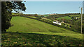
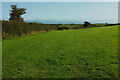
Farmland by Jawbones Hill
by Derek Harper
geograph for square SX8750
With a view across a side valley above Warfleet.
|