
|
Warning signs on Brookhouse Lane
by Jonathan Hutchins
geograph for square SJ8061
These warning signs are placed either side of the gaps in the roadside hedges... (more)
|

|
Washpool Lane horse rider warning sign near Kemble
by Jaggery
geograph for square SU0096
According to one source, this is an Accompanied Horses warning sign. Based on a... (more)
|
|
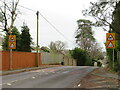
Springdale Road, Corfe Mullen
by Malc McDonald
geograph for square SY9995
Springdale Road in Corfe Mullen, near Poole. Here the road starts to go down a... (more)
|

|
Warning sign - horse riders, Pengenffordd, Powys
by Jaggery
for square SO1730
Above a 50 sign alongside the A479.
|

|
Warning sign - horse riders, Shifnal
by Jaggery
geograph for square SJ7407
The sign is on a lamppost alongside the A4169 at the western edge of Shifnal.
|
|
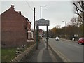
A57 approaching Broomstair Bridge
by Gerald England
geograph for square SJ9395
Broomstair bridge over the River Tame was originally the boundary between Hyde,... (more)
|

|
Carr Lane at the 102 metre spot height
by Christine Johnstone
geograph for square SE3639
With warnings of possible horse riders and a definite double bend.
|

|
Warning sign - horse riders, Woodcroft, Gloucestershire
by Jaggery
for square ST5496
The red-edged triangular sign is alongside the B4228 near the Lancaut Lane junction.
|

|
Warning sign in Pantyffordd - horse riders for 2 miles
by Jaggery
geograph for square SN8209
The text is also in Welsh on the sign alongside the A4109 on the approach to... (more)
|
|
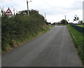
Warning sign - horse riders, Broughton Road, Lodge
by Jaggery
geograph for square SJ3052
Wordless road sign in the village of Lodge near Brynteg.
|

|
Horse warning in Bramley Fall woods
by Stephen Craven
geograph for square SE2436
The curved path is part of a horse riding trail through the woods. The sign... (more)
|

|
Warning sign - horse riders for half a mile ahead north of Lydney
by Jaggery
geograph for square SO6405
The sign is alongside Allaston Road beyond the northern edge of Lydney.
|

|
Warning sign - horse riders, West Road near Porthcawl
by Jaggery
geograph for square SS8079
The sign above a litter bin is at the edge of this... (more)
|

|
Warning sign - horse riders, Crick, Monmouthshire
by Jaggery
for square ST4889
Facing southbound traffic on Crick Road.
|

|
Warning sign - horse riders, Llangrove Road near Trewen, Herefordshire
by Jaggery
geograph for square SO5418
On the approach to crossroads.
|

|
Warning sign - horse riders, Newland, Gloucestershire
by Jaggery
geograph for square SO5509
Alongside Newland Road in the Forest of Dean District of Gloucestershire.
|

|
Warning sign - horse riders, Cefn Mawr Lane, Monkswood
by Jaggery
geograph for square SO3402
Located here Link near the A472 junction. |

|
Penn Lane
by Derek Harper
geograph for square ST5111
Looking to the right from where ST5111 : Eastfield was taken. The sign warns of horse riders. |

|
Warning sign - horse riders, Abercanaid
by Jaggery
geograph for square SO0504
Alongside Graig Road.
|
|
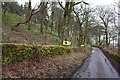
Horse warnings
by Bob Harvey
geograph for square SD7736
A concealed farm gate used by Horseriders has attracted a fluttering of warning... (more)
|

|
Warning sign - horse riders on the road to Llanbedr, Powys
by Jaggery
geograph for square SO2219
Alongside the minor road from Crickhowell to Llanbedr.
|

|
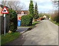
Warning sign - horse riders, Pantlasau, Swansea
by Jaggery
geograph for square SN6500
Alongside Pant Lasau Road.
|
|
Warning sign - horse riders, Old Bristol Road, Newtown near Stonehouse
by Jaggery
geograph for square SO7905
Alongside a side road formerly part of Bristol Road which now follows a... (more)
|

|
Warning sign - horse riders, Hardwicke
by Jaggery
geograph for square SO8012
Facing the B4008 Bristol Road in Hardwicke, a village in Stroud District, Gloucestershire.
|

|
Southern end of Marsh Lane, Clements End
by Jaggery
geograph for square SO5807
Looking north towards Ellwood from the corner of Oakwood Road.
The triangular... (more)
|

|
Eastbound A17 near Byard's Leap
by David Dixon
geograph for square SK9849
|

|
A17 near Byard's Leap
by David Dixon
geograph for square SK9849
|
|
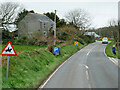
A387 near Carey Park
by David Dixon
geograph for square SX2152
|

|
Beware of horse riders
by Christine Johnstone
geograph for square SE3340
Tarn Lane heading eastwards.
|

|
Start of a path parallel to the A59 at Bolton Bridge
by Stephen Craven
geograph for square SE0752
A path which takes pedestrians and cyclists from Beamsley Lane to Bolton Bridge... (more)
|

|
Cyclists on Barrowby Lane
by Stephen Craven
for square SE3248
There's a warning of the possibility of coming across horses on this... (more)
|

|
Field gateway on NW side of A59 SW of Gisburn
by Roger Templeman
geograph for square SD8148
With horseriders warning sign on the verge
|

|
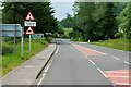
A442 Bridgnorth Road
by David Dixon
geograph for square SO7980
|
|
A87, Auchtertyre
by David Dixon
geograph for square NG8427
|

|
A939 Southbound
by David Dixon
geograph for square NH9547
|

|
A134 Southbound
by David Dixon
geograph for square TL8389
|

|
Power Lines Crossing the A52 near Bottesford
by David Dixon
geograph for square SK8037
|

|
A81 Castle Rednock Trekking Centre
by David Dixon
geograph for square NN6001
|

|
Junction of Bay Horse Lane and Brandon Lane
by Christine Johnstone
geograph for square SE3540
Seen from Brandon Crescent.
|

|
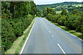
A134 near Timworth
by David Dixon
geograph for square TL8568
|
|
B9006, Drummossie Muir
by David Dixon
geograph for square NH7745
|

|
B9006 near Cantray
by David Dixon
geograph for square NH7948
|

|
Road at Wallaton Cross
by Derek Harper
geograph for square SX7948
The junction gets two signposts; this is one of them, featuring NCN route... (more)
|
|
Road past Lake Hill Cottages
by Derek Harper
geograph for square SU1338
The road from Upper Woodford passes two footpaths on the left and a bridleway on... (more)
|

|
Road from Kirkton to Auchterhouse
by Stanley Howe
geograph for square NO3437
Approaching a crossroads.
|

|
Himalayan Balsam at the edge of the road
by Christine Johnstone
for square SE3540
Many of the lanes around Shadwell are tinted pink with this plant.
|

|
On foot from Portsmouth Harbour to London Waterloo (2745)
by Basher Eyre
geograph for square SU9854
Roadsign in Burdenshott Road
|

|
Bend in the road...
by Bill Harrison
geograph for square NJ8714
...past Kirk Cottage.
|

|
Belbroughton, Stourbridge Road (A491)
by David Dixon
geograph for square SO9476
|
|
B3311 near Halsetown
by David Dixon
geograph for square SW5038
|
