
|
Bridge over Station Road, Carrbridge, near Aviemore
by Malc McDonald
geograph for square NH8922
A bridge carries the Highland Main Line over Station Road in the village of... (more)
|
|
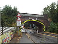
Railway bridge on Kettering Road, Market Harborough
by Malc McDonald
geograph for square SP7487
This bridge carries the Midland Main Line across Kettering Road in Market... (more)
|

|
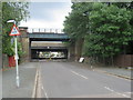
Park Road, Edmonton
by Malc McDonald
geograph for square TQ3492
Park Road is a minor road in Edmonton, in the suburbs of north London. Here,... (more)
|
|
Shawbrooke Road, near Eltham
by Malc McDonald
geograph for square TQ4175
Bridges across Shawbrooke Road near Eltham in south east London. The bridge... (more)
|
|
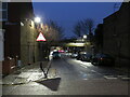
Pembury Road, Tottenham
by Malc McDonald
geograph for square TQ3390
Pembury Road is a minor residential road in Tottenham, in the suburbs of north... (more)
|
|
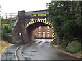
Bridge over Scotland Road, Market Harborough
by Malc McDonald
geograph for square SP7486
This arch bridge carries the Midland Main Line across Scotland Road, in Market... (more)
|

|
Shortlands Station and railway bridge
by Malc McDonald
geograph for square TQ3969
The bridge carries the railway line from London to Bromley South and onwards... (more)
|

|
Railway bridge, Balham
by Malc McDonald
geograph for square TQ2873
A railway bridge over Bedford Hill at Balham. The bridge carries warning... (more)
|

|
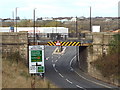
Railway bridge at Turkey Street, near Enfield
by Malc McDonald
geograph for square TQ3598
A railway bridge across Turkey Street in the outer suburbs of north London.... (more)
|
|
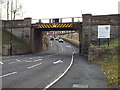
Former railway bridge at Pallion, Sunderland
by Malc McDonald
geograph for square NZ3757
This bridge used to carry a railway line across the road. The railway has been... (more)
|
|
Former railway bridge at Pallion, Sunderland
by Malc McDonald
geograph for square NZ3757
A former railway bridge at Pallion, in Sunderland. The railway route has been... (more)
|

|
Low bridge, Norbiton
by Malc McDonald
geograph for square TQ1969
This bridge carries a railway line across the A238 Coombe Road at Norbiton, in... (more)
|
|
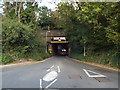
Railway bridge over Toms Lane, Kings Langley
by Malc McDonald
geograph for square TL0702
This bridge carries the West Coast Main Line over Toms Lane.
|
|
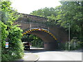
Railway bridge over Bourne Valley Road, Branksome, Poole
by Malc McDonald
geograph for square SZ0692
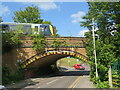
An arch bridge carrying the London to Weymouth railway line over Bourne Valley... (more)
|
|
Railway bridge over Bourne Valley Road, Branksome, Poole
by Malc McDonald
geograph for square SZ0692
An arch bridge carries the London to Weymouth railway line over Bourne Valley... (more)
|

|
Railway bridge, Middlesbrough
by Malc McDonald
geograph for square NZ4920
The Albert bridge carries the railway line east from Middlesbrough railway... (more)
|

|
Warning sign on a low road bridge near Southampton Central railway station
by Jaggery
geograph for square SU4112
The warning sign shows 3 metres headroom below the bridge carrying the A3057... (more)
|

|
Warning sign - low bridge ahead, Waymills, Whitchurch, Shropshire
by Jaggery
geograph for square SJ5541
The sign alongside the B5398 Waymills warns of a 13' 6" headroom bridge ahead.
|
|
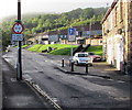
Low bridge warning sign and traffic calming, Celynen Road, Newbridge
by Jaggery
geograph for square ST2196
The sign gives advance warning of a bridge with 11ft headroom a mile and a... (more)
|
|
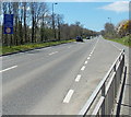
Warning of low bridge ahead, Freemans Way, Haverfordwest
by Jaggery
geograph for square SM9514
The blue sign at the edge of the A4076 Freemans Way shows that there is a low... (more)
|

|
Warning sign on the road to Ewen - low arch bridge ahead
by Jaggery
geograph for square ST9998
The sign faces the A429 alongside the unclassified road to Ewen in... (more)
|

|
Warning sign - low bridge ahead northeast of Lydstep
by Jaggery
geograph for square SS0998
550 yards from a 9' 6" headroom railway bridge, the sign is alongside... (more)
|

|
Railway bridge over Sheepcote Lane, near Swanley
by Malc McDonald
geograph for square TQ4868
This bridge carries a railway line across Sheepcote Lane, near Swanley. The... (more)
|

|
Warning sign - low bridge ahead, Colwyn Bay
by Jaggery
geograph for square SH8479
Facing the B5113 Prince's Drive 100 yards from this... (more)
|
|
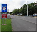
Low bridge sign, Goodwick
by Jaggery
geograph for square SM9437
Alongside the A487 Wern Road on the approach to the Main Street junction and... (more)
|

|
Deerton Street near Teynham, Kent
by Malc McDonald
geograph for square TQ9762
Signs warn that the maximum height beneath the railway bridge ahead is 13 feet... (more)
|
|
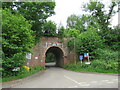
Railway bridge at Gomshall
by Malc McDonald
geograph for square TQ0847
An arch bridge carries the North Downs Line over a narrow lane in Gomshall. The... (more)
|
|
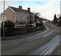
Warning sign 13' 3" headroom bridge half a mile ahead, Hawarden Road, Caergwrle, Flintshire
by Jaggery
geograph for square SJ3156
The sign faces the A550 Hawarden Road near the A541 Wrexham Road junction,... (more)
|

|
Warning sign - 11' 0" bridge ahead, Abercarn
by Jaggery
geograph for square ST2194
This Link railway bridge is above Bridge... ( more) |
|
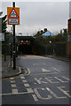
Low railway bridge over Lower Downs Road
by Christopher Hilton
geograph for square TQ2369
|

|
Railway bridge near Watford Junction
by Malc McDonald
geograph for square TQ1197
This bridge carries the railway line over a road near Watford Junction station.... (more)
|

|
Lanacar Lane with traffic warnings
by David Smith
geograph for square SD8489
|

|
Warning sign - traffic lights and low bridge ahead, North Road, Newbridge
by Jaggery
geograph for square ST2197
The bilingual (English/Welsh) sign faces North Road on the descent to this... (more)
|

|
Low bridge 180 yards ahead, Main Road, Havenstreet
by Jaggery
geograph for square SZ5589
On the northern approach to this Link bridge. |
|
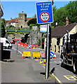
Low bridge 50 yards ahead, High Street, Templecombe
by Jaggery
geograph for square ST7022
The headroom under the railway bridge Link... ( more) |

|
Low bridge 110 yards ahead, Llwydcoed
by Jaggery
geograph for square SN9804
The road descends from the corner of Lon Las... (more)
|
|
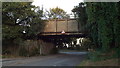
Low bridge, Gas Road, Sittingbourne
by Malc McDonald
geograph for square TQ9064
This bridge carries the Sittingbourne & Kemsley Light Railway across Gas... (more)
|
|
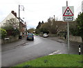
Warning sign - low bridge 1 mile ahead, Parkfield Road, Pucklechurch
by Jaggery
geograph for square ST6976
The sign is at the edge of a grass triangle one mile from a bridge with 11'... (more)
|

|
Junction in Havenstreet
by Jaggery
geograph for square SZ5589
Station Road on the left leads to the entrance... (more)
|

|
Warning sign - low bridge ahead, Copperhill Street, Aberdovey
by Jaggery
geograph for square SN6196
Copperhill Street ascends towards the bridge carrying the Cambrian Coast... (more)
|

|
Warning sign - 9' 3" headroom bridge, Cardiff Road, Dinas Powys
by Jaggery
geograph for square ST1571
The sign on the left facing westbound vehicles on the A4055 Cardiff Road warns... (more)
|

|
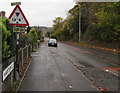
Warning sign - low bridge 80 yards ahead, Mill Lane, Chepstow
by Jaggery
geograph for square ST5393
On the approach to this Link railway bridge. |
|
Warning sign - low bridge 600 yards ahead, Hartshill, Telford
by Jaggery
geograph for square SJ6810
Facing Hartshill on the approach to this... (more)
|
|
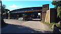
Railway bridge near Higham
by Malc McDonald
geograph for square TQ7073
This railway bridge over Canal Road carries freight trains heading to/from the... (more)
|
|
Railway bridge, Mackadown Lane
by Christine Johnstone
geograph for square SP1586
Close to the junction with Tile Cross Road, this bridge is just about at the... (more)
|
|
Railway bridge, Mackadown Lane
by Christine Johnstone
geograph for square SP1586
Carrying the main Birmingham - London line, and built when this was farmland,... (more)
|

|
Warning sign facing Station Road, Brithdir
by Jaggery
geograph for square SO1502
Informing drivers of vehicles about to turn right that a 10' 6"... (more)
|

|
Low Bridge on Bailick Road
by David Dixon
geograph for square W8872
Bridge carrying the N25 to the south of Midleton.
|
|
Aqueduct, Maryhill Road
by David Dixon
geograph for square NS5668
The A81 (Maryhill Road) passes under the Forth and Clyde Canal.
|

|
Approaching bridge 60, Monmouthshire & Brecon Canal
by M J Roscoe
geograph for square SO3002
Looking upstream on NCR 49
|
