
|
Warning sign - staggered crossroads ahead, Cwmcarn
by Jaggery
geograph for square ST2193
Facing northbound traffic on the A467 on the approach to Abercarn.
|

|
Warning sign - staggered crossroads ahead, Woolaston
by Jaggery
geograph for square ST5898
The sign faces westbound traffic on the A48 on the approach to the St Briavels... (more)
|
|
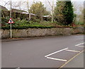
Warning sign - staggered crossroads ahead, Newport Road, Albrighton
by Jaggery
geograph for square SJ8004
Facing the Whiteladies Court junction, the red-edged triangular sign is on the... (more)
|

|
Warning signs facing the B4348, Much Dewchurch
by Jaggery
geograph for square SO4831
Staggered minor crossroads and school ahead.
|

|
Warning sign - staggered crossroads, Monmouth
by Jaggery
geograph for square SO5014
The sign faces northbound traffic on the A466 Hereford Road in Manson's... (more)
|

|
Staggered minor crossroads warning sign, Llanfrechfa Way, Cwmbran
by Jaggery
geograph for square ST3094
In the Llanyravon (or Llanyrafon) area of Cwmbran.
|

|
Warning sign - staggered crossroads, Gwscwm Road, Pembrey
by Jaggery
geograph for square SN4301
On the approach to the Furnace Road junction and the Y Cwm junction.
|

|
Warning sign - staggered crossroads near Castleton
by Jaggery
geograph for square ST2482
Facing vehicles heading SW on the A48 between Castleton and Cardiff.
|

|
Warning sign - staggered minor crossroads, Tythegston
by Jaggery
geograph for square SS8578
Alongside the A4106 Bridgend Road.
|

|
Warning sign - staggered crossroads, Libanus, Powys
by Jaggery
geograph for square SN9925
Facing northbound traffic on the A470, the main road through Libanus.
An... (more)
|
|
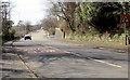
Gwscwm Road towards the centre of Pembrey
by Jaggery
geograph for square SN4301
Here named Gwscwm Road, the A484 from Burry Port heads towards the centre of... (more)
|
|
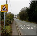
Warning sign - staggered crossroads ahead, Penrhiwfer
by Jaggery
geograph for square ST0089
Alongside the B4278 Penrhiwfer Road near the southern edge of the village.
|

|
A494 approaching staggered crossroads at Bethel
by David Dixon
geograph for square SH9839
|

|
Northbound A470, Trericket Bridge
by David Dixon
geograph for square SO1141
|

|
Eastbound A17 near Walpole Cross Keys
by David Dixon
geograph for square TF5020
|
|
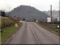
A81, Dumgoyne
by David Dixon
geograph for square NS5282
The southbound A81, near the turning for the Glengoyne Distillery.
|

|
Letheringsett, Southbound A148
by David Dixon
geograph for square TG0638
Letheringsett is a village which straddles the A148 King’s Lynn to Cromer road.... (more)
|

|
B6049 near Windmill
by David Dixon
geograph for square SK1777
|

|
Westbound A17 near to Terrington St Clement
by David Dixon
geograph for square TF5519
|

|
Westbound A17 near to Tilney All Saints
by David Dixon
geograph for square TF5719
|

|
Holbeach Bypass, Westbound
by David Dixon
geograph for square TF3625
At Holbeach, the A17 becomes the town's (single carriageway) bypass. The... (more)
|

|
Northbound A134 near Thetford Rugby Club
by David Dixon
geograph for square TL8586
|

|
A52 near Bottesford
by David Dixon
geograph for square SK8037
|

|
Eastbound A17 Approaching Crossroads
by David Dixon
geograph for square SK9153
|
|
Eastbound A47
by David Dixon
geograph for square TF9712
|

|
A390 between Threemilestone and Three Burrows
by David Dixon
geograph for square SW7646
|

|
A3400 near Mitford Bridge
by David Dixon
geograph for square SP2637
|

|
Layby on the Eastbound A17
by David Dixon
geograph for square TF4421
|

|
Washway Road, Westbound
by David Dixon
geograph for square TF3230
|

|
Westbound A66, passing Mousthwaite Comb
by David Dixon
geograph for square NY3427
|

|
N71 northbound between Clonakilty and Bandon
by David Dixon
geograph for square W4150
|
|
A47 near Poplar Farm
by David Dixon
geograph for square TF9612
|

|
Westbound A52 near Saxondale
by David Dixon
geograph for square SK6739
|

|
A607, near Belton
by David Dixon
geograph for square SK9340
|

|
A534, Layby near Brookhouse Green
by David Dixon
geograph for square SJ8162
|

|
Stockbury Valley
by David Dixon
geograph for square TQ8360
|

|
Southbound A56
by David Dixon
geograph for square SD7728
Looking south from the lay-by near Moleside Moor.
|

|
A390, West Taphouse
by David Dixon
geograph for square SX1563
West Taphouse is a hamlet in Cornwall, England. It is on the A390 road west of... (more)
|
|
B9006, Culloden Road
by David Dixon
geograph for square NH7144
|

|
A703 near Waterheads
by David Dixon
geograph for square NT2450
|

|
A683, Tunstall
by David Dixon
geograph for square SD6073
Tunstall is a village in north Lancashire, approximately 11 miles northeast of... (more)
|

|
Westbound A95
by David Dixon
geograph for square NH9822
|

|
Layby on the A483 North of Crossgates
by David Dixon
geograph for square SO0865
|

|
A148 Eastbound Through White Hills Wood
by David Dixon
geograph for square TF6924
|
|
Hayley's Snack Shack
by David Dixon
geograph for square SJ5984
Mobile catering in a layby on the A56 near to Higher Walton.
|

|
Westbound A52 (Grantham Road) approaching Radcliffe on Trent
by David Dixon
geograph for square SK6639
|

|
Westbound A52, Easthorpe
by David Dixon
geograph for square SK8138
|
