Public Tags
Showing images tagged with warning:Falling Rocks tag.
|
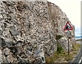
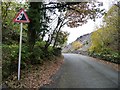
Warning of rock falls
by Gerald England
geograph for square SH7583
Around a bend on Marine Drive, a sign warns of rock falls.
|
|
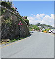
Warning sign - risk of rock falls, Hannafore Road, West Looe
by Jaggery
geograph for square SX2552
Below Rock Towers apartments. Link |
|
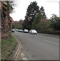
Warning sign - risk of falling rocks, Wilton Road, Ross-on-Wye
by Jaggery
geograph for square SO5924
The sign is located here. Link |
|
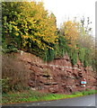
Falling rocks warning sign, Ross-on-Wye
by Jaggery
geograph for square SO5924
The sign is alongside Wilton Road.
|
|
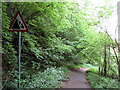
Beware of falling rocks on the way to Tanyrallt
by Christine Johnstone
geograph for square SH4952
There are disused slate tips on both sides of the road.
|
|
Falling rocks warning sign north of a disused railway bridge near Upper Redbrook
by Jaggery
geograph for square SO5410
North of this Link bridge. There is a... ( more) |
|
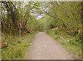
Old railway line, by Loch Oich
by Craig Wallace
geograph for square NN3098
Once part of the Invergarry and Fort Augustus Railway.
Now part of the Great... (more)
|
|
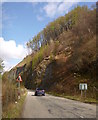
A890 road below steep slopes, by Loch Carron
by Craig Wallace
geograph for square NG9037
The A890 road and the railway run along the south shore of Loch Carron. Here the... (more)
|
|
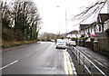
Merthyr Road below a former quarry, Pontypridd
by Jaggery
geograph for square ST0790
Houses on the NW side of the A4054 Merthyr Road face a wooded slope near a... (more)
|
|
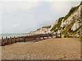
Falling Sands Beach, Holywell
by David Dixon
geograph for square TV6097
Looking towards the chalk cliffs of Beachy Head from Holywell Retreat.
The... (more)
|
|
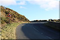
Road to Port William
by Billy McCrorie
geograph for square NX2650
|