Public Tags
Tag: Wartime·Relic
Showing latest 50 of 103 images tagged with Wartime Relic tag.

|
Flotta: wartime lookout on Stanger Head
by Chris Downer geograph for square ND3792 Flotta is peppered with wartime relics as it was an important strategic location... (more)
Tags:
top:Coastal
top:Defence, Military
top:Derelict, Disused
Headland
top:Islands
Lookout
subject:Observation Post
Wartime Defences
Wartime Relic
|

|
Neglected pillbox
by Tiger for square TL4359 At the edge of the Ascension burial ground in All Saints' Lane, this... (more)
Tags:
top:Burial Ground, Crematorium
type:Close Look
top:Defence, Military
top:Historic Sites and Artefacts
subject:Pillbox
top:Suburb, Urban Fringe
Wartime Defences
Wartime Relic
|

|
Talacre: a wartime relic on the beach
by Chris Downer geograph for square SJ1285 This concrete lump looks as if it was probably a pillbox or other wartime... (more)
|

|
Kimmeridge: a wartime relic watches over us
by Chris Downer geograph for square SY9079 A family enjoys the spectacular coastline of Kimmeridge Bay as an alien-like... (more)
|

|
Pill box, Portrush
by Albert Bridge for square C8640 Category: Wartime relics The north coast of NI faces the Atlantic and, during WWII, there was a... (more)
|

|
Lepe House
by Andy Stephenson geograph for square SZ4498 Records from 1752 show that Lepe House was originally an alehouse called The... (more)
Tags:
river:Beaulieu
Beaulieu River
top:Coastal
D-Day
top:Estuary, Marine
type:Geograph
Hampshire
Historic Building
subject:Historic Building
Historic House
top:Historic Sites and Artefacts
subject:House
top:Housing, Dwellings
Wartime Relic
Wartime Relics
|

|
Pillbox by the River Stour
by Glyn Baker for square TL8838 A wartime relic by the river.
Tags:
type:Cross Grid
top:Defence, Military
top:Derelict, Disused
top:Historic Sites and Artefacts
Pillbox
Wartime Relic
|

|
Salt Ness
by Bill Boaden geograph for square HY4719 A low headland distinguished by its wartime relics.
Tags:
top:Coastal
top:Estuary, Marine
type:Geograph
top:Historic Sites and Artefacts
top:Islands
Wartime Relic
|

|
Lerwick: lookout relic on The Knab
by Chris Downer geograph for square HU4740 An old wartime instalment, no doubt providing a lookout along Bressay Sound,... (more)
|

|
Water storage tank, Savernake Forest, Wiltshire (2)
by Brian Robert Marshall geograph for square SU2365 Category: Wartime relics In the second world war Savernake Forest was a huge ammunition depot. It stored... (more)
Tags:
top:Defence, Military
top:Derelict, Disused
top:Historic Sites and Artefacts
top:People, Events
Wartime Relic
top:Woodland, Forest
|

|
Water storage tank, Savernake Forest, Wiltshire (1)
by Brian Robert Marshall for square SU2365 Category: Wartime relics In the second world war Savernake Forest was a huge ammunition depot. It stored... (more)
Tags:
top:Defence, Military
top:Derelict, Disused
top:Historic Sites and Artefacts
top:People, Events
Wartime Relic
top:Woodland, Forest
|

|
Entrance to North Meadow National Nature Reserve, Cricklade, Wiltshire
by Brian Robert Marshall geograph for square SU0994 Category: Entrance The fourteen concrete blocks at the side of the entrance are wartime relics from... (more)
|

|
Pillbox on the beach near Bridge of Don, Aberdeen
by Malc McDonald geograph for square NJ9510 A derelict wartime pillbox on the beach near Aberdeen, on Scotland's North Sea coast.
Tags:
near:Aberdeen
subject:Beach
Beach
near:Bridge of Don
top:Coastal
Concrete Structure
top:Defence, Military
top:Derelict, Disused
type:Geograph
Observation Post
Pillbox
Sand Beach
Sandy Beach
country:Scotland
Wartime Defences
Wartime Fortifications
Wartime Relic
WW2 Observation Post
|

|
Pillbox on the beach near Bridge of Don, Aberdeen
by Malc McDonald geograph for square NJ9510 A derelict wartime pillbox on the beach near Aberdeen, on Scotland's North Sea coast.
Tags:
near:Aberdeen
Beach
near:Bridge of Don
top:Coastal
Concrete Structure
top:Defence, Military
top:Derelict, Disused
type:Geograph
Observation Post
Pillbox
subject:Pillbox
Sand Beach
Sandy Beach
country:Scotland
Wartime Defences
Wartime Fortifications
Wartime Relic
WW2 Observation Post
|

|
Pillbox and wind turbine near Bridge of Don, Aberdeen
by Malc McDonald geograph for square NJ9510 A derelict wartime pillbox on the beach near Abderdeen, on Scotland's North... (more)
Tags:
near:Aberdeen
Beach
near:Bridge of Don
top:Coastal
Concrete Structure
top:Defence, Military
top:Derelict, Disused
top:Energy Infrastructure
type:Geograph
Observation Post
subject:Pillbox
Pillbox
Sand Beach
Sandy Beach
country:Scotland
Wartime Defences
Wartime Fortifications
Wartime Relic
Wind Turbine
WW2 Observation Post
|

|
Beach and pillbox near Bridge of Don, Aberdeen
by Malc McDonald geograph for square NJ9510 A view north along the sandy beach near Aberdeen, on Scotland's North Sea... (more)
Tags:
near:Aberdeen
Beach
near:Bridge of Don
top:Coastal
Concrete Structure
top:Defence, Military
top:Derelict, Disused
type:Geograph
Observation Post
Pillbox
subject:Pillbox
Sand Beach
Sandy Beach
country:Scotland
Wartime Defences
Wartime Fortifications
Wartime Relic
WW2 Observation Post
|
|
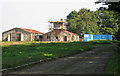
Relic of RAF Ingham
by David Wright geograph for square SK9585 WWII buildings now in use for agricultural purposes.
|

|
Hurn: a tree growing out of some concrete remnants
by Chris Downer geograph for square SZ1396 The slopes of Ramsdown Plantation are peppered with old wartime remains, of... (more)
Tags:
top:Defence, Military
top:Derelict, Disused
type:Geograph
Roots
Tree
subject:Tree
Wartime Defences
Wartime Relic
top:Wild Animals, Plants and Mushrooms
|

|
Wartime Target in Luce Bay
by Mary and Angus Hogg for square NX1252 Viewed from the next square, the concrete pillars are all that's left of a... (more)
|

|
Cylinder and pillbox
by Bill Nicholls geograph for square SU9256 These anti-tank cylinders would have been used in conjunction with the... (more)
|

|
Knipe Point or Osgodby Point
by Pauline E geograph for square TA0685 Viewed from the old wartime defences which have tumbled onto the beach.
|

|
Brick circle, Orlock, Groomsport/Donaghadee (July 2018)
by Albert Bridge for square J5682 A brick circle in the lay-by J5682 : Old road line, Orlock, Groomsport/Donaghadee (July 2018). It has the appearance of a WWII... (more)
Tags:
type:Close Look
top:Derelict, Disused
place:Donaghadee
place:Groomsport
Wartime Relic
World War II Relic
|

|
Old air raid shelter, Belvoir forest, Belfast (August 2014)
by Albert Bridge geograph for square J3369 During World War II Belvoir forest was used by the army and navy – see... (more)
Tags:
place:Belfast
Forest
Former Air Raid Shelter
subject:Military Relic
top:Park and Public Gardens
Wartime Relic
top:Woodland, Forest
World War II
World War II Relic
|

|
RAF Bomb Shelter at Chester Castle
by Jeff Buck for square SJ4065 This domed concrete structure was originally located at the end of the runway at... (more)
Tags:
Barrack Yard
Bomb Shelter
Castle
county:Cheshire
place:Chester
place:Chester Castle
Chester Castle
top:Defence, Military
country:England
top:Historic Sites and Artefacts
subject:Military Relic
RAF Relic
Wartime Relic
|

|
Wartime shelter remains
by Richard Croft geograph for square SK8627 Overgrown remains of a WW2 shelter in Cooper's Plantation associated with... (more)
|

|
WW2 Remnants in the Woods
by Des Blenkinsopp geograph for square SU6580 There are several structures like this in the woods around here, left over from... (more)
|

|
Churchill
by Richard Croft for square TF1059 Winston Churchill says 'You Deserve Victory' from a wartime poster at... (more)
|

|
Moss-covered cylinder
by Bill Nicholls for square SU9256 Another little surprise was finding a moss-covered anti-tank cylinder behind the pillbox.
|
|
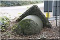
The top of the block
by Bill Nicholls for square SU9256 This would have been the top of the roadblock at Curzon Bridge; I might add that... (more)
|

|
A better view
by Bill Nicholls for square SU9256 This gives a better view and more of an idea as to what the dragon's tooth... (more)
|

|
And better still
by Bill Nicholls for square SU9256 Took me a few moments to realise that this was a dragon's tooth which had... (more)
|

|
On its side
by Bill Nicholls for square SU9256 Day got better as well finding this roadblock which had been pushed over on its side.
|

|
Position of the tooth
by Bill Nicholls geograph for square SU9256 Not sure if it was here originally but there would have been a whole lot of them... (more)
|

|
A lonely tooth
by Bill Nicholls for square SU9256 A lonely dragon's tooth left over from the Second World War sits beside the... (more)
|
|
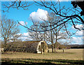
Old Airfield Huts
by Des Blenkinsopp geograph for square SU4699 Old WW2 relics formerly part of RAF Abingdon. There are several more in this field.
Tags:
top:Derelict, Disused
Wartime Relics
|
|
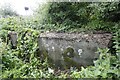
The whole side
by Bill Nicholls geograph for square SU5266 After a couple of minutes treading down stingers I reveal the whole side and can... (more)
|

|
All filled in
by Bill Nicholls for square SU5266 Here we see the area that would have held the gun on a hold fast. It is now... (more)
|
|
There you are
by Bill Nicholls for square SU5266 So after tramping a few stingers down you see the side of a gunpit and one end.... (more)
|

|
Confirmation of the gunpit
by Bill Nicholls for square SU5266 Then after following along the concrete I came out the other end and confirmed... (more)
|

|
Corner of the gunpit
by Bill Nicholls for square SU5266 After crawling under the bush I came out the other side and spotted a corner,... (more)
|

|
Where the rail went
by Bill Nicholls geograph for square TQ0347 This is the first of this type of road block I have seen which I think is a rail... (more)
|

|
World War II Pill Box
by Richard Carter geograph for square TF2009 Old WWII pill box near Newborough
Tags:
top:Defence, Military
subject:Defences
Defences
type:Geograph
top:Grassland
Newborough
place:Peterborough
Pill Box
Pillbox
Pillboxes
War
Wartime Defences
Wartime Relic
World War II
World War II Defences
|

|
Ringstead: pillbox to the east of Bran Point
by Chris Downer geograph for square SY7481 One of two wartime lookouts (see SY7481 : Osmington Mills: pillbox on Bran Point and view of White Nothe), this is the more easterly and... (more)
Tags:
Cliffs
Coast Path
top:Coastal
top:Defence, Military
type:Geograph
Lookout
top:Paths
subject:Pillbox
Pillbox
View
Wartime Relic
|

|
Osmington Mills: pillbox on Bran Point and view of White Nothe
by Chris Downer for square SY7481 A wartime lookout cuts a rather bleak figure on the top of Bran Point, just... (more)
Tags:
top:Coastal
type:Cross Grid
top:Defence, Military
top:Historic Sites and Artefacts
Lookout
subject:Pillbox
Pillbox
Wartime Relic
|

|
Flotta: the old signal station from the rear
by Chris Downer geograph for square ND3792 Another view of ND3792 : Flotta: old signal station at Stanger Head from across a pond of water, possibly natural but... (more)
Tags:
top:Defence, Military
top:Derelict, Disused
top:Islands
subject:Signal Station
Signal Station
Wartime Defences
Wartime Relic
|

|
Flotta: old signal station at Stanger Head
by Chris Downer geograph for square ND3792 The former Naval signal station stands as a brash ruin above the disused quarry... (more)
Tags:
top:Defence, Military
top:Derelict, Disused
top:Islands
Quarry
top:Quarrying, Mining
subject:Signal Station
Signal Station
Wartime Defences
Wartime Relic
|

|
Flotta: looking out from a lookout on Stanger Head
by Chris Downer for square ND3792 The seaward view from ND3792 : Flotta: wartime lookout on Stanger Head.
Tags:
top:Coastal
top:Defence, Military
top:Derelict, Disused
Headland
top:Islands
Lookout
subject:Observation Post
View
Wartime Defences
Wartime Relic
|

|
Wartime remains on Carn Llidi
by Bill Boaden geograph for square SM7327 This site was used in both world wars, for observation and communication. It has... (more)
Tags:
top:Derelict, Disused
top:Farm, Fishery, Market Gardening
top:Heath, Scrub
top:Uplands
Wartime Relics
|

|
Old wartime buildings at Gilmerton
by M J Richardson geograph for square NT5477 I presume part of the old East Fortune Airfield, and still in use.
|

|
Interior, former searchlight emplacement, Grey Point, Helen's Bay
by Albert Bridge for square J4583 The inside of this former searchlight emplacement J4583 : Old searchlight at Grey Point (1). Warning for... (more)
|
