Public Tags
Tag: Watercourse
Other tags: former:Watercourse
Showing latest 50 of 102 images tagged with Watercourse tag.
|
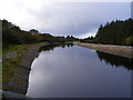
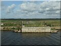
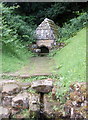
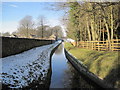
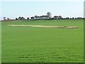
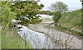
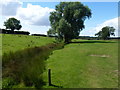
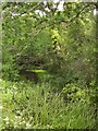
Artificial watercourse - Arduns Townland
by Mac McCarron geograph for square B8422 Category: Watercourse This watercourse has been constructed to take water from Lough Nacung Lower to a... (more)
|
|
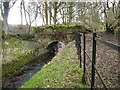
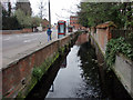
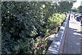
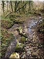
Small stone bridge over watercourse
by Maggie Cox geograph for square SJ2748 This watercourse runs from the Cae-Llwyd reservoir. Whilst the watercourse has... (more)
Tags:
type:GeographX
top:LowlandsX
Old Stone BridgeX
top:Rivers, Streams, DrainageX
top:Water ResourcesX
Watercourse
|
|
Carshalton Park: dry watercourse
by Christopher Hilton geograph for square TQ2864 Along the east side of Carshalton Park, this depression leading down from what... (more)
|
|
Watercourse, Dudbridge
by Chris Allen for square SO8304 This is between the main road and a Sainsbury's at Dudbridge and is likely... (more)
Tags:
type:Close LookX
place:DudbridgeX
subject:Water InfrastructureX
top:Water ResourcesX
Watercourse
|
|
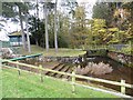
Whittledean Watercourse
by Oliver Dixon geograph for square NY9776 At the foot of the dam retaining Hallington East Reservoir, water enters the... (more)
Tags:
type:GeographX
SpillwayX
subject:Water InfrastructureX
top:Water ResourcesX
Watercourse
top:Woodland, ForestX
|
|
Whittle Dene Watercourse, Matfen
by Jeff Buck geograph for square NZ0371 The Whittle Dean Watercourse at Matfen.
Wikipedia Matfen... (more)
Tags:
country:EnglandX
type:GeographX
place:MatfenX
county:NorthumberlandX
top:Rivers, Streams, DrainageX
top:Village, Rural SettlementX
Watercourse
|
|
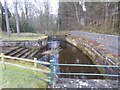
Whittledean Watercourse
by Oliver Dixon geograph for square NY9776 Head of the Whittledean Watercourse which carries water from the Hallington... (more)
Tags:
FootbridgeX
type:GeographX
subject:LeatX
LeatX
top:PathsX
SpillwayX
top:Water ResourcesX
Watercourse
|
|
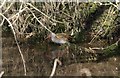
Water rail, Hackney Marshes
by Derek Harper geograph for square SX8772 Category: Birds I managed to let slip the best opportunity for photographing this water rail... (more)
|
|
Watercourse on Ince Banks, Mersey estuary
by Christine Johnstone geograph for square SJ4777 The water from Hoolpool Gutter and other drains is siphoned under the Manchester... (more)
|
|
Beverley and Barmston Drain
by Graham Robson geograph for square TA0541 Looking along a man made watercourse from a bridge which crosses the drainage channel.
|
|
Watercourse near Norton Way, Carterton, Oxon
by P L Chadwick geograph for square SP2807 Probably either a drainage channel or a small stream. Behind the camera position... (more)
|
|
The Ainsty Beck
by Chris Heaton geograph for square SE4450 A sluggish watercourse, given the rather grand title of "beck" -... (more)
|
|
Wellhead for Mount Grace Priory
by Bill Harrison geograph for square SE4598 Mount Grace Priory, established in 1398, had (for its time) a sophisticated... (more)
Tags:
top:Historic Sites and ArtefactsX
top:Religious SitesX
top:Water ResourcesX
Watercourse
WellheadX
|
|
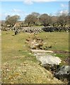
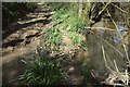
Sluggish Watercourse below Sweet Hill
by Chris Heaton geograph for square SE0071 One of many peaty water channels -resembling blood vessels on the map, that... (more)
|
|
Blacko Water
by Chris Heaton geograph for square SD8541 The watercourse just before it empties into Pendle Water - Pendle Way long... (more)
|
|
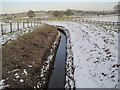
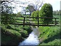
Watercourse near Hallington
by Les Hull geograph for square NY9876 |
|
Watercourse from Hallington Reservoir
by Les Hull geograph for square NY9875 |
|
Fields near Oldington Bridge, near Kidderminster
by P L Chadwick geograph for square SO8273 Some of the watercourses here appear to have been made recently, presumably to... (more)
|
|
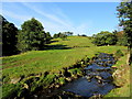
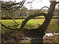
Carshalton: watercourse
by Christopher Hilton geograph for square TQ2864 Running from Carshalton Park towards the Wandle, this wide strip of land boasts... (more)
|
|
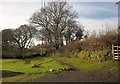
Watercourse near Sandhurst
by Julian P Guffogg geograph for square TQ8027 Tags:
top:Farm, Fishery, Market GardeningX
top:Rivers, Streams, DrainageX
near:SandhurstX
Watercourse
|
|
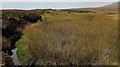
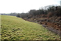
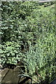
The line of a watercourse, east of Swine Lane
by Christine Johnstone geograph for square SE4016 Marked out by tall dry grass.
|
|
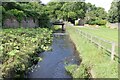
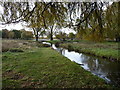
Watercourse by Lake, Bourne Hall, Ewell West, Surrey
by Christine Matthews geograph for square TQ2162 |
|
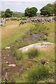
Sheep dip and pens, Maas Townland
by Mac McCarron geograph for square G7697 Category: Sheep-dip The dipper seems to have been supplied with water via road run-off and drained... (more)
|
|
|
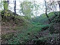
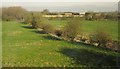
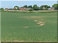
Looking over farmland from the railway towards houses on Binnimoor Road
by Christopher Hilton geograph for square TL4396 The contour lines in this area of the map suggest that a watercourse may have... (more)
Tags:
top:Farm, Fishery, Market GardeningX
subject:FieldX
top:Flat LandscapesX
type:GeographX
former:Watercourse
|
|
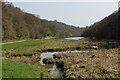
Somewhere in there is a river
by Bob Harvey geograph for square SP7387 Looking downstream from SP7387 : Footbridge along the watercourse of the River Welland.
Tags:
type:GeographX
top:LowlandsX
place:Market HarboroughX
subject:RiverX
river:River WellandX
top:Rivers, Streams, DrainageX
top:Suburb, Urban FringeX
Watercourse
Welland BridgesX
|
|
Walled in river
by Bob Harvey geograph for square SP7387 The Welland has been ruthlessly restrained to this narrow watercourse.
Tags:
type:GeographX
top:LowlandsX
place:Market HarboroughX
subject:RiverX
river:River WellandX
RiverbankX
top:Rivers, Streams, DrainageX
top:Suburb, Urban FringeX
Watercourse
|
|
There is water
by Bob Harvey geograph for square SP7387 Taken from the same spot as SP7387 : Downstream from the footbridge (you can see the shadow of one of the... (more)
Tags:
top:City, Town CentreX
bridge:FootbridgeX
type:GeographX
top:LowlandsX
place:Market HarboroughX
subject:RiverX
river:River WellandX
top:Rivers, Streams, DrainageX
Town CentreX
Watercourse
Welland BridgesX
|
|
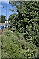
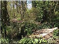
Flytipping by Ridgeway Lane near Longhole Bridge
by Robin Stott geograph for square SP3863 A watercourse runs parallel to the canal on the south side. Ridgeway Lane, which... (more)
Tags:
postcode district:CV47X
Dumping GroundX
FlytippingX
type:GeographX
canal:Grand Union CanalX
top:LowlandsX
top:PathsX
top:Rivers, Streams, DrainageX
season:SpringX
top:Waste, Waste ManagementX
Watercourse
|
|
Nettledale
by Chris Heaton geograph for square SE5584 The watercourse of Grass Keld running down the valley of Nettledale, before... (more)
|
|
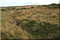
Moorland, Holne Moor
by Derek Harper geograph for square SX6770 No sign of this watercourse on the map; perhaps it represents some exploratory working.
|
|
Watercourse, Emsworthy
by Derek Harper geograph for square SX7476 In spite of a prodigiously dry and sunny spring, there is water along the... (more)
Tags:
Access LandX
national park:DartmoorX
Dry Stone WallsX
type:GeographX
MoorlandX
top:MoorlandX
Nature ReserveX
top:Rivers, Streams, DrainageX
RockX
top:Rocks, Scree, CliffsX
TreesX
top:UplandsX
Watercourse
|
|
Watercourse connecting Lynford Lakes
by David Pashley geograph for square TL8193 Tags:
Breckland NorfolkX
top:Flat LandscapesX
type:GeographX
top:Rivers, Streams, DrainageX
Watercourse
top:Woodland, ForestX
|
|
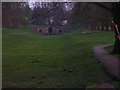
Outflow from Leg of Mutton Pond, Bushy Park
by Christine Johnstone geograph for square TQ1669 Not a natural watercourse.
Tags:
season:AutumnX
Bushy ParkX
type:GeographX
subject:ParkX
top:Park and Public GardensX
Royal ParkX
Watercourse
|
|
Dry watercourse, east of Lodge Farm
by Christine Johnstone geograph for square SD8261 Issue-fed, and obviously in spate sometimes.
Tags:
type:GeographX
near:Lodge FarmX
top:Rivers, Streams, DrainageX
subject:StreamX
Water ErosionX
Watercourse
|
|
Monkey flower, Elmley Castle
by Derek Harper for square SO9841 Mimulus guttatus thrives in this watercourse by Main Street.
|
|
Footpath through the dip
by Ian Calderwood geograph for square SK4825 The path follows the line of the hedge into the dip, across the watercourse and... (more)
|
|
Dry watercourse, Emsworthy
by Derek Harper geograph for square SX7476 With the red-roofed barn in the background.
|
|
River mouth, Belfast Lough (May 2016)
by Albert Bridge geograph for square J3479 See J3478 : Watercourse, Belfast (1) (May 2011). The same watercourse (most likely the Shore Road... (more)
Tags:
place:BelfastX
place:Belfast LoughX
top:CoastalX
type:GeographX
RiverX
subject:RiverX
River MouthX
top:Rivers, Streams, DrainageX
Watercourse
|
|
Leap required on the Monarch's Way
by Derek Harper geograph for square SY4296 The watercourse occupying the Way here has broken through the bank shown in... (more)
Tags:
top:Boundary, BarrierX
FordX
Green LaneX
long distance path:Monarchs WayX
Other Route with Public AccessX
top:PathsX
top:Rivers, Streams, DrainageX
TreesX
Watercourse
|
|
Footbridge over an un-named watercourse
by Ian Calderwood geograph for square SK4431 The bridge is in a deteriorating state, with cracked and missing timbers and... (more)
Tags:
subject:BridgeX
BrookX
DrainX
top:Farm, Fishery, Market GardeningX
FootbridgeX
FootpathX
top:PathsX
top:Rivers, Streams, DrainageX
Watercourse
|
|
Castle Lane, Wilton
by Derek Harper geograph for square SU0931 One of many watercourses in Wilton runs beside this last stretch of the lane as... (more)
|
|
Ancient pasture and brook near Papley
by Richard Humphrey geograph for square TL1088 Papley is a deserted medieval village not far from this watercourse
|
|
Bridleway, Water Cleave
by Derek Harper geograph for square SX7680 Water Cleave is the steep, mostly wooded, southern valley side of the River... (more)
Tags:
national nature reserve:Bovey Valley WoodlandsX
BridlewayX
national park:DartmoorX
top:LowlandsX
top:PathsX
top:Rivers, Streams, DrainageX
Watercourse
WoodlandX
top:Woodland, ForestX
|
|
Tree, Middlemoor
by Derek Harper geograph for square SX4972 From Tavistock Footpath 9, this tree (an ash, I think) can be seen on the left... (more)
Tags:
Access LandX
tree:AshX
top:GrasslandX
GrasslandX
top:LowlandsX
top:Rivers, Streams, DrainageX
Watercourse
|
|
Path to Whitchurch
by Derek Harper geograph for square SX4972 From the turning area at the end of the public road shown in SX4972 : Houses at Middlemoor,... (more)
Tags:
Access LandX
top:GrasslandX
Hedge on WallX
top:LowlandsX
top:PathsX
Public FootpathX
top:Rivers, Streams, DrainageX
TreesX
Watercourse
|
|
Channel, Hackney Marshes
by Derek Harper geograph for square SX8772 Looking up a watercourse that takes the Fairwater Leat down to the Teign, from a... (more)
Tags:
Local Nature ReserveX
top:LowlandsX
top:Rivers, Streams, DrainageX
TreesX
Watercourse
top:Woodland, ForestX
|
|
Watercourse near Alrewas
by Derek Harper geograph for square SK1815 A channel linking the River Tame near Croxall Lakes to ... well, nowhere much in... (more)
|
|
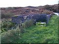
Canal infrastructure near Rodhill Corner
by Christine Johnstone geograph for square SE3330 It looks like a syphon taking a watercourse under the canal and into the River Aire.
Tags:
canal:Aire and CalderX
top:CanalsX
DrainX
top:Rivers, Streams, DrainageX
building material:StoneX
Watercourse
|
|
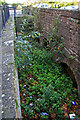
Watercourse, Combe St Nicholas
by Derek Harper geograph for square ST3011 The village is built around springs, and here a tiny stream has been channelled... (more)
|
|
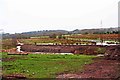
Signs of run-off
by Alan Murray-Rust geograph for square SK6345 Looking at older views on Google Earth shows that there was formerly a field... (more)
|