|
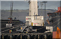
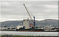
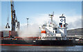
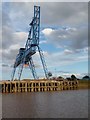
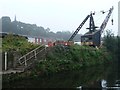
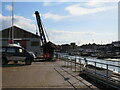
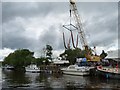
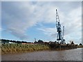
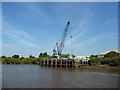
Crane, Belfast
by Rossographer
for square J3576
|
|
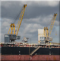
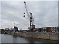
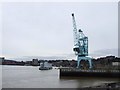
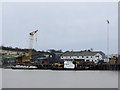
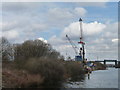
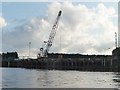
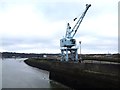
Cranes, Belfast
by Rossographer
for square J3576
|
|
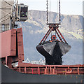
Crane grab, Belfast
by Rossographer
for square J3576
|
|
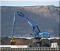
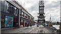
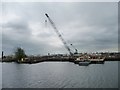
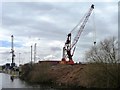
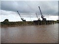
Crane, Belfast
by Rossographer
for square J3576
|
|
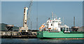
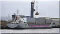
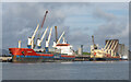
The 'Aasnes' at Belfast
by Rossographer
geograph for square J3576
100m (7,182 DWT) Gibraltar flagged vessel 'Aasnes'... (more)
|
|
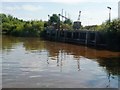
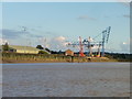
Wharfs, Belfast
by Rossographer
for square J3576
Stormont and West Twin wharfs in Belfast. This area is mostly used for... (more)
|
|
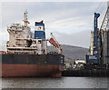
The 'Arklow Wood' departing Belfast
by Rossographer
for square J3576
150m (16,861 DWT) Irish flagged cargo vessel 'Arklow Wood'... (more)
|
|
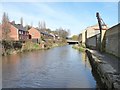
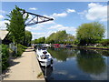
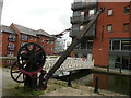
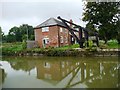
Crane, Dudbridge Wharf, Stroudwater Navigation
by Christine Johnstone
geograph for square SO8304
This is the last surviving crane on the Cotswolds Canals. It replaced an earlier... (more)
|
|
The 'Danae' at Belfast
by Rossographer
geograph for square J3576
183m (40,015 DWT) Liberian flagged bulk carrier 'Danae'... (more)
|
|
Container crane, Irlam Wharf
by Christine Johnstone
geograph for square SJ7293
This wharf has found a new use as a transhipment point for containers.
|
|
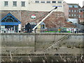
Prince's Wharf, Bristol
by Rossographer
geograph for square ST5872
Prince's Wharf in Bristol. The M Shed museum is on the left with the... (more)
|
|
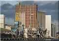
The 'CL Beijing' at Belfast
by Rossographer
geograph for square J3576
|
|
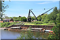
The largest crane on Flixborough Wharf, River Trent
by Christine Johnstone
geograph for square SE8514
Seen from the barge Sobriety, heading upstream on a rising tide. The barge is... (more)
|
|
Crane at Blue Boar Wharf, Rochester
by Chris Whippet
geograph for square TQ7468
|
|
The 'Hanife Ka' at Belfast
by Rossographer
for square J3576
130m (10,714 DWT) Turkish flagged coaster 'Hanife Ka'... (more)
|
|
Land-based crane, south bank, Wheatley Cut
by Christine Johnstone
geograph for square SE5905
Used to load steel piles before they are taken across the canal, to the bank... (more)
|
|
Wharf crane, Navigation Yard, Northwich
by Christine Johnstone
geograph for square SJ6573
Colonised by cormorants.
|
|
Phoenix Wharf, Strood
by Chris Whippet
geograph for square TQ7469
|
|
Ship air draft gauge, Irlam Wharf
by Christine Johnstone
geograph for square SJ7293
The small metal tower [between the two cranes]is one of a pair that stretches a... (more)
|
|
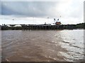
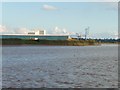
Ships at Belfast
by Rossographer
for square J3576
|
|
Crane at Seaclose Quay, Newport
by Malc McDonald
geograph for square SZ5089
A crane on the river bank at Seaclose Quay, on the bank of the River Medina in Newport.
|
|
Disused Crane on Lee Navigation
by PAUL FARMER
geograph for square TQ3488
|
|
Manchester Ship Canal beacon 356
by Christine Johnstone
geograph for square SJ7292
On the north bank, just below Irlam Wharf.
|
|
A crane at Iron Wharf, Faversham
by pam fray
geograph for square TR0262
Near the Saxon Shore Way next to Faversham Creek.
|
|
Canal crane on Ashton Canal, Manchester
by Colin Cheesman
geograph for square SJ8498
Construction of the Ashton Canal was started in 1796. It was built to provide... (more)
|
|
Disused wharf, east of Olympia Mill, Selby
by Christine Johnstone
geograph for square SE6232
On the south bank of the River Ouse.
|
|
Crane by Deptford Creek
by Chris Whippet
geograph for square TQ3777
|
|
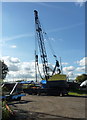
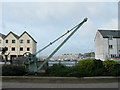
Crane - West Quay, Bridgwater
by Chris Allen
for square ST3037
An old crane survives from when ships used mud berths along the River Parrett.
|
|
Boat crane at Stourport Marina
by Christine Johnstone
geograph for square SO8169
Ready to lift boats in and out of the Severn.
|
|
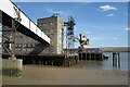
P D Port Services' Trentside Wharf, Keadby
by Christine Johnstone
geograph for square SE8311
On the west bank of the Trent. Seen from the barge Sobriety, as it turned to... (more)
|
|
Uppermost jetty, Grove Wharf, River Trent
by Christine Johnstone
geograph for square SE8413
Seen from the barge Sobriety, heading upstream on a rising tide. The barge is... (more)
|
|
Lower jetty, Neap House Wharf, River Trent
by Christine Johnstone
geograph for square SE8513
Seen from the barge Sobriety, heading upstream on a rising tide. The barge is... (more)
|
|
Burton Stather wharf, on the River Trent
by Christine Johnstone
geograph for square SE8618
My 1997 Nicholson's canal guide says 'Built and operated by Victor... (more)
|
|
Old crane, St. Mary's Island
by Chris Whippet
geograph for square TQ7670
|
|
Burbage Wharf, from the south-east
by Christine Johnstone
geograph for square SU2263
Built for freight, now used for housing.
|
|
Crane and Barge near the Lock
by Des Blenkinsopp
geograph for square SO8453
The yard upstream of the lock doesn't look to have changed much over the years.
|

|
Leeds and Liverpool Canal approaching Banks Bridge
by Luke Shaw
geograph for square SE0742
The Marquis of Granby pub in left background and remains of crane at left hand... (more)
|
|
Smaller upstream jetty on the River Ouse at Howdendyke
by Christine Johnstone
geograph for square SE7526
Loose white mineral cargo is unloaded here.
|
|
Little jetty, big wharf, Flixborough Stather
by Christine Johnstone
geograph for square SE8514
Seen from the barge Sobriety, heading upstream on a rising tide. The barge is... (more)
|
|
The Trent at Flixborough Wharf
by Christine Johnstone
geograph for square SE8514
Seen from the barge Sobriety, heading upstream on a rising tide. The barge is... (more)
|
|
Prince's Wharf, Bristol
by David P Howard
geograph for square ST5872
Part of the Floating Harbour.
|
|
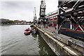
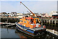
Portrush Lifeboat, Girvan Harbour
by Billy McCrorie
geograph for square NX1898
RNLB "William Gordon Burr"
|
|
Building on the Pier
by Des Blenkinsopp
geograph for square TQ5079
Some of the riverside piers are big constructions.
This is a five storey... (more)
|
|
Looking West from Cremyll Street, Stonehouse
by Mike Lyne
geograph for square SX4653
The view from Cremyll Street looking west towards the enormous Marina and the... (more)
|