About tags on Geograph

Public Tags

Related Tags | Coverage Map
Tag:  Wind  
Other tags: power station:Wind     weather:Wind    

Showing latest 50 of 89 images tagged with Wind tag.

View all tagged images - In Browser
:

TL1942 : Wind farm, Langford by Christopher Hilton Wind farm, Langford by Christopher Hilton
for square TL1942
TL1942 : Wind farm, Langford by Christopher Hilton Wind farm, Langford by Christopher Hilton
geograph for square TL1942
Tags: top:Energy Infrastructure   top:Farm, Fishery, Market Gardening   Fields   plant:Wheat   crop:Wheat   Wheat   Wheat Field   power station:Wind   Wind Farm   subject:Wind Turbine   Wind Turbines  
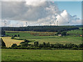
TL1942 : Wind farm, Langford by Christopher Hilton Wind farm, Langford by Christopher Hilton
geograph for square TL1942
Seen from the railway just south of Holme Green Crossing, these three turbines... (more)
TL1941 : Wind farm, Langford by Christopher Hilton Wind farm, Langford by Christopher Hilton
geograph for square TL1941
The three turbines here seen nearly in alignment run through the middle of the farm.
Tags: woodland:Covert   top:Energy Infrastructure   top:Farm, Fishery, Market Gardening   crop:Wheat   Wheat   plant:Wheat   Wheat Fields   Wheatfield   power station:Wind   Wind Farm   Wind Turbine   Wind Turbines  
NJ0245 : Bantrach - Looking towards Hill of Glaschyle by valenta Bantrach - Looking towards Hill of Glaschyle by valenta
geograph for square NJ0245
Glaschyle wind farm under construction at the time this photo was taken.
Tags: top:Energy Infrastructure   type:Geograph   top:Grassland   top:Lowlands   power station:Wind   subject:Wind Farm   Wind Turbine   Wind Turbine Construction Site   Wind Turbines   top:Woodland, Forest  
SE5004 : Two turbines, Marr Wind Farm by Christine Johnstone Two turbines, Marr Wind Farm by Christine Johnstone
geograph for square SE5004
On the north-west side of Hangman Stone Lane.
Tags: top:Energy Infrastructure   top:Lowlands   power station:Wind   Wind Farm   subject:Wind Turbine   Wind Turbines  
SE5004 : Entrance and two turbines, Marr Wind Farm by Christine Johnstone Entrance and two turbines, Marr Wind Farm by Christine Johnstone
geograph for square SE5004
On the south-east side of Hangman Stone Lane.
Tags: top:Energy Infrastructure   power station:Wind   Wind Farm   subject:Wind Turbine   Wind Turbines  
NJ2071 : Wind Direction Indicators by Anne Burgess Wind Direction Indicators by Anne Burgess
for square NJ2071
No prizes for guessing that the wind has blown from right to left here. Each... (more)
Tags: top:Coastal   top:Geological Interest   Pebbles   Rocks   Sand   Wind   Wind Blown Sand  
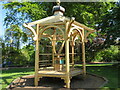
NT2475 : The Harp to Aeolus by M J Richardson The Harp to Aeolus by M J Richardson
geograph for square NT2475
A carved harp in a pagoda. Designed and made by Mark Norris; created from a Wych... (more)
SE5004 : Turbine, Marr Wind Farm by Christine Johnstone Turbine, Marr Wind Farm by Christine Johnstone
geograph for square SE5004
On the north-west side of Hangman Stone Lane.
Tags: top:Energy Infrastructure   power station:Wind   Wind Farm   subject:Wind Turbine  
SE2004 : Royd Moor Wind Farm by Dave Pickersgill Royd Moor Wind Farm by Dave Pickersgill
for square SE2004
The Royd Moor wind farm on a grey November day. Royd Moor has 13 500 kW... (more)
Tags: top:Energy Infrastructure   place:Royd Moor   top:Uplands   Wind   Wind Farms  
SP7378 : Looking towards Kelmarsh wind farm from Scotland Wood by Christopher Hilton Looking towards Kelmarsh wind farm from Scotland Wood by Christopher Hilton
geograph for square SP7378
Tags: top:Air, Sky, Weather   Clouds   weather:Clouds   top:Energy Infrastructure   top:Farm, Fishery, Market Gardening   Field   subject:Field   type:Geograph   power station:Wind   Wind Farm   Wind Turbines  
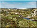
NH7225 : Estate track and ford over the Caochan Bad an t-Sneachda by valenta Estate track and ford over the Caochan Bad an t-Sneachda by valenta
for square NH7225
Several of the Farr wind farm turbines visible on the horizon.
Tags: top:Country Estates   type:Cross Grid   top:Energy Infrastructure   Ford   subject:Ford   top:Moorland   top:Rivers, Streams, Drainage   top:Roads, Road Transport   top:Uplands   power station:Wind   subject:Wind Farm   Wind Turbine  
SW6520 : View east from Jangye-Ryn by Christopher Hilton View east from Jangye-Ryn by Christopher Hilton
geograph for square SW6520
In the distance, the Goonhilly satellite earth station and adjacent wind farm.... (more)
SH5628 : Sea foam on Llandanwg beach, Gwynedd by I Love Colour Sea foam on Llandanwg beach, Gwynedd by I Love Colour
geograph for square SH5628
Llandanwg beach, Gwynedd; just south down the coast from Harlech. The last day... (more)
Tags: top:Air, Sky, Weather   subject:Beach   Beach   Beach at High Tide   Breaking Waves   top:Coastal   top:Estuary, Marine   county:Gwynedd   place:Harlech   High Tide   place:Llandanwg   place:North Wales   Receding Tide   Sea Foam   top:Sport, Leisure   subject:Tide   Tide   Waves   weather:Wind   Wind   Wind Blown Sea Foam  
SE5004 : Entrance, Marr Wind Farm by Christine Johnstone Entrance, Marr Wind Farm by Christine Johnstone
geograph for square SE5004
Passing through a wheatfield on the north-west side of Hangman Stone Lane.
Tags: top:Energy Infrastructure   subject:Entrance   power station:Wind   Wind Farm  
NS4852 : Wind power by Richard Sutcliffe Wind power by Richard Sutcliffe
geograph for square NS4852
A strong breeze bends the grasses beside the shore of White Loch and turns the... (more)
SZ0890 : Bournemouth: Storm Gareth has toppled some palm trees by Chris Downer Bournemouth: Storm Gareth has toppled some palm trees by Chris Downer
geograph for square SZ0890
Looking out from the canopy of the eastern side of the main Pier building,... (more)
Tags: top:City, Town Centre   top:Coastal   type:Geograph   Palm Trees   Storm   Storm Damage   subject:Tree   Trees   Wind  
TQ0083 : Black Park Model Boat regatta - yacht heels over in wind by David Hawgood Black Park Model Boat regatta - yacht heels over in wind by David Hawgood
for square TQ0083
In gusty wind this model yacht heeled over near the bank of the lake.
NY4212 : Old Wall, Gray Crag by Michael Graham Old Wall, Gray Crag by Michael Graham
geograph for square NY4212
On the northern flank above Hayeswater. Tired of the specialist mountain... (more)
SJ9495 : Ripples on the Peak Forest Canal by Gerald England Ripples on the Peak Forest Canal by Gerald England
geograph for square SJ9495
Whilst much of the UK was blanketed in snow, here there had only been a few... (more)
Tags: top:Canals   Construction   canal:Peak Forest   trees:Willow   weather:Wind  
SH6806 : Winding House, Nant Gwernol, Gwynedd by Peter Trimming Winding House, Nant Gwernol, Gwynedd by Peter Trimming
geograph for square SH6806
This former winding house stands at the top of the incline, above the Nant... (more)
Tags: Bryn Eglwys   place:Gwynedd   House   Nant Gwernol   Quarry   top:Quarrying, Mining   Top of the Incline   top:Uplands   place:Wales   Winding   top:Woodland, Forest  
SD4871 : High tide and high winds on the Keer estuary by Karl and Ali High tide and high winds on the Keer estuary by Karl and Ali
geograph for square SD4871
It's just past high tide but the gale force wind is driving waves back... (more)
Tags: top:Air, Sky, Weather   top:Coastal   Estuary   top:Estuary, Marine   Sunset   Waves   weather:Wind  
NT2475 : The Harp to Aeolus by M J Richardson The Harp to Aeolus by M J Richardson
for square NT2475
A close-up of the wood-carving in the RBGE NT2475 : The Harp to Aeolus. I'm not sure if... (more)
SH7682 : Afon Conwy estuary at West Shore, Llandudno by I Love Colour Afon Conwy estuary at West Shore, Llandudno by I Love Colour
geograph for square SH7682
Low tide in the Afon Conwy estuary at West Shore, Llandudno. Taken from one of... (more)
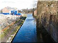
SP0587 : Turn at the basin again - Edgbaston, Birmingham by Martin Richard Phelan Turn at the basin again - Edgbaston, Birmingham by Martin Richard Phelan
for square SP0587
A narrowboat and its steerer using the space provided by the Monument Road Basin... (more)
SP0587 : Turn at the basin - Edgbaston, Birmingham by Martin Richard Phelan Turn at the basin - Edgbaston, Birmingham by Martin Richard Phelan
for square SP0587
A narrowboat and its steerer using the space provided by the Monument Road Basin... (more)
SH5628 : Slipway to Llandanwg beach, Gwynedd by I Love Colour Slipway to Llandanwg beach, Gwynedd by I Love Colour
geograph for square SH5628
The slipway to the beach at Llandanwg, Gwynedd. The last day of November with... (more)
Tags: top:Air, Sky, Weather   top:Coastal   top:Estuary, Marine   county:Gwynedd   High Tide   place:Llandanwg   place:North Wales   Sea Foam   Slipway   subject:Slipway   top:Sport, Leisure   Tide   Waves   Weather   Wind   Wind Blown Sea Foam  
TQ3088 : Wind damage, Crouch End by Jim Osley Wind damage, Crouch End by Jim Osley
geograph for square TQ3088
The legacy of Storm Katie, 28 March 2016.
Tags: top:Suburb, Urban Fringe   weather:Wind  
NS6786 : Wind farm access route, Todholes by Richard Webb Wind farm access route, Todholes by Richard Webb
geograph for square NS6786
This was the route in during construction of the Earlsburn windfarm.
Tags: top:Energy Infrastructure   top:Roads, Road Transport   power station:Wind  
NT7055 : Grouse butts, Dronshiel by Richard Webb Grouse butts, Dronshiel by Richard Webb
geograph for square NT7055
The tree is a remnant of a woodland which once occupied land here. View towards... (more)
Tags: Butt   top:Heath, Scrub   Moorland   power station:Wind  
TR1558 : North Holmes Road, Canterbury by Stephen Craven North Holmes Road, Canterbury by Stephen Craven
geograph for square TR1558
Category: Urban road
A view eastwards from outside the entrance to Christ Church University (right).... (more)
Tags: top:Roads, Road Transport   Urban Road   weather:Wind  
SU5600 : Windy day at Lee-on-the-Solent by David Martin Windy day at Lee-on-the-Solent by David Martin
geograph for square SU5600
On the seafront opposite Milvil Road.
Tags: top:Air, Sky, Weather   top:Coastal   top:Estuary, Marine   type:Geograph   subject:Seafront   Wind   Wind Sock  
NY2026 : Not ideal weather for seated Lords by Andy Waddington Not ideal weather for seated Lords by Andy Waddington
geograph for square NY2026
Category: Summit
It was a bit of a struggle to get to the top of Lord's Seat and definitely... (more)
Tags: top:Air, Sky, Weather   type:Geograph   top:Moorland   top:Paths   category:Summit   top:Uplands   Wind  
NC3120 : Arriving at the summit of Ben More Assynt by Trevor Littlewood Arriving at the summit of Ben More Assynt by Trevor Littlewood
geograph for square NC3120
A mountain walker reaching the summit of the mountain in a fierce wind having... (more)
NC3019 : Upper rocks of east ridge of Conival by Trevor Littlewood Upper rocks of east ridge of Conival by Trevor Littlewood
geograph for square NC3019
The ridge heads out towards Ben More Assynt. A fierce wind was blowing at the... (more)
NC3120 : Ridge heading south from summit of Ben More Assynt by Trevor Littlewood Ridge heading south from summit of Ben More Assynt by Trevor Littlewood
geograph for square NC3120
The broad, south ridge of Ben More Assynt leaving the mountain's summit. An... (more)
Tags: top:Air, Sky, Weather   type:Geograph   Mountain   Mountain Ridge   subject:Ridge   top:Rocks, Scree, Cliffs   Snow Cover   top:Uplands   Wind  
NC3120 : Minor top along west ridge of Ben More Assynt by Trevor Littlewood Minor top along west ridge of Ben More Assynt by Trevor Littlewood
geograph for square NC3120
The west ridge of Ben More Assynt descends to cross the rise then continues to... (more)
Tags: top:Air, Sky, Weather   type:Geograph   Mountain   Ridge   top:Rocks, Scree, Cliffs   Snow Cover   top:Uplands   Wind  
TF0820 : Blown sideways by Bob Harvey Blown sideways by Bob Harvey
geograph for square TF0820
A strong southerly wind is stirring the branches of the silver birch, and... (more)
Tags: season:Autumn   place:Bourne   type:Geograph   top:Lowlands   subject:Sky   top:Suburb, Urban Fringe   subject:Tree   weather:Wind  
TF0820 : A windy morning by Bob Harvey A windy morning by Bob Harvey
geograph for square TF0820
The wind was from the South, and blowing quite hard. Gales have been sweeping... (more)
Tags: top:Air, Sky, Weather   Back Garden   Bare Trees   place:Bourne   Early Spring   type:Geograph   top:Lowlands   season:Spring   subject:Weather   weather:Wind  
SJ9330 : Wind-ruffled water, Trent & Mersey Canal by Christine Johnstone Wind-ruffled water, Trent & Mersey Canal by Christine Johnstone
geograph for square SJ9330
Seen from a boat approaching Long Meadow Bridge [no 87] from the north.
Tags: Accommodation Bridge   top:Air, Sky, Weather   subject:Canal   top:Canals   type:Geograph   Ripples   canal:Trent & Mersey   weather:Wind   Windy Weather  
SX9365 : Walls Hill Road by Derek Harper Walls Hill Road by Derek Harper
geograph for square SX9365
A reverse view of SX9365 : Walls Hill Road. The leaves show the strength of the wind.
ST8590 : Gale force storm wind damage, nr Westonbirt, Gloucestershire 1990 by Ray Bird Gale force storm wind damage, nr Westonbirt, Gloucestershire 1990 by Ray Bird
geograph for square ST8590
Damage to large Oak Tree following the storm force gales of January 25th 1990
Tags: top:Air, Sky, Weather   Cotswolds   type:Geograph   Trees   subject:Weather   Weather   Wind   top:Woodland, Forest  
ST7882 : Gale force storm wind damage, Badminton, Gloucestershire 1990 by Ray Bird Gale force storm wind damage, Badminton, Gloucestershire 1990 by Ray Bird
geograph for square ST7882
Storm force gale damage to Severn Mile Plantation, The Verge Woodland on January 25th 1990
Tags: top:Air, Sky, Weather   type:Geograph   Trees   subject:Weather   Weather   Winds   top:Woodland, Forest  
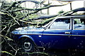
ST7983 : Gale force storm wind damage, Badminton, Gloucestershire 1990 by Ray Bird Gale force storm wind damage, Badminton, Gloucestershire 1990 by Ray Bird
for square ST7983
Damage to car following the storm force gales of 25.1.1990
Tags: top:Air, Sky, Weather   type:Close Look   Gales   subject:Weather   Winds  
J3776 : G-ECOA, Belfast City Airport (January 2017) by Albert Bridge G-ECOA, Belfast City Airport (January 2017) by Albert Bridge
for square J3776
Today’s wind was a 20/25 knot southerly with occasional gusts one of which... (more)
Tags: top:Air Transport   top:Air, Sky, Weather   subject:Aircraft   Aircraft   Airport   place:Belfast   Belfast City Airport   type:Cross Grid   Flybe   Wind  
SH7882 : Lifeboat Access/Mynediad Bad Achub by Gerald England Lifeboat Access/Mynediad Bad Achub by Gerald England
geograph for square SH7882
The tide was going out, the rain had eased off but the wind was still blowing... (more)
Tags: top:Coastal   Dog Walkers   Lifeboat Slipway   Promenade   weather:Rain   Storm Clodagh   weather:Wind  
ST9060 : Kennet & Avon Canal, between bridges 157 and 158 by Christine Johnstone Kennet & Avon Canal, between bridges 157 and 158 by Christine Johnstone
geograph for square ST9060
Looking west. The strong wind is ruffling the normally still waters.
Tags: subject:Canal   top:Canals   canal:Kennet & Avon   canal:Kennet and Avon   weather:Wind   Windy Day  
SE2104 : Royd Moor wind farm, Penistone by Dave Pickersgill Royd Moor wind farm, Penistone by Dave Pickersgill
geograph for square SE2104
Tags: top:Energy Infrastructure   top:Grassland   place:Royd Moor   top:Uplands   Wind   Windfarm  
NH6595 : Loch an Lagain by Trevor Littlewood Loch an Lagain by Trevor Littlewood
geograph for square NH6595
Loch an Lagain as seen from a gap in the tree cover south-west of Meall Ṃr.... (more)
View more in the Image Search or in Browser
View images matching 'Wind' anywhere in the tags
Don't click these: PotMel 1 PotMel 2