
|
Entrance to Wood Farm Buildings
by Geographer
geograph for square TM3668
Off Green Road near South Grange Farm
|
|
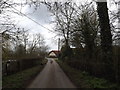
Wood Lane, Starston
by Geographer
geograph for square TM2386
Approaching Wood Farm
|

|
Wood Farm sign & mailbox
by Geographer
for square TM3170
Off New Road at the entrance to Wood Farm
|

|
Footpath to Green Road & Potash Farm
by Geographer
geograph for square TM3668
Category: Footpath
Looking towards Coe Wood off Green Road (U2503) near Wood Farm
Sibton footpath no.14
|

|
Wood Farm sign
by Geographer
for square TM1652
At the entrance to Wood Farm off Clay Lane
|

|
Wood Farm
by J.Hannan-Briggs
geograph for square TF0863
On the edge of Nocton Wood
|

|
Entrance to Wood Farm
by Geographer
geograph for square TM1652
Off Clay Lane
|

|
Road to Wood Farm
by J.Hannan-Briggs
geograph for square SK9555
The road ends just after the farm.
|

|
Entrance to Wood Farm
by Geographer
geograph for square TM3170
Off New Road
|

|
New Road, Badingham
by Geographer
geograph for square TM3170
At the entrance to Wood Farm
|
|
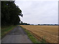
Footpath to the B1119 Church Hill & entrance of Wood Farm
by Geographer
geograph for square TM3962
Saxmundham footpath no.23
|

|
Drive to Wood Farm
by J.Hannan-Briggs
geograph for square SK8878
|

|
Kerdiston Road at Brick Kiln Farm
by Geographer
geograph for square TG0723
Looking towards Themelthorpe turn right to Brick Kiln Farm & left to Wood Farm
|

|
Broad Oak Farm
by Geographer
for square TM3368
Category: Farm
Taken from the road junction near Wood Farm
|

|
The entrance to Wood Farm
by Geographer
for square TM3962
Category: Farm access road
Off the B1119 Church Hill
|

|
Wood Farm, Kerdiston
by Geographer
geograph for square TG0723
Taken from Kerdiston Road near Rusca Farm
|

|
Looking towards Wood Farm
by Geographer
geograph for square TG0723
Taken from Kerdiston Road near Rusca Farm
|

|
Track to Wood Farm
by J.Hannan-Briggs
geograph for square TF0509
Electricity cables between the pylons run across the sky.
|

|
Footpath to the former Badingham Hall, Punchard's Farm & Wood Farm
by Geographer
geograph for square TM3269
Off Old Hall Road
Badingham footpath no.13 leading to Badingham footpath no.12... (more)
|

|
Footpath to the former Badingham Hall, Punchard's Farm & Wood Farm
by Geographer
geograph for square TM3269
Off Old Hall Road
Badingham footpath no.13 leading to Badingham footpath no.12... (more)
|

|
Footpath to the former Badingham Hall, Punchard's Farm & Wood Farm
by Geographer
geograph for square TM3269
Off Old Hall Road
Badingham footpath no.13 leading to Badingham footpath no.12... (more)
|
|
Footpath to Moor Farm
by Geographer
geograph for square TM3962
At Wood Farm
Saxmundham footpath no.23 leading to Sternfield footpath no.6
|

|
Entrance to Wood Farm
by Geographer
geograph for square TM3178
Off the B1123 Harleston Road
|

|
Footpath to Hubbard's Hill & entrance to Wood Farm
by Geographer
geograph for square TM3571
Off Dunwich Lane
|

|
Wood's Farm on Fen Road
by J.Hannan-Briggs
geograph for square TF3361
The Farm was for sale at the time.
|
|
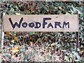
Wood Farm sign
by Geographer
for square TM3568
|

|
The Entrance to Wood Farm
by Geographer
geograph for square TM3568
Off Bruisyard Road
|

|
Coltsclose Pickle footpath & entrance to Wood Farm
by Geographer
geograph for square TM3963
Category: Footpath
Off the B1119 Saxmundham Road
Saxmundham footpath no.23 leading to Sternfield... (more)
|

|
Coltsclose Pickle footpath & entrance to Wood Farm
by Geographer
geograph for square TM3963
Category: Footpath
Off the B1119 Saxmundham Road
Saxmundham footpath no.23 leading to Sternfield... (more)
|
|
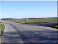
B1119 Saxmundham Road & Wood Farm entrance
by Geographer
geograph for square TM3963
Category: B road (Classified B)
Looking towards Leiston
Also Coltsclose Pickle footpath
|

|
Wood Farm, Kerdiston
by Geographer
geograph for square TG0723
Taken from Marriott's Way
|

|
Wood Farmhouse
by Geographer
geograph for square TG0723
Taken from Marriott's Way
(Close up)
|

|
Wood Farm, Kerdiston
by Geographer
geograph for square TG0723
Taken from Marriott's Way
|

|
Clay Lane, Hemingstone
by Geographer
geograph for square TM1652
At the entrance to Wood Farm
|

|
Clay Lane, Hemingstone
by Geographer
geograph for square TM1652
At the entrance to Wood Farm
|
|
Footpath off the entrance to Wood Farm
by Geographer
geograph for square TM3962
Off the B1119 Church Hill
|

|
Footpath to Hill Farm & the C234 & Wood Farm
by Geographer
geograph for square TM2765
Off Pepperwash Lane (U2114)
Framlingham footpath no.8
|

|
Footpath to Hill Farm & the C234 & Wood Farm
by Geographer
geograph for square TM2765
Off Peppers Wash Lane (U2114)
Framlingham footpath no.8
|

|
2011 : Wood Farm, at the base of the Cotswold Escarpment
by Maurice Pullin
geograph for square ST9977
The minor road heads east from Foxham to the A3102 at the top of the hill.
|

|
Footpath to Hill Farm
by Geographer
geograph for square TM3668
Category: Footpath
Off Green Road (U2503) near Wood Farm
Sibton footpath no.13
|

|
Footpath to Hill Farm
by Geographer
geograph for square TM3668
Category: Footpath
Off Green Road (U2503) near Wood Farm
Sibton footpath no.13
|

|
Bruisyard Road
by Geographer
geograph for square TM3467
Category: Road
Looking towards Wood Farm near Broad Oak Farm
|

|
Fields off New Road
by Geographer
for square TM3169
Category: Farm
Wood Farm can be seen in the distance
|

|
Green Road, Sibton
by Geographer
geograph for square TM3668
Category: Lane
Lane between South Grange Farm and Wood Farm
Road No.U2503
|

|
Open-sided metal barn at Wood Farm
by Christine Johnstone
geograph for square SK1219
For storing bales of hay or straw.
|

|
Trees around a pond, near Wood Farm
by Christine Johnstone
geograph for square SK1219
Looking west from Morrey Lane.
|

|
Barn at Wood Farm
by Geographer
geograph for square TG0723
Taken from Marriott's Way
(Close up)
|

|
Farmland off Marriott's Way
by Geographer
geograph for square TG0723
Looking towards Wood Farm
|
|
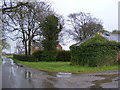
Wood Farm & Tannington Road, Worlingworth
by Geographer
geograph for square TM2367
|

|
Brick Kiln Lane, Kerdiston
by Geographer
geograph for square TG0723
At the junction with Kerdiston Road
Road No.U 57020
|
