
|
Shoreline of Montrose Basin near Maryton
by Adrian Diack
geograph for square NO6856
This photo shows a morning view of part of the shoreline and wooded banks of... (more)
|

|
Shoreline, Ashlan, Loch Lomond
by Robin Drayton
geograph for square NN3307
The West Highland Way runs along the shoreline.
The following shared... (more)
|

|
The shoreline in Totland
by Steve Daniels
geograph for square SZ3186
|
|
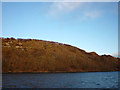
Wooded shore north of Tobermory
by Karl and Ali
geograph for square NM5156
Catching the first light of dawn as we sail to Ardnamurchan on the Kilchoan ferry.
|

|
Moor Gill Foot, Coniston Water
by Karl and Ali
geograph for square SD2993
The small stream at Moor Gill descends through a wooded valley from Torver Back... (more)
|

|
Groynes on the beach at Totland
by Steve Daniels
geograph for square SZ3186
|

|
Shore to the east of Wear Point
by M J Roscoe
for square SM9404
Shingle shore on the tidal Daugleddau.
|

|
Ullswater shore, below Soulby Fell
by Christine Johnstone
geograph for square NY4624
Seen from a ferry leaving Pooley Bridge.
|

|
Ullswater shore, below Dunmallard Hill
by Christine Johnstone
geograph for square NY4624
Seen from a ferry moored at the Pooley Bridge landing stage.
|

|
Shallow water off Oulton Dyke
by Christine Johnstone
geograph for square TM5092
Seen from the top deck of the Waveney Princess, a trip boat based near Mutford... (more)
|

|
Outlet from Slutton's Dyke, Oulton Broad
by Christine Johnstone
geograph for square TM5092
Draining White Cast Marshes. Seen from the top deck of the Waveney Princess, a... (more)
|

|
The Cumbria Way entering Harrison Coppice
by Karl and Ali
geograph for square SD2994
Tree-felling is in progress (but not today on a Sunday).
|
|
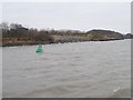
Green navigation buoy, Eastham Channel
by Christine Johnstone
geograph for square SJ3682
Near the west bank of the Mersey estuary. Green means keep the buoy on your... (more)
|

|
Parked cars, Eastham Country Park
by Christine Johnstone
geograph for square SJ3681
On the west bank of the Mersey estuary, near to high tide.
|

|
Eastham Ferry Hotel
by Christine Johnstone
geograph for square SJ3681
Where passengers once waited before catching the ferry to Liverpool. For the... (more)
|

|
Eastham Ferry jetty
by Christine Johnstone
geograph for square SJ3681
The building behind, now the Tap pub, may have been where ferry crews stayed.... (more)
|

|
Lock entrance, Queen Elizabeth Dock
by Christine Johnstone
geograph for square SJ3681
On the south-west bank of the Manchester Ship Canal.
|

|
Light beacon just north of Oban
by Karl and Ali
geograph for square NM8531
Seen from the MV 'Isle of Mull' just before docking in Oban.
|
