Public Tags
Tag: Woodland·Walks
Showing latest 50 of 120 images tagged with Woodland Walks tag.

|
Woodland Walk at Attingham Park
by Jeff Buck geograph for square SJ5410 The Woodland Walk is part of a circular walk starting at the Stables Courtyard... (more)
Tags:
place:Attingham Park
top:Country Estates
country:England
National Trust
National Trust Property
top:Paths
county:Shropshire
Woodland
subject:Woodland
Woodland Walk
top:Woodland, Forest
|

|
Leith Hill Place Wood - Woodland Walk
by Colin Smith geograph for square TQ1342 Path junction close to Hartshurst Farm on the National Trust's Etherley... (more)
Tags:
Footpath
type:Geograph
place:Leith Hill
subject:Path
top:Paths
top:Sport, Leisure
Woodland Walk
top:Woodland, Forest
|

|
Woodland Walk at Plas Newydd
by Jeff Buck geograph for square SH5269 The woodland walk at Plas Newydd leads to a rhododendron garden.
Tags:
place:Anglesey
top:Country Estates
Country House
county:Isle of Anglesey
Isle of Anglesey
place:Llanfairpwllgwyngyll
National Trust
National Trust Property
place:Plas Newydd
country:Wales
Woodland
Woodland Path
Woodland Walk
top:Woodland, Forest
|

|
The Woodland Walk at Arley Hall
by Jeff Buck geograph for square SJ6781 The Woodland Walk is a recent creation at the extreme east of the Grove.
Tags:
place:Arley
Arley Hall
county:Cheshire
top:Country Estates
country:England
Tulips
Woodland
subject:Woodland
Woodland Walk
top:Woodland, Forest
|

|
The Woodland Walk at Arley Hall
by Jeff Buck geograph for square SJ6781 The Woodland Walk is a recent creation at the extreme east of the Grove.
Tags:
place:Arley
Arley Hall
county:Cheshire
top:Country Estates
country:England
Gardens
Hall
subject:Woodland
Woodland
Woodland Walk
top:Woodland, Forest
|

|
Woodland Walk
by Richard Sutcliffe geograph for square NO1436 Start of the Woodland Walk in the grounds of the Ballathie House Hotel.
|

|
Gate to woodland walk
by Bill Kasman for square NO5705 This is one of several gates giving access to Innergellie Woodland walk.
See... (more)
Tags:
type:Close Look
Innergellie
Kilrenny
top:Paths
top:Village, Rural Settlement
Woodland Walk
top:Woodland, Forest
|

|
Bench by the Woodland Walk
by Des Blenkinsopp geograph for square ST9700 The longest of the trails at Kingston Lacy, the Woodland Walk follows the... (more)
|

|
Rhododendron in the Woodland Walk
by Jeff Buck for square SJ6781 Rhododendron in the Woodland Walk at Arley Hall.
Tags:
place:Arley
Arley Hall
county:Cheshire
top:Country Estates
country:England
Gardens
Rhododendron
Woodland
Woodland Walk
top:Woodland, Forest
|

|
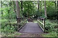
Woodland Walk at Rufford Old Hall
by Jeff Buck geograph for square SD4616 The woodland walk in the grounds of Rufford Old Hall.
Wikipedia... (more)
Tags:
country:England
county:Lancashire
National Trust
National Trust Land
National Trust Property
top:Paths
place:Rufford
Rufford Old Hall
Woodland
Woodland Walk
top:Woodland, Forest
|
|
Woodland Walk at Rufford Old Hall
by Jeff Buck geograph for square SD4616 The woodland walk in the grounds of Rufford Old Hall.
Wikipedia... (more)
Tags:
country:England
county:Lancashire
National Trust
National Trust Land
National Trust Property
top:Paths
place:Rufford
Rufford Old Hall
Woodland
Woodland Walk
top:Woodland, Forest
|

|
Woodland Walk on Brownsea
by Nigel Mykura geograph for square SZ0187 This pinewood path is very close to the western end of the island. Large numbers... (more)
|
|
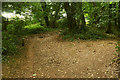
Woodland walk, Manscombe Plantation
by Derek Harper geograph for square SX8963 The walk follows footpath TQ141 as it runs behind houses on Broadley Drive. On... (more)
Tags:
type:Geograph
Path Junction
top:Paths
Public Footpath
fence:Timber
Waymark
Woodland
Woodland Walk
top:Woodland, Forest
|

|
The Woodland Walk at Chirk Castle
by Jeff Buck geograph for square SJ2738 The Woodland Walk in the Pleasure Ground Wood at Chirk Castle.
Tags:
place:Chirk
Chirk Castle
top:Country Estates
type:Geograph
National Trust
National Trust Land
National Trust Property
top:Paths
country:Wales
Woodland Walk
top:Woodland, Forest
county:Wrexham
|

|
Woodland Walk at Chirk Castle
by Jeff Buck geograph for square SJ2738 The Woodland Walk in the Pleasure Ground Wood at Chirk Castle.
Tags:
place:Chirk
Chirk Castle
top:Country Estates
type:Geograph
National Trust
National Trust Land
National Trust Property
country:Wales
Woodland Walk
top:Woodland, Forest
county:Wrexham
|

|
Gate to woodland walk
by Bill Kasman geograph for square NO5705 This gate leads to the Innergellie Woodland walk.
See main article... (more)
|

|
Regenerating woodland
by Trevor Littlewood geograph for square NH6890 This is Spinningdale Wood or other woodland adjacent to it where there seems to... (more)
|

|
Walking the dog by Valley Brook
by Christine Johnstone geograph for square SJ7255 A tangle of pleasant woodland walks have been laid out alongside Valley Brook,... (more)
|

|
Forestry Track in Wareham Forest.
by Nigel Mykura geograph for square SY9189 This track is one of the many woodland walks in the Forestry Commission... (more)
|
|
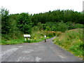
Start of the An Torr woodland walk
by Dave Fergusson geograph for square NN1256 The various walks cover more than 3km.
|

|
Uig Woodland walk
by Dave Fergusson geograph for square NG3963 This wood, managed by the Woodland Trust, is the largest broadleaved wood in... (more)
|

|
Netherton Woodland
by M J Richardson geograph for square NS9065 'WALKERS WELCOME' - the entrance to an area of woodland walks in a... (more)
Tags:
plant:Anthriscus
near:Blackridge
plant:Cow Parsley
top:Energy Infrastructure
type:Geograph
top:Grassland
top:Lowlands
top:Paths
place:West Lothian
top:Wild Animals, Plants and Mushrooms
Wind Farm
Wind Turbines
subject:Woodland
Woodland Walks
top:Woodland, Forest
|

|
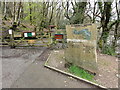
Woodland Walks at Newbyth
by M J Richardson for square NT5979 Plan of the woodland area at Newbyth. Part of a large woodland area, including... (more)
Tags:
type:Close Look
place:East Lothian
top:Educational Sites
top:Lowlands
Map
subject:Notice
top:Paths
near:Tyninghame
near:Whitekirk
Woodland Walks
top:Woodland, Forest
|
|
Entrance to Kilminorth Woods
by Tony Atkin geograph for square SX2453 From the large car park by the West Looe River most people make their way east... (more)
|

|
The Lady’s Walk on the Bowhill Estate
by Walter Baxter geograph for square NT4228 This part of the 2 mile circular walk is by the Yarrow Water in Harewood Glen.
|

|
Woodland walk alongside Hatfeild View
by Christine Johnstone geograph for square SE3322 A waymarked walk in the grounds of Fieldhead Hospital. And yes, Fieldhead is... (more)
|

|
Start of the Woodland Walk at Kellie Castle
by Oliver Dixon geograph for square NO5105 Tags:
top:Country Estates
type:Geograph
Path
top:Paths
Wood
subject:Woodland
Woodland Walk
top:Woodland, Forest
|

|
Waymark, Manscombe Plantation
by Derek Harper for square SX8963 Just visible on the right of SX8963 : Public footpath, Manscombe Plantation, this waymark announces that I am on... (more)
|

|
Beckley, woodland walk
by Mike Faherty geograph for square SZ2196 Through oak woodland to the staging point for tractor rides, at East Close... (more)
Tags:
type:Geograph
top:Lowlands
subject:Path
top:Paths
top:People, Events
Woodland Walk
top:Woodland, Forest
|
|
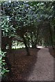
Woodland Walk
by John Myers geograph for square TR3749 The grounds of Walmer Castle
Tags:
top:Country Estates
type:Geograph
Grounds
bucket:Landscape
Walmer Castle
subject:Woodland
Woodland Walk
top:Woodland, Forest
|

|
Woodland Walk at Beeston Castle
by Jeff Buck geograph for square SJ5359 The path through the Woodland Park skirting the perimeter of Beeston Castle,... (more)
Tags:
place:Beeston
Beeston Castle
county:Cheshire
country:England
top:Paths
Woodland Walk
top:Woodland, Forest
Woodlland
|

|
Woodland Walk at Beeston Castle
by Jeff Buck geograph for square SJ5359 The path through the Woodland Park skirting the perimeter of Beeston Castle,... (more)
Tags:
place:Beeston
Beeston Castle
county:Cheshire
country:England
top:Paths
Woodland Walk
top:Woodland, Forest
Woodlland
|

|
Woodland Track on Brownsea
by Nigel Mykura geograph for square SZ0188 There are many wide flat tracks such as this one meandering round the island... (more)
|

|
Pen Woods Walking Trail
by Nigel Mykura geograph for square ST5108 This is the end of the trail as far as the public can go. The trail in most... (more)
|

|
Pen Wood Trail
by Nigel Mykura geograph for square ST5109 The walking trail in these privately owned woods is well maintained.... (more)
|

|
Loch Leven Heritage Trail
by Martin Addison geograph for square NO1302 The Loch Leven Heritage Trail is aimed at cyclists and walkers. The trail... (more)
|

|
Old bridge
by Bill Kasman geograph for square NT2998 This old and crumbling bridge once carried a railway line over the Lochty Burn.... (more)
Tags:
Crumbling Bridge
type:Geograph
Lochty Burn
Old Bridge
top:Rivers, Streams, Drainage
Woodland Walk
top:Woodland, Forest
|

|
Perimeter path, Barony Castle Hotel
by Jim Barton geograph for square NT2347 A woodland walk in the hotel grounds, skirting the ravine of the Dean Burn at this point.
|

|
Glencharnoch Wood Walk, Carrbridge
by Jim Barton geograph for square NH9022 There are several signposted woodland paths in and around the village.
|

|
Monkey World, woodland walk
by Mike Faherty geograph for square SY8488 Next to wetland towards the higher southern end of the rescue centre:... (more)
|

|
Woodland Walk, Ullacombe
by Derek Harper for square SX7877 Little evidence of recent visitors - perhaps it is more popular at bluebell time.
Tags:
Bluebell Wood
type:Close Look
national park:Dartmoor
Notice
top:Paths
top:Sport, Leisure
gate:Timber
Woodland Walk
top:Woodland, Forest
|
|
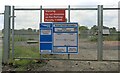
Level crossing
by Bill Kasman for square NT3098 In the days before the Levenmouth Rail Link was re-established this level... (more)
Tags:
type:Close Look
Level Crossing
Levenmouth Rail Link
top:Paths
top:Railways
Woodland Walk
top:Woodland, Forest
|
|
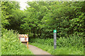
Start of Loop Walk, Staple Hill
by Derek Harper geograph for square ST2415 The signs have changed since ST2415 : Viewpoint walk on Staple Hill was taken at the eastern corner of the... (more)
Tags:
Access Land
type:Geograph
Information Board
top:Paths
top:Uplands
Woodland
Woodland Walk
top:Woodland, Forest
|

|
Innergellie Woodland walk
by Bill Kasman geograph for square NO5705 A gate leading to the main path from the play area is just visible.
See main... (more)
Tags:
type:Geograph
Innergellie
Kilrenny
top:Paths
top:Village, Rural Settlement
Woodland Walk
top:Woodland, Forest
|

|
Innergellie Woodland walk
by Bill Kasman geograph for square NO5705 See main article Link
Tags:
type:Geograph
Innergellie
Kilrenny
top:Paths
top:Village, Rural Settlement
Woodland Walk
top:Woodland, Forest
|

|
Glenarm, woodland walk
by Mike Faherty geograph for square D3014 Through the Glenarm Estate.
|

|
Entrance to woodland walks at Newbyth
by M J Richardson geograph for square NT5979 Obviously there are deer around.
Tags:
top:Boundary, Barrier
place:East Lothian
top:Educational Sites
subject:Gate
type:Geograph
top:Lowlands
top:Sport, Leisure
near:Tyninghame
near:Whitekirk
Woodland Walks
top:Woodland, Forest
|

|
Arne, Woodland Walk
by Mike Faherty geograph for square SY9788 At RSPB Arne; oak, birch and conifers.... (more)
Tags:
type:Geograph
top:Lowlands
subject:Path
top:Paths
RSPB Reserve
Woodland Walk
top:Woodland, Forest
|

|
Steward Wood
by Derek Harper geograph for square SX7685 A woodland walk past a clearing at the wood above the Wray Brook.
Tags:
Clearing
national park:Dartmoor
Hillside
Logs
top:Lowlands
top:Paths
trees:Scots Pine
Woodland Walk
top:Woodland, Forest
|

|
Flaxmill Centre, Drumduff
by Kenneth Allen geograph for square H5570 The start of a small woodland walk
|
