Public Tags
Showing latest 50 of 203 images tagged with woodland:Broadleaf tag.

|
Ride in Leake New Wood
by Alan Murray-Rust geograph for square SK5328 An extensive mixed woodland.
This ride separates a section of broadleaf... (more)
|

|
New woodland near Thrussington, with footpath
by Alan Murray-Rust geograph for square SK6516 Part of a substantial development of broadleaf woodland by a local family, on... (more)
|

|
Skerry group of Sgeirean Buidhe framed by woodland
by C Michael Hogan geograph for square NG8053 The skerry group is clearly visible at image right, framed by a foreground... (more)
Tags:
woodland:Broadleaf
top:Coastal
top:Estuary, Marine
top:Geological Interest
top:Islands
Native Woodland
top:Rocks, Scree, Cliffs
Skerry
top:Woodland, Forest
|

|
Footpath alongside the stream
by Alan Murray-Rust geograph for square SK5240 Harrison's Plantation nature reserve, linked with Martin's Pond and... (more)
Tags:
woodland:Broadleaf
type:Geograph
Local Nature Reserve
top:Paths
Public Footpath
top:Rivers, Streams, Drainage
Stream
top:Woodland, Forest
|

|
Ride through Halloughton Wood
by Alan Murray-Rust geograph for square SK6751 Largely broadleaf woodland.
|

|
New woodland near Thrussington
by Alan Murray-Rust geograph for square SK6516 Part of a substantial development of broadleaf woodland by a local family, on... (more)
|

|
New woodland near Thrussington
by Alan Murray-Rust geograph for square SK6516 Part of a substantial development of broadleaf woodland by a local family, on... (more)
|

|
Path near Moness Burn
by C Michael Hogan geograph for square NN8548 The broadleaf woodland at image left is part of the riparian woodland along Moness Burn.
Tags:
woodland:Broadleaf
top:City, Town Centre
top:Paths
Riparian
top:Rivers, Streams, Drainage
top:Woodland, Forest
|

|
New woodland
by Alan Murray-Rust for square SK7534 Planted around 2008 and clearly developing well. A preponderance of birch but... (more)
|

|
Rolleston Gorse
by Alan Murray-Rust geograph for square SK7552 Broadleaf woodland plantation, pre-dating the 1884 OS 6-inch mapping.
|

|
Manchester Wood
by Alan Murray-Rust geograph for square SK4144 An area of broadleaf woodland which remained undisturbed by adjacent opencast mining.
|

|
Broadleaf riparian woodland of the River Gloy
by C Michael Hogan geograph for square NN2286 The guardrail at image left prevents vehicles from sliding off into the River... (more)
|

|
Footpath through Chilwell Dam Plantation
by Alan Murray-Rust geograph for square SK5143 This is broadleaf woodland established in the early part of the 19th century,... (more)
Tags:
woodland:Broadleaf
Broxtowe Country Park
type:Geograph
Public Footpath
top:Roads, Road Transport
top:Woodland, Forest
|
|
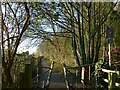
Midland Wood Cycle Route
by Alan Murray-Rust geograph for square SK6141 The wood doesn't have a name on any OS mapping, and the name may have been... (more)
|
|
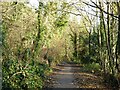
Midland Wood Cycle Route
by Alan Murray-Rust geograph for square SK6140 The wood doesn't have a name on any OS mapping, and the name may have been... (more)
|

|
The edge of Parkside Close, Brackenhurst estate
by Alan Murray-Rust geograph for square SK7052 This section of the field has been given over to broadleaf woodland plantation.
Tags:
woodland:Broadleaf
top:Farm, Fishery, Market Gardening
type:Geograph
Plantation
top:Woodland, Forest
|
|
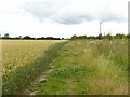
Public footpath through Middle Meadow
by Alan Murray-Rust geograph for square SK7052 The section of the field cut off by the path has been given over to woodland... (more)
Tags:
Arable Land
woodland:Broadleaf
top:Farm, Fishery, Market Gardening
type:Geograph
top:Paths
Plantation
Public Footpath
crop:Wheat
top:Woodland, Forest
|
|
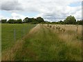
Public footpath through Cow Pasture
by Alan Murray-Rust geograph for square SK7052 The awkward corner of the field has been given over to woodland plantation with... (more)
Tags:
woodland:Broadleaf
top:Farm, Fishery, Market Gardening
type:Geograph
Pasture
top:Paths
Plantation
Public Footpath
top:Woodland, Forest
|

|
Trentside cliff
by Alan Murray-Rust geograph for square SK7045 Currently standing well back from the current river channel. The cliffs are... (more)
Tags:
woodland:Broadleaf
Cliff
type:Geograph
top:Geological Interest
Mudstone
top:Rivers, Streams, Drainage
top:Rocks, Scree, Cliffs
river:Trent
top:Woodland, Forest
|
|
Field below the standing stone
by C Michael Hogan geograph for square NN5631 This field is on the floodplain of the River Dochart. The standing stone is in... (more)
Tags:
woodland:Broadleaf
top:Historic Sites and Artefacts
Riparian
top:Rivers, Streams, Drainage
Standing Stone
top:Woodland, Forest
|

|
Rubha a’ Chaisteil
by C Michael Hogan for square NG7712 Variable patches of broadleaf woodland, scrub and grassland provide a verdant... (more)
Tags:
woodland:Broadleaf
top:Coastal
top:Heath, Scrub
top:Rivers, Streams, Drainage
top:Woodland, Forest
|

|
Seaweed covered rocky southern shoreline of Loch Sunart
by C Michael Hogan geograph for square NM8060 Photographer is standing not far from the A884 Road. This location is one of the... (more)
Tags:
woodland:Broadleaf
top:Coastal
top:Estuary, Marine
top:Rocks, Scree, Cliffs
Shingle Beach
top:Woodland, Forest
|

|
New plantation
by Alan Murray-Rust geograph for square SK6345 A small plantation of broadleaf species, including hazel, ash, oak and willow.... (more)
Tags:
woodland:Broadleaf
type:Geograph
New Plantation
top:Paths
Public Footpath
top:Woodland, Forest
|

|
Curving road through the dense broadleaf forest
by C Michael Hogan geograph for square NM6965 |

|
Tunnel of broadleaf trees
by C Michael Hogan geograph for square NM7861 |

|
Woodsy broadleaf scene along the single track road
by C Michael Hogan geograph for square NM4566 |

|
Meadow in the River Dochart watershed
by C Michael Hogan geograph for square NN4627 The broadleaf copses are chiefly riparian forest patches along the River Dochart.
|

|
Young broadleaf forest framed with steep stony hills
by C Michael Hogan geograph for square NG9256 Tags:
woodland:Broadleaf
top:Geological Interest
top:Rocks, Scree, Cliffs
top:Uplands
top:Woodland, Forest
|

|
New plantation
by Alan Murray-Rust geograph for square SK6432 This block of Cotgrave Forest has recently been restocked after felling. The new... (more)
Tags:
woodland:Broadleaf
place:Cotgrave Forest
Forestry Track
top:Lowlands
New Plantation
top:Paths
Public Bridleway
top:Woodland, Forest
|

|
Ride, Ellen's Wood
by Robin Stott geograph for square ST5884 Tags:
woodland:Broadleaf
Community Woodland
top:Flat Landscapes
place:Over
top:Paths
top:Woodland, Forest
|

|
Southwest edge of Ellen's Wood
by Robin Stott geograph for square ST5884 This permissive path appears to replace a public footpath through the fields.
|

|
Gedling House Woods – 4
by Alan Murray-Rust geograph for square SK6242 The predominant ground cover in the eastern section of the woods is an extensive... (more)
Tags:
woodland:Broadleaf
type:Geograph
plant:Goosegrass
Local Nature Reserve
top:Wild Animals, Plants and Mushrooms
top:Woodland, Forest
|

|
Gedling House Woods – 3
by Alan Murray-Rust for square SK6242 Solitary bluebell. There was no evidence of a large woodland population of... (more)
Tags:
plant:Bluebell
woodland:Broadleaf
type:Close Look
Local Nature Reserve
top:Wild Animals, Plants and Mushrooms
top:Woodland, Forest
|
|
Gedling House Woods – 1
by Alan Murray-Rust geograph for square SK6242 The main woodland path alongside Wood Lane.
Tags:
woodland:Broadleaf
path:Footpath
type:Geograph
Local Nature Reserve
top:Paths
top:Woodland, Forest
|
|
Crich Chase
by Alan Murray-Rust geograph for square SK3453 Woodland on the steep side of the valley of the River Derwent. This is... (more)
Tags:
Ancient Woodland
woodland:Broadleaf
type:Geograph
top:Rocks, Scree, Cliffs
SSSI
top:Woodland, Forest
|

|
Gedling House Woods – 5
by Alan Murray-Rust for square SK6242 Two tiny beetles on Red Campion (Silene dioica). The flower itself is only c15mm... (more)
Tags:
insect:Beetle
woodland:Broadleaf
type:Close Look
Local Nature Reserve
plant:Red Campion
top:Wild Animals, Plants and Mushrooms
top:Woodland, Forest
|

|
Orwin's Field and Woodland, Brackenhurst estate
by Alan Murray-Rust geograph for square SK7051 The woodland has been planted with a variety of trees – willow, ash, hazel, oak... (more)
|
|
Entrance to Springdale Wood
by Alan Murray-Rust geograph for square SK6942 Woodland created by the Woodland Trust and now managed by East Bridgford Parish... (more)
|
|
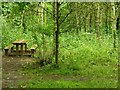
Picnic table in Springdale Wood
by Alan Murray-Rust geograph for square SK6942 Woodland created by the Woodland Trust and now managed by East Bridgford Parish Council.
|

|
Bonney Doles, woodland
by Alan Murray-Rust geograph for square SK6245 A Woodland Trust Millennium project, planting of woodland took place in 1998.
Tags:
woodland:Broadleaf
type:Geograph
Millennium Project
Open Access Land
Woodland Trust
top:Woodland, Forest
|

|
Diamond Wood, Sutton Bonington
by Alan Murray-Rust geograph for square SK4925 An area of diverse woodland developed from arable land by the University of... (more)
Tags:
woodland:Broadleaf
Coppicing
type:Geograph
Queen Elizabeth Diamond Jubilee
Woodland Trust
top:Woodland, Forest
|

|
Coppiced and other cut timber, Bunny Old Wood
by Alan Murray-Rust geograph for square SK5828 The woodland is carefully managed using traditional methods, with timber being... (more)
Tags:
Ancient Woodland
woodland:Broadleaf
Coppicing
type:Geograph
Local Nature Reserve
Woodland Ride
top:Woodland, Forest
|

|
Bunny Old Wood
by Alan Murray-Rust geograph for square SK5828 Typical scene in this wood, showing evidence of coppicing.
Trying to recreate... (more)
Tags:
Ancient Woodland
woodland:Broadleaf
Coppicing
type:Geograph
Local Nature Reserve
top:Woodland, Forest
|

|
Dumble landscape near Hill Farm
by Alan Murray-Rust geograph for square SK6549 Looking down the southern branch of the Thurgarton Beck, indicated by the strip... (more)
Tags:
Ancient Woodland
crop:Barley
woodland:Broadleaf
Dumble
top:Farm, Fishery, Market Gardening
Farming Landscape
type:Geograph
top:Geological Interest
Public Footpath
top:Rivers, Streams, Drainage
top:Woodland, Forest
|
|
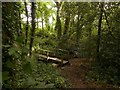
Footbridge in the dumble – 3
by Alan Murray-Rust geograph for square SK6550 On the southern branch of the Thurgarton Beck.
Dumbles are the deep-cut... (more)
Tags:
Ancient Woodland
woodland:Broadleaf
Dumble
bridge:Footpath Over Stream
type:Geograph
top:Geological Interest
top:Paths
Public Footpath
top:Rivers, Streams, Drainage
Stream
top:Woodland, Forest
|
|
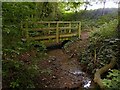
Footbridge in the dumble – 2
by Alan Murray-Rust for square SK6550 On the southern branch of the Thurgarton Beck.
Dumbles are the deep-cut... (more)
Tags:
Ancient Woodland
woodland:Broadleaf
type:Cross Grid
Dumble
bridge:Footpath Over Stream
top:Geological Interest
top:Paths
Public Footpath
top:Rivers, Streams, Drainage
Stream
top:Woodland, Forest
|

|
Dumble landscape near Lady Well Barn
by Alan Murray-Rust geograph for square SK6650 Looking down the spur between the two branches of the Thurgarton Beck, indicated... (more)
Tags:
Ancient Woodland
woodland:Broadleaf
Dumble
top:Farm, Fishery, Market Gardening
Farming Landscape
type:Geograph
top:Geological Interest
Glaciated Valley
top:Rivers, Streams, Drainage
top:Woodland, Forest
|
|
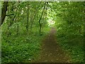
Footpath in Springdale Wood
by Alan Murray-Rust geograph for square SK6942 Woodland created by the Woodland Trust and now managed by East Bridgford Parish Council.
|

|
Site of Waingroves Colliery
by Alan Murray-Rust geograph for square SK4148 As is usual, the old colliery site has been overgrown with woodland - owned... (more)
Tags:
woodland:Broadleaf
former:Colliery
Community Woodland
top:Lowlands
top:Quarrying, Mining
Wood Sculpture
top:Woodland, Forest
|

|
Footpath into Bestwood Country Park
by Alan Murray-Rust geograph for square SK5447 An unofficial short cut through woodland from the path on the railway embankment.
|
